The Presidential Range

Wednesday morning I started my hike through the Presidential Range of New Hampshire.  This range includes the five tallest peaks in the state, named after the first five presidents, with the tallest being named after the first president, and so on.  Two other peaks in the range have been renamed; one for President Eisenhower and one for President Pierce, the only president from New Hampshire.  While I have hiked all of these peaks previously, this trip would bypass some of the peaks as the Appalachian Trail only summits Mt. Madison, Mt. Washington, and Mt. Pierce.

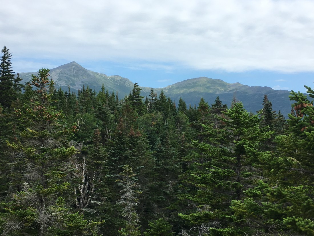
I set out early on Wednesday from the Appalachian Mountain Club (AMC) Joe Dodge Lodge and soon reached one of my favorite viewpoints at Lowe’s Bald Spot.  As often happens, the picture I took of Mt. Adams and Mt. Madison does not do justice to the view.

7CCD8CA1-2FC4-4A07-A822-1F3B3C89AA6A
Mts. Adams and Madison Viewed from Lowe’s Bald Spot

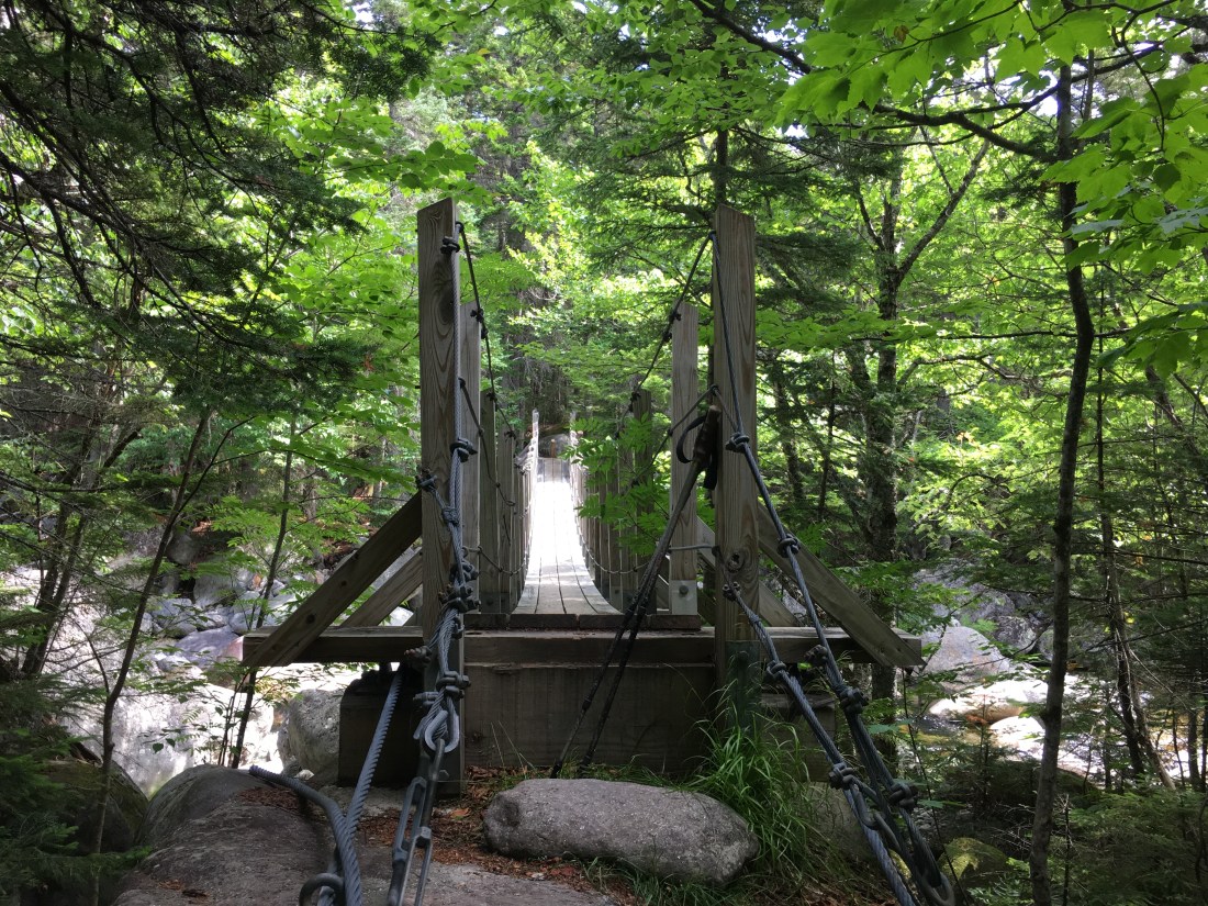
On my way to Mt. Madison, I  crossed the West Branch of the Peabody River on a suspension bridge.  I was happy to have the view to myself, and also to not have a second person on the bridge with me.  While crossing the bridge did not raise any safety concerns, the “bouncing” of the bridge was exciting enough with just me on the bridge.

F9117989-BA20-40A1-AEA2-F36CDFF40AA0
Suspension Bridge over the West Branch of the Peabody River
92B76CB1-E7DD-4609-AE6E-D3760C2738EF
Water Cascading Down the Peabody River

I soon reached the Osgood Trail to begin the steep and exposed ascent of Mt. Madison.  While I have been on the summit in both the summer and winter previously, this route was new to me.  I was grateful for the beautiful weather, which made sunscreen my greatest concern while above tree-line.  The trail crosses several rocky “knobs” on the way to the summit.

31413BE5-4EDF-43E8-BAC8-085A55F07C8B
View Approaching the Summit of Mt. Madison (left) on the Osgood Trail

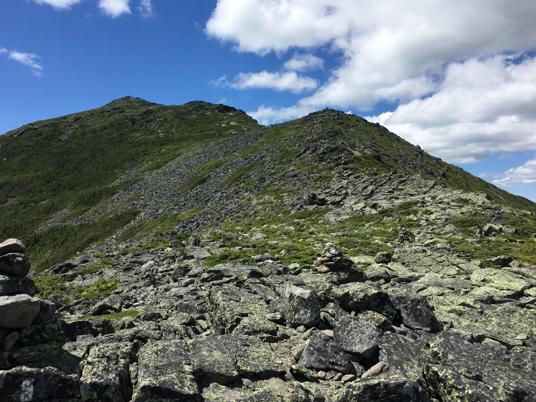
From the summit, I looked ahead to two of the next three peaks — Mts. Adams and Washington — with Mt. Jefferson hidden from view behind Mt. Adams.

C1B9A162-4636-4F4F-BF64-792281DC2F69
Mt. Adams (right) and Mt. Washington (left) from the Summit of Mt. Madison

I spent the night at the AMC Madison Spring Hut, and was treated to a spectacular sunset.

5E792E69-239C-4C55-BC34-49A765757654
Sunset from Madison Spring Hut

Thursday was an ambitious day, with 11.8 miles, virtually all above tree-line.  While the AT bypasses the summits of Mt. Adams and Mt. Jefferson, the trail gains significant elevation as it ascends over the shoulders of each.

1AA2A180-AFAA-49ED-964A-4273B6506244
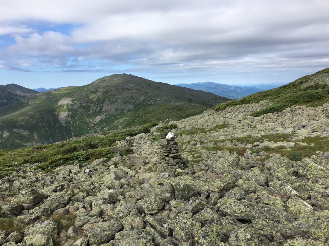
Cairns Marking the Trail Across Edmand’s Col, on the Ridge between Mt. Adams and Mt. Jefferson
6622B4E3-EB10-4160-A734-DB2E219B026F
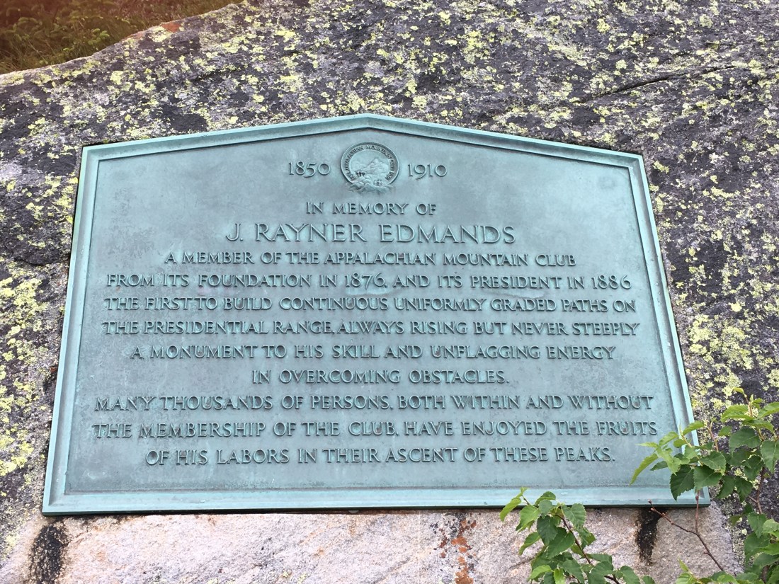
Plaque in Edmands Col, Dedicated to J. Rayner Edmands, a Foundimg Member of the AMC

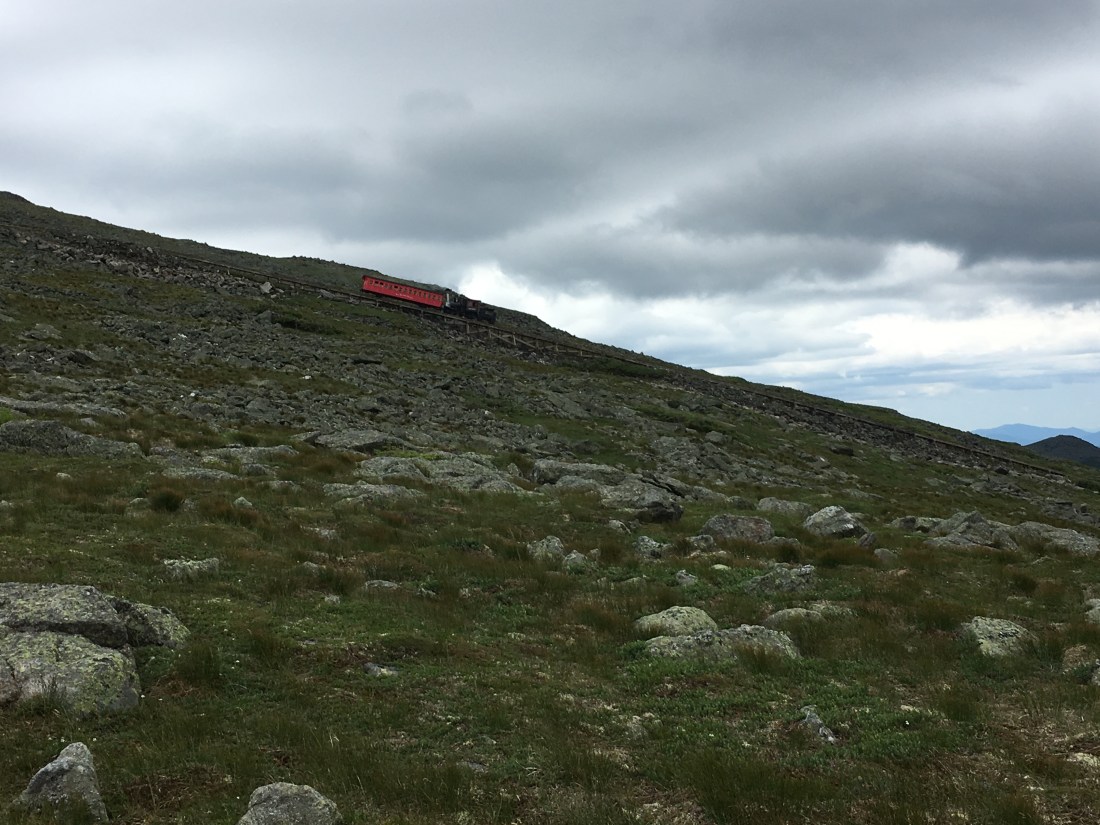
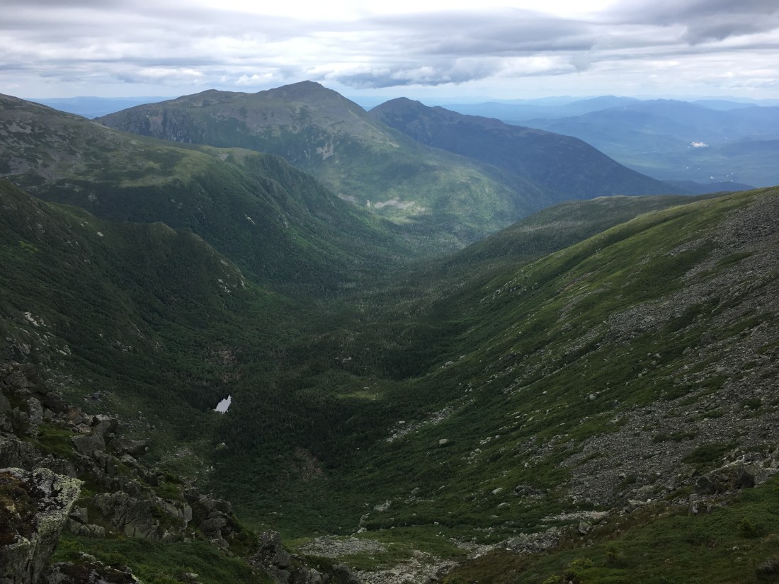
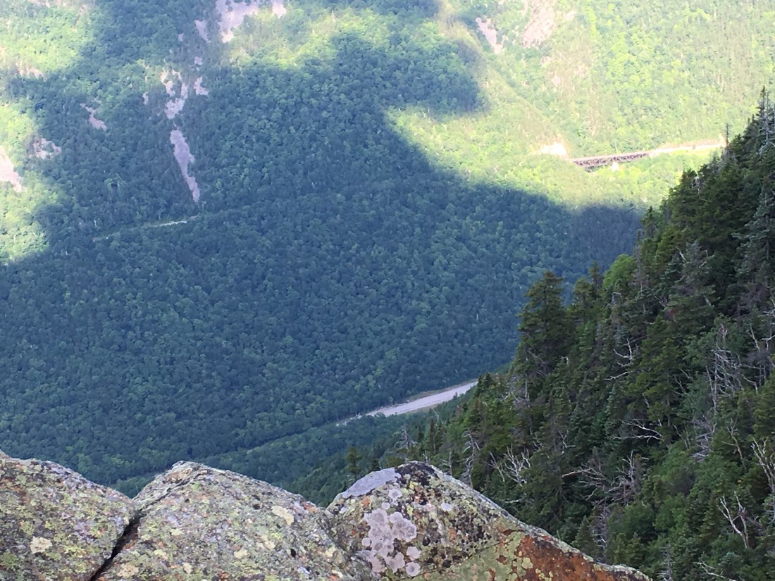
Along the way to the summit of Mt. Washington, I watched the cog railroad train descend the mountain and also had a wonderful view of the Great Gulf.  The Great Gulf is one of my favorite sections of Mt. Washington and the ascent up the headwall is my favorite route to the summit.

577AC404-382A-4BBF-B48C-0E9CC45BFCEA
Cog Railway Train Descending Mt. Washington
663C95B3-3DD8-4862-AB37-ABD6403BBFF2
The Great Gulf Viewed from the Gulfside Trail

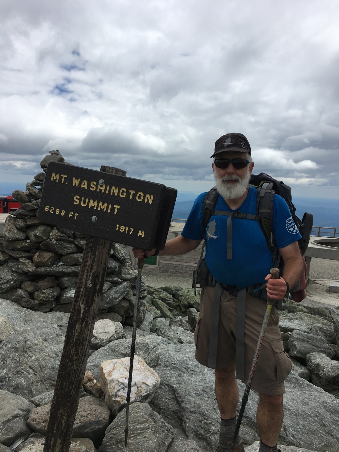
Upon reaching the summit of Mt. Washington, I took the usual summit photo and enjoyed my usual summit lunch.  As far as I know, the best chili dogs in the world are served at the summit of Mt. Washington — of course, the only time I have had them is after hiking to the summit.  Until I take a car ride or train ride to the summit, I will not know for sure.

30542898-A6C6-4629-9B0E-BF864DED2C40
Uncle Malty on the Summit of Mt. Washington, the Highest Summit in the Northeast U.S.
9E1F7610-B94A-4538-A256-31BFDB2FCC26
Chili Dogs at the Summit of Mt. Washington

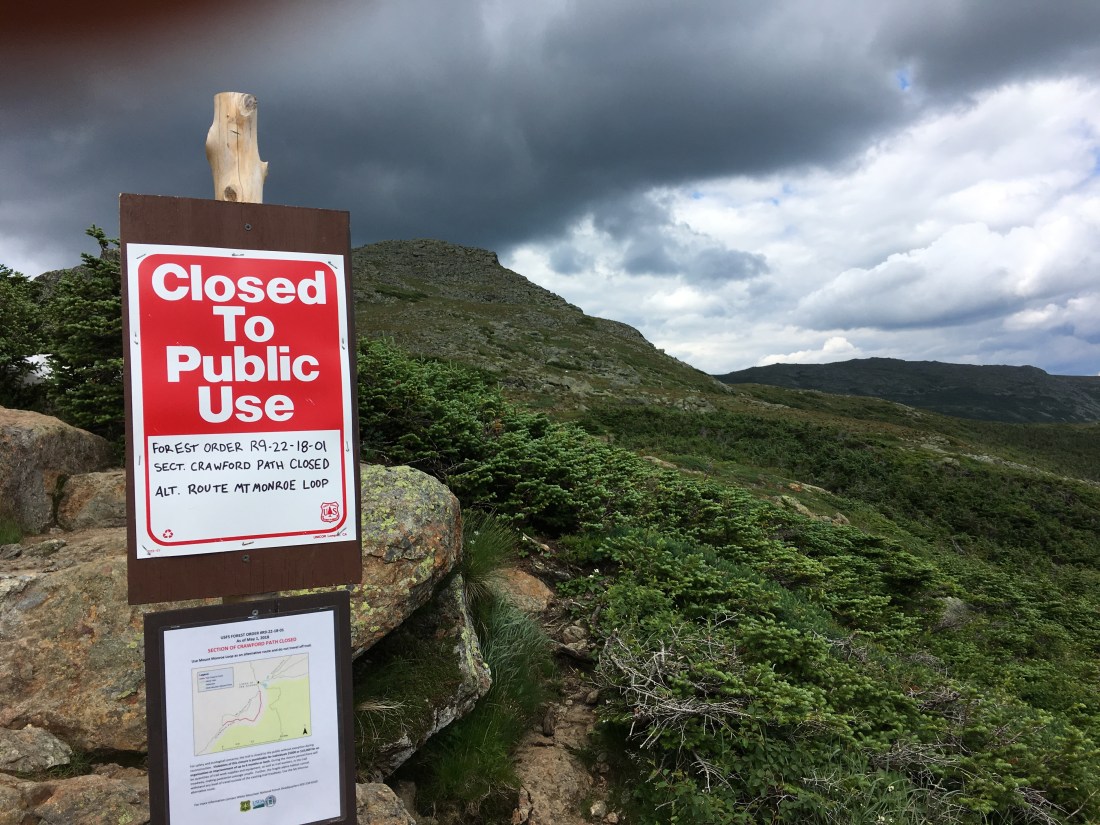
After descending from Mt. Washington, I was detoured off the AT due to trail reconstruction to address severe erosion on the Crawford Path.  The detour took me over the summit of Mt. Monroe, the fifth highest peak in New Hampshire.

F386A06A-4426-427D-B832-0994159DE6B9
Trail Closure Sign on Crawford Path

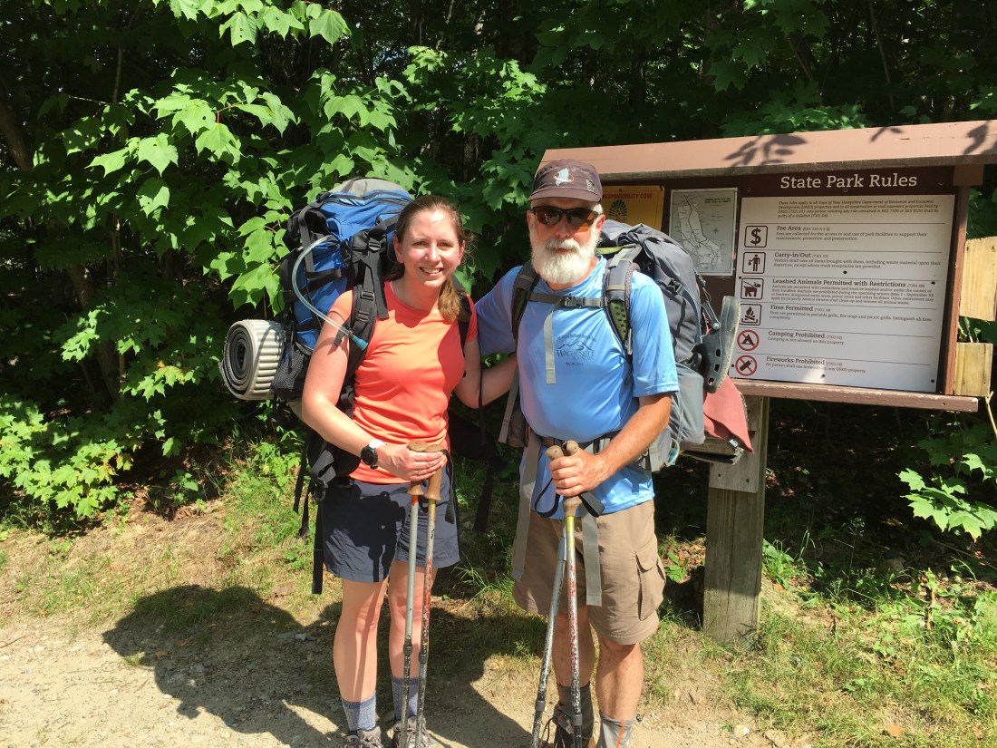
Friday began with anticipation of meeting family members for the first time in over five weeks.  My daughter, Casey, would join me for the weekend and my wife, Katie, would drive up to assist with spotting Casey’s car at the end of our hike in Franconia Notch and bring her to the AT crossing in Crawford Notch.  I quickly crossed over Mts. Jackson (not named after a president) and Webster, and then began the steep descent down the Webster Cliffs trail.

F72C2E97-4E81-4669-B7DD-974CE9C4EFF8
View Down to U.S. Route 302 in Crawford Notch from Webster Cliffs

After I showered at the Crawford Depot, we enjoyed lunch and conversation at the AMC Highland Center.  Katie then drove  us to the trailhead to begin our hike to Ethan Pond.

B166CFA0-8A80-431A-A8EA-7A702D3C78F5
Casey and Uncle Malty at the Ethan Pond Trailhead

Although we had two-and-a-half very enjoyable days of conversation and hiking, the weather prevented many pictures.  Saturday we woke to an overcast day and we were hiking in the clouds, with no views, as we crossed Mts. Zealand, Guyot, and South Twin.  We caught some rain late in the day as we worked our way over to Mt. Garfield and ascended to the campsite just below the summit.  Given it was a weekend, there were plenty of wet hikers seeking shelter in the lean-to, which made for uncomfortably tight sleeping quarters.

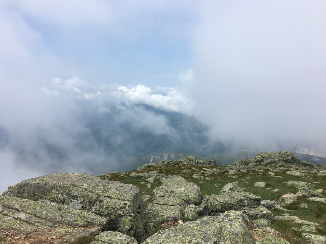
Sunday morning looked promising briefly, but we were quickly back in the fog as we summited and descended Mt. Garfield, and then ascended Mt. Lafayette on the Franconia Ridge.  The wind blew the clouds away briefly on Mt. Lafayette.  The weather finally cleared after we had crossed the ridge above tree-line over Mt. Lincoln and Little Haystack, and descended into the trees.

E0C7FC7A-6D9F-481B-9B46-904889360DDE
View from Mt. Lafayette, Obscured by Clouds

I had difficulty keeping up with Casey on the descent to Franconia Notch, but she patiently waited for me to keep up.  After a nice dinner and ice cream cones, we parted company and I am now working up motivation to finish the last two days in the White Mountains so I can move on to some easier trails.

Entering the White Mountains

This week started with some beautiful weather and scenery as I entered into the White Mountains of New Hampshire.  I departed the Rattle River Hostel in Shelburne, NH on Sunday morning and began the day by hiking north about 0.5 miles to the point at which I caught a ride into town on Friday.  I am sure it will be no surprise to most of you that the purist in me could not skip hiking this short section, even if it was on a road.  The electric power engineer in me caused me stop along the way and take a photo of the Shelburne hydroelectric station — a small, 3.7 MW plant on the Androscoggin River. Continue reading “Entering the White Mountains”

Hazy, Hot, and Humid

Another four days of hiking and I have arrived in Andover, Maine.  My total mileage is now at 257 since starting at the summit of Katahdin.  My boots have not been dry since the last time I wrote — the product of almost daily thunderstorms and wet, muddy trails.

My departure from Rangely on Friday started well.  It was a relatively easy day and I took my time as I enjoyed the trail. As I sat at the edge of Chandler Mill Stream, the outlet of a boreal bog, I enjoyed the sound of running water and decided it was finally time to photograph one of the blue, black, and white butterflies I have seen through much of Maine.  As it turned out, the half-hour I spent having a snack and relaxing resulted in being caught in an afternoon downpour the last half-hour of my hike. Continue reading “Hazy, Hot, and Humid”

The Rain in Maine

“The sun did not shine.  It was too wet to play.” — Dr. Seuss

They say that “you won’t get to Maine if you don’t hike in the rain.”  I suppose that is true also for getting to Georgia, even though I can’t think of a word that rhymes with Georgia.  After taking a zero because of the rain on Monday, I decided to hike through the rain on Thursday.  The rationale being that I would rather get wet hiking into town where a hot shower awaits, than get wet hiking out of town after starting with dry gear and clothes. Continue reading “The Rain in Maine”

Monson to Stratton, ME

Another week has passed and I am now in Stratton, Maine, contemplating whether to take a “zero” tomorrow.  Since I left Monson on Tuesday, I have covered another 70 miles and now am at 188 miles traveled.  My primary focus for not hiking tomorrow is to take an occasional day off to avoid injury.  It looks like rain tomorrow, so that may sway the decision. Continue reading “Monson to Stratton, ME”

The 100-Mile Wilderness

I reached Monson, ME on Sunday, June 17 and am taking a “zero day” in town today.  I have covered 112.6 miles since my last post, including 9 miles or so to exit Baxter State Park, the 100-Mile Wilderness, and 3 miles to get into Monson.  The 100-Mile Wilderness is the most isolated section of the Appalachian Trail, with no access other than an occasional logging road.

The hike out of Baxter State Park began on Friday, June 8, with a goodbye to Brian Tatro, before entering the woods.  I enjoyed the scenery as I contemplated hiking for the next six months. Continue reading “The 100-Mile Wilderness”

Mile 0

Reached Mile 0 on the AT today after one of the hardest hikes of my life to the summit of Mt. Katahdin.  Many thanks to Brian Tatro for guiding me up and down some of the steeper sections along the ledges.  5.2 miles later, we were back at Katahdin Stream campground.  Tomorrow I will hike out of Baxter State Park and into the 100 Mile Wilderness. I expect to be incummunicado for the next 10 days or so until I reach Monson, ME. Continue reading “Mile 0”

Welcome!

“Life is what happens to you while you’re busy making other plans.”  — John Lennon

I have decided to take some time off and spend the next 5-6 months thru-hiking the Appalachian Trail — 2189 miles from Maine to Georgia.  I will use this site to share my experiences.

In case you are wondering about the site name, thru-hikers use “trail names” during their hikes.  Rather than risk being assigned one along the way that I don’t like, I have selected my own – Uncle Malty; i.e., think malty, like a nice German Doppelbock, Maibock, or Oktoberfest beer!  (Some of you also may note a similarity to the title of an Aerosmith song.)

Posts to the page will likely be sporadic after I depart and will coincide with time I spend off the trail resupplying.  I welcome your comments, questions, and support.  I look forward to seeing everyone when I return home.  If you would like to see me sooner, I welcome your companionship on the trail or in trail towns along the way. Drop me a line and we can work out a time and place to meet.