I am already well into Vermont, but have not had a chance to post anything for a while as I have not been into town other than passing though Hanover, NH and Norwich, VT last Saturday.
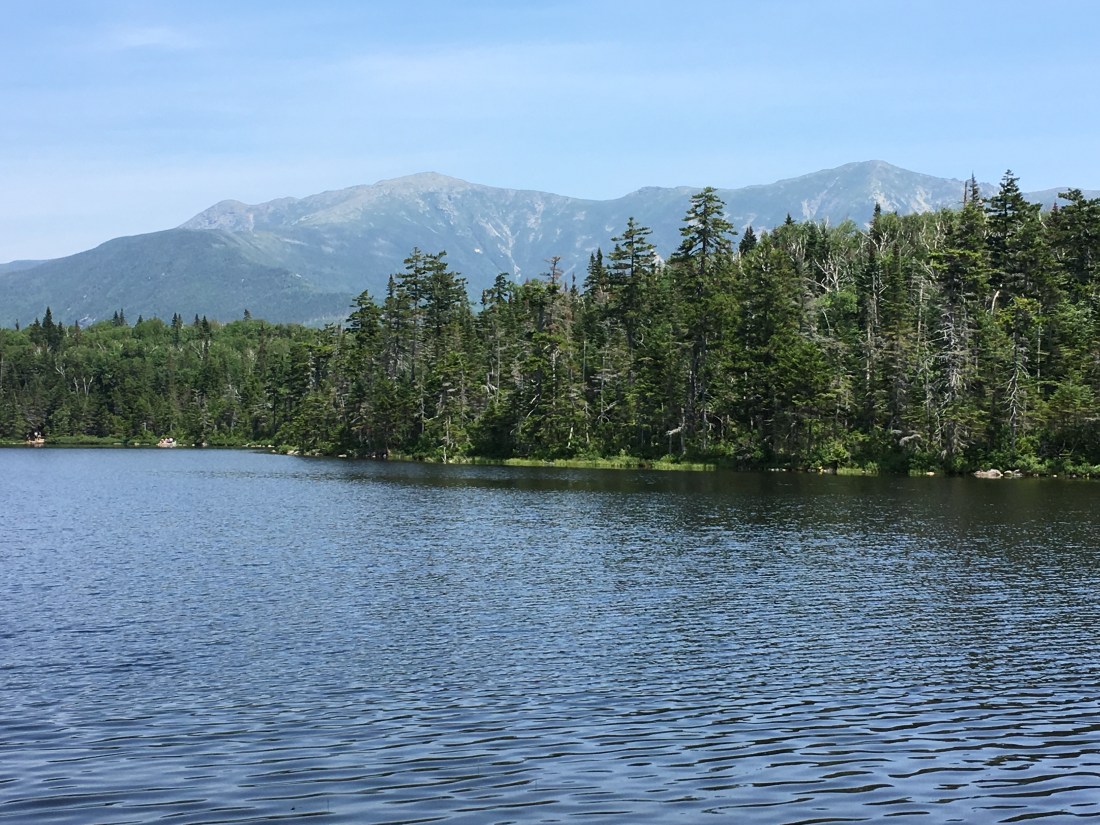
I started last week with a road walk from Lincoln, NH back to the AT. The walk went quickly — the worst part was seeing people swimming and lounging at pools at the hotels along Route 3, and wondering why I wanted to hike in the hot sun. Once I was back on the trail, all was well. I reached Lonesome Lake by early afternoon and ate my lunch at the hut. The view across the lake provided a nice view of the Franconia Ridge, which I had hiked the day before with. Casey. Looking in the other direction also provided a nice view of the outlet from the lake.
The hike up to North Kinsman Mountain went quickly as did the trip across the col to South Kinsman. I had read previously that the descent from South Kinsman would be steep, and it lived up to the trail description and then some! After a slow, tedious descent, I reached my destination at the Eliza Brook shelter.
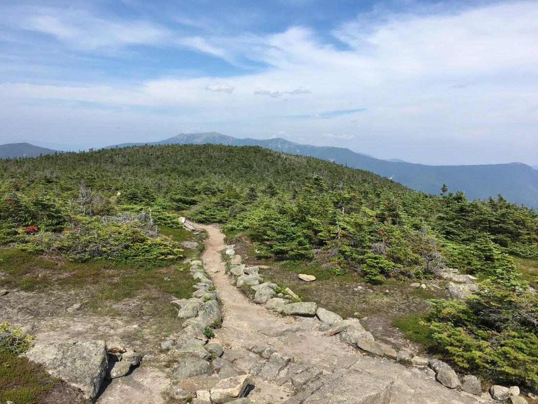
Eliza Brook ended up being my home for two nights, as thunderstorms were predicted for the Tuesday and I did not want to be caught above tree line on Mt. Moosilauke. Wednesday morning started slowly, taking care to avoid a slip on the wet rocks and tree roots that dominate the trails in New Hampshire. I crossed Mt. Wolf and was treated to one more view back toward the Franconia Ridge.

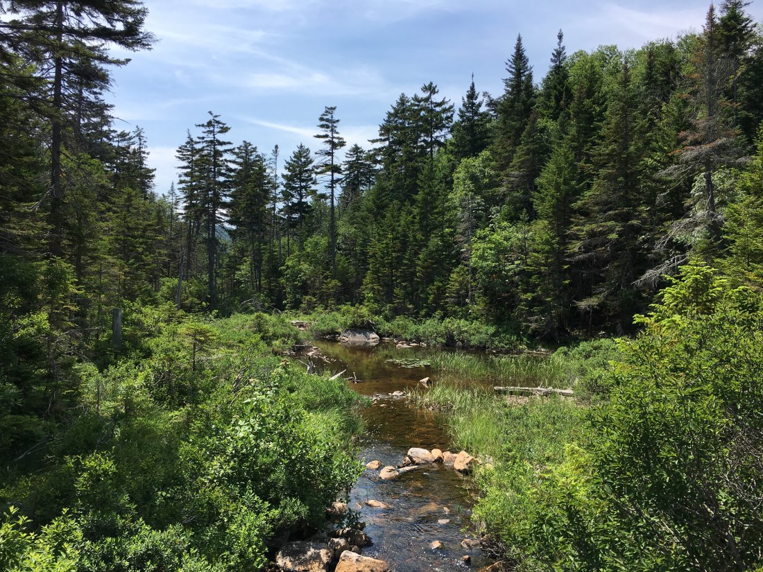
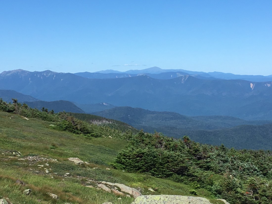
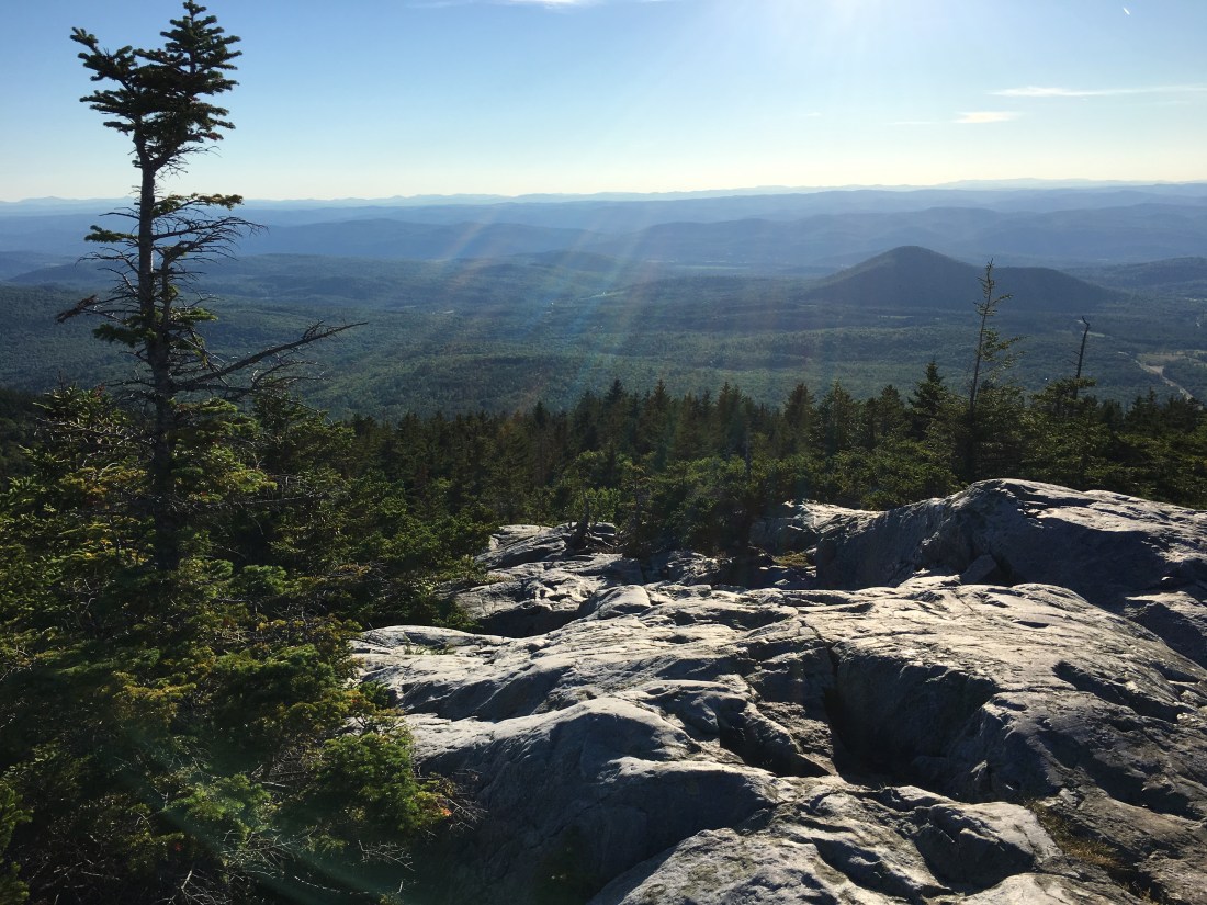
After descending to Kinsman Notch, I began the ascent up Mt. Moosilauke. The first section of trail was steep, but had wooden blocks attached to the granite slabs to make the ascent easier. It also followed the path of a stream that cascaded down the mountain. I took a picture as I started, but it turned out the views were better further up the trail. Once at the summit, Mt. Moosilauke provided a panoramic view of the past week of hiking.

The hike down to Jeffers Brook went quickly. Shortly after arriving at the shelter, a man and his daughter, who hiked the AT in 2015, arrived with homemade doughnuts and Long Trail ale. The doughnuts were fried and cream filled, and reported to be 700 calories each. After some good conversation, I set up my tent and hung my food bag. I have been mostly sleeping in the lean-tos; however, when I saw others had hung their food in the lean-to, I decided I would rather not sleep there in case a hungry bear visited during the night. I fail to understand people who assume that because they “have not had a problem so far,” they do not have to worry about bears. In this particular case, an 8-1/2 x 11 sign was posted in the lean-to warning about bear activity in the area.
Thursday was mostly hiking through the woods. At one road crossing I passed under some power lines that are part of my past. The line in the center of the right-of-way is the high-voltage direct current transmission line that brings up to 2,000 MW of power to New England from hydroelectric generators at James Bay in Quebec — a project I worked on in the early 1990’s.

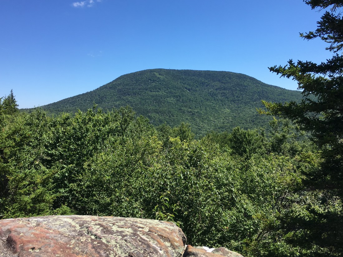
At a subsequent road crossing, I learned that Carl, the omelet guy, was back in business and I enjoyed a plate full of scrambled eggs, ham, cheese, green peppers, and onions. Carl is a retired construction worker who for several years now spends his days from June through September cooking free meals for passing thru-hikers. Carl was “evicted” from his usual location by the U.S. Forest Service the previous week and word spread quickly along the trail. However, Carl’s resilience is as large as his generosity, and after a few days off he had found a new location. After lounging for a while to digest my meal, I was back on the trail with several miles left to hike over Mt. Cube before sunset. After ascending the mountain, I snapped a few quick pictures and sent a text message home before descending to the Hexa-Cuba lean-to. I arrived at dusk, but still full from my late-afternoon omelet I decided I could skip cooking dinner this evening.
Friday began with an ascent of Smarts Mountain, which provided views from the summit fire tower as well as from the open ledges while descending the mountain. By Friday, I was paying the price for the great weather the past few weeks as many of the streams were dry and finding water became more difficult. Information was frequently passed back and forth between the north-bounders and south-bounders regarding which lean-tos had dry water sources and where the next water source could be found.

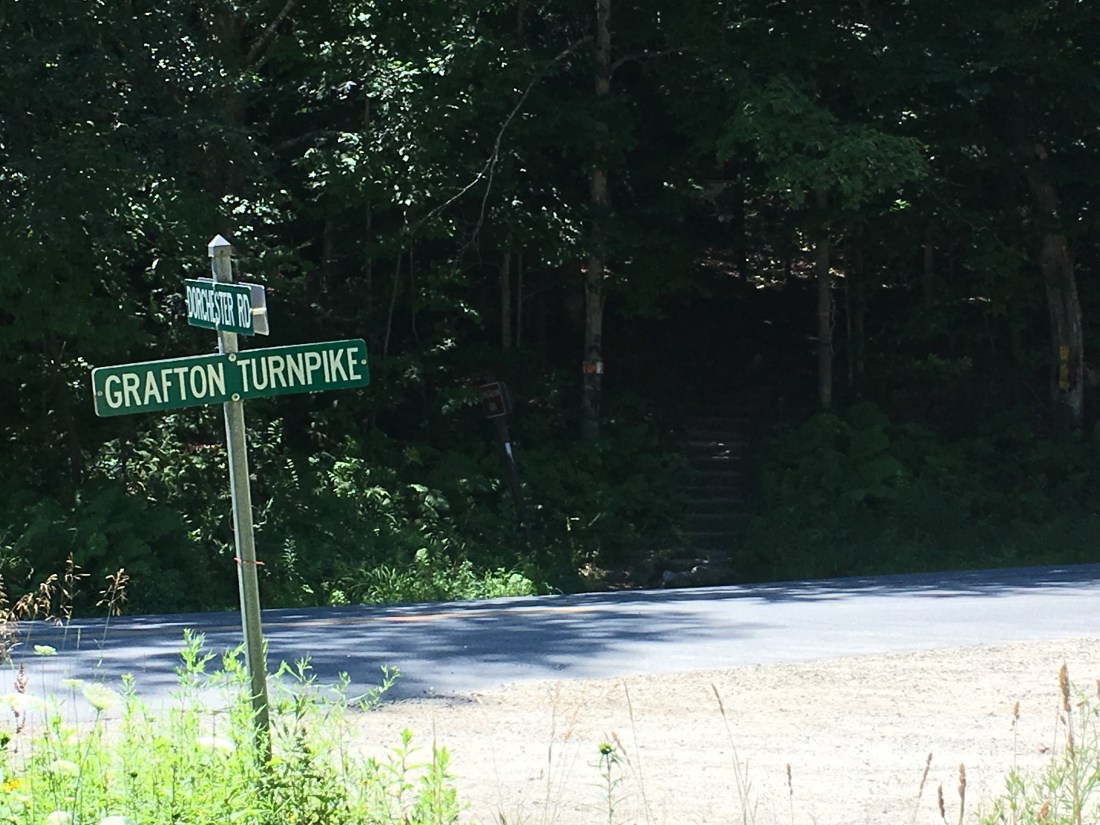
After descending from Smarts Mountain, I came to a sign that reminded me of home. While feeling a bit homesick, I knew the road I crossed would only take me to Grafton, NH rather than home to Grafton, MA. Fortunately, I knew I would be home for a long weekend in six more days.
I spent Friday evening at the lean-to on Moose Mountain between the North and South peaks. I had the lean-to to myself as the only other hikers had set up their tents for the evening.
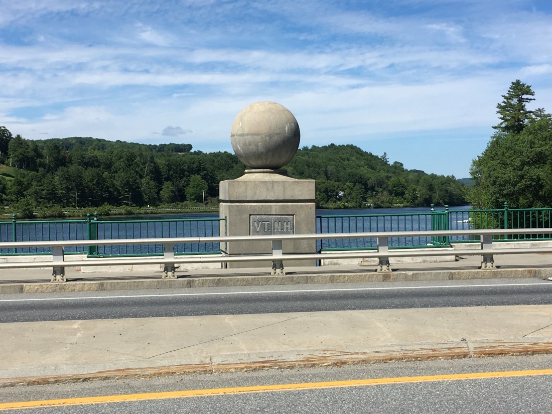
Saturday morning brought me down to Hanover, NH, where I was able to shop for groceries to refill my food bag. I also stopped at Ramunto’s Brick and Brew for a lunch and to recharge my phone. The first slice of pizza was on-the-house for thru-hikers, and enticed me to purchase a second slice and a Caesar’s salad, washed down with a Bell’s Two-Hearted Ale — a double IPA from Kalamazoo, MI. As much as I would have liked a second beer, I resisted the urge knowing I had almost seven miles more to get to camp for the night. I descended down to the Connecticut River and crossed the border into Vermont. Fours days later I have reached Wallingford, VT, and I will cover these four days in my next post.


Great progress and photos. Thanks for posting. I enjoy reading about your adventures. Dwayne
LikeLike