Had I known what was coming, I would have titled my last post, “Beautuful Vermont” and titled this one, “Vermont Mud!” I always hear about mud season in Vermont, from the time the snow melts in the spring until about Memorial Day when the ground dries out. I haven’t experienced it first-hand, but can only imagine as the rain this week has turned the trail into a mess. I encountered several sections that were 2-3 miles of almost constant mud, several inches deep, as wide as the trail, interspersed with sections of standing water (underneath which, was, of course, more mud). When I checked into the hiker-friendly, Williamstown Motel, I felt guilty giving them my laundry until I washed my socks out in the shower. After wringing them out a dozen times, they were still far dirtier than after a day gardening at home. Now that I have clean, dry clothes, I am ready to go out and get wet again!
The week started well. Katie dropped me off Sunday evening in Wallingford after a restful and very enjoyable weekend and I hiked 1.5 miles in to reach the first lean-to. Another night setting up my tent as a I arrived late and saw at least one hike had food hanging in the lean-to.
Monday was a beautiful day. I made good time and enjoyed several nice views along the way, including Little Rock Pond, the Big Branch wilderness area, Baker Peak, and Griffith Lake. The trails were still not dried out from the rain the previous week, but were generally in good condition.

I got an early start and crossed Peru Peak and Styles Peak under overcast skies on Tuesday morning, and headed up Bromley Mountain, one of the alpine skiing mountains in southern Vermont. Although rain was forecast, it held off for the entire day and the sun eventually came out, brightening everyone’s outlook in spite of the forecast of rain for the rest of the week. While I heard some complaints about mud, the trails were in good shape at this point, in my opinion.

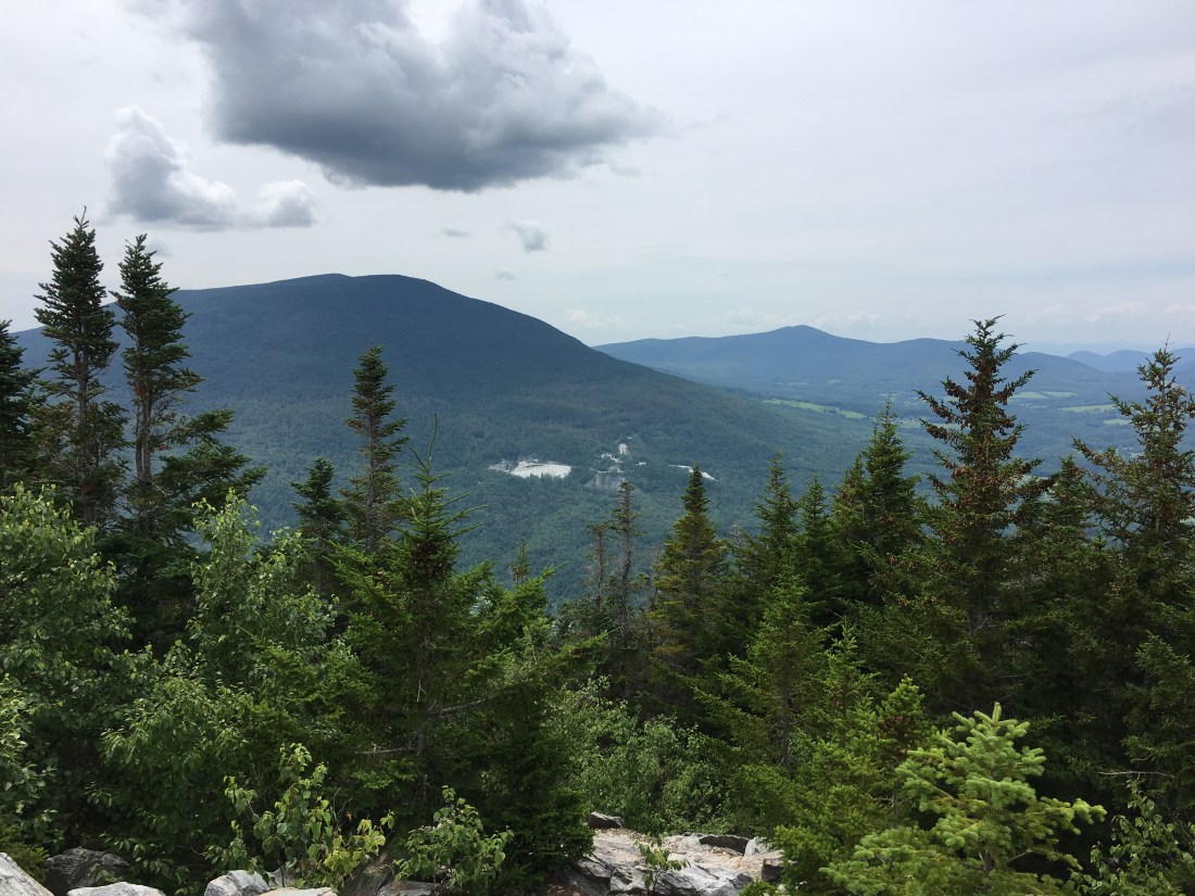
As I approached Manchester, VT, I reached Prospect Rock and had a wonderful view of the town. This location was a special moment on my trip, as this was the destination of my first hike with Casey and Brian, about 20 years ago. We still laugh about the uneaten half of a tuna sandwich that we found in my backpack on our next camping trip, about one month after the hike. Fortunately it was well-sealed in a plastic bag!
As I approached my destination of Stratton Pond, the trails become muddy, but still nothing like I was about to encounter the next few days.

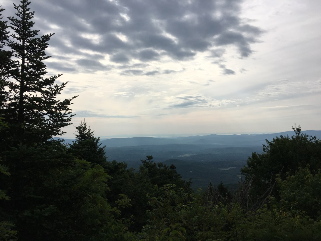
Wednesday morning was overcast again, but the rain graciously held off until noon. I summited Stratton Mountain and enjoyed the view from halfway up the fire tower steps. That was plenty high enough for me given my respect for (a.k.a. fear of) high places.

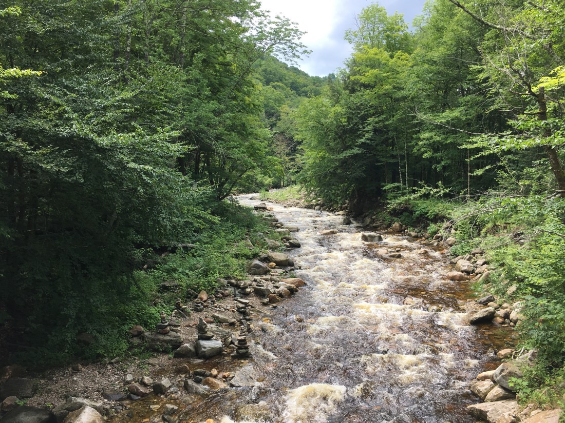
Hiking for the next three days quickly deteriorated after descending Stratton Mountain, as I entered one of the muddiest sections of trail I had ever encountered up to that point. Then the rain started and I realized I hadn’t seen anything yet! It was a good day to be a beaver and I contemplated their role as I passed by a pond. Recalling a nature show from many years ago that referred to them as nature’s engineers, I couldn’t help but think this must be true, as I observed they must have spent all their time at work building a wonderful dam while their home looked like it could use some work.

After several hours of rain, I stopped at the Kid Gore lean-to for lunch and conversation with a couple of north-bounders. I then headed back into the rain, to ascend Glastenbury Mountain and reach my destination at Goddard lean-to. Looking at the bright side, there was no lightning during the day. I awoke to a heavy thunderstorm and lightning that night and was thankful.
Thankful for the lightning occurring at night, but not for the rain. The Wednesday night downpour made for a miserable day hiking on Thursday. After several miles of muddy trails, I reached a raging stream, appropriately named given the circumstances, Hell Hollow Brook. As my shoes were already soaked and covered with mud, it was an easy decision to ford the stream without changing to my crocks, which I wore while wading across some of the rivers in Maine. After finding a safe place to cross, I resumed my hike and received a brief reprieve from the mud with a couple of miles of relatively dry trail. I crossed City Stream along VT Route 9 and stopped for lunch.
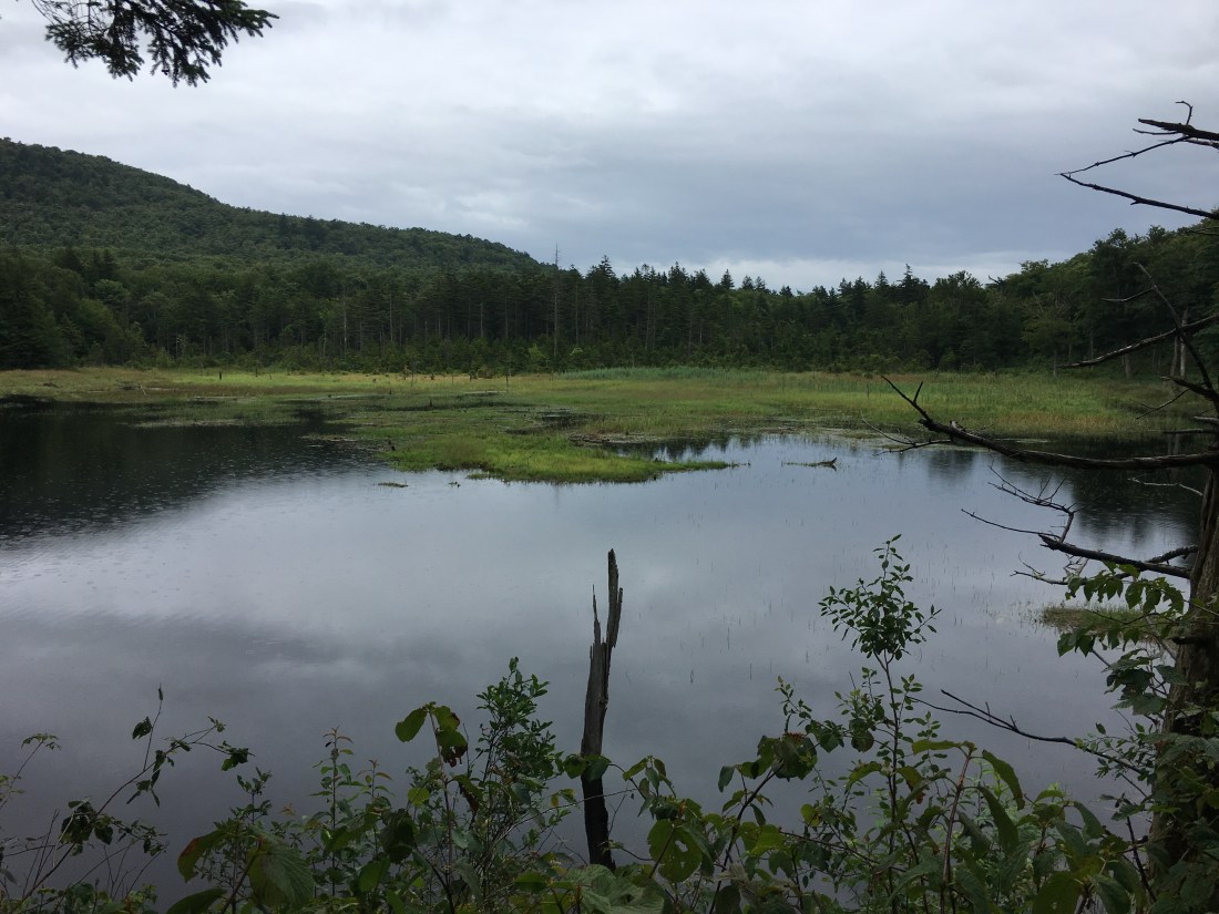
After checking the forecast and seeing the rain would hold off u til 9 pm, I decided to bypass the Compton lean-to and continue another seven miles to the Seth Warner lean-to per my original plan. About 20 minutes later the rain started again. During a lighter period of rain, I passed another beaver pond and saw my first wildlife of the trip other than snakes, toads, and frogs as I watched one of the beavers swimming back and forth across the pond. As I turned to walk away, I heard the loud smack of its tail on the water and I looked back to see it had submerged.
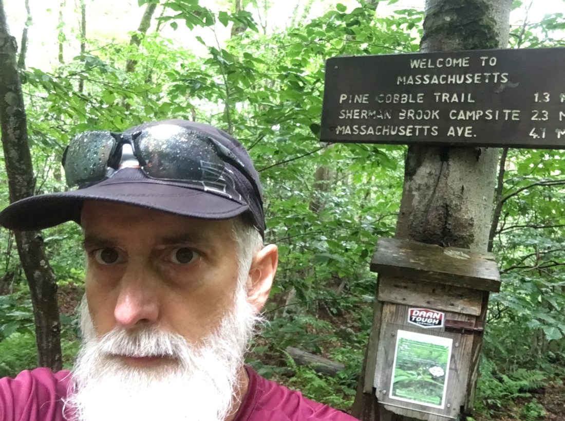
Friday brought more rain. The trails improved as I exited Vermont, vowing never to hike that section of trail again. I am sure as I time passes and my memories fade, I may be back, but hopefully during a drought. I crossed into Massachusetts with 593 miles complete.
Given an impending afternoon thunderstorm, I booked the last room at the Williamstown Motel and prepared for the next section of trail. The weather caused Brian and I to postpone our weekend of hiking, but he was still good enough to drive up and bring me a resupply of food and we enjoyed a wonderful afternoon together staying dry.

Dang – that mud sounds awful! Hoping drier days ahead!
LikeLike
Phil —
I thoroughly enjoy each and every update buddy – keep them coming! Your most recent post doesn’t make me envy you anymore!
Btw…we missed you at the quarterly meeting and barbecue yesterday!! Barry Nichols joined me at the packie and helped load beers and ice and then helped pack the coolers. I couldn’t help but think of you. When will Dan, John and I be traveling to see you – and where?
LikeLike
Phil, I get that hanging food in the lean-to is a bad idea, but how should you store your food at night to keep the bears away? John
LikeLike
I hang my food on a tree branch with parachute cord, 12’ above the ground, 5’ below the branch, and 5’ away from anything the bear could climb. The PCT method works best because it is not necessary to tie the rope to anything, but when the perfect branch is not available, I improvise.
LikeLike