After drying out in Williamstown last Friday night, I patiently waited for the rain to stop on Saturday so that I would not immediately be wet again upon my departure. After being dropped of at the trail, I quickly backtracked a few hundred feet to take a picture of the Housatonic River that I had missed on Friday because my phone battery was low.

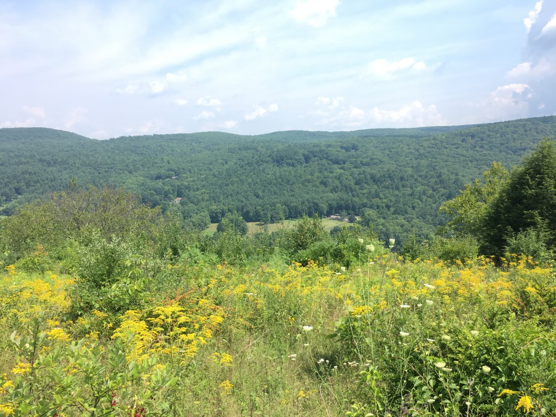
From there, I started south again and soon began the ascent of Mt. Greylock, the highest peak in Massachusetts, at 3,489 feet above sea level. I stopped on the way up and enjoyed the iconic, postcard view of the valley below.

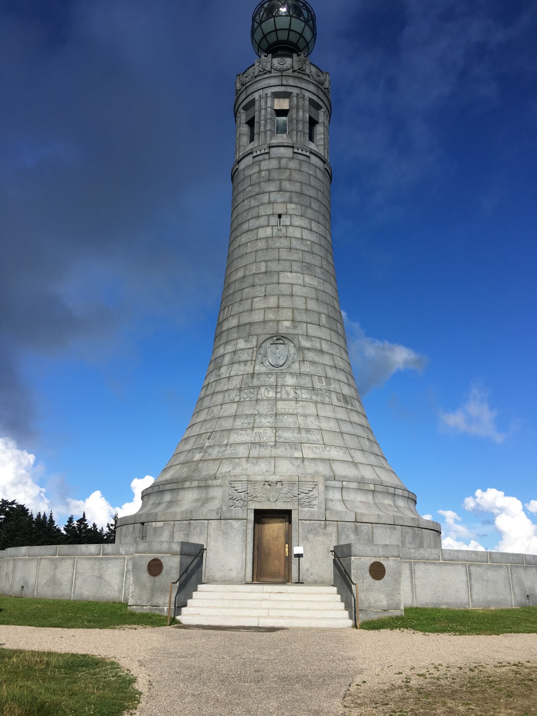
At the summit is a memorial to Massachusetts war veterans. I would haves liked to gone inside and climbed the stairs to the observation deck, but decided that given my late start, I had better keep hiking.

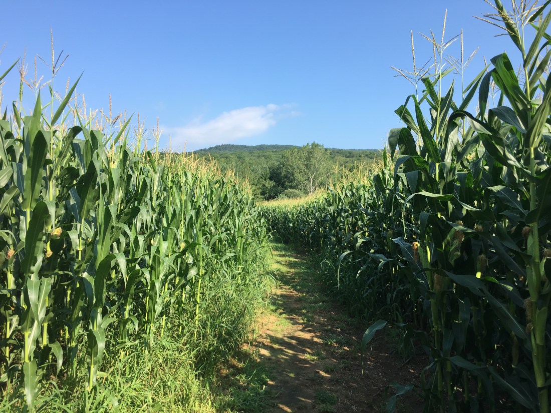
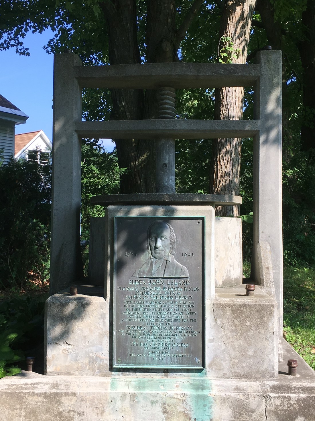
On Sunday, I woke to sunshine and headed out on the trail toward Cheshire, MA. The hike included walking through a few meadows and a corn field on my toward town. The trail passes through town and I arrived in time to attend Mass. I also was able to see the cheese monument in the center of town, which honors Reverend John Leland and the 1,235 pound “Big Cheshire Cheese” that he presented to President Thomas Jefferson.
Later in the day, the trail also passed through Dalton, MA, where I was able to escape the afternoon sun and enjoy a cheese steak sandwich and a cold ginger ale, before continuing my journey.
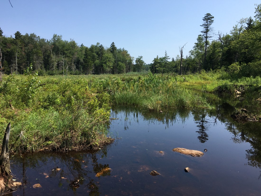
Monday brought a variety of terrain, including a limited view from Warner Hill, passing by a marsh, and crossing over the Massachusetts Turnpike. While I had driven under the footbridge many times before while traveling between Massachusetts and New York, this provided a different perspective of the road.


Tuesday brought the return of thunderstorms. I started early, both to beat the afternoon heat and the rain, and completed my 16-mile hike before the afternoon thunderstorm. Along the way, I had some limited views from Cobble Hill.
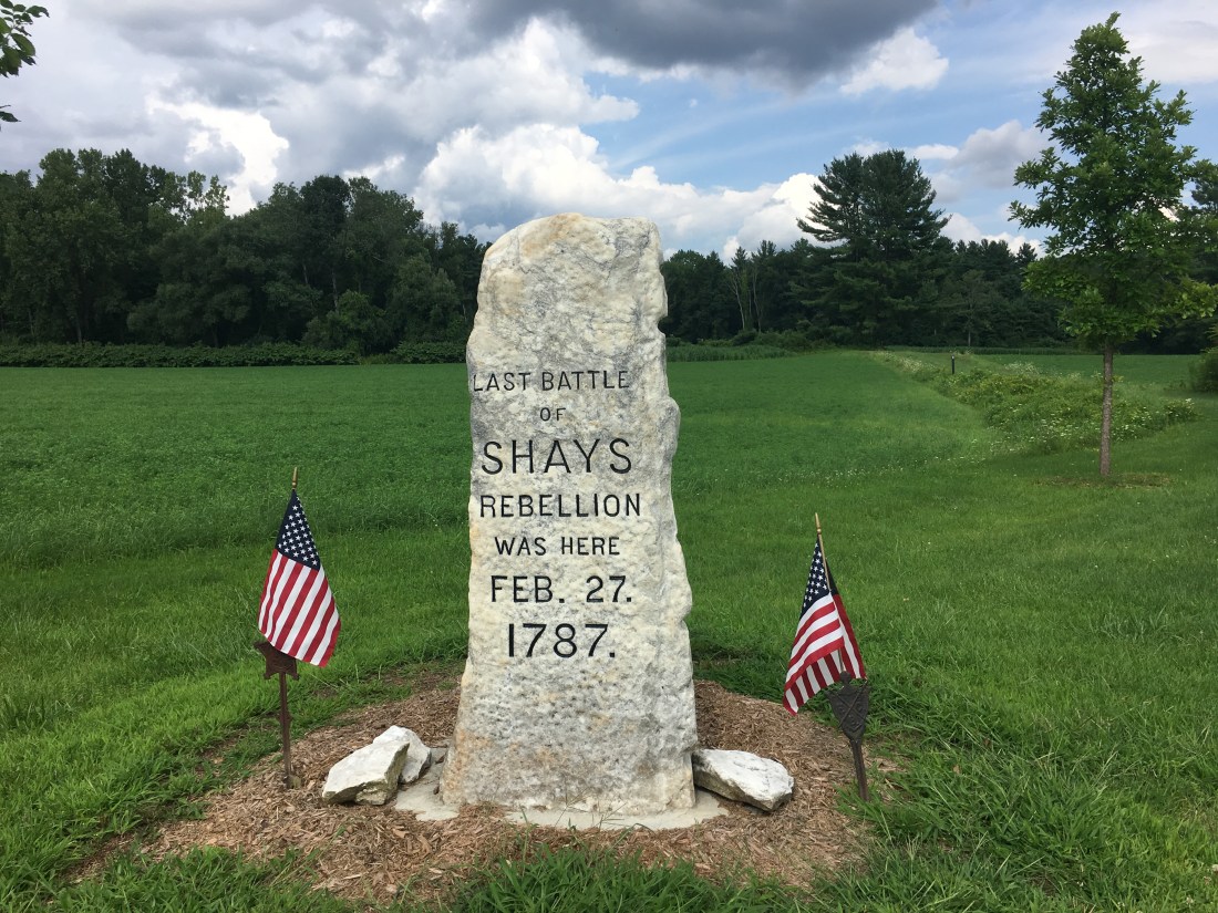
Wednesday was another hot day and I was caught in a late afternoon rain. Fortunately, my pack cover kept my gear dry and my clothes, other than my boots and socks, dried quickly to the usual “dampness” to which I have become accustomed during the humid days of July and August. The trail passed several fields and a monument to the last battle of Shays’ Rebellion. The rebellion was fought in western Massachusetts to protest economic and civil rights injustices under the Articles of Confederation. While the rebellion was defeated by the Massachusetts militia, it was one of the factors leading to the Constitutional Convention.
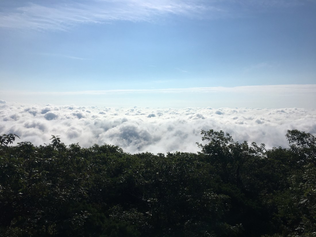
Thursday brought me to Mt. Everett, the second highest point on the trail in Massachusetts. The summit was above the morning clouds as the sun worked on burning off the moisture from the previous night’s rain. By the time I reached the ledges on Race Mountain, the clouds had cleared and I had views back to Mt. Everett and ahead to Connecticut.

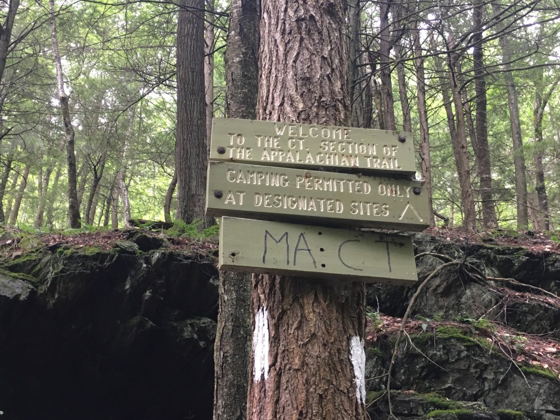
I soon descended into Sages Ravine and crossed into Connecticut. it felt good to have another state complete.
I am enjoying a Saturday afternoon and Sunday morning with my son, Brian, before returning to the trail in Kent, CT. I will post pictures of Connecticut the next time I am connected to the internet.

I love how you described your journey through different landscapes.
LikeLike