The past week has been a mixture of clouds, fog, and rain, and progress has been slowed due to scheduled and unscheduled breaks. However, the sun should return soon and I look forward to entering Shenandoah National Park when I resume my hike tomorrow.
I crossed the Mason-Dixon Line into Maryland over a week ago on Thursday, September 6, just before lunchtime. Shortly after, I reached Pen Mar County Park and enjoyed a view of Pennsylvania as I ate my lunch. The afternoon was a mixture of hiking over rocky ledges, through forests, and across open fields.


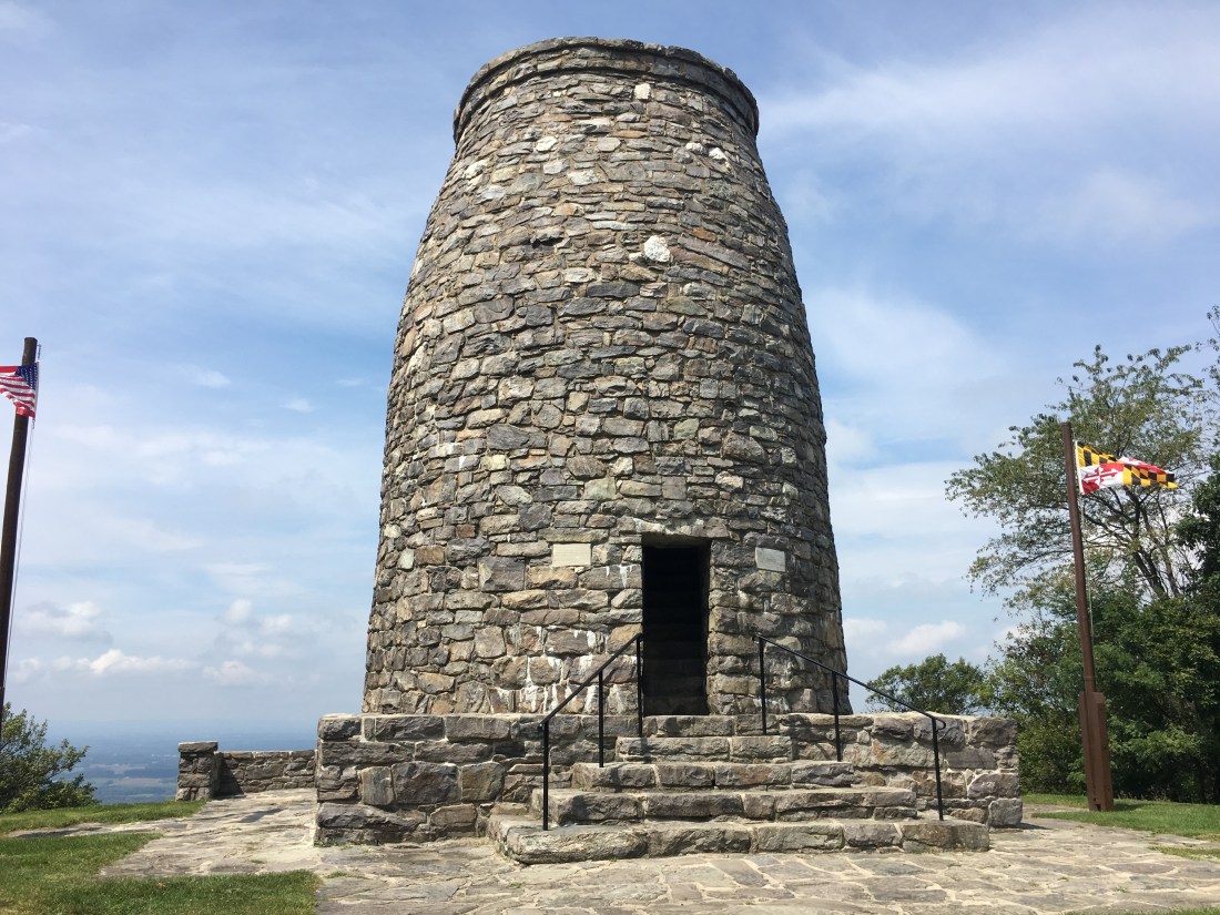
Friday brought more of the same, but also brought me to Washington Monument State Park. The park is the site of a monument constructed in honor of George Washington in 1827. The monument is much smaller than the one on the mall in Washington, DC; however, it was nonetheless impressive. The tower offered nice views of the surrounding countryside from its observation deck, including several Civil War sites such as Antietam.


Although we had threats of thunderstorms most of the preceding hot and humid week, the rain finally started to fall Friday evening. I was camped on a tent pad at the Dahlgren Campground and the rain came down fast and hard enough that at one point I could feel a half-inch of water accumulated below the tent floor. Fortunately, the tent remained watertight and the water subsided before morning as the rain gradually let up.
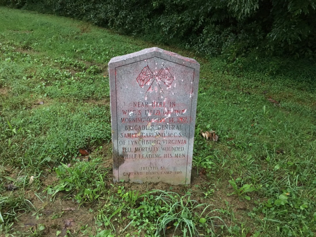
Saturday morning dawned with foggy overcast skies and the threat of more rain. I started the morning passing through a Civil War site in Fox Gap. A monument marked the location where Confederate Brigadier General Samuel Garland, Jr. was mortally wounded in the Battle of South Mountain, just prior to the Battle of Antietam. I missed a second monument in the area where Union Major General Jesse Lee Reno was also mortally wounded in the battle.
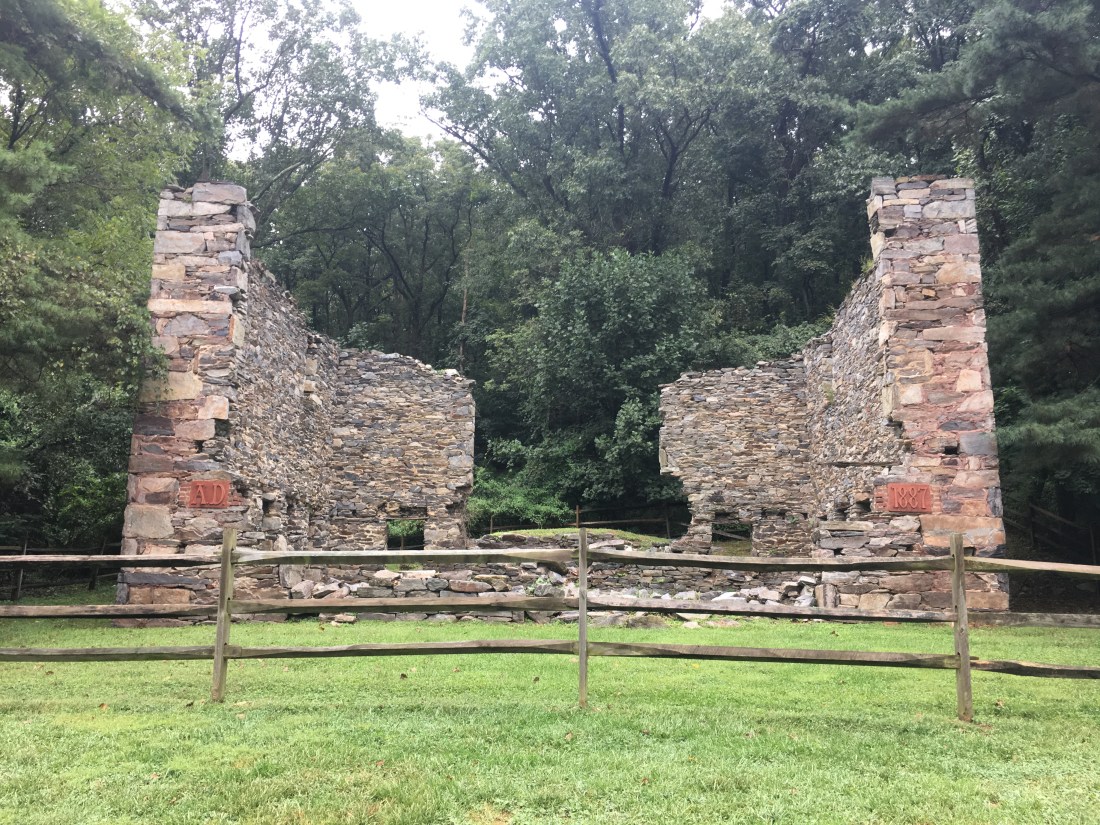
Later that morning I passed through Gathland State Park, which contains the estate of Civil War correspondent George Alfred Townsend. I passed the ruins of one building that was particularly interesting, but did not find any specific information on the origin of the structure.
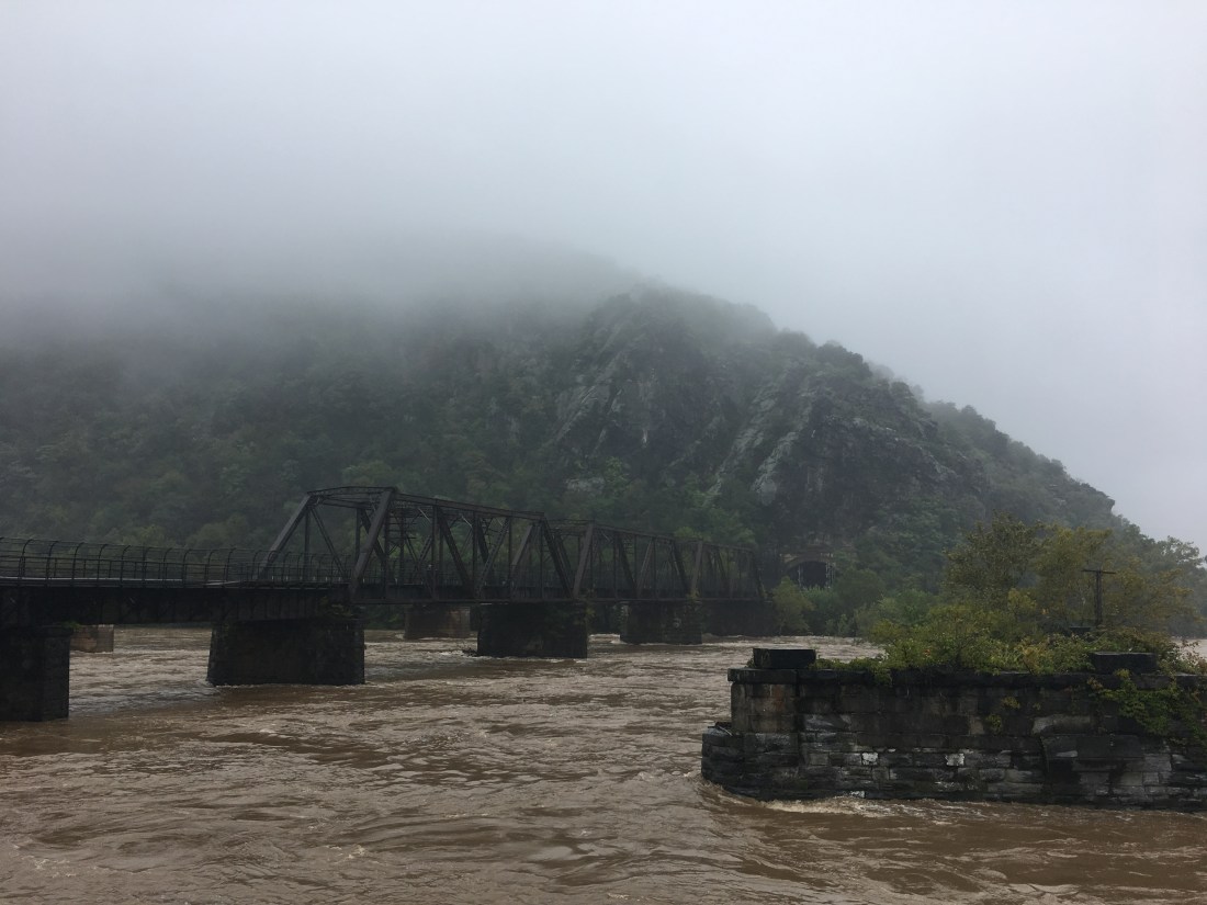
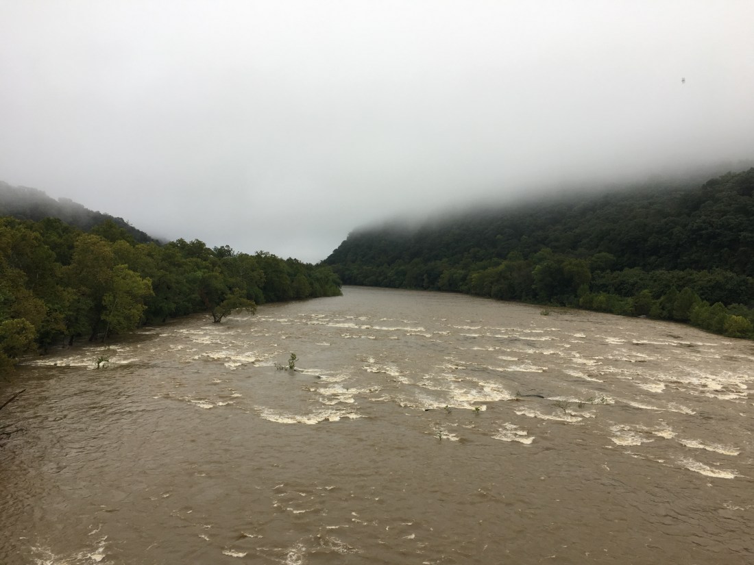
As I approached the Potomac River, the rain began to fall and continued for the next few days. The last 2.7 miles of the trail in Maryland is on the old Chesapeake & Ohio canal towpath, between the Potomac River and the remains of the canal. I crossed a bridge over the river and into West Virginia, noting that the water level was already high. The next day the bridge and towpath were closed due to concerns with flooding with more rain on the way.
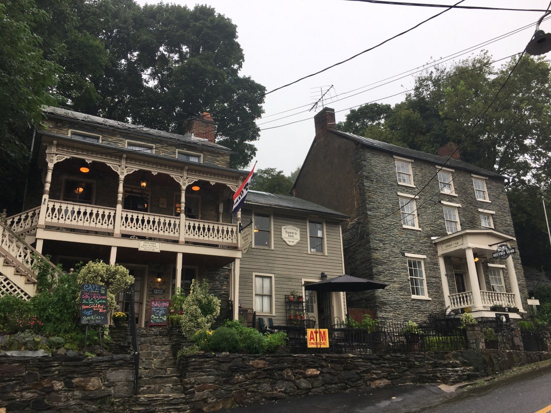
I spent the next two days at the Teahorse Hostel in Harpers Ferry. The first day planned, and the second day unplanned. Finding the hostel was a minor challenge as I had planned to use the Appalachian Trail map application on my phone, but was unable to “open” my phone due to the rain. After stopping at the Appalachian Trail Conservancy office for directions, I was back on my way to the hostel. I cooled off quickly while not hiking and was happy to reach the hostel and have a hot shower. I spent the evening having dinner with two friends from Maryland, Bill Edwards and Neil Burbure, who drove into town to meet me. Both are colleagues from my former job at the North American Electric Reliability Corporation (NERC), and Neil is also a current colleague at EN Engineering, having joined me at Energy Initiatives Group shortly after I left NERC. Our hostel host, Ben, ran a very organized and comfortable establishment and kept us well fed with a breakfast of all you can eat waffles each morning.
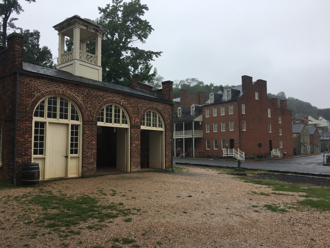
Monday was still drizzly and so I decided to stay another day and explore the historic Lower Town. I saw the U.S. armory fire house used as a stronghold by abolitionist, John Brown, when he and his men raided the armory in an attempt to arm and liberate local slaves in 1859. The raid was ended in 36 hours by local farmers, militiamen, and U.S. Marines led by Robert E. Lee. The history-rich area has inspired me to learn more about the Civil War and return to the area someday to investigate further.

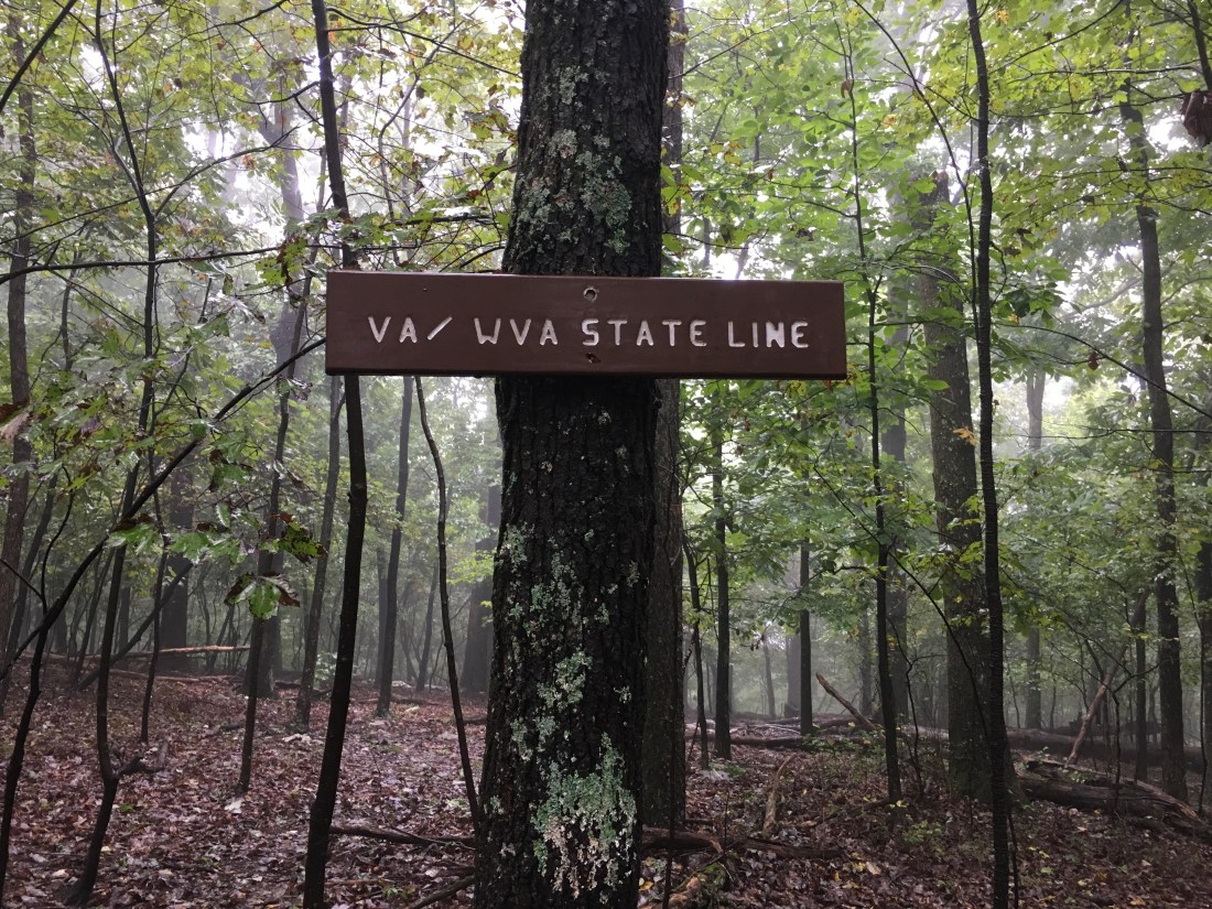
A dense fog still covered the area the next morning as I departed Harpers Ferry, but at least the rain had stopped. As West Virginia has the fewest Appalachian Trail miles of any state on my trip, I soon found myself crossing the border into Virginia. The trail followed the border for much of the next two days and I crossed back into West Virginia briefly at least once. By nightfall I received news that Shenandoah National Park would be closed until further notice beginning on Thursday in preparation for Hurricane Florence. With only 33 miles remaining before reaching the park, I shortened my mileage for the next two days. Fortunately, my wife Katie would be joining me on Friday for a planned weekend off the trail.
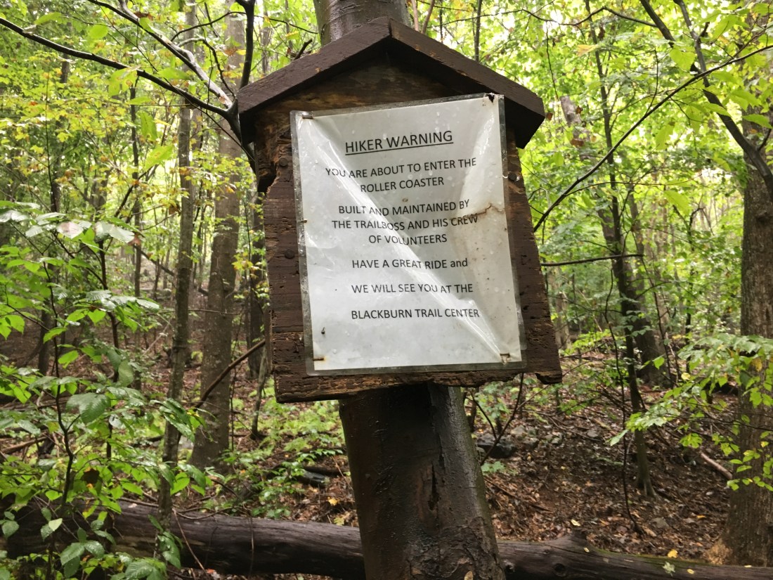
Tuesday afternoon and Wednesday morning took me across a section of trail known as the roller coaster. Over 13.5 miles, the trail traverses up and down across 10 ascents and descents of 300 to 500 vertical feet. The hills are generally rocky and none of the ledges provide views, even in clear whether. The guidebook indicates the trail crews had no choice due to the narrow corridor allocated to the trail in this area; however, it seems the trail generally traverses every hill over its entire length.
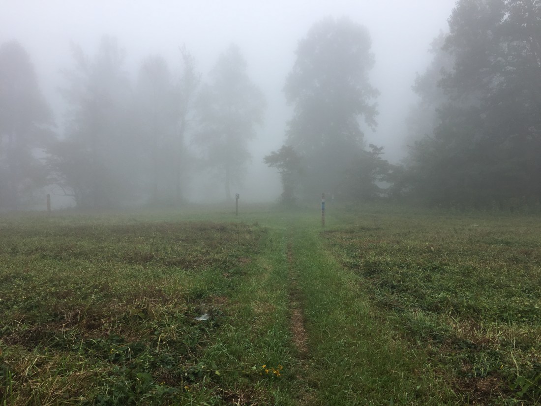
The fog persisted, no matter the terrain. Even the open fields in Sky Meadows State Park offered limited visibility.
I arrived at the Mountain Home B&B on Thursday afternoon and waited for Katie to arrive. Our host, Scott, provided transportation into town and I enjoyed a bison burger, Vienna lager, and a dunkelweizen (a dark German-style wheat beer) at the Front Royal Brewing Company.
On Friday, Katie and I toured the Copper Fox distillery. They are hiring and I was tempted to change careers after my hike, but decided the commute from Massachusetts would be a bit too long. On Saturday, Katie and I decided to give Skyline Drive a try, but concluded on our way to Thornton Gap that it was not only too foggy to enjoy any views, it probably was also too dangerous to drive the winding road. Instead we opted for Plan B and toured the Luray Caverns.

The weekend was too short. Katie is now back home and I am back at the Mountain House B&B. The park is open, but the remnants of Florence are passing over the area today. Given the heavy rain and wind, I decided to stay dry one more day before entering Shenandoah and working through the final 970 miles of trail.
