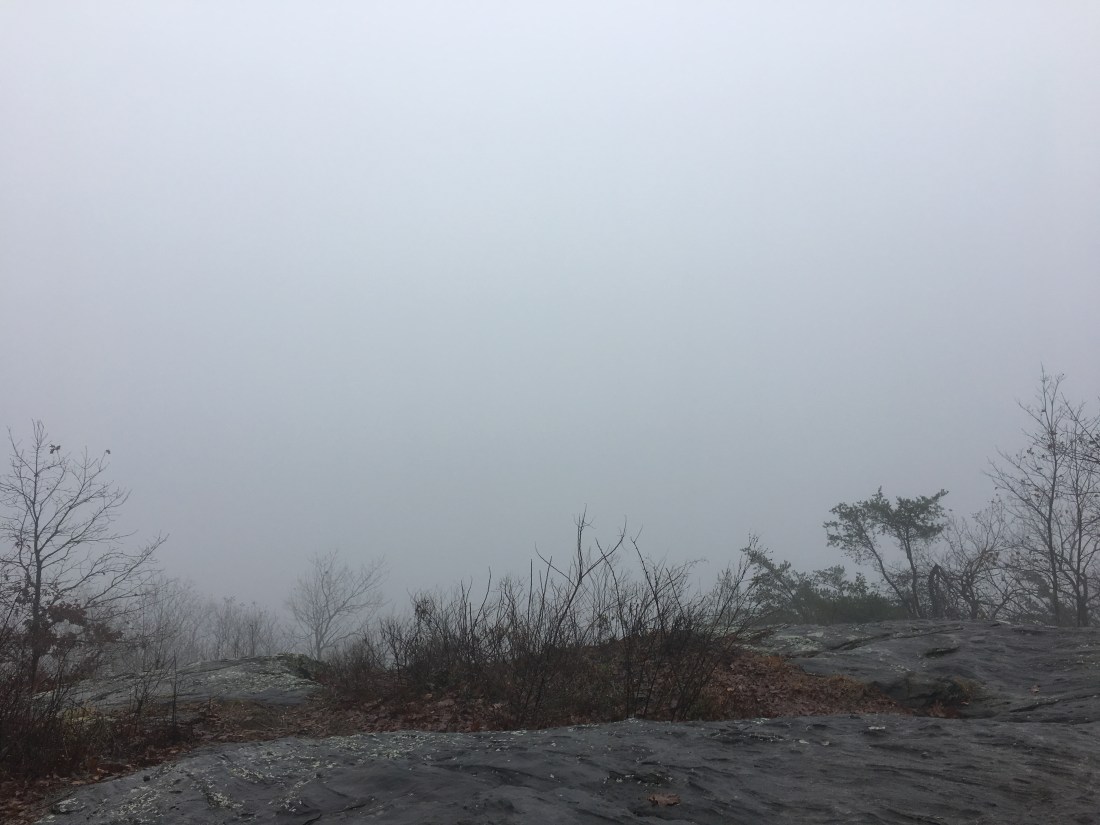
I set out from the Top of Georgia Hiker Center on Tuesday, November 13, with the end of the trip in sight. It was another rainy day, although fortunately, the rain was not as heavy as Monday. The trail undulated up and down across Powell Mountain, Kelly Knob, Tracy Mountain, Rocky Mountain, and Blue Mountain. The grades were easy and the trail surface was smooth until the last section climbing from Unicoi Gap to Blue Mountain. This last section was rocky and it was dark when I arrived at Blue Mountain Shelter, although my eyes had adjusted and I just barely made it before needing my headlamp. The rain had stopped mid-afternoon, but I was still hiking in the clouds except for brief periods when I climbed above them on Rocky Mountain and Blue Mountain. When I put on my headlamp to cook dinner, I could see that not only had I hiked back down into the clouds, but the moisture in the air was so thick it was difficult to see more than a few feet. I put as much gear as possible in my pack for the night in an effort to keep as dry as possible.
I woke Tuesday morning to a heavy dew on everything from my sleeping bag to my camp shoes. I was able to pour water out of my Crocs before I put them on. Tuesday was another 19 mile hike up and down small peaks. The destination for the day was Neels Gap, 31 miles from Springer Mountain. This is the first stop where ill-prepared northbound hikers swap out gear at the outfitter or decide to quit the trail and head back home. The weather was overcast with patches of light rain, but I got an early start and the hike was relatively quick, allowing me to arrive at the outfitter, Mountain Crossings, by 4 pm. I had already planned on spending the night at the hostel before I saw the weather forecast or the “southbound special” consisting of a hot shower, bunk, and a Red Baron pizza for $20. After another cold, wet day, the pizza tasted especially good.
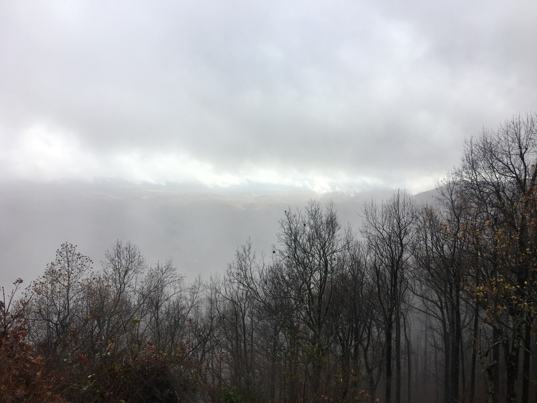
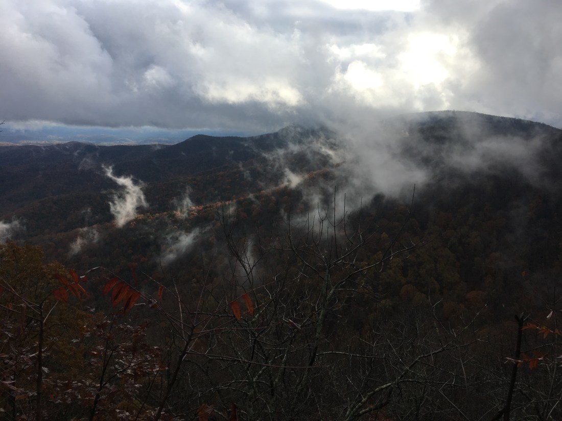
Thursday morning was overcast and rainy, but forecast to clear up by noon. The day started hiking up Blood Mountain, the last significant peak on the trip. The trail was rocky and wet, requiring extra care, but the grade was easy, rising 1,400 feet over 3 miles. The summit was fogged in and I continued on my way. The rain had stopped and I hoped for clear skies. Around noon, the rain started again and continued for a couple more hours. Somewhere along the ridge between Woods Gap and Gooch Gap the rain stopped and the clouds slowly dissipated.
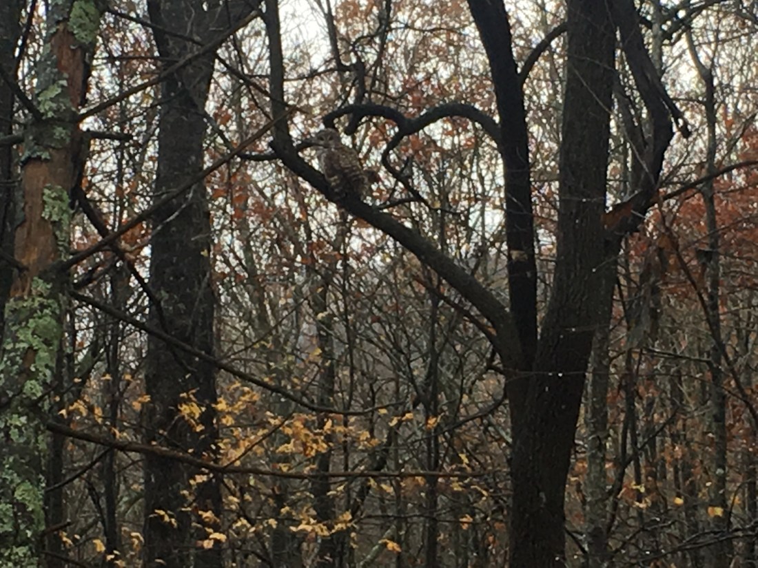
As I approached Gooch Gap and was back in the woods, I saw an owl flying low through the trees. It perched in a tree and I was lucky enough to get a few pictures as I approached.
The sun never came out, but the skies cleared up overnight. The temperature dropped to 19 degrees making for an uncomfortable night. I had picked up an extra dry bag after my shoes froze in North Carolina, so I was able to put my shoes in the bag and place them in the bottom of my sleeping bag to prevent them from freezing again.
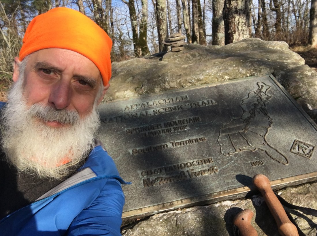
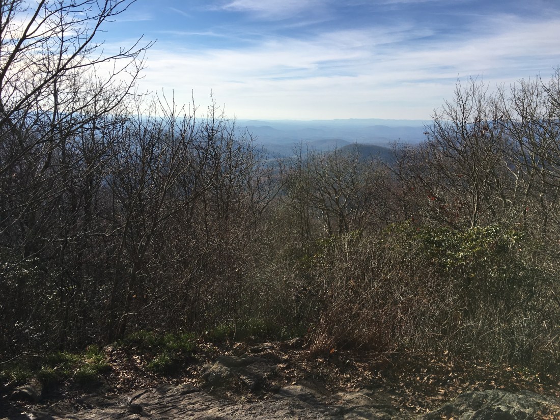
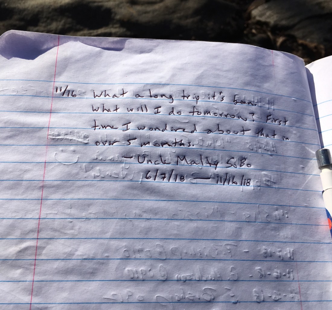
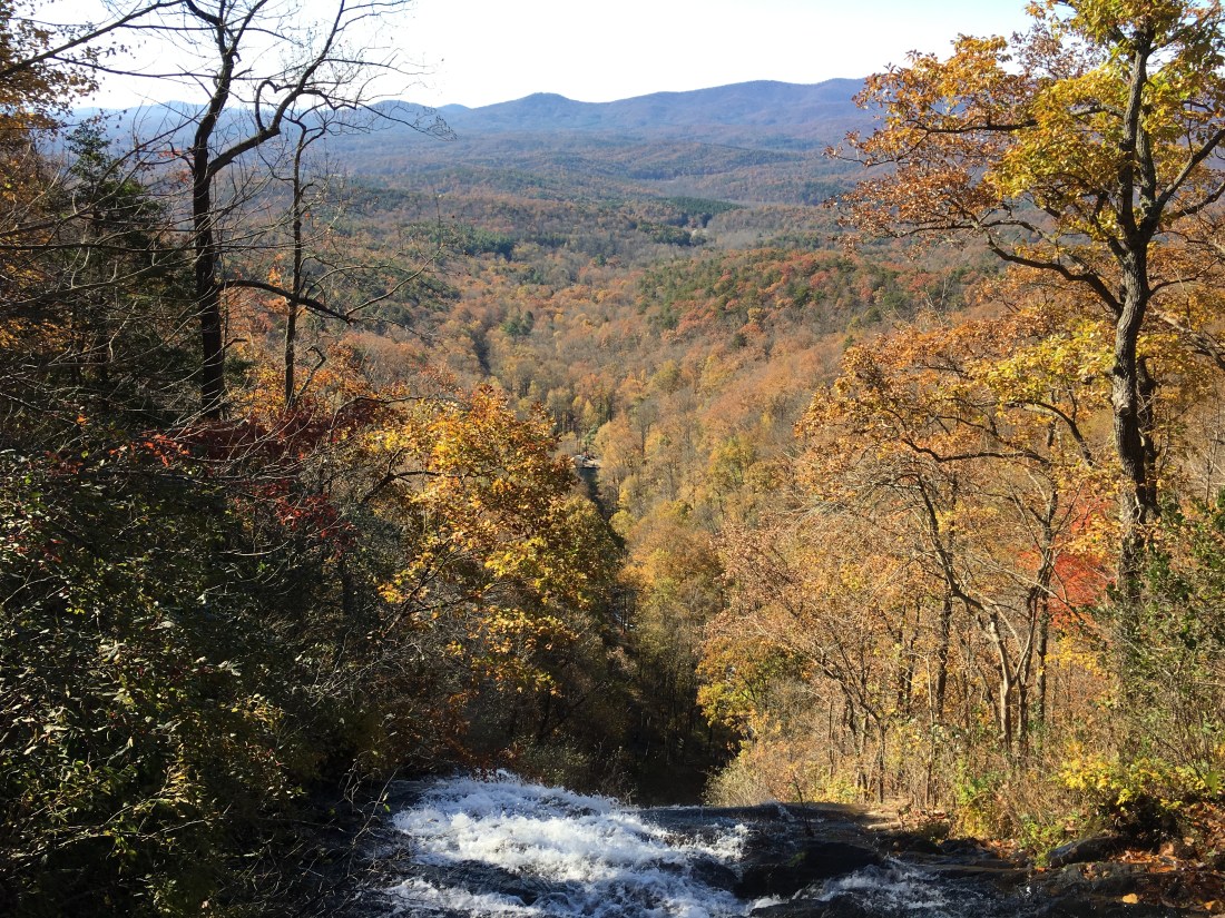
Friday morning was clear, but cold. I ate breakfast and packed quickly, knowing that hiking would warm me up. The hike was a bit surreal — it was hard to believe that I was already at the end of my journey despite this being day 163. I knew in advance that hiking southbound would provide an anticlimactic finish, and the trail was rather unremarkable approaching Springer Mountain.

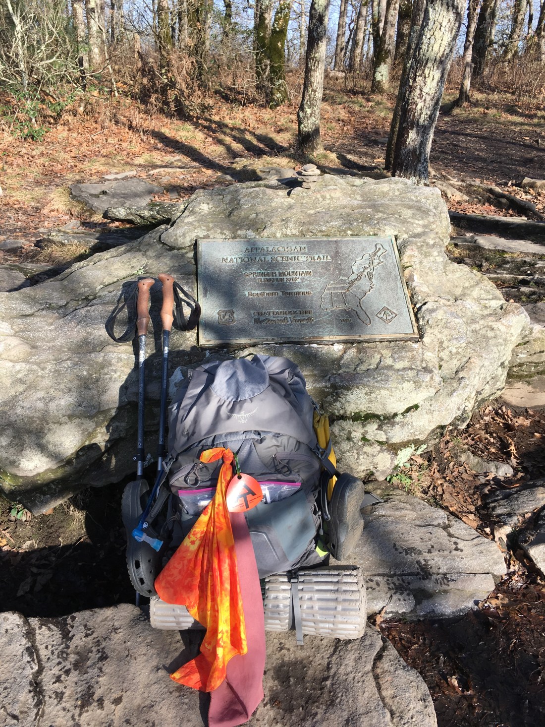
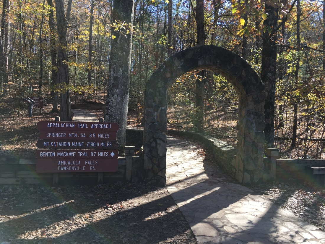
I would likely have walked past the summit had I not seen a sign marking the end of the Approach Trail from Amicalola Falls. As I turned left to get my bearings, I saw the plaque marking the southern terminus of the trail.
I spent the next 45 minutes taking pictures and writing an entry in the trail log. I hoped that a day hiker would come by so I could ask to have my picture taken, but no one came by and I had to settle for a selfie and a picture of my backpack.
I continued my hike for another mile and a half down the Approach Trail to the Black Gap Shelter. Fortunately, the temperature only dropped into the low 30s this night and I enjoyed my last night of camping.
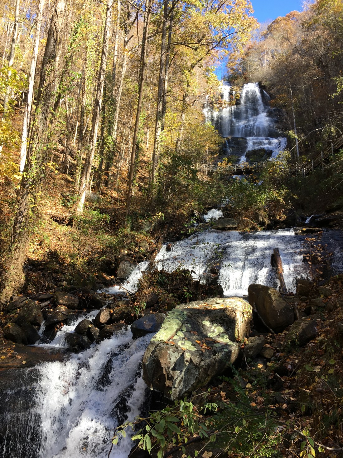
On Saturday morning, I hiked the last 7.5 miles of the Approach Trail to the visitor’s center at Amicalola Falls State Park. The Falls were spectacular and made up for the lackluster view from Springer Mountain.
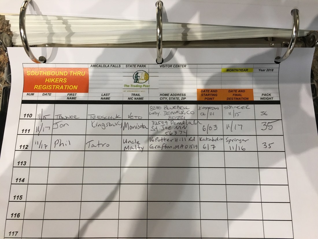
Upon reaching the visitors center, I signed the trail log and waited for a ride I had arranged to take me to the North Springs MARTA train station, from which I would ride into Atlanta and visit friends before flying back home.
I hope everyone enjoyed following my journey. Thank you for being part of my trip and for putting up with any typos or errors in my blog, which I wrote and maintained on my iPhone. While I do not have any other major hikes planned, I plan to continue to post pictures and reports from future dayhikes and weekend backpacking trips. I would be happy to have you continue to follow my blog if you are interested. I am looking forward to getting back to the White Mountains in New Hampshire this winter and hope to finally visit Isle Royale National Park in Michigan next summer.

Congrats Uncle Malty!
What an accomplishment! Your blog was great! Well written, pictures beautiful, enjoyed reading and following you on the trip of a lifetime . Glad you are home safe!
LikeLike
Congrats! Loved following your trek.
LikeLike
Congrats!!!!
LikeLike
Congratulations, Uncle Malty. An amazing achievement and wonderful photos and commentary along the way. You are a special human being (which my daughter Jill Pendleton had told me when she first informed me about your hitting the trail!) Thanks for sharing your journey with us.
LikeLike
Congratulations Phil! I’ve been following your trek through this blog since you began and have thought of you many times; both out of envy (for the great writing and scenic photos) and sometimes with concerns (during the bad weather spells). I’m glad to see you will be continuing your posts for future hikes. It gives me good reason to keep your bookmark at the top of my browser and check in on your new adventures!
Hope to see you soon,
Jim
LikeLike
Congratulations! Welcome back!
LikeLike
Well done and thank you, Sir! I have enjoyed following the chronicles of your journey of five months. Now you should enjoy much deserved rest. Merry Christmas!
LikeLike
Enjoyed the blog. Thinking of doing a thru hike. View from my front porch is Mt. Moosilauke. Lambda ’86
LikeLike
That would be a great view! That also places you close to the Woodstock Inn Brewery! Glad you enjoyed the blog. Let me know if you have any questions about thru-hiking. I am thinking about the PCT or CDT in the next few years.
LikeLike