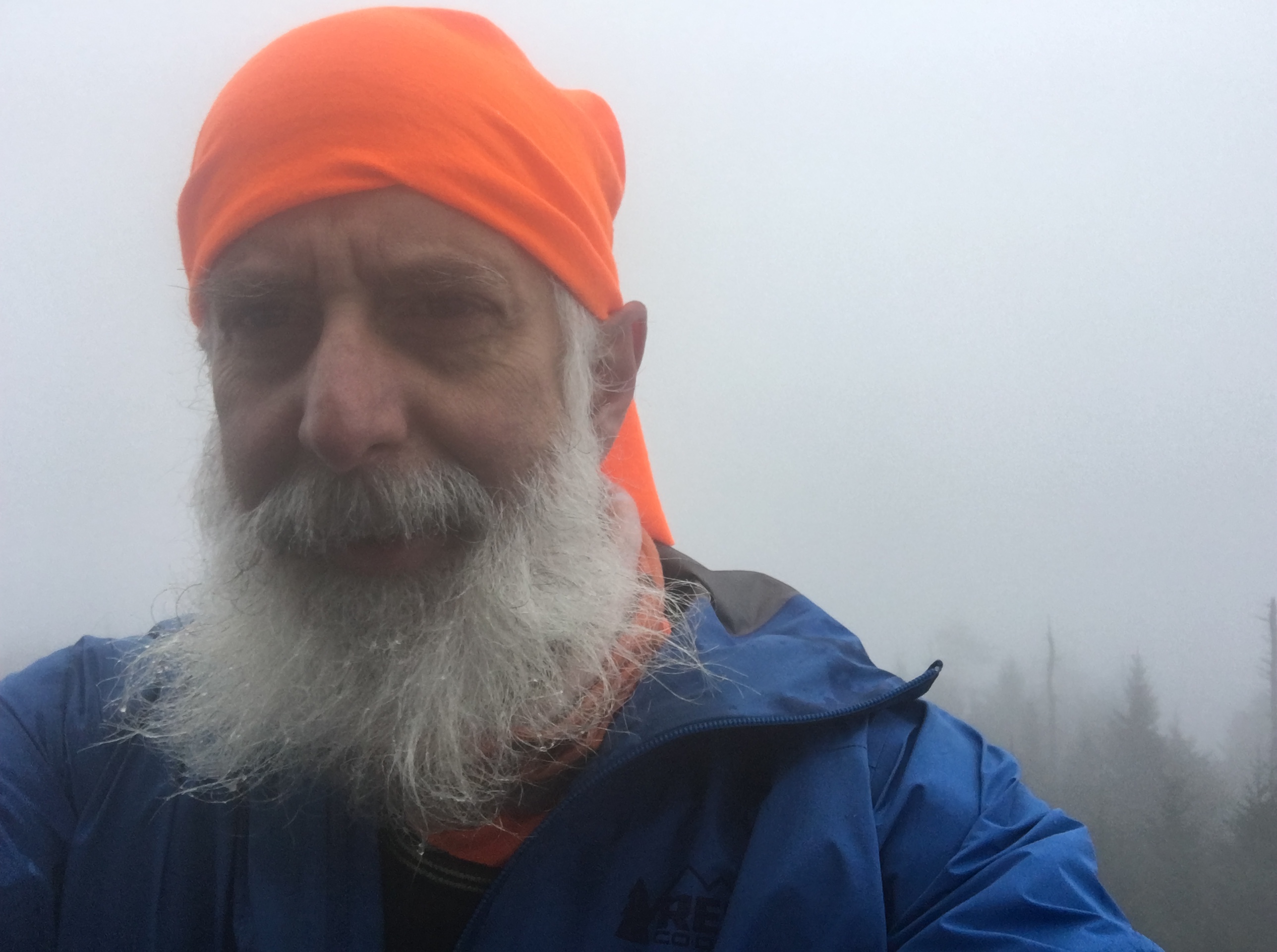
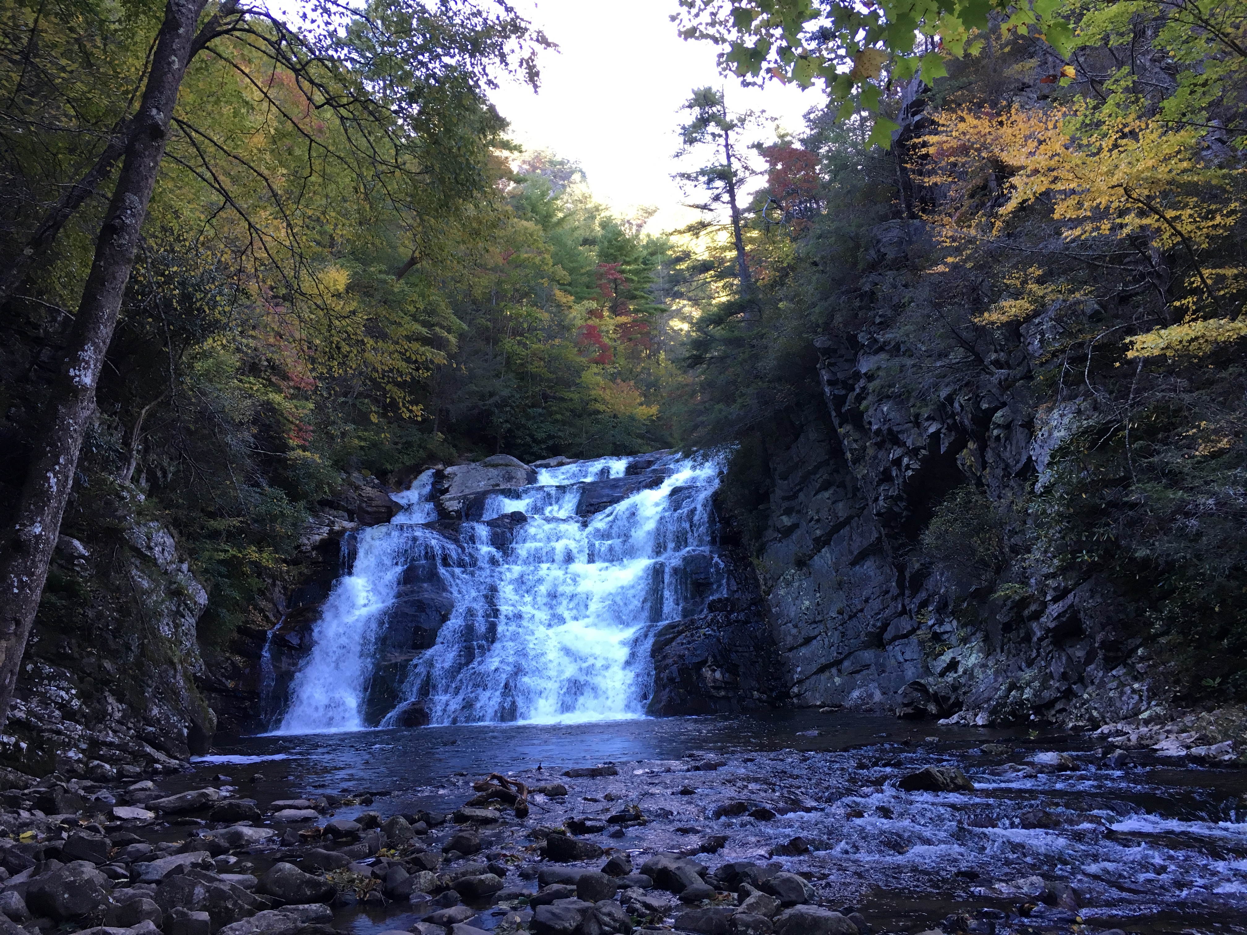
I find it ironic that as time passes, it seems harder to get away rather than easier. I recently decided I need to make getting away a priority to relax and hike. As with many undertakings, I started with baby steps and set out this past Monday for an overnight camping trip and a hike of Mt. Weeks in New Hampshire.
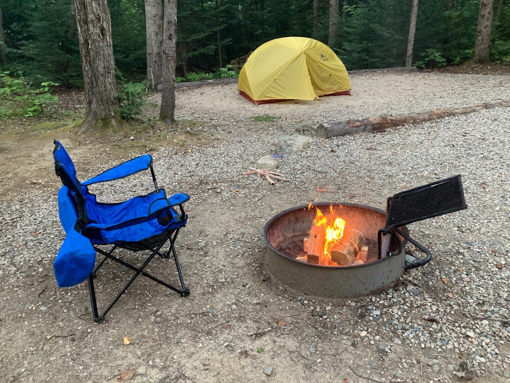
My trip started with escaping from work a few hours early on Monday and driving to the Moose Brook State Park campground in New Hampshire. I arrived an hour or so before sunset and had time to set up my tent and start a fire for cooking dinner.
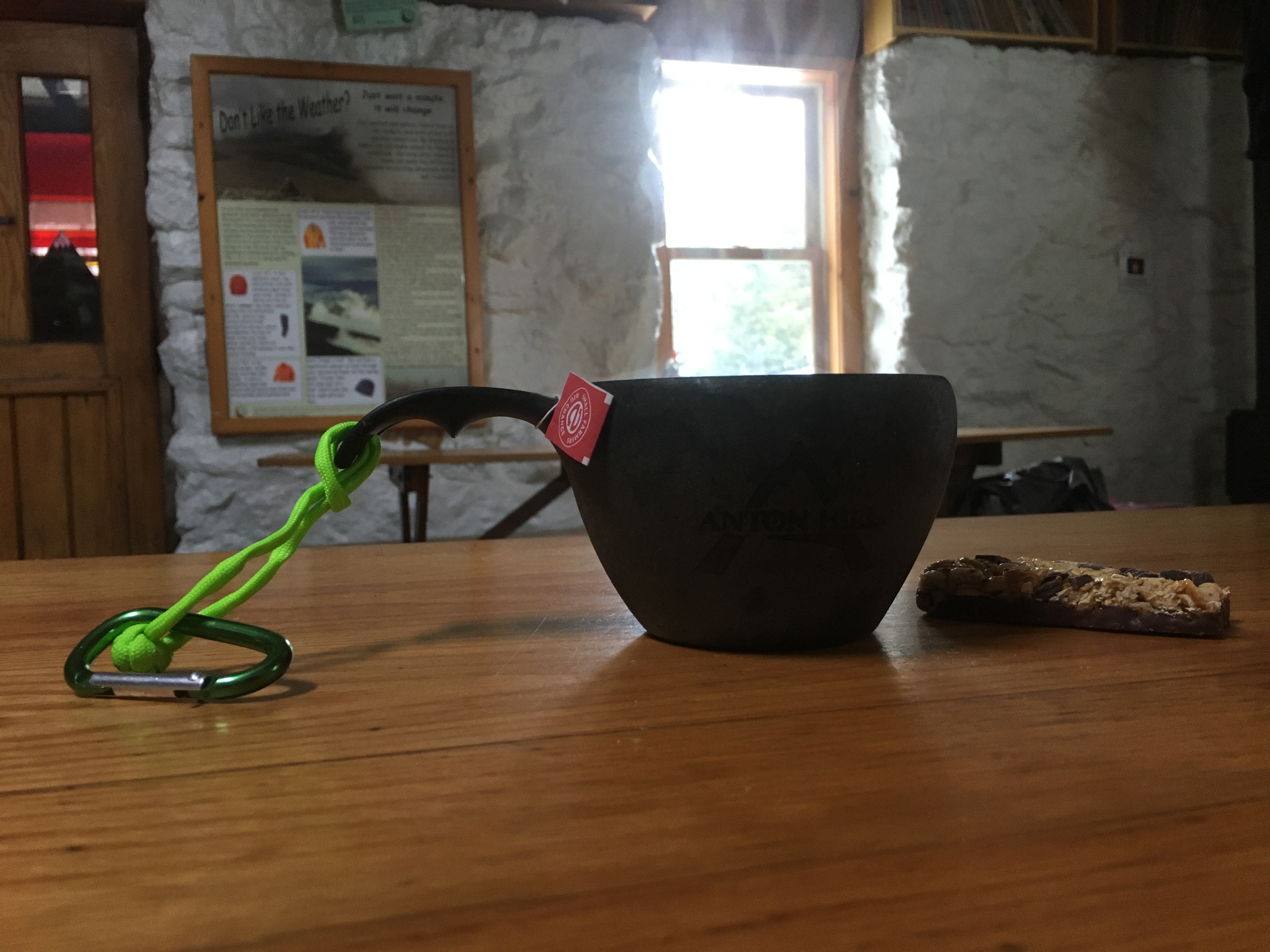
Campsite #37 at Moose Brook State Park
I have camped many times at Moose Brook, but this was likely the first time by myself. I finished dinner just after dusk and relaxed in my camp chair listening to music and reminiscing about past trips with Casey and Brian. One of our go-to campfire activities was a game we called, “Who Said It,” in which one of us would say a phrase used by a TV character and the others would guess who said it (e.g., “Missed it by that much”). I also recall reading Treasure Island to them at Moose Brook, I believe two or three campsites down from where I was on Monday.
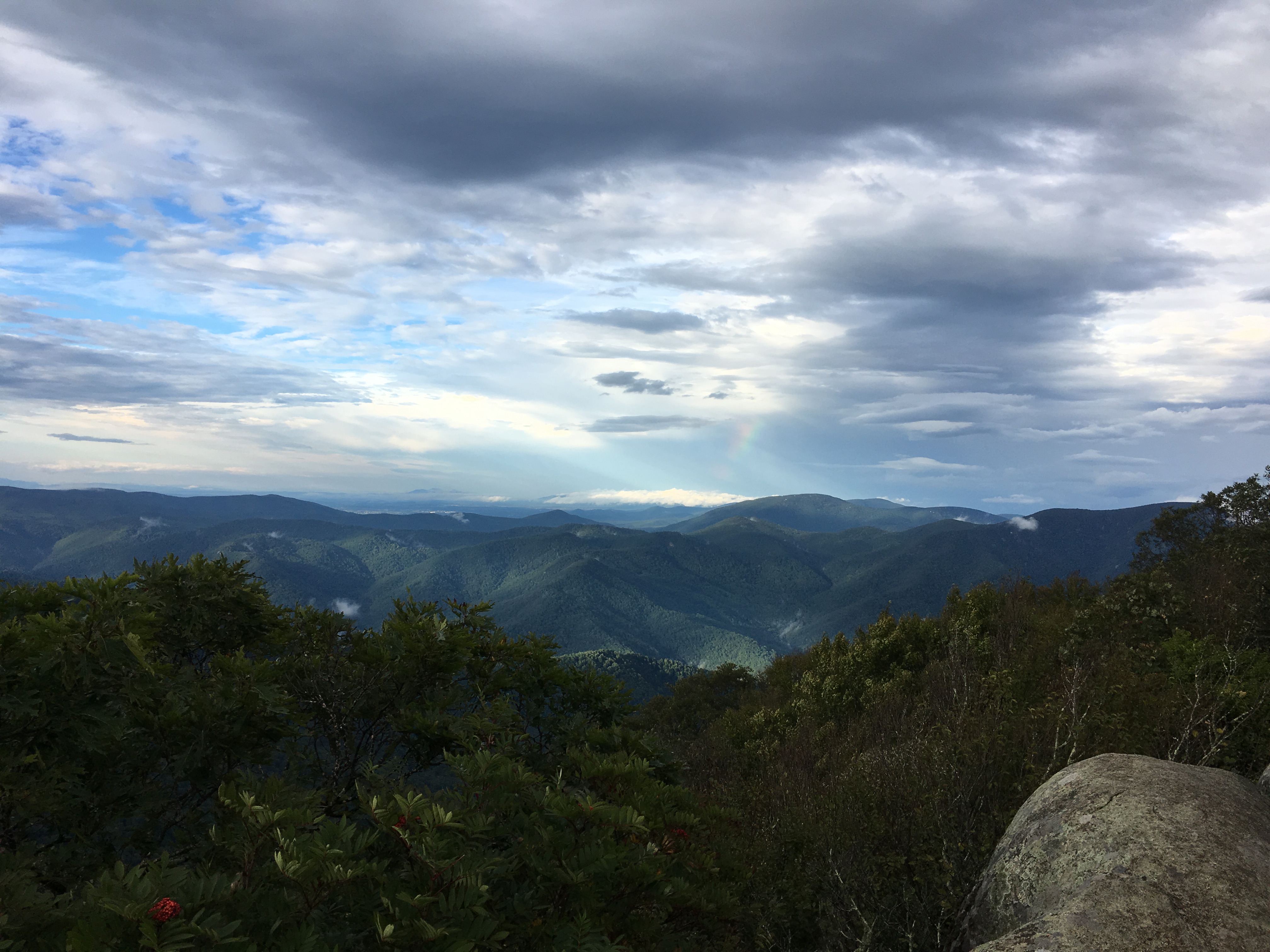
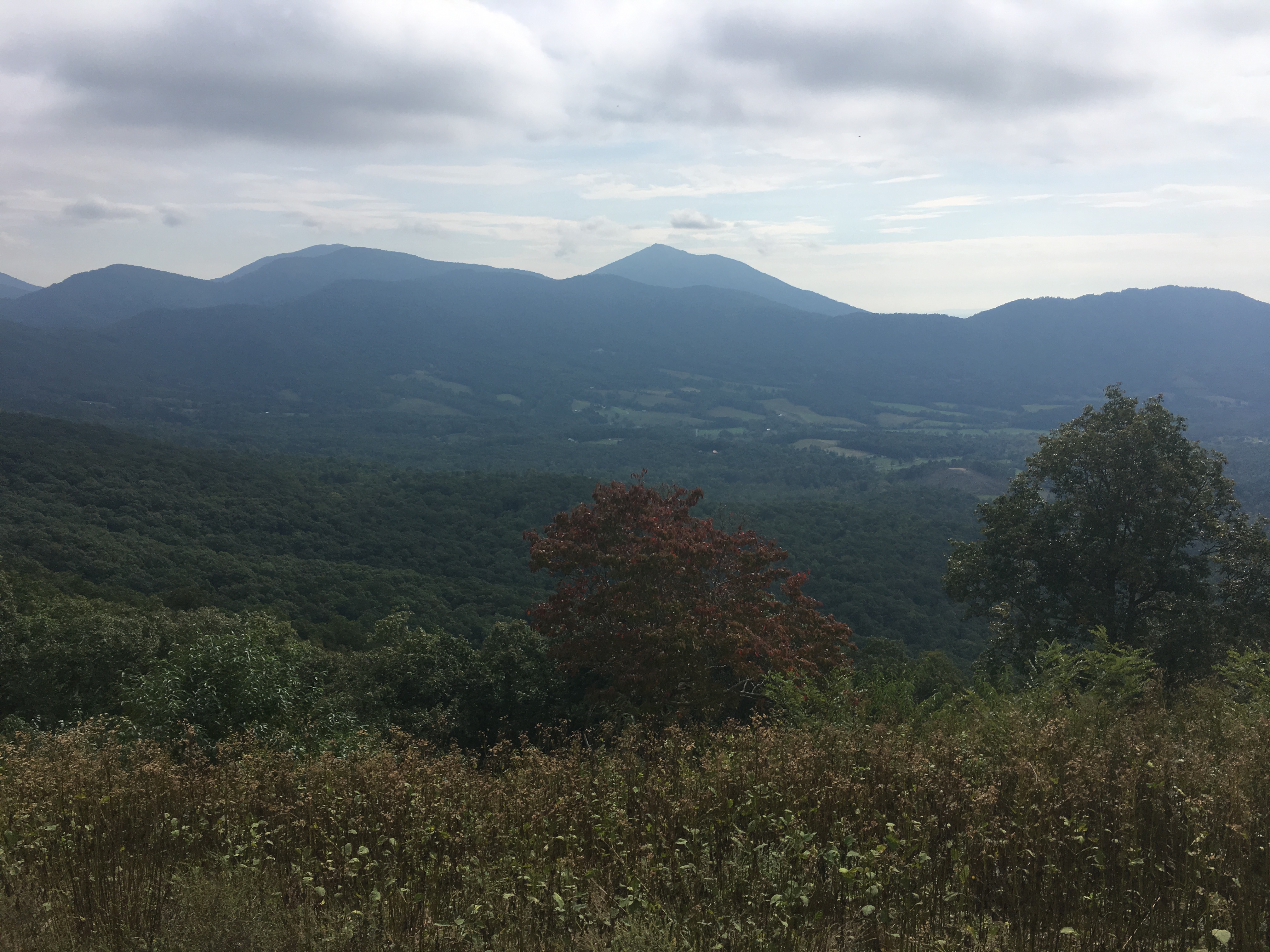
I woke to good weather on Tuesday with clear skies and a bit cooler than the past few weeks. After a quick breakfast and a short drive, I was at the Starr King Trailhead where I would start a full day of hiking — approximately 17 miles and 5,400′ of cumulative elevation gain. The motivation for the day is I am working on completing the New England Hundred Highest summits, and the north and south summits of Mt. Weeks would be #71 an #72. The first 3.6 miles would cover trail I have hiked twice before over Mt. Starr King to Mt. Waumbeck, followed by 4.9 miles to Mt. Weeks.
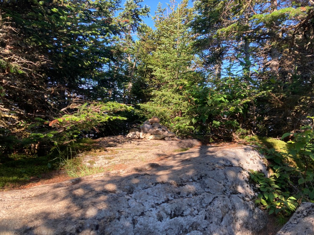
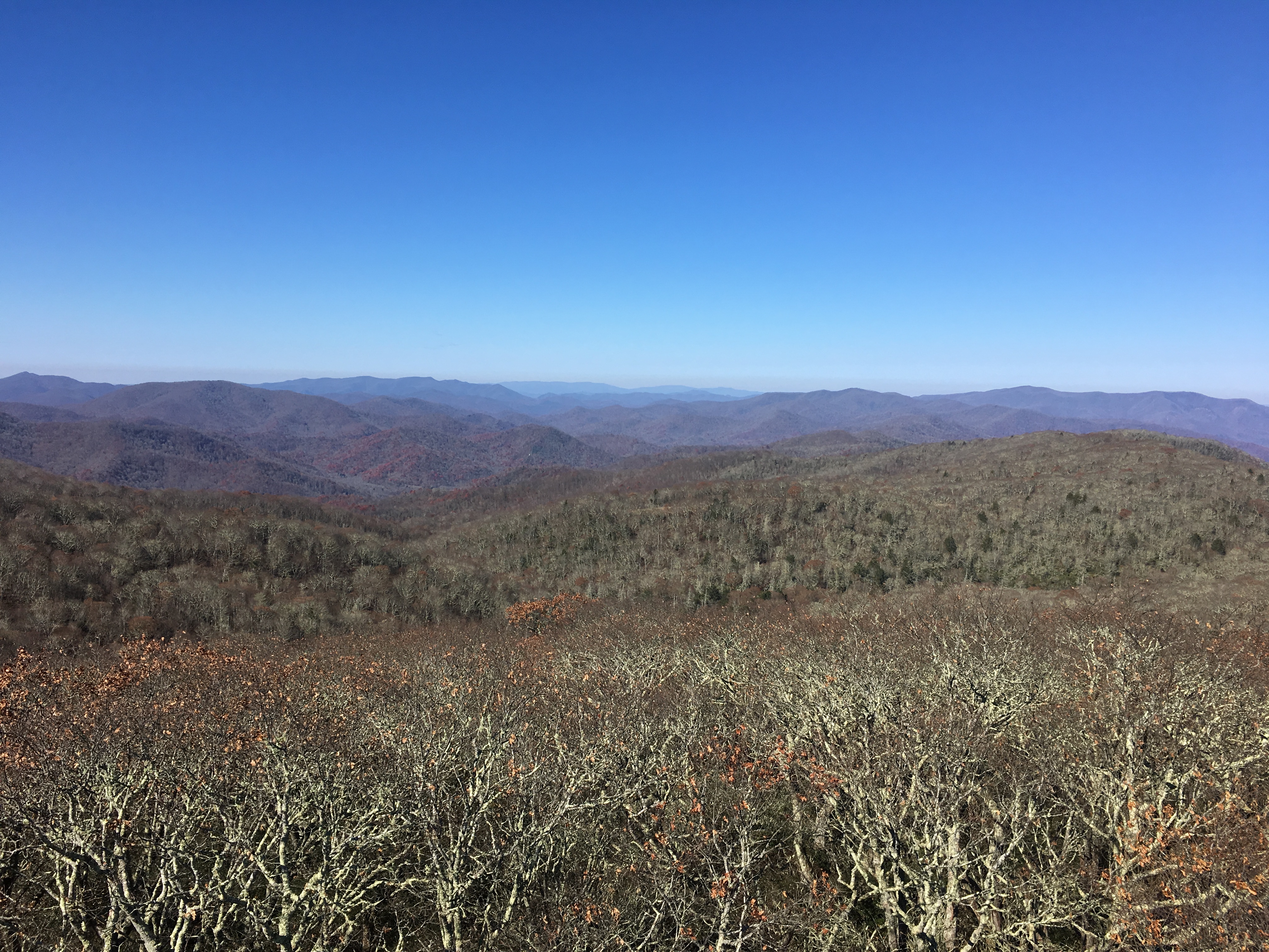
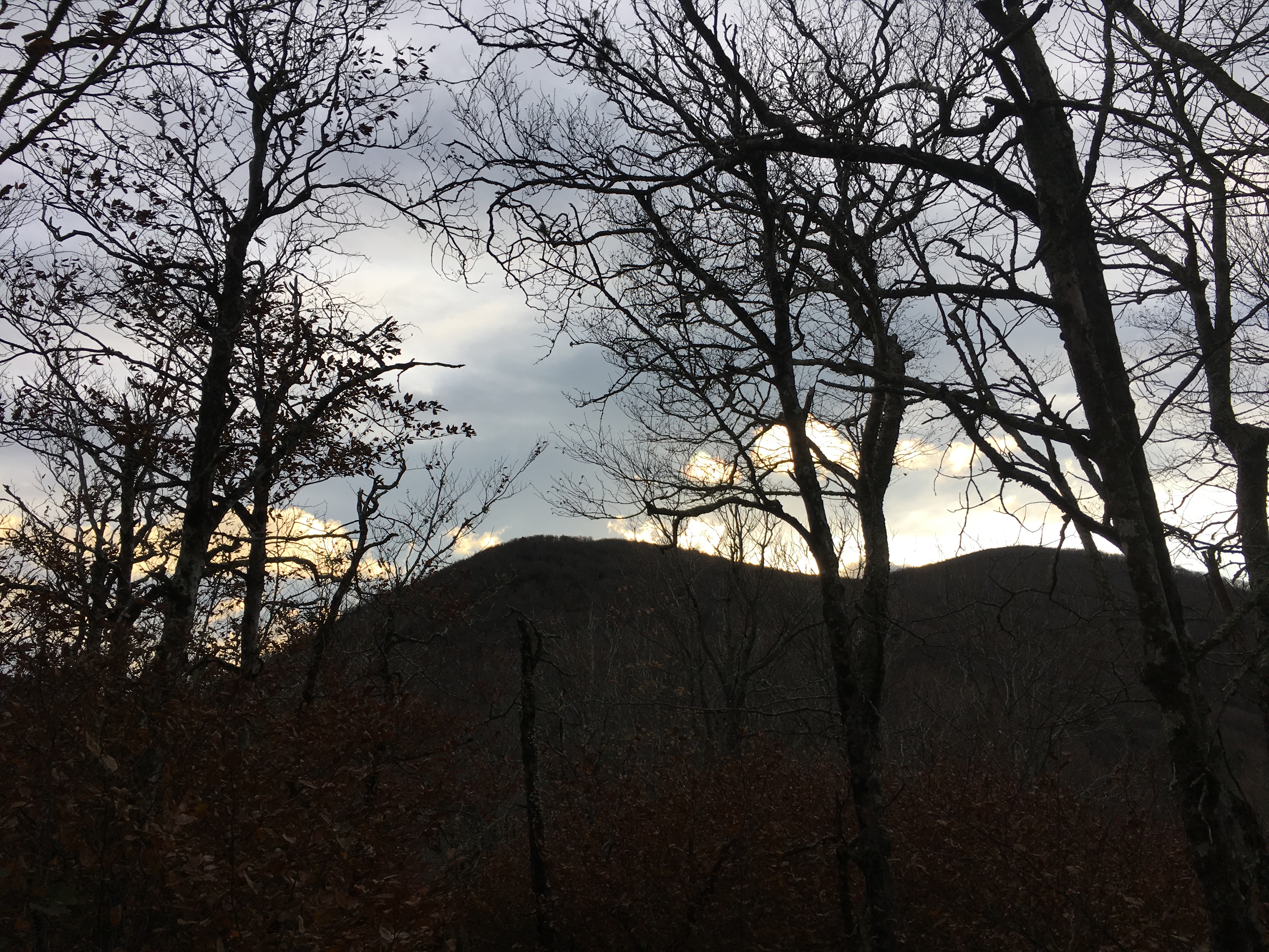
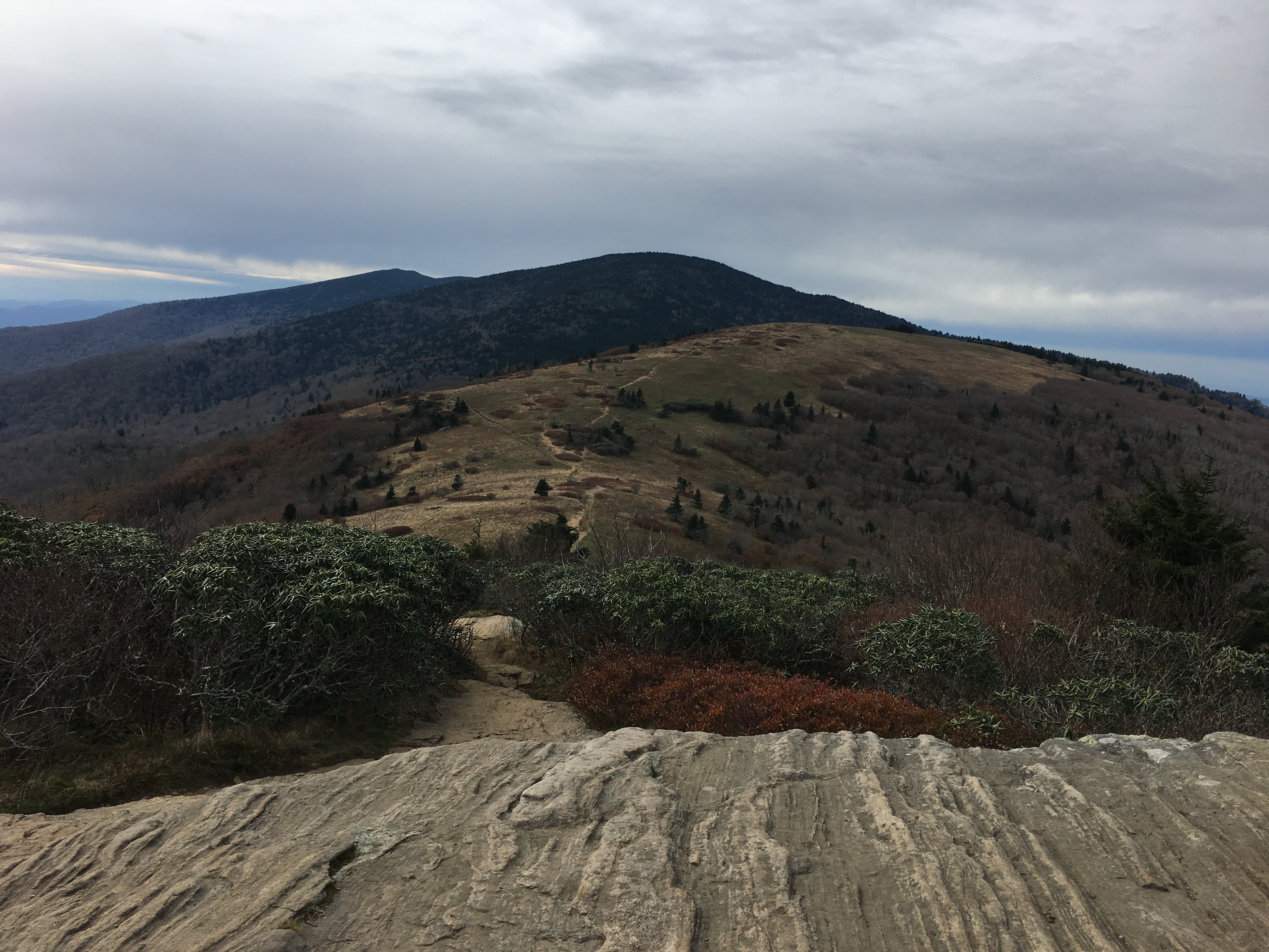
I made good time and soon found myself at Mt. Starr King at 3,907′ above sea level. I knew the day would offer limited views, but would make up for it with a chance for solitude on less traveled trails. The summit of Mt. Starr King is treed-in, but just past the summit is an area that offers some limited views.
The Summit of Mt. Starr KingView to the East just Past the Summit of Mt. Starr King
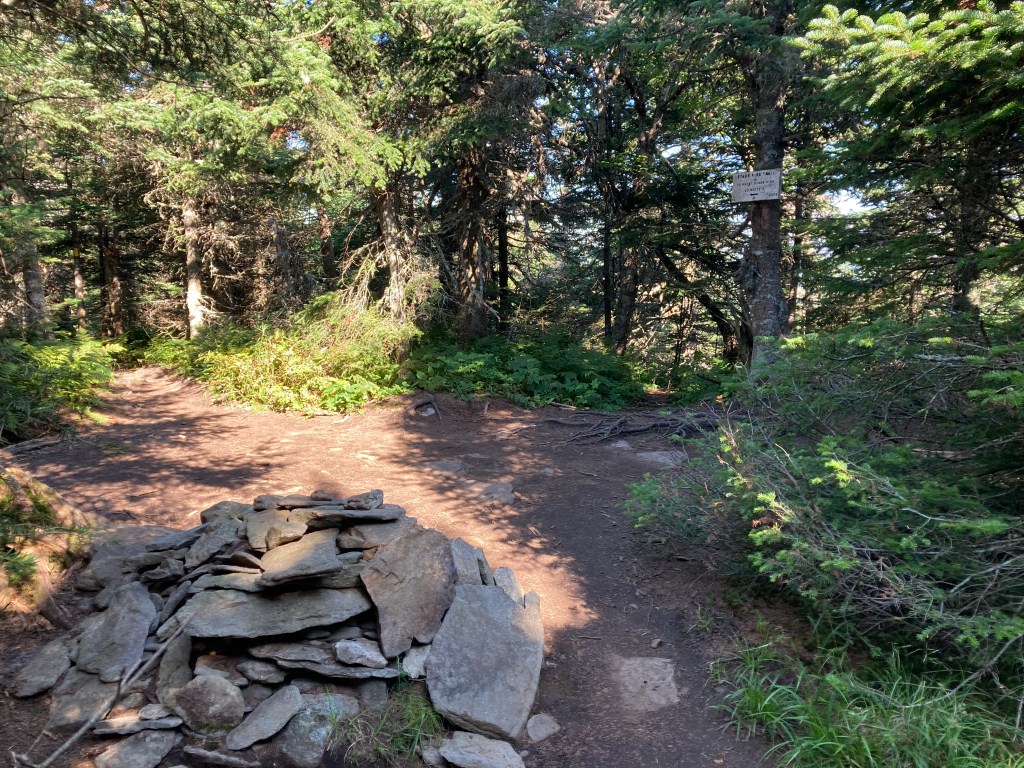
Another mile found me at the summit of Mt. Waumbeck, one of the forty-eight 4,000′ foot peaks in New Hampshire, albeit one of the shortest at 4,006′. At the summit of Mt. Waumbeck is the end of the Starr King trail, and the start of the Kilkenny Ridge Trail that traverses Mt. Weeks and continues on to Willard Notch, Mt. Cabot, Unknown Pond, Rogers Ledge, and the Devil’s Hopyard. At some future time, I would like to spend some time backpacking in this area.
The Summit of Mt. WaumbeckA “New” Trail to Hike
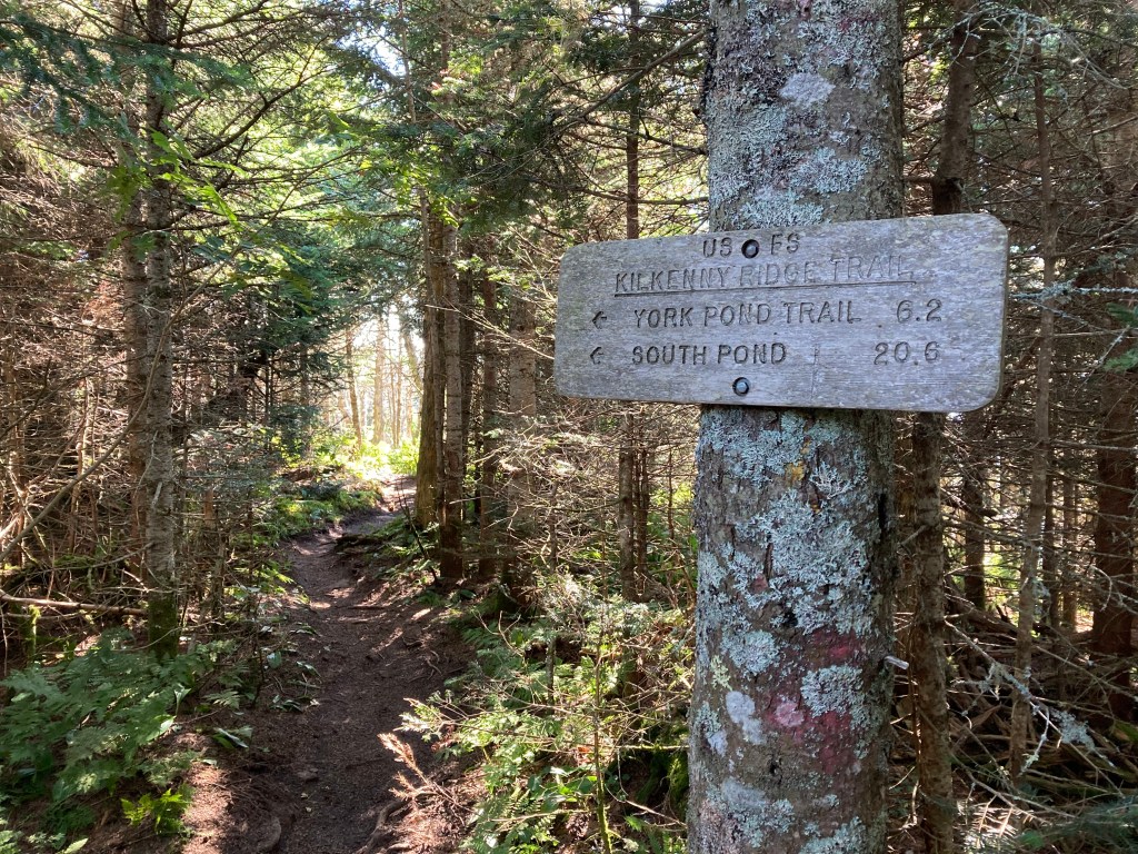
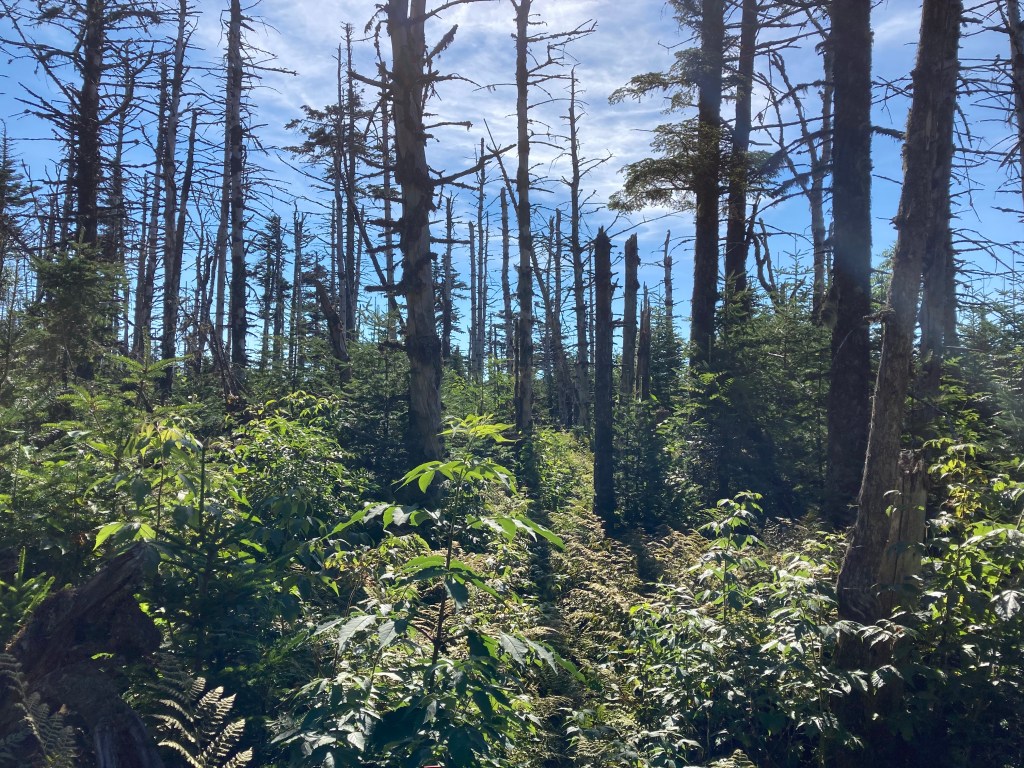
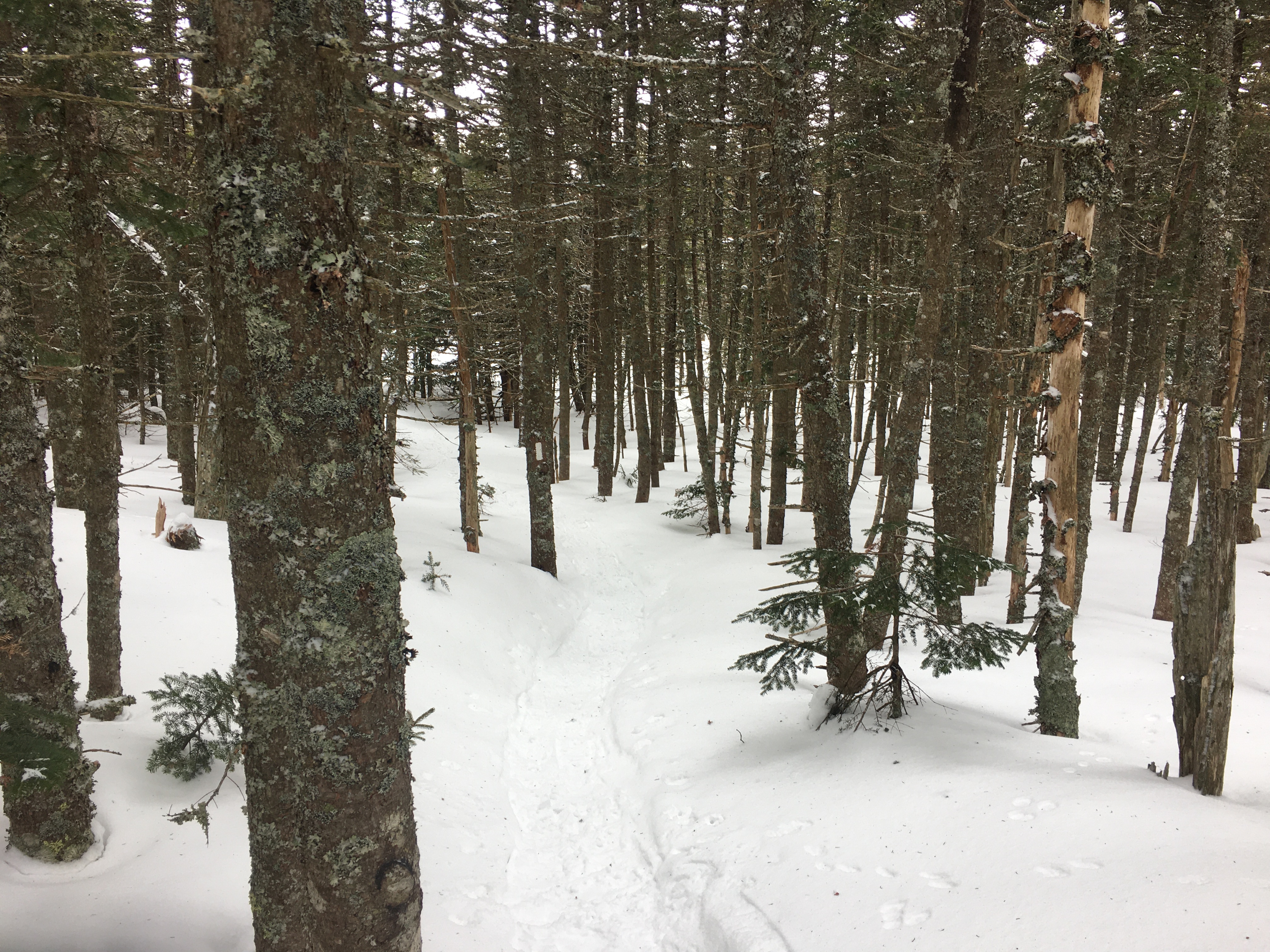
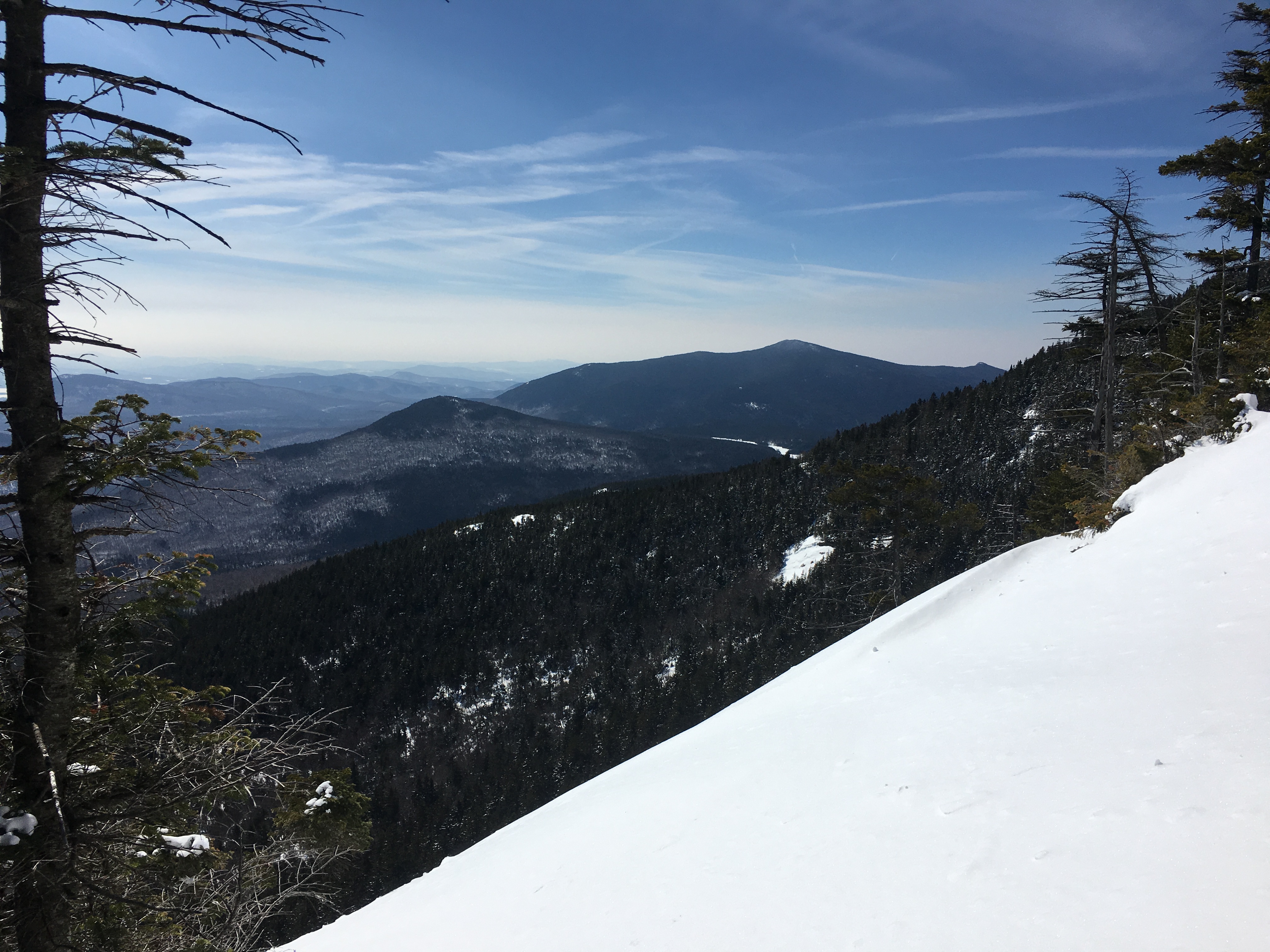
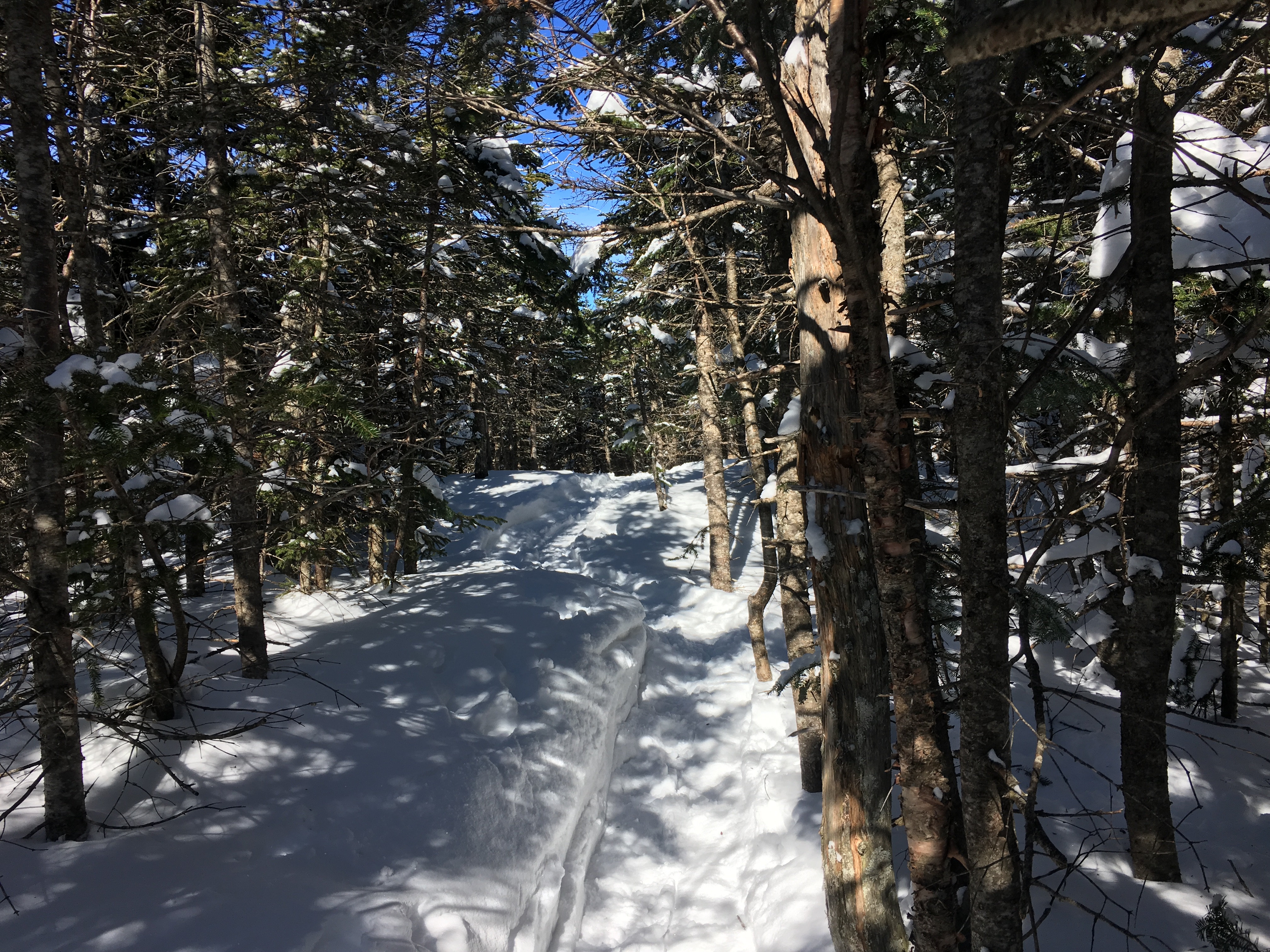
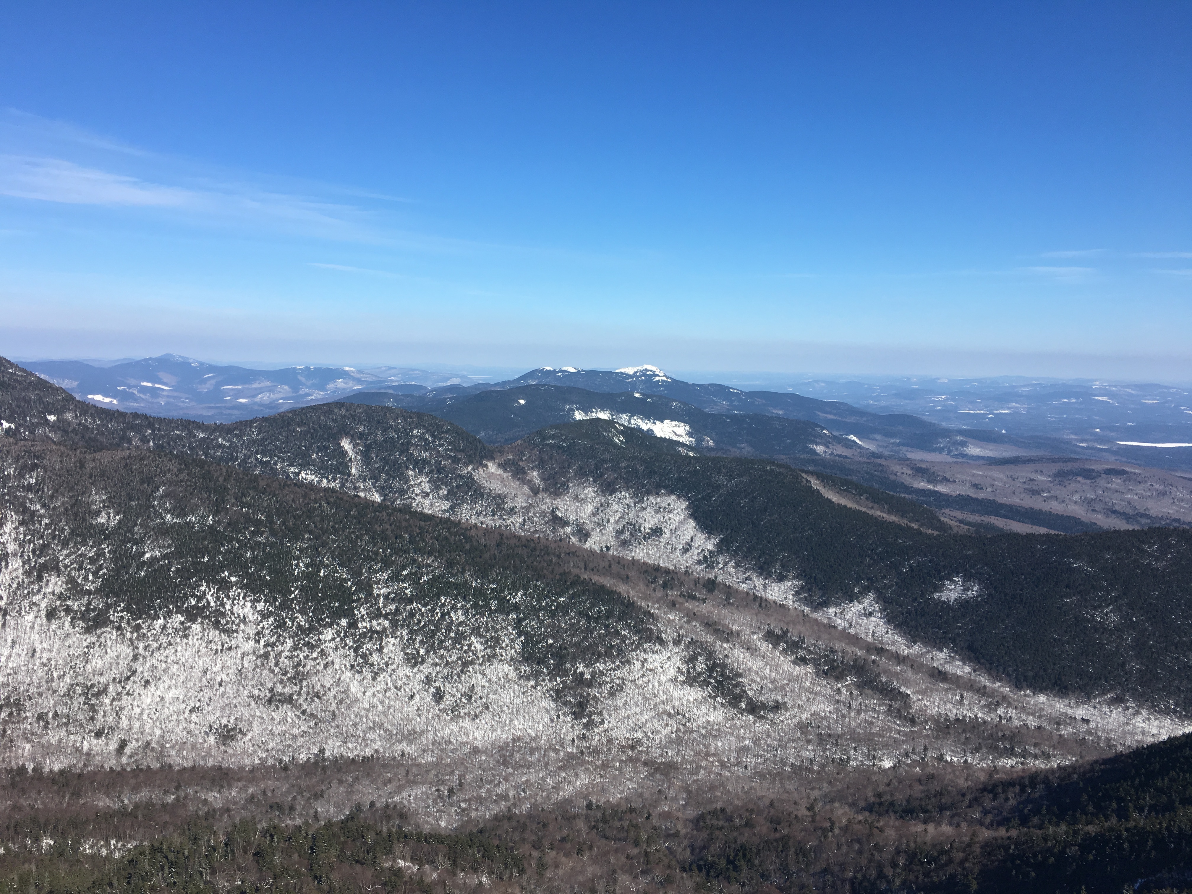
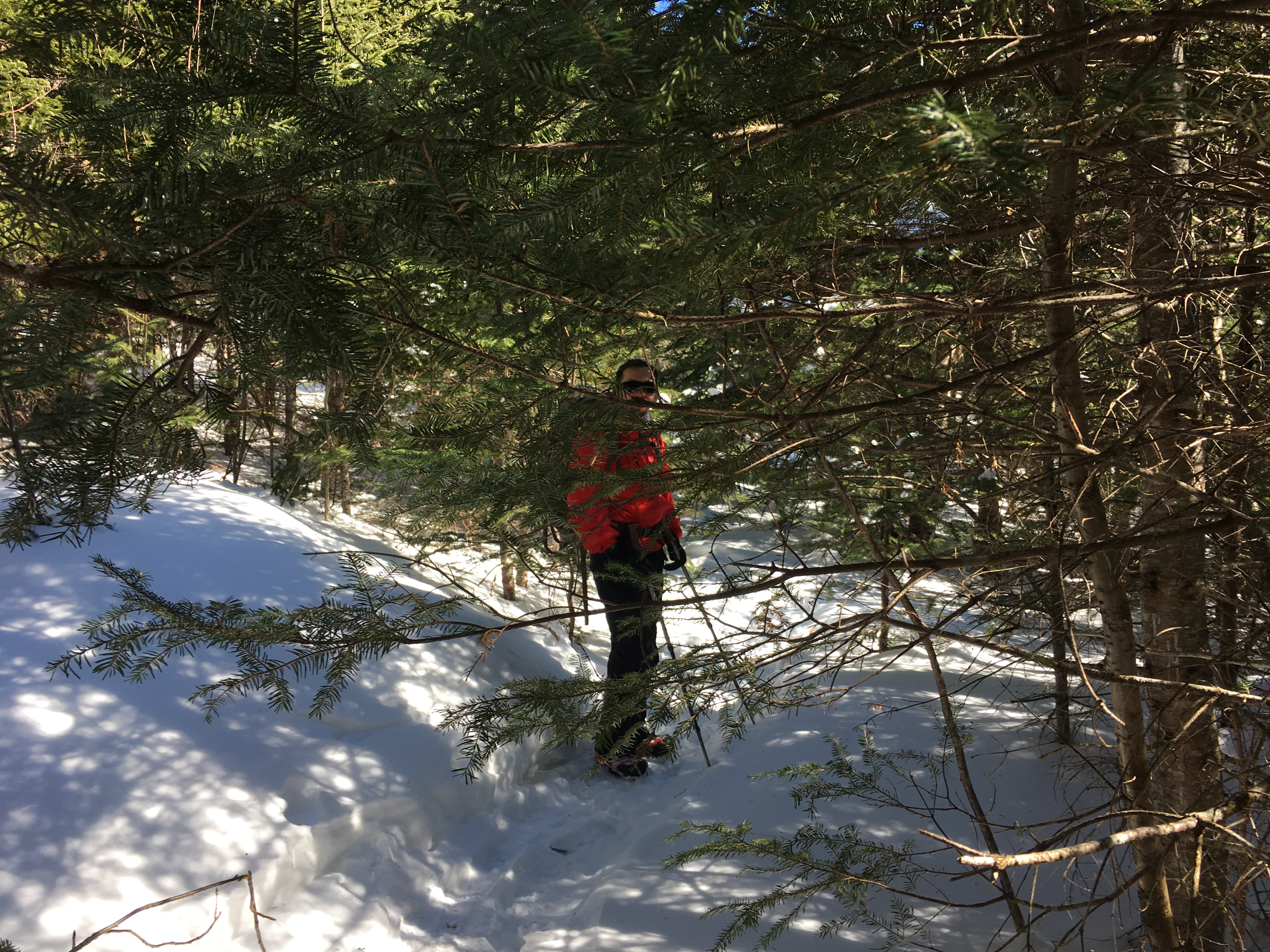
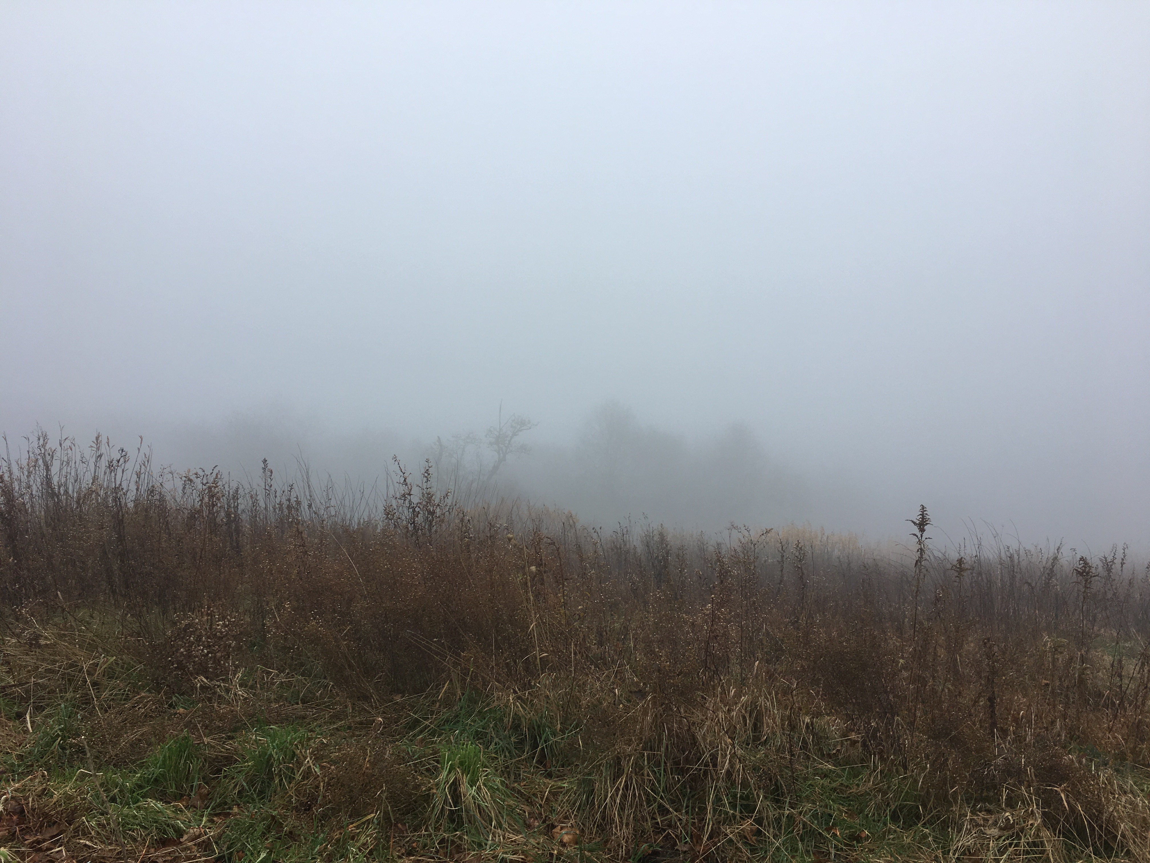
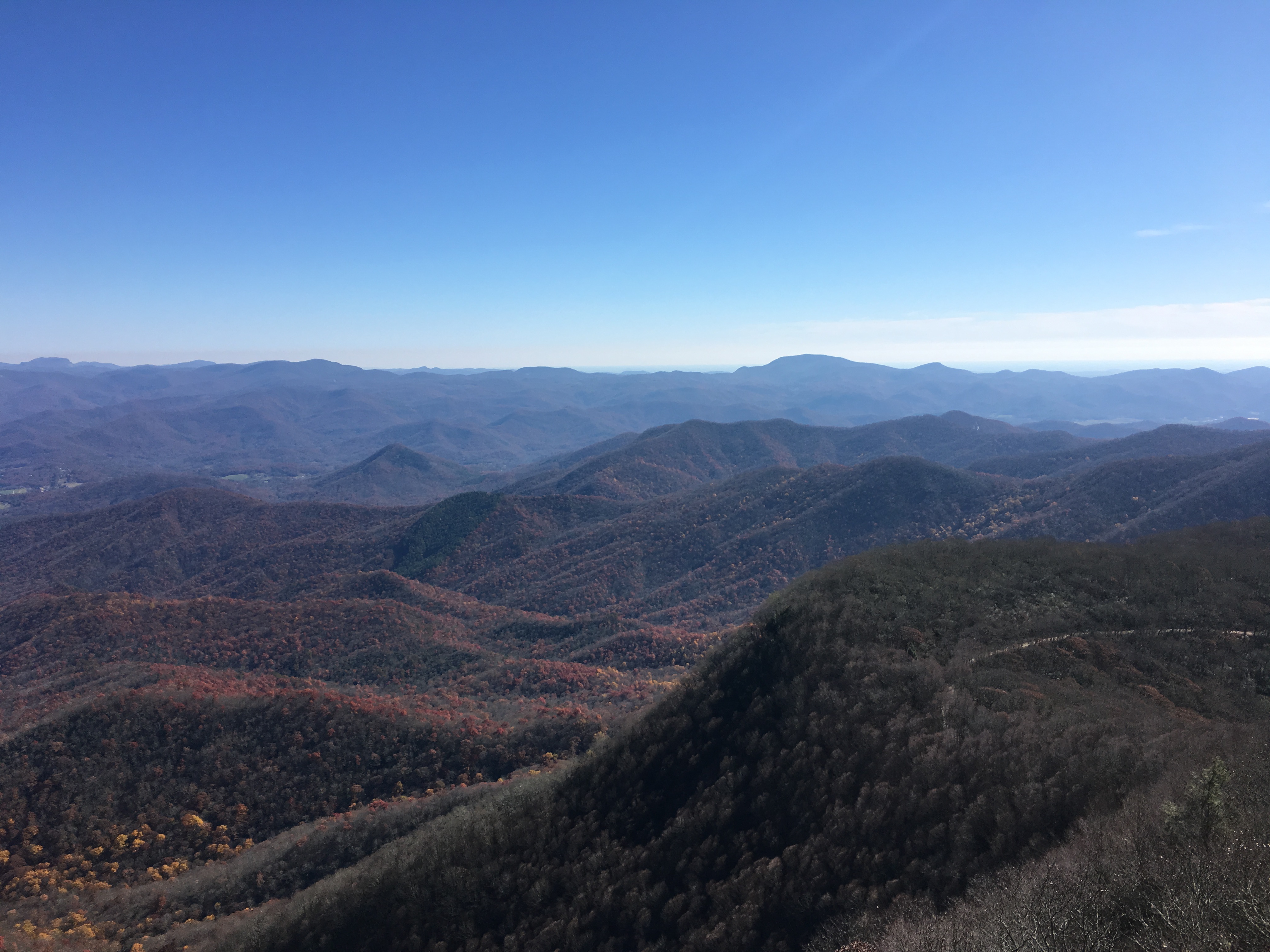
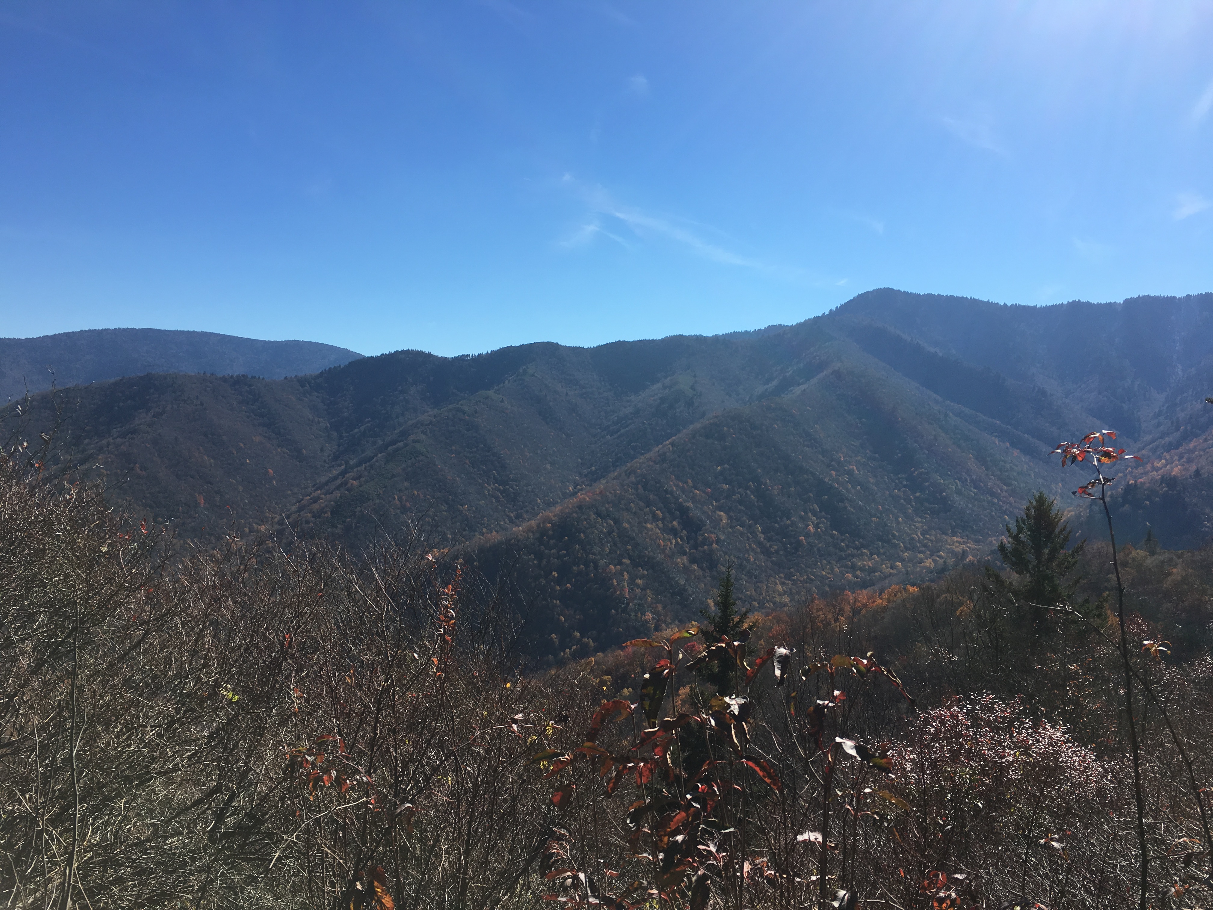
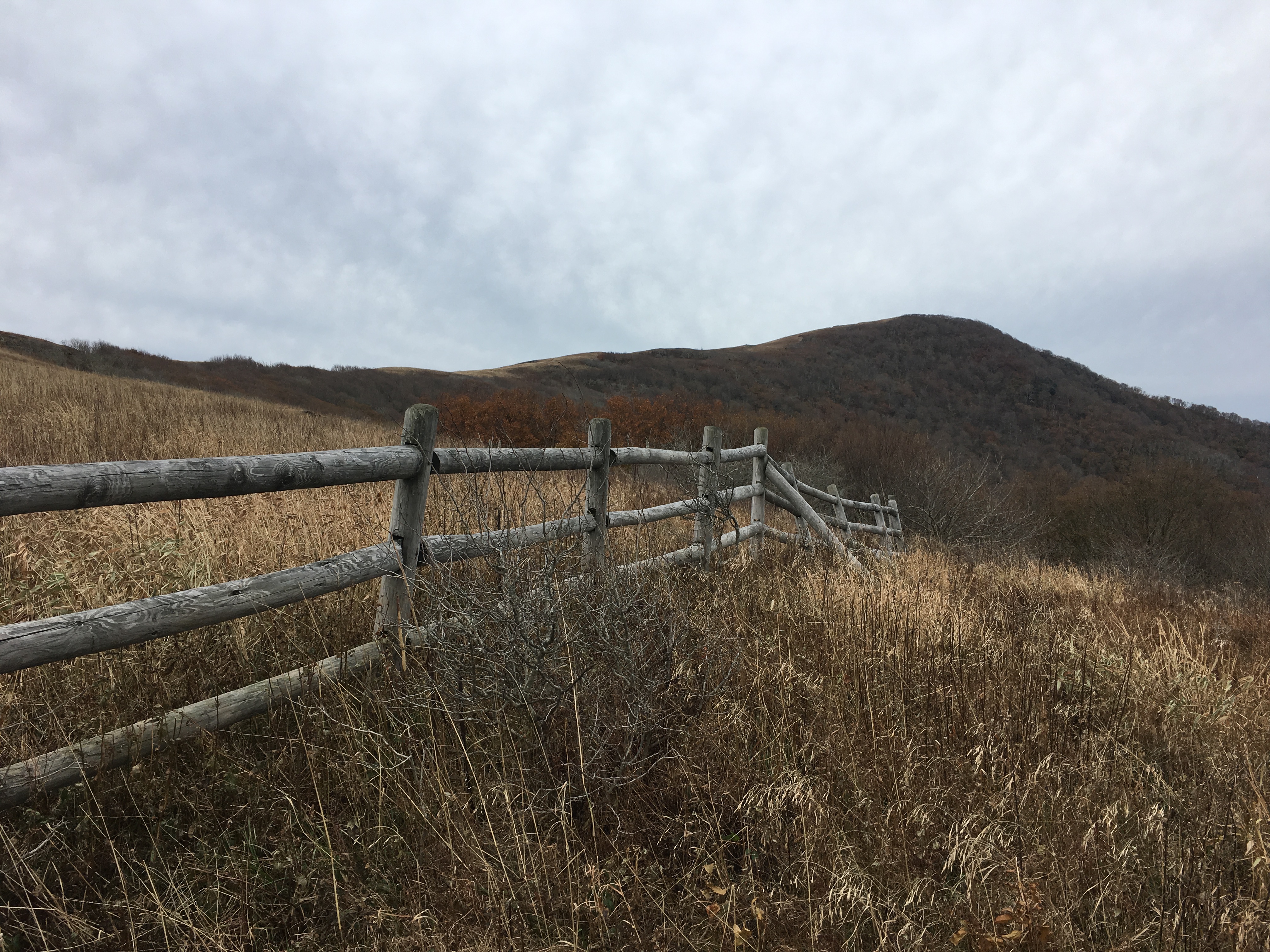
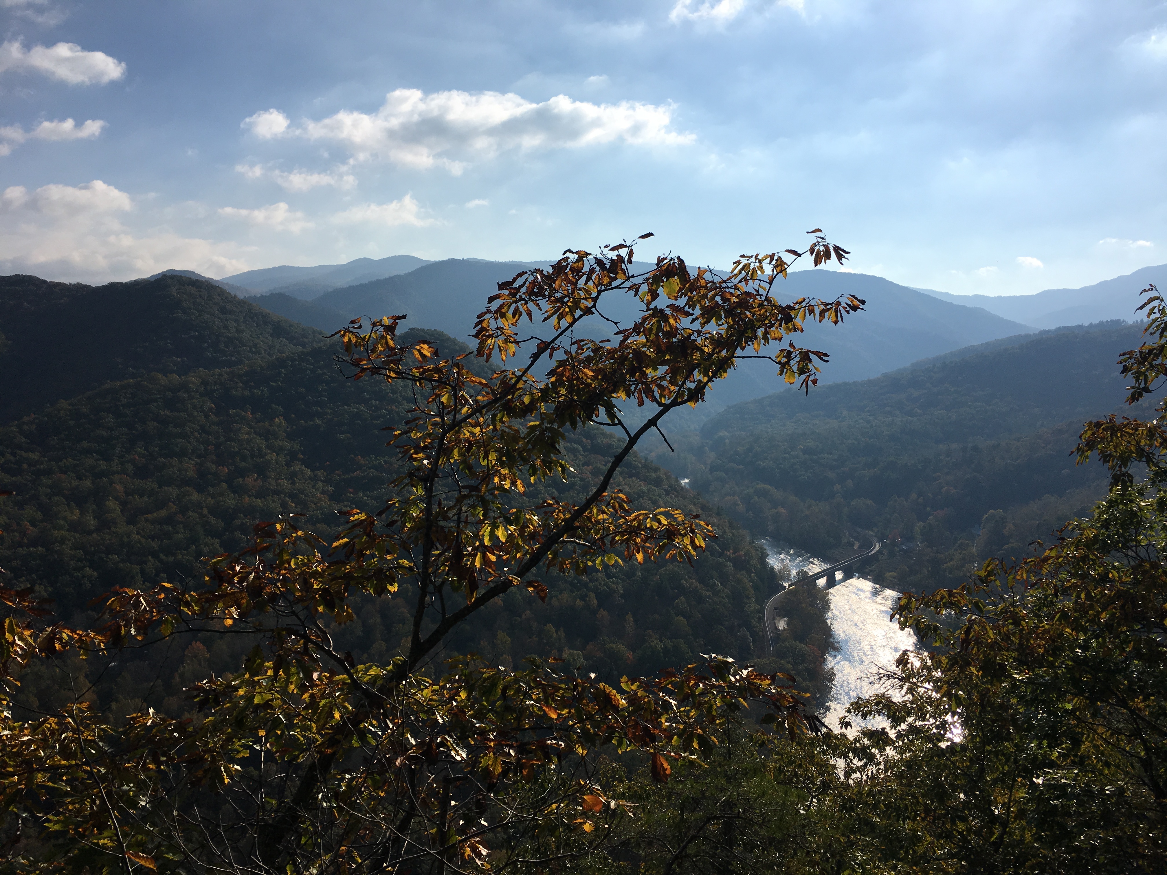
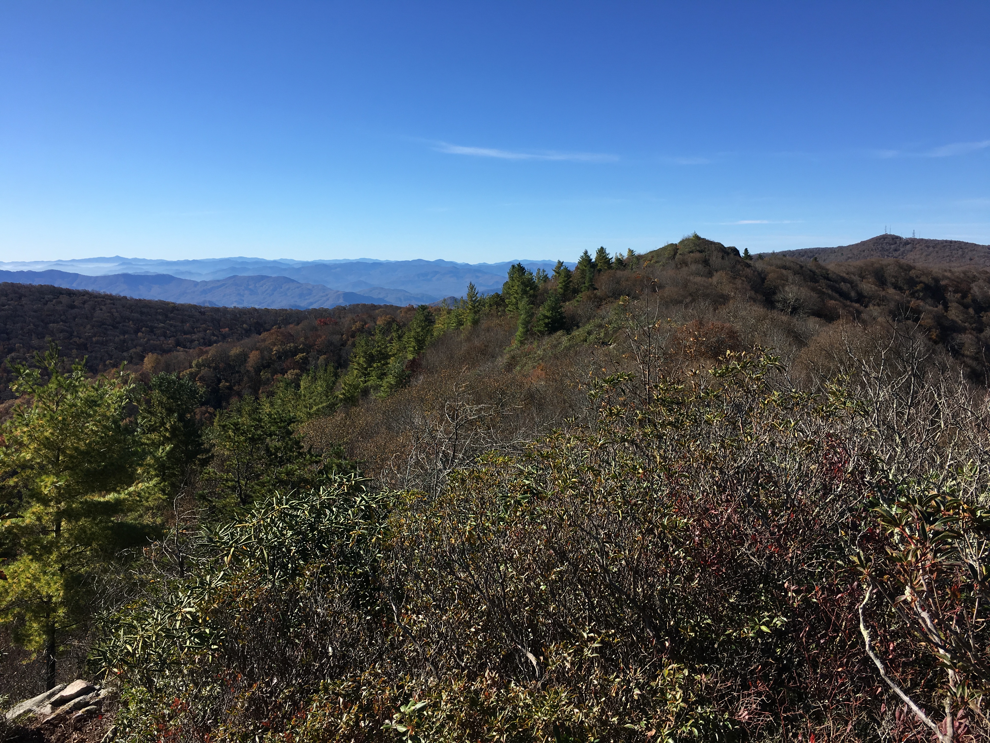
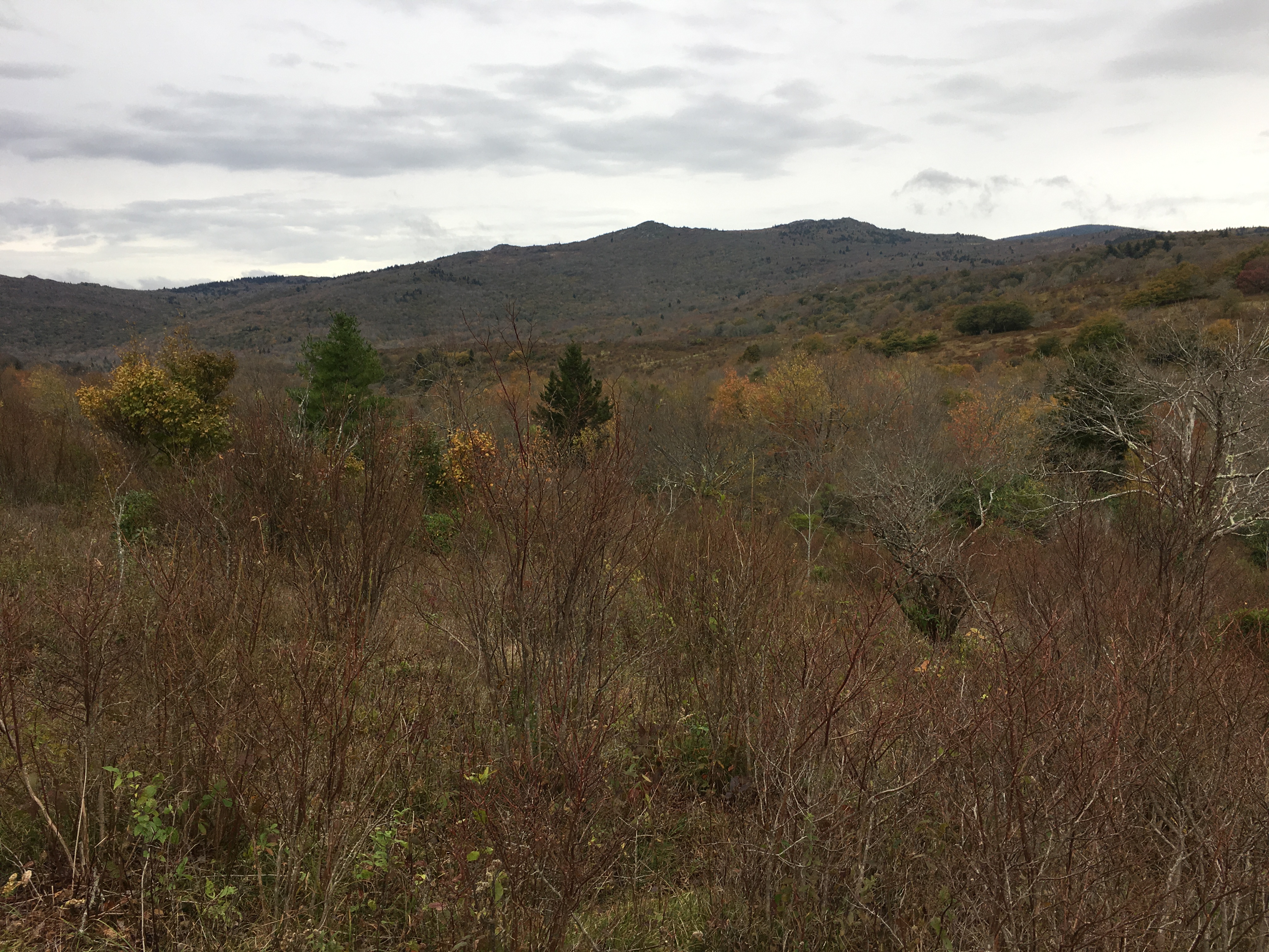
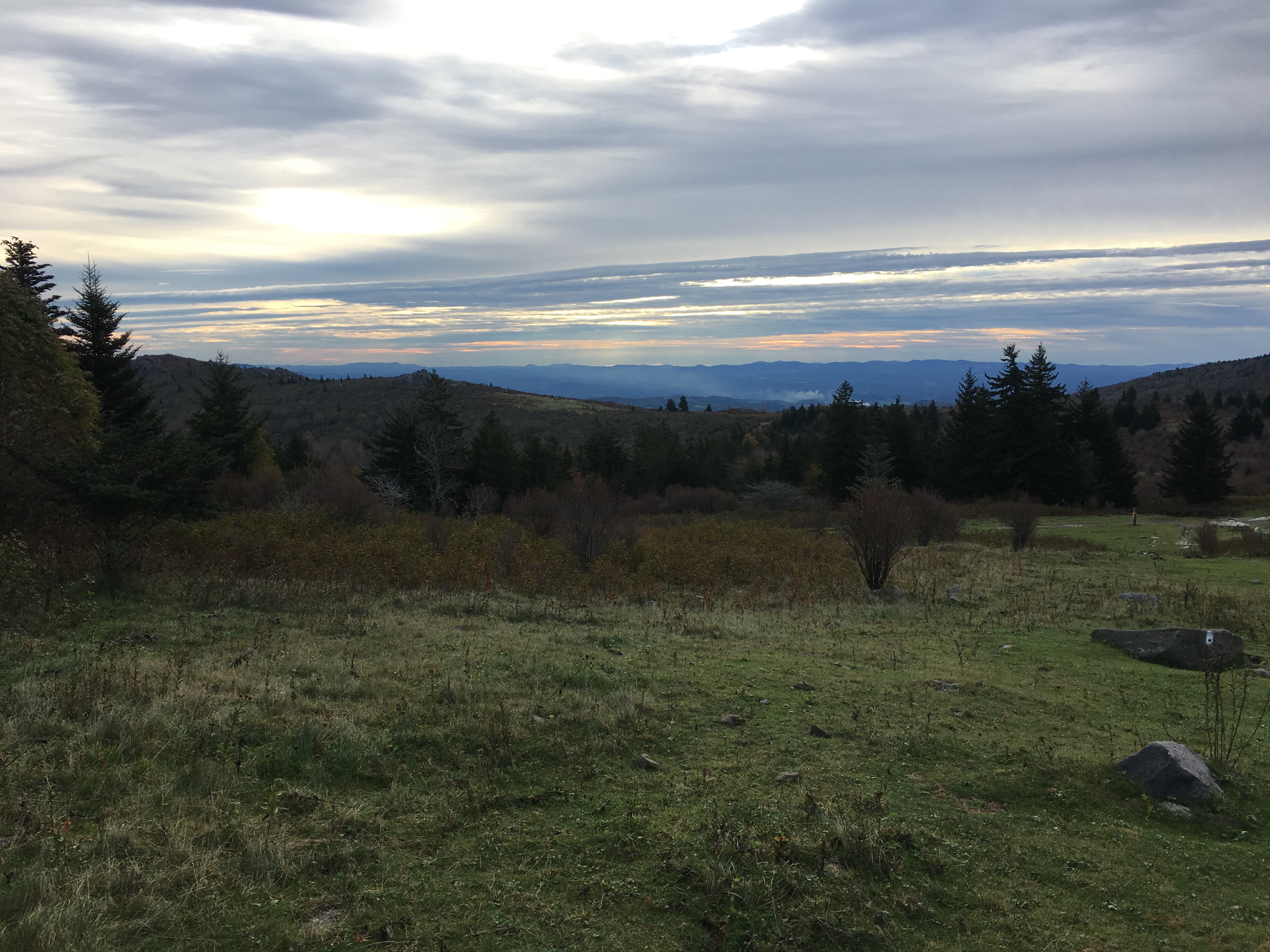
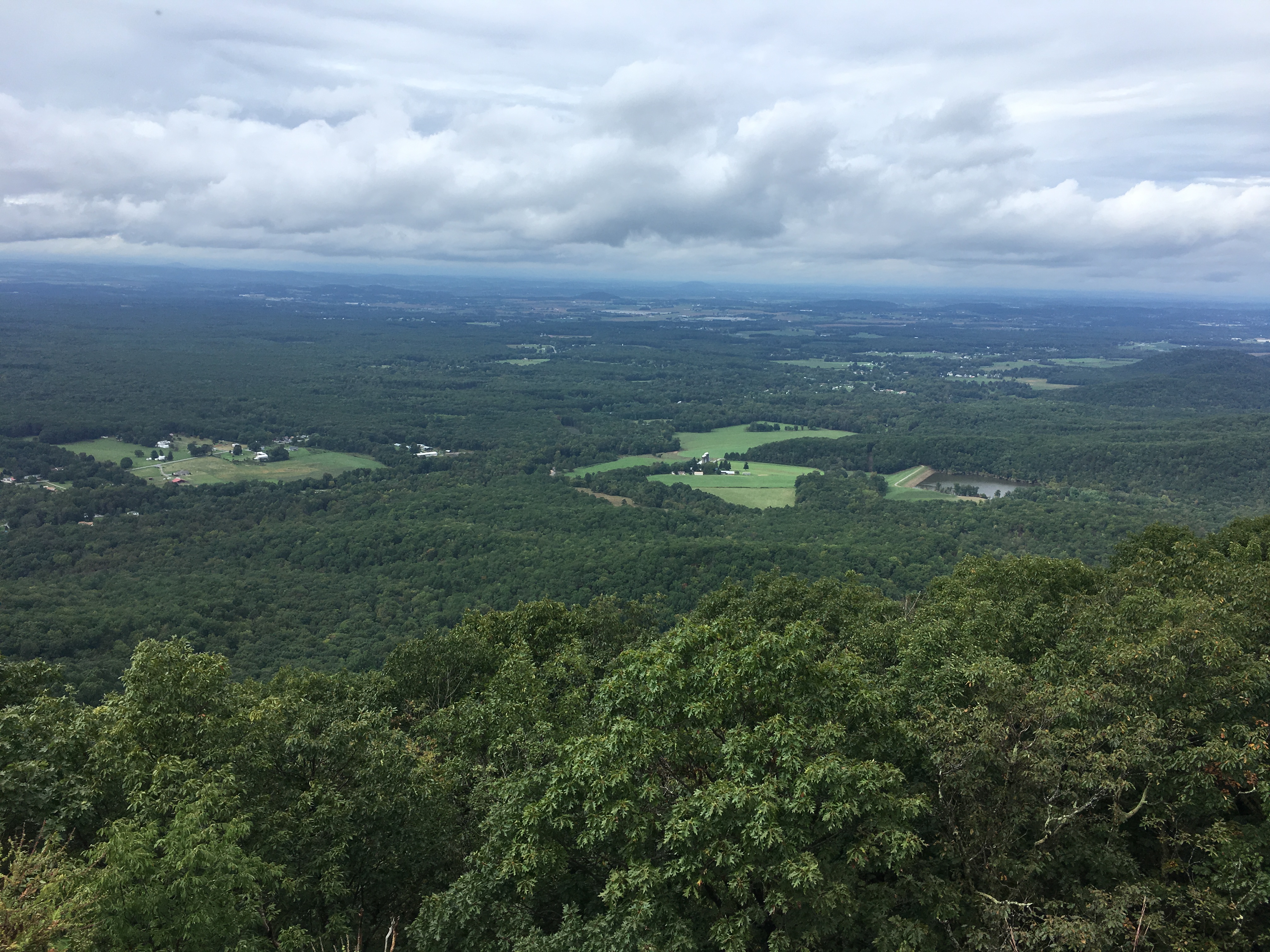
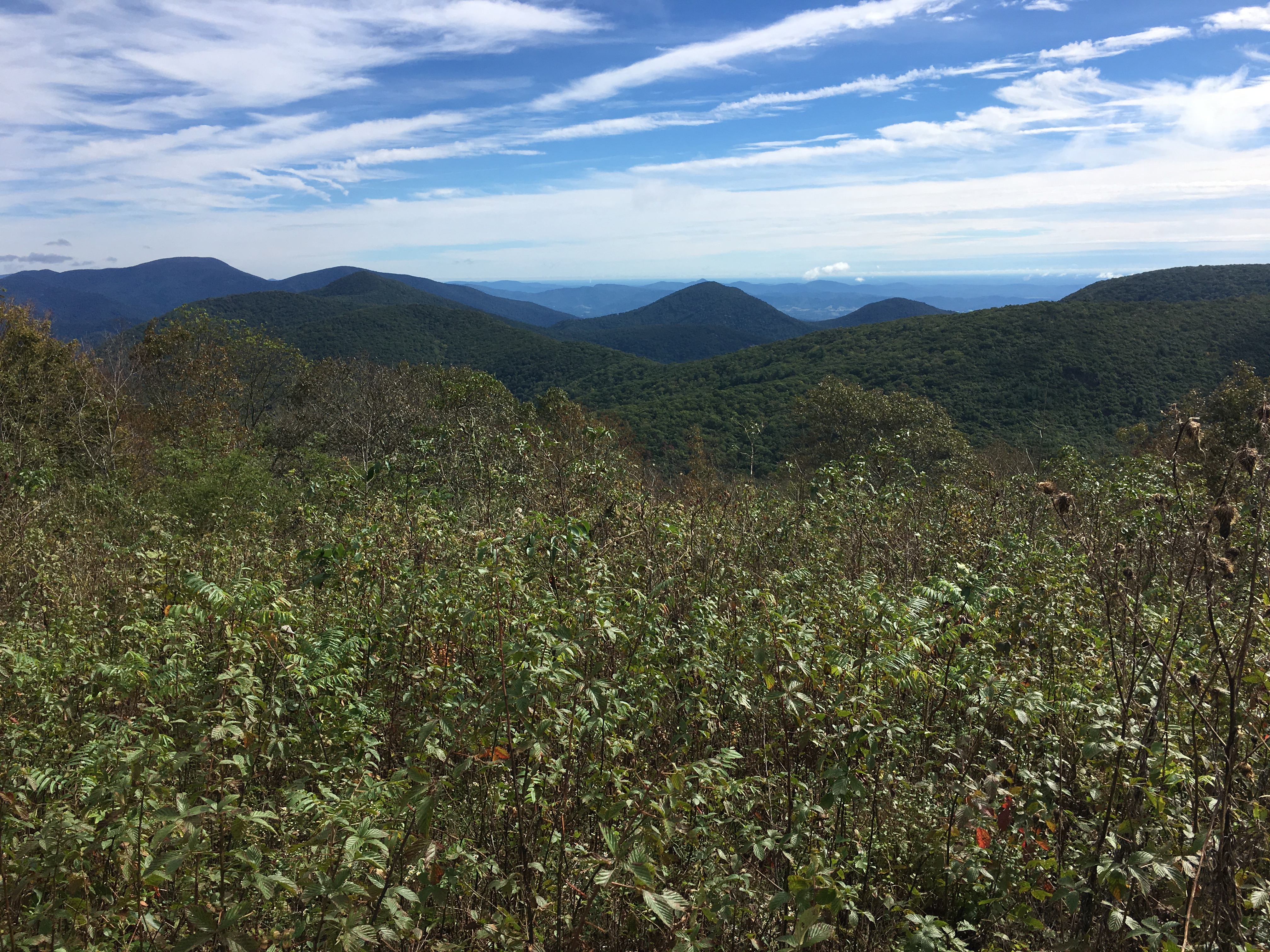
Just past the summit of Mt. Waumbeck was a nice view point. Given the position of the sun I decided to defer taking pictures until my return, as this would be an out-and-back hike. As I had read online, the trail often had me wading through waist-high ferns and wild raspberries,. However, the trail was actually rather easy to follow as the vegetation was primarily grown in from the sides, but not actually growing in the path. The first mile or so was easy hiking and fairly level, with a limited view of the south summit ahead.
Following the Kilkenny Ridge TrailApproaching the South Summit of Mt. Weeks from Mt. Waumbeck
Shortly after the taking the picture above, I descended a few hundred feet before ascending to the south summit of Mt. Weeks at 3,885′. As expected, there was no view from the top awaiting me at the summit.
The South Summit of Mt. Weeks
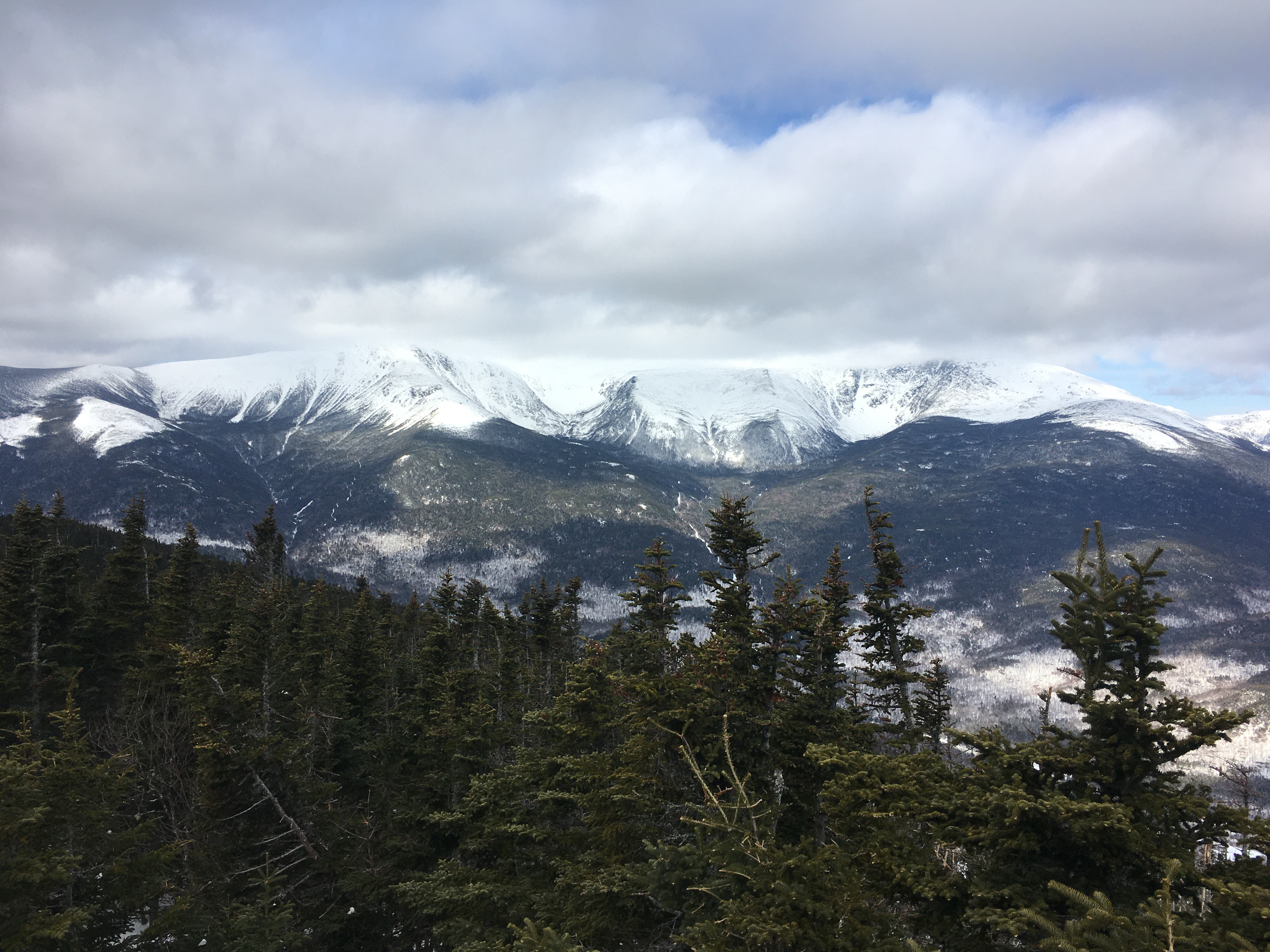
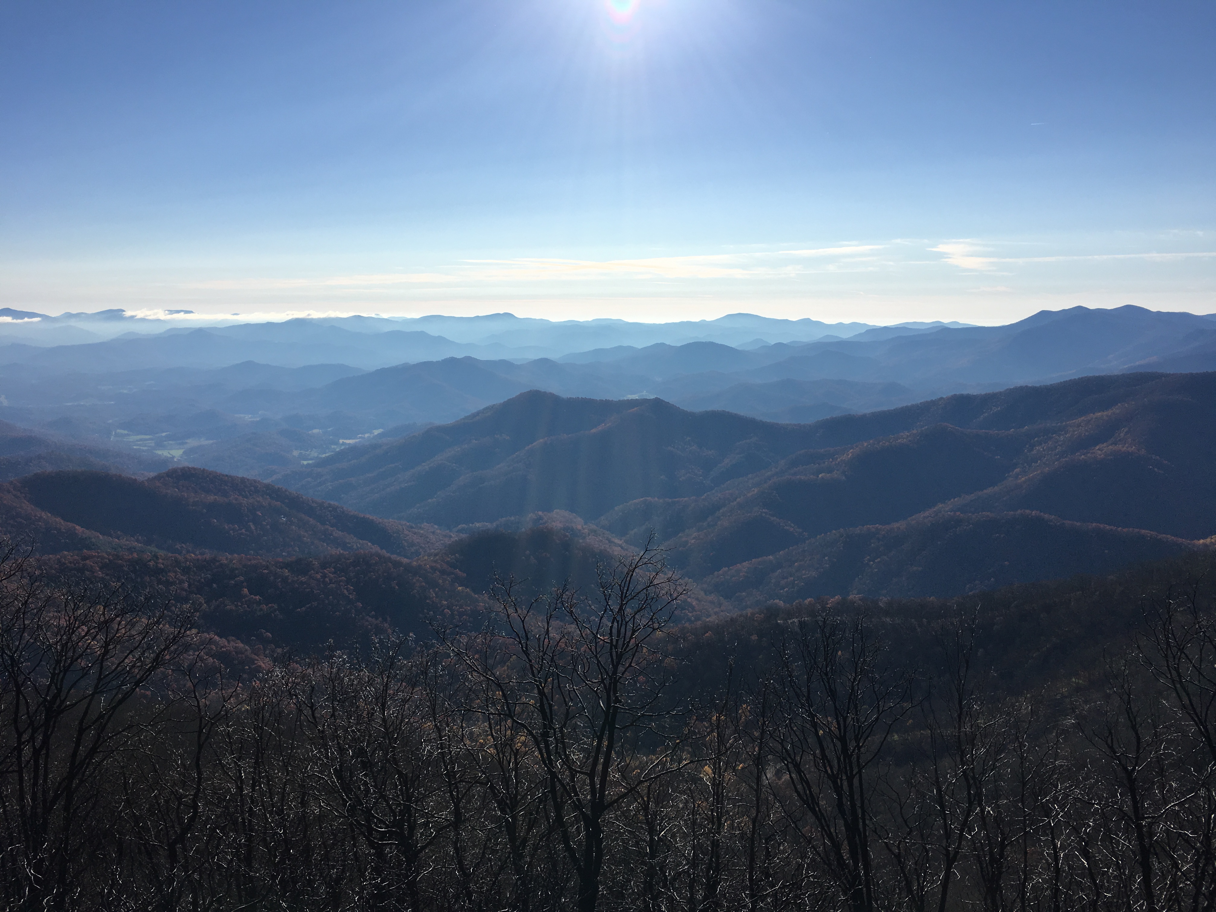
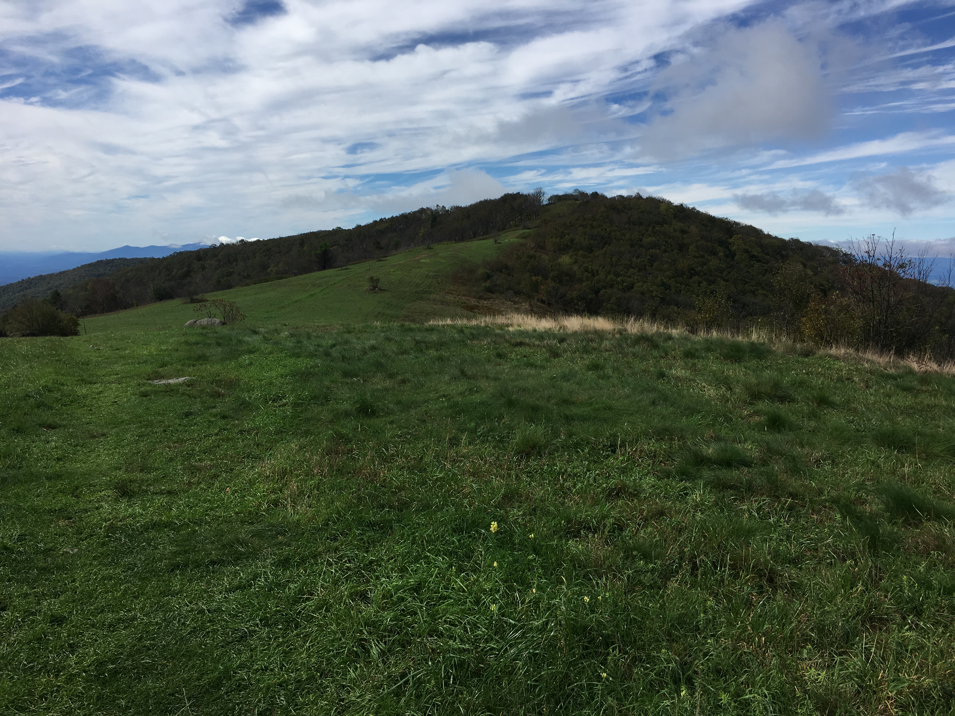
After enjoying a snack at the summit, I descended into the col between the south and middle summits. Mt Weeks has three summits, North, Middle, and South, two of which are on the New England Hundred Highest list. The descent from the south summit was one of the more difficult sections for the day, but was by no means difficult compared to some other trails in New Hampshire. The ascent and descent of Middle Weeks and ascent of the main (north) summit were relatively easy. By noon I was eating lunch at the Summit of Mt. Weeks (3,901′) with my traverse half complete.
Looking Ahead while descending from the South Summit, to the Middle Summit (right) and North Summit (left) of Mt WeeksThe North Summit of Mt. Weeks
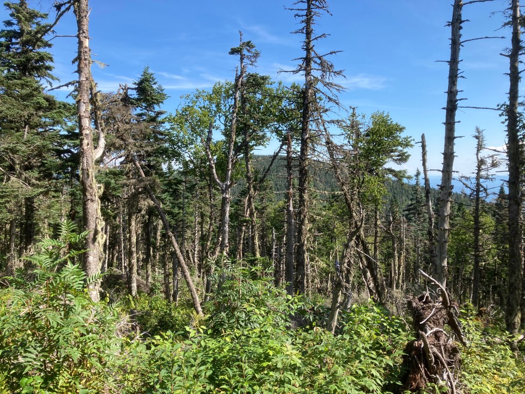
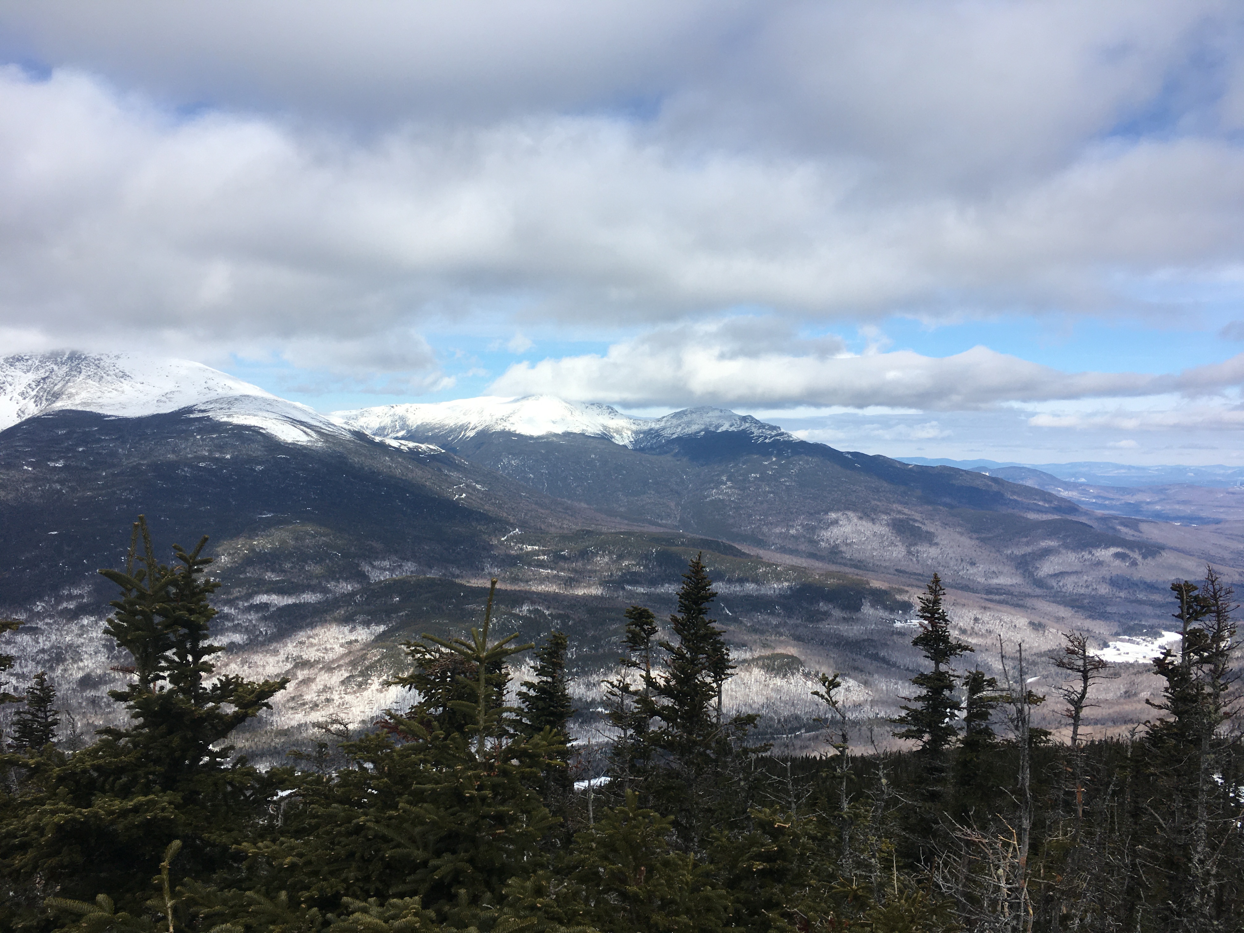
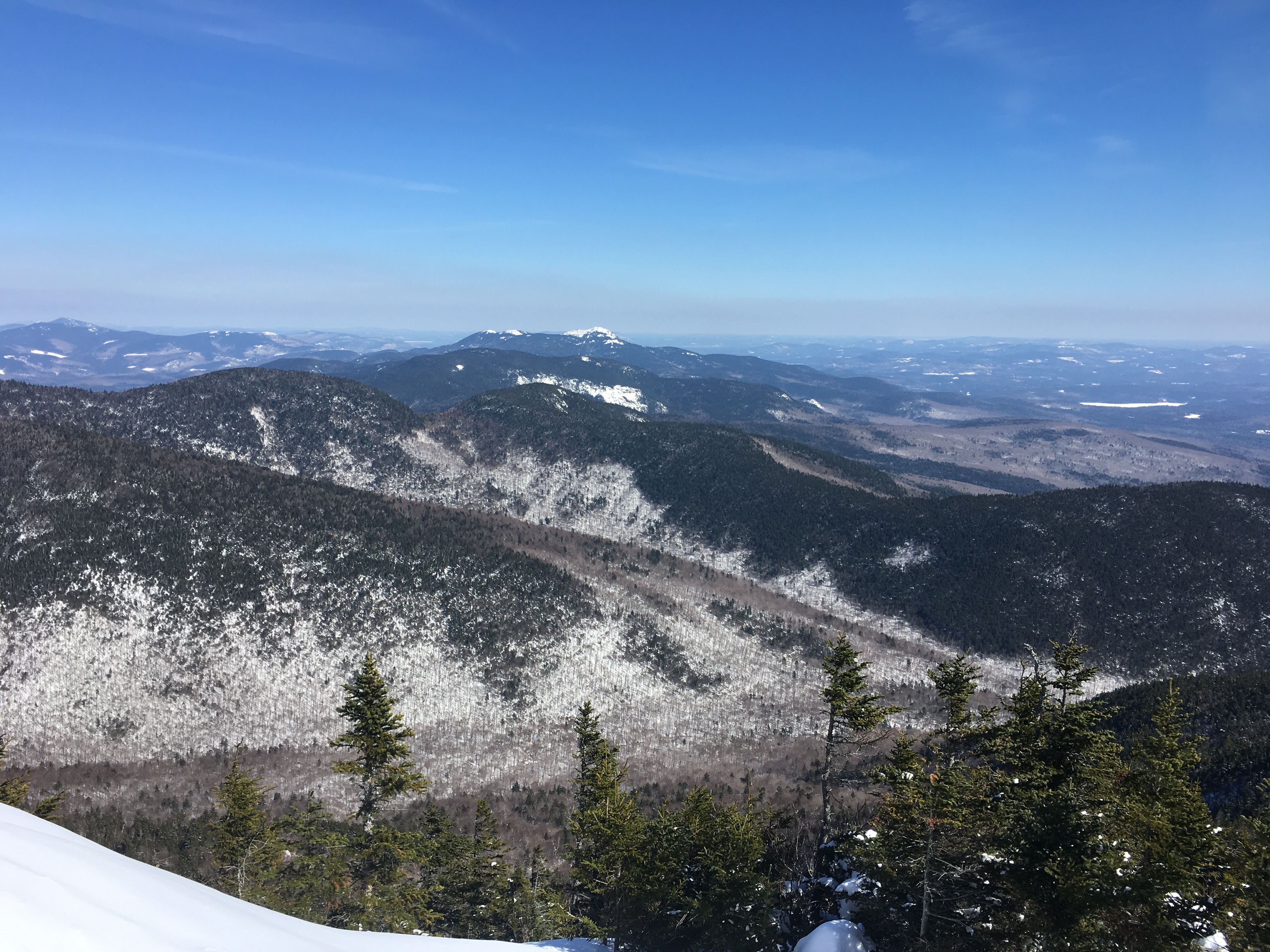
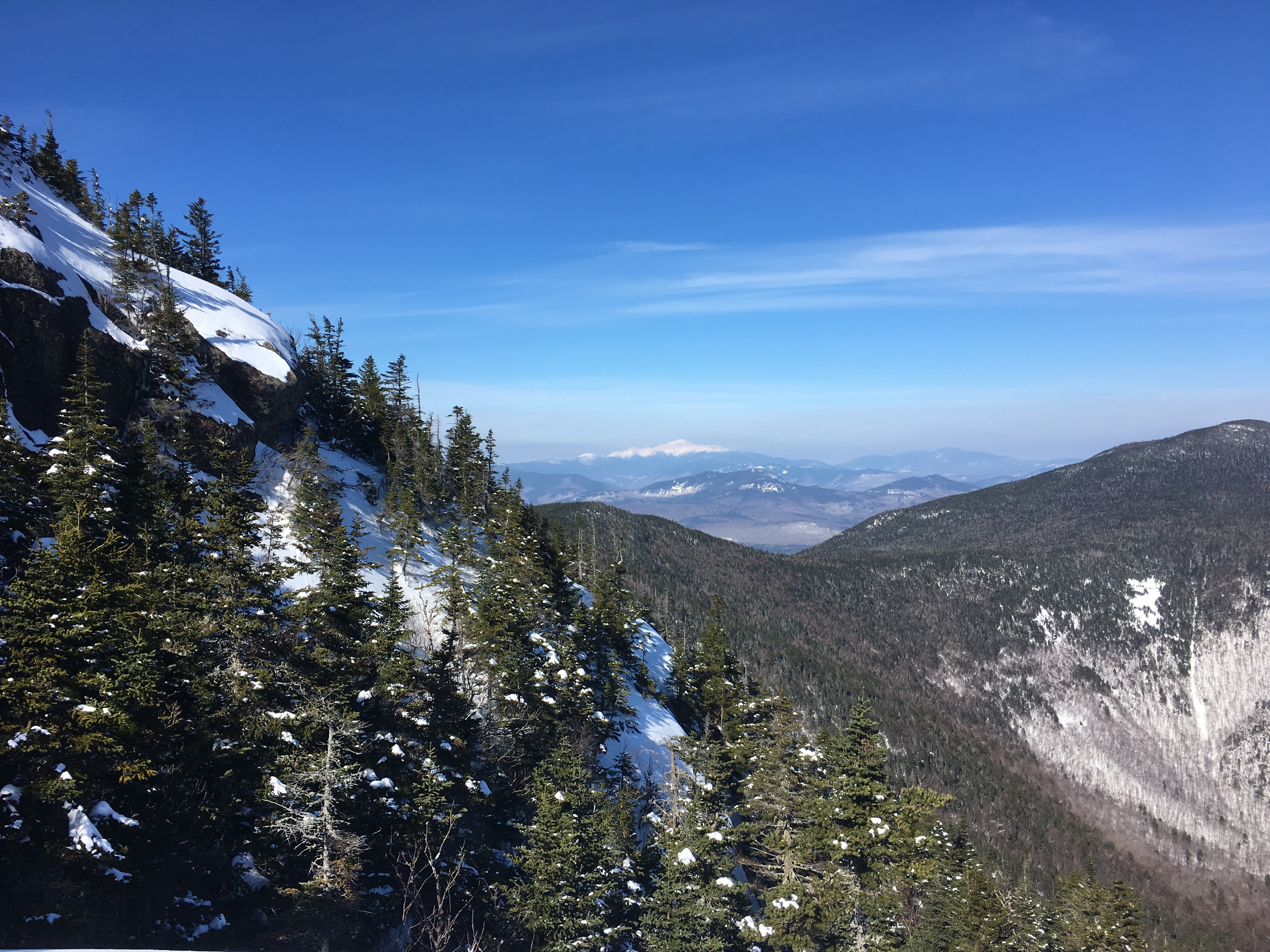
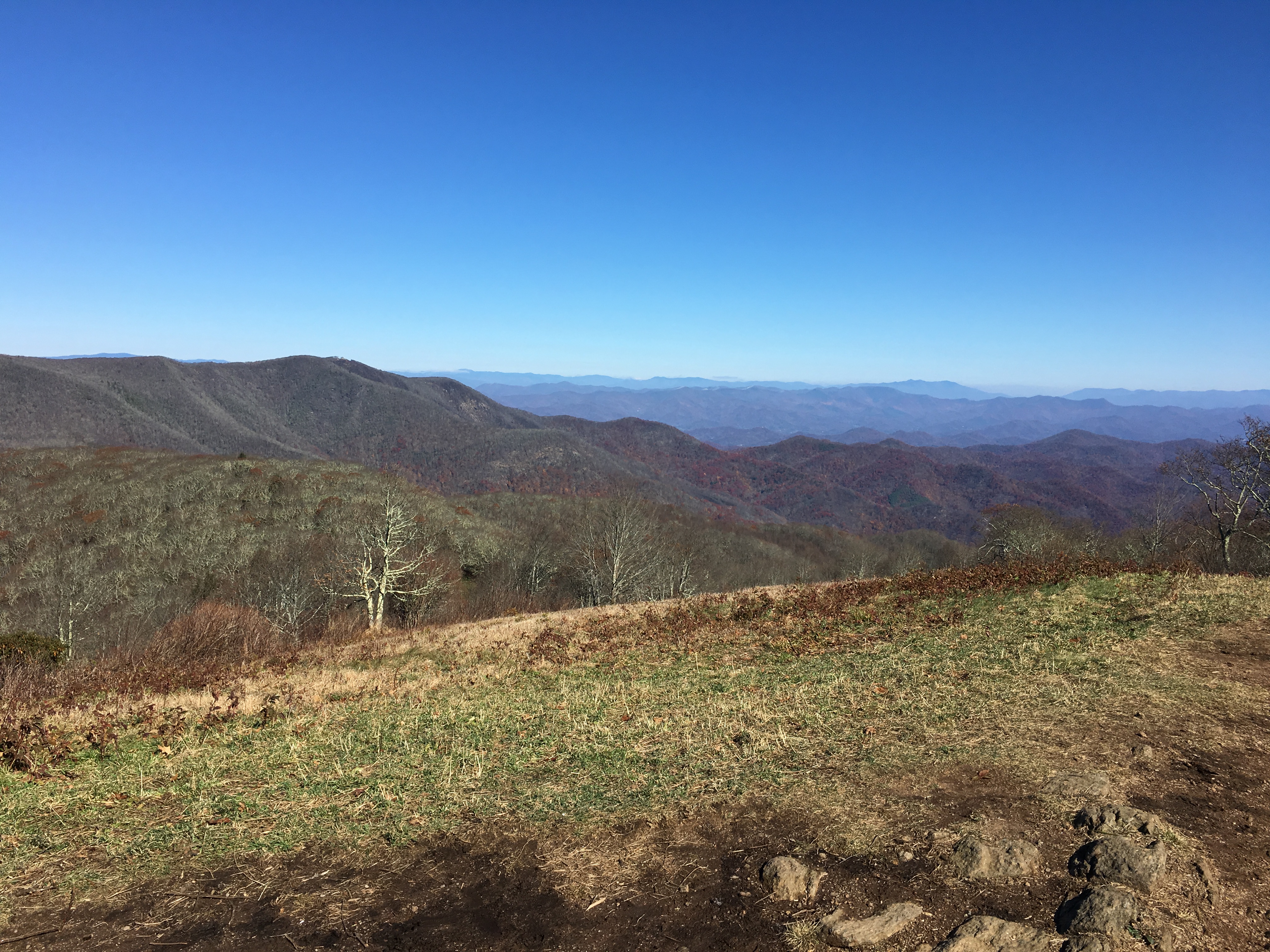
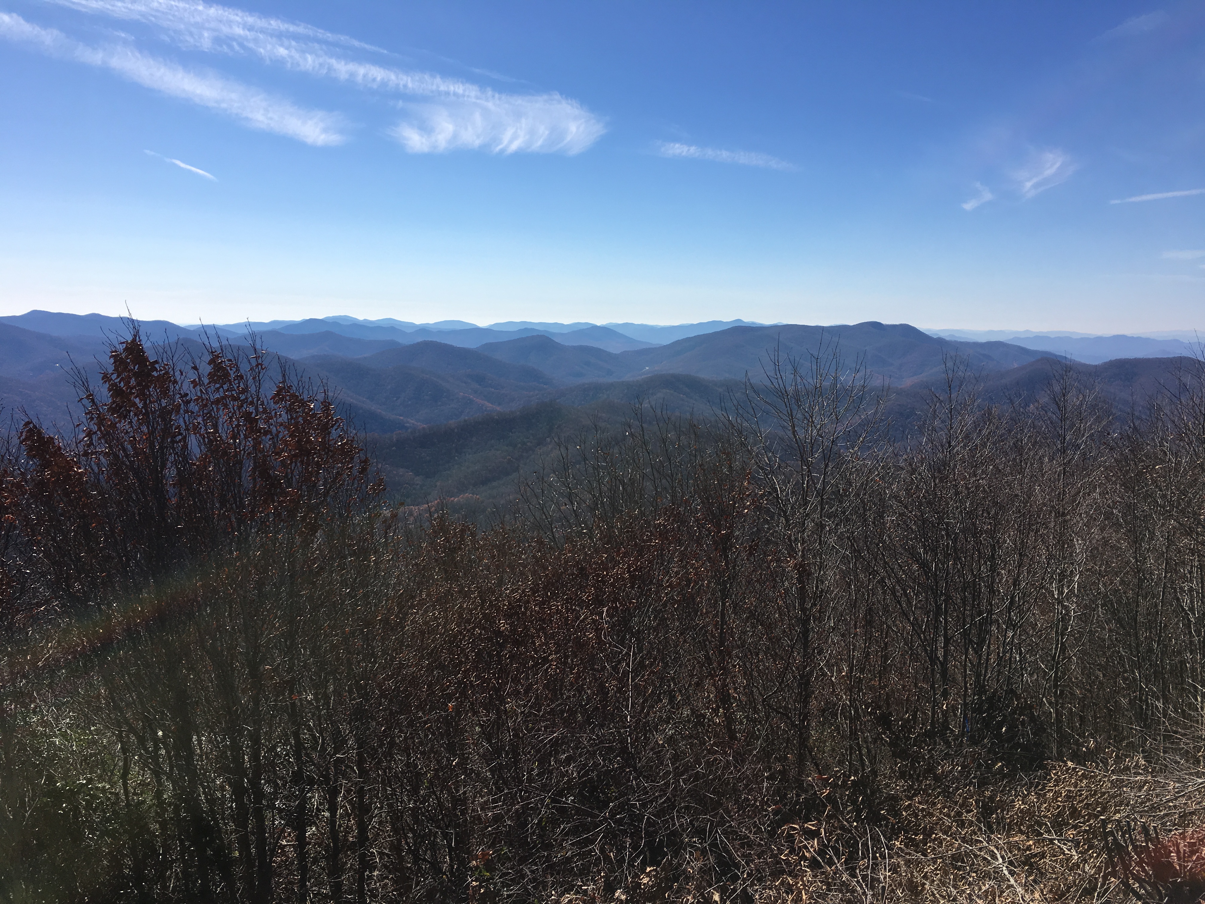
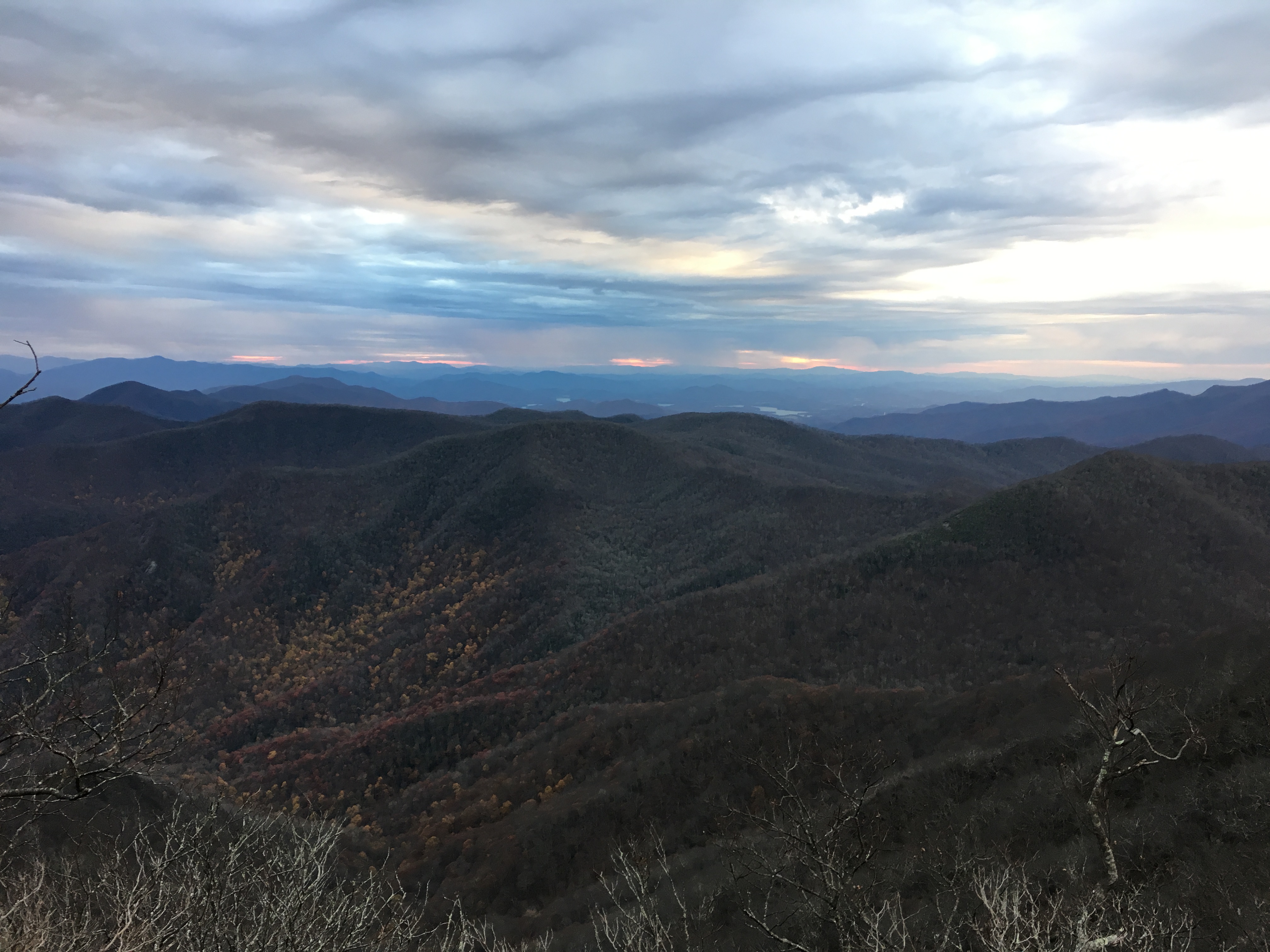
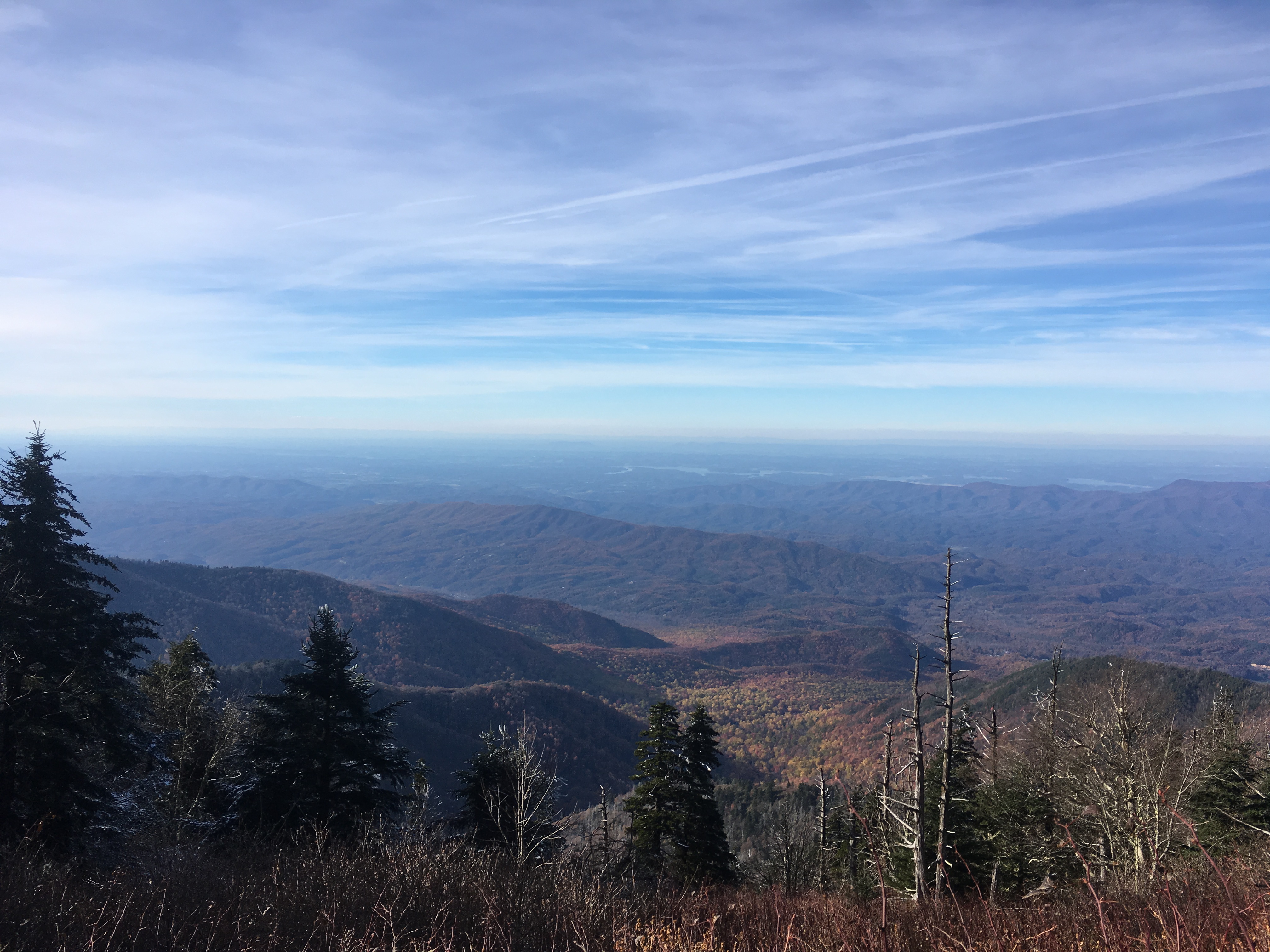
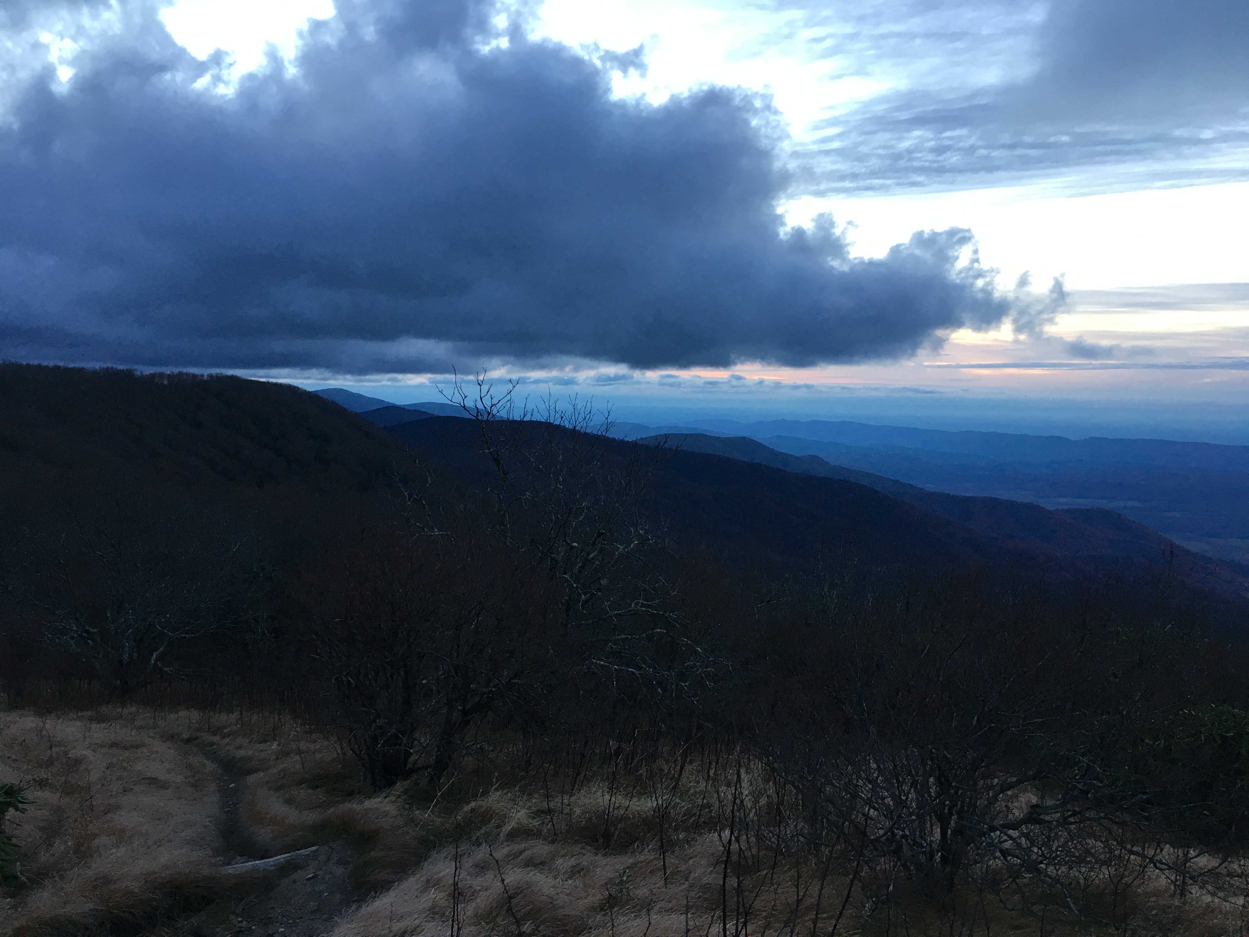
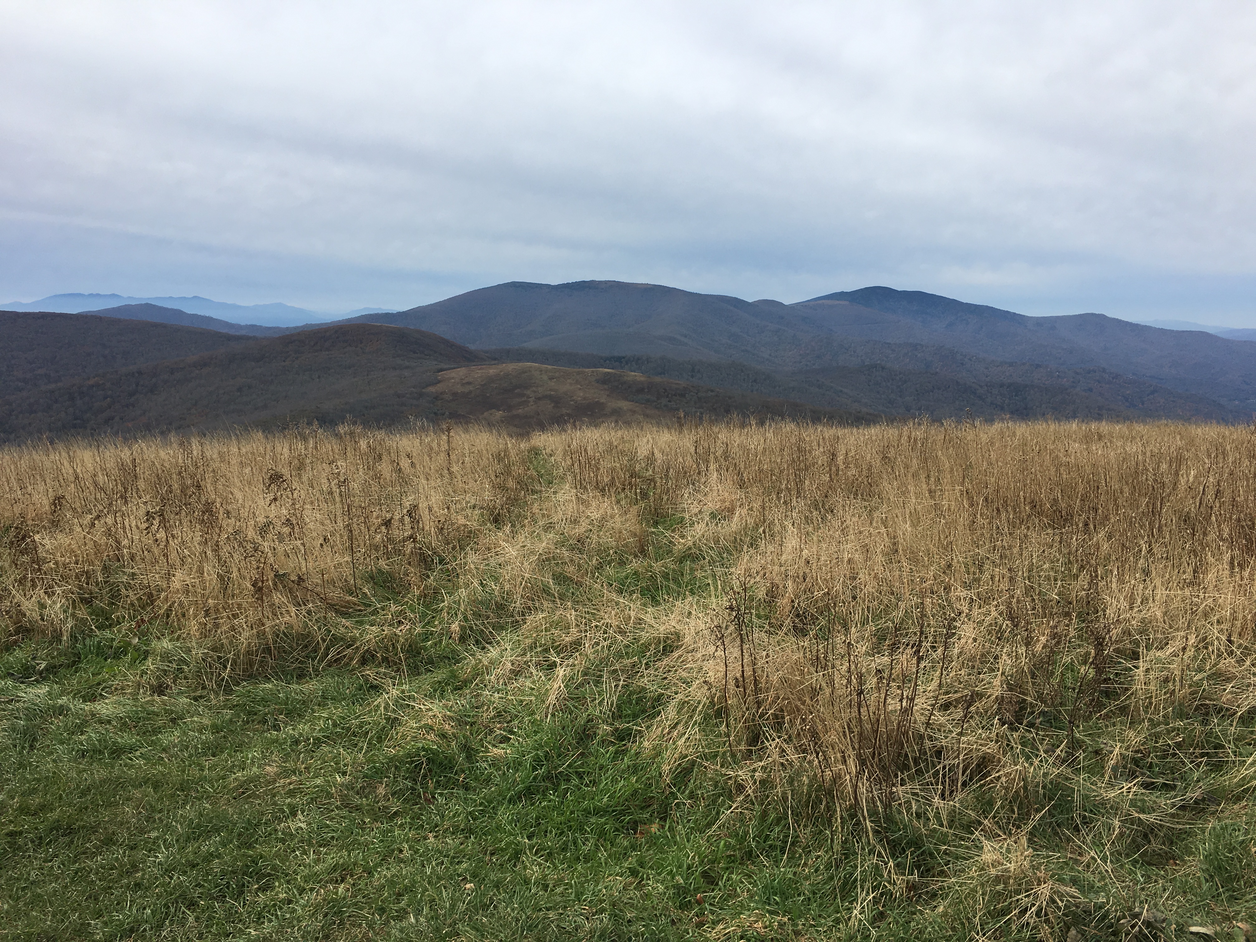
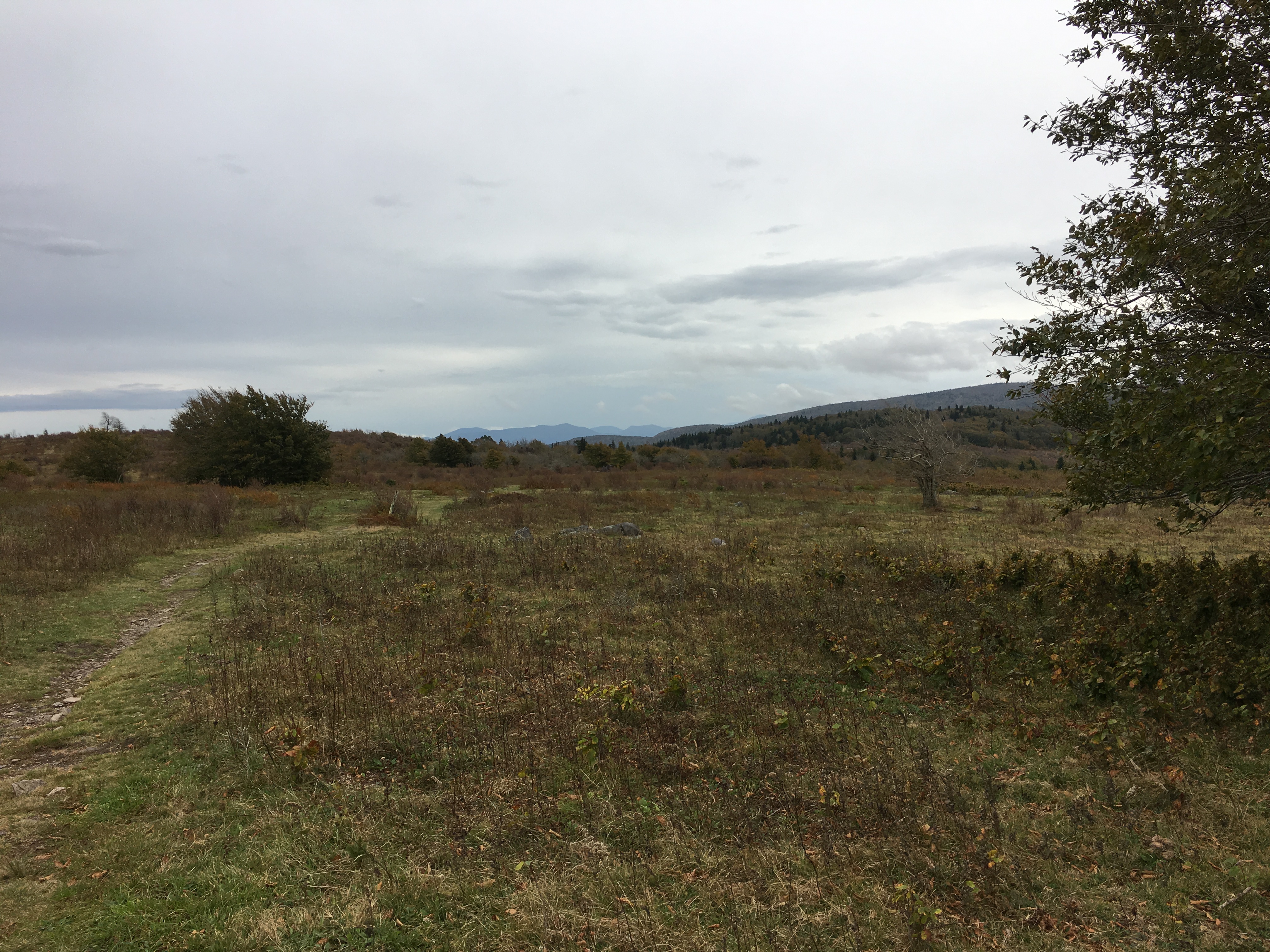
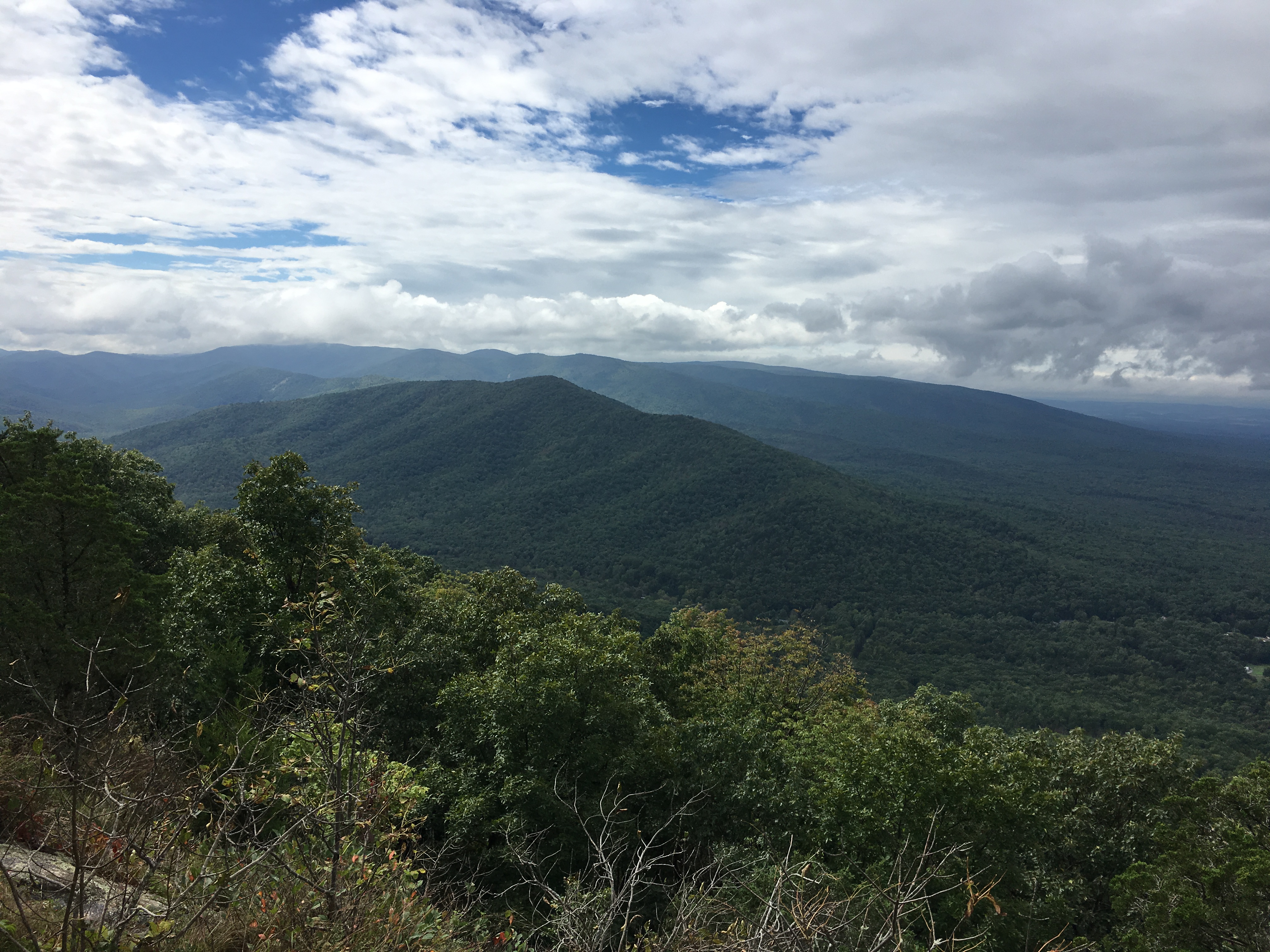
I made good time on the way back to the trailhead. Just before the summit of Mt. Waumbeck, I took a picture from the viewpoint I had passed earlier in the day.
View from the Kilkenny Ridge Trail, just North of Mt. Waumbeck
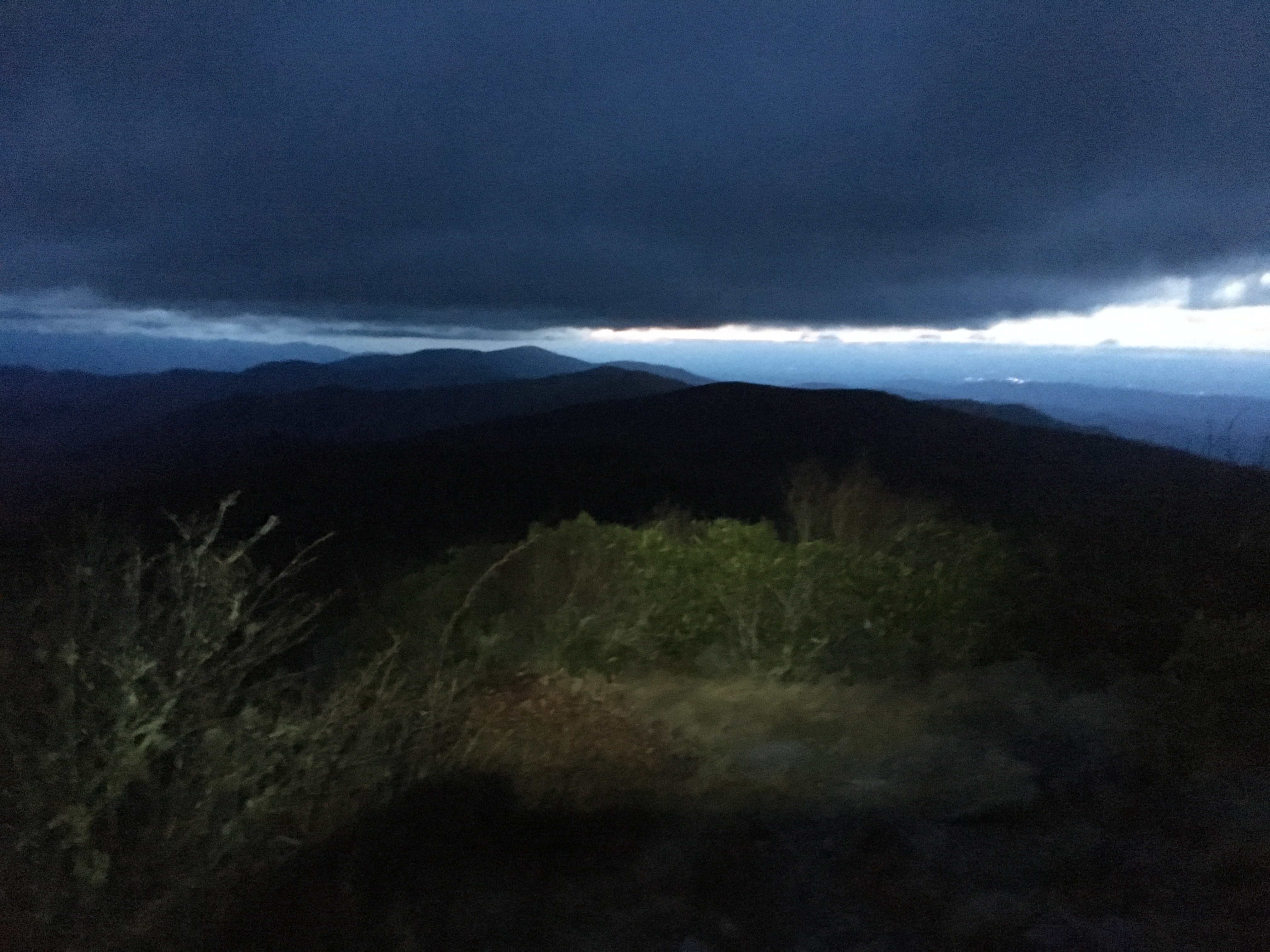
I was back at the trailhead by 6:30, 11 hours and 25 minutes after I had started my day. A very enjoyable day, my spirits dampened only by knowing I had a three-plus hour drive to get home and three days of work to be completed before the weekend.
In addition to getting out more, I also plan to update my blog more often with new adventures and some past adventures that are far overdue for sharing, including a hiking trip in Finland in 2019 and backpacking the Three Sisters Wilderness area in Oregon in 2021.
I am terribly behind in updating my blog. While my hiking the past year has been limited, I have made a few notable trips and will catch up as time permits.
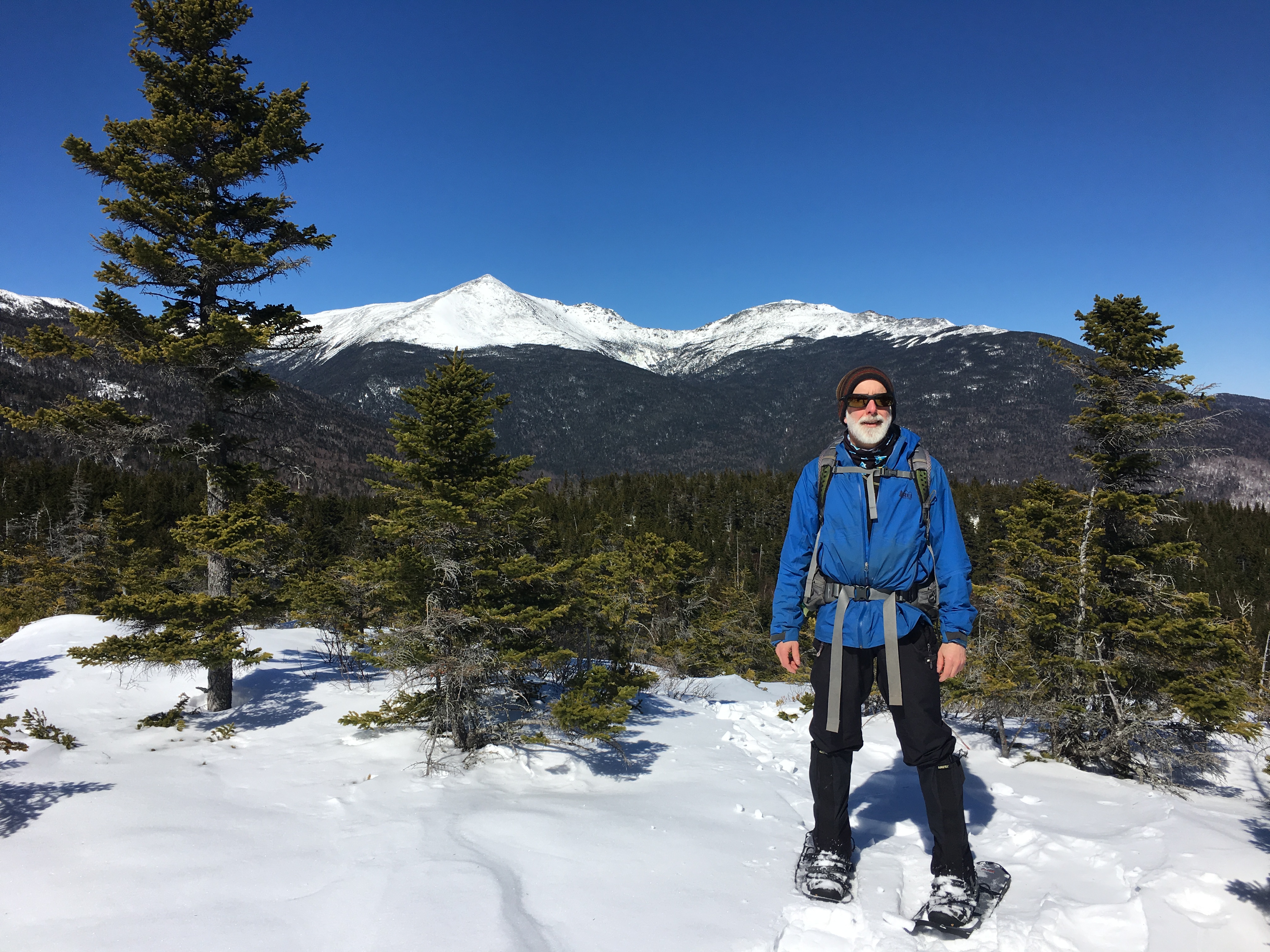
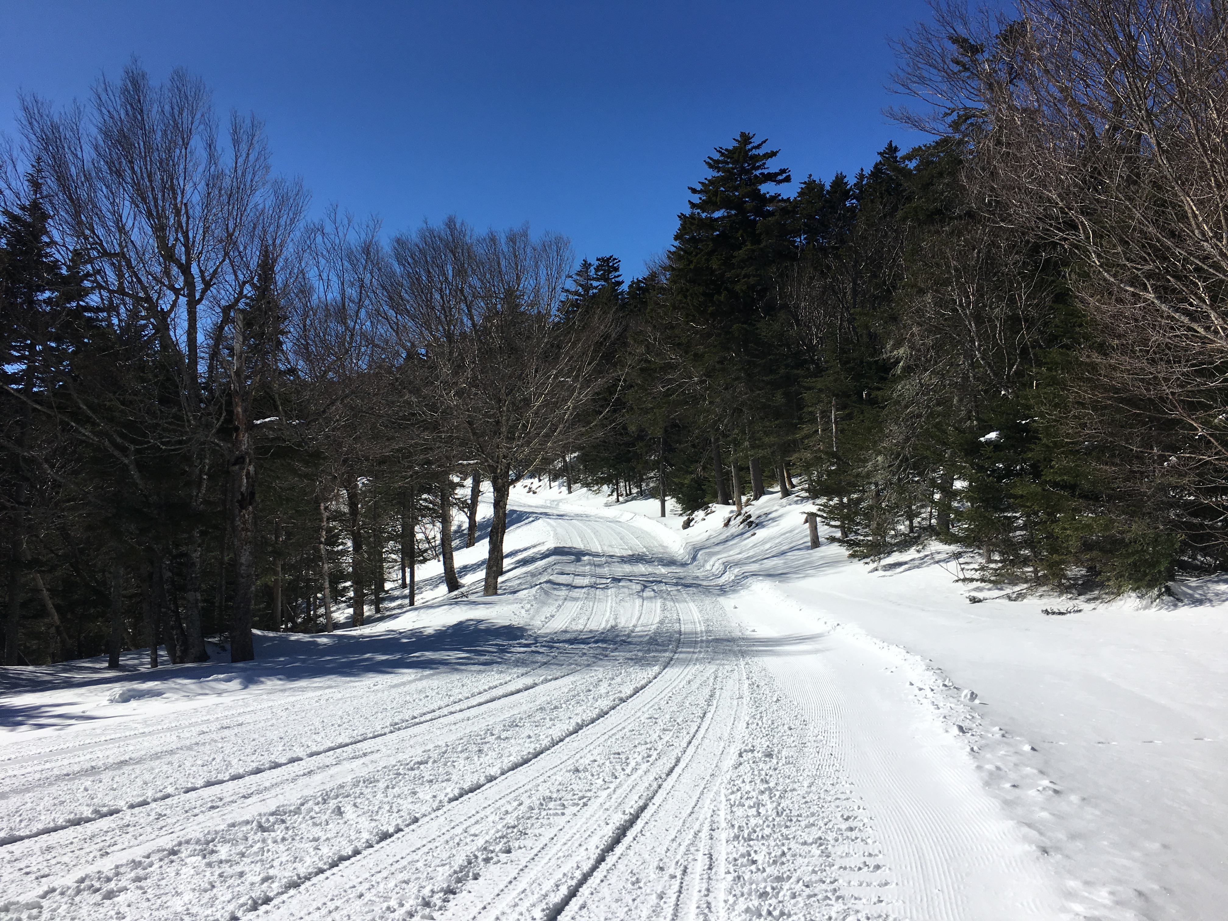
I have been far too busy the past few months and similar to last year, it was not until March that I made time for my first winter hiking trip of the year. Winter is my favorite season to hike in the White Mountains of New Hampshire because the trails are smooth with snow covering the rocks, the air quality and views are better, and there are fewer people out.
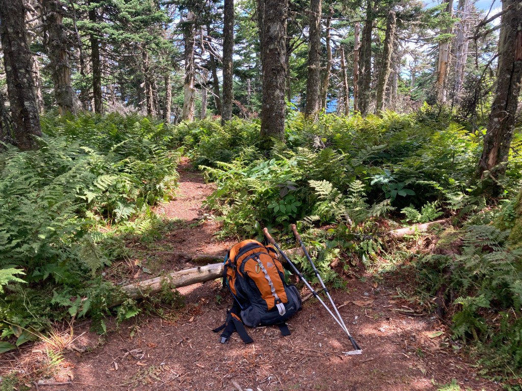
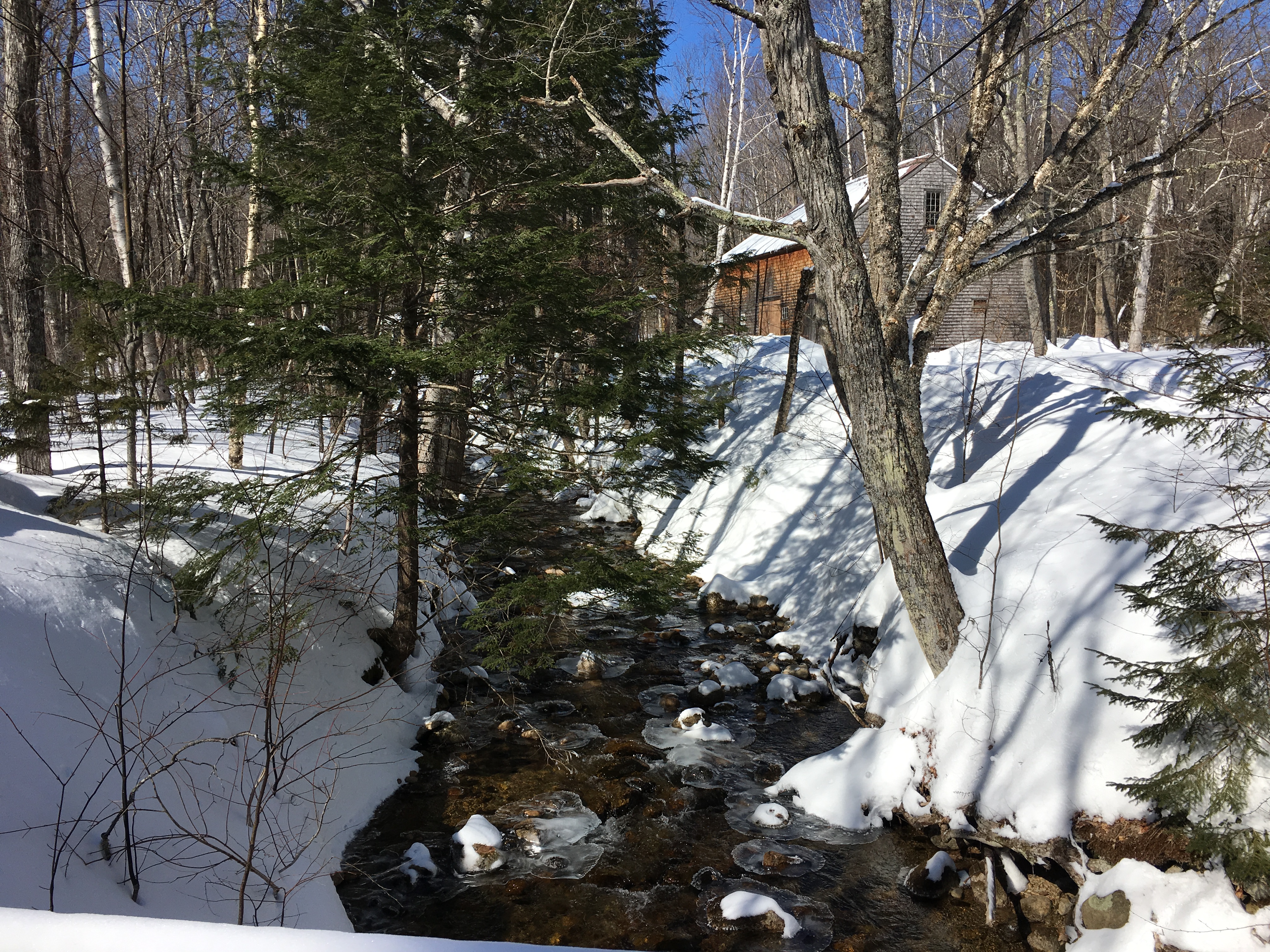
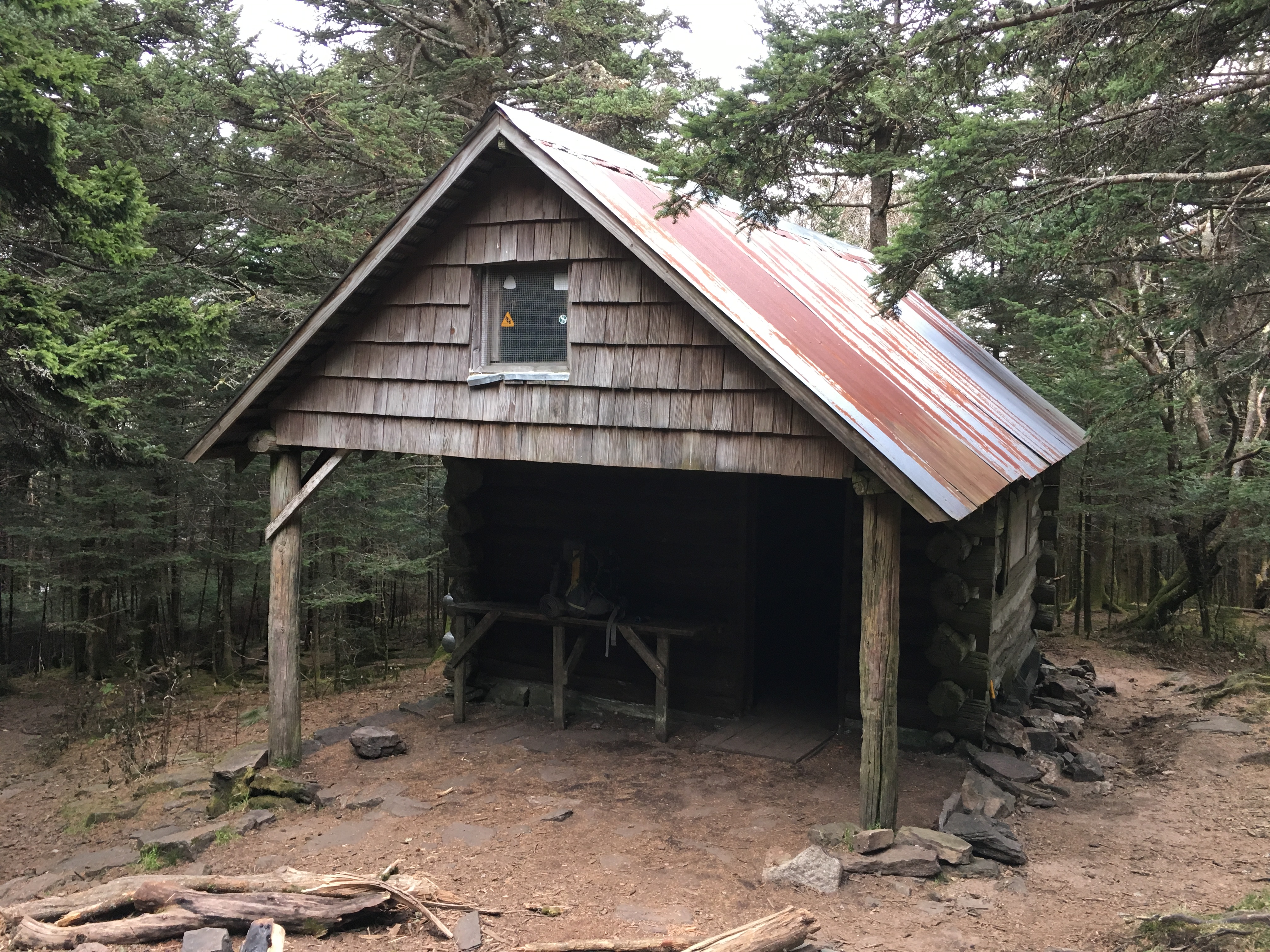
I left home later than planned on Thursday, March 5, and arrived at the Nineteen Mile Brook trailhead around 4:45 p.m. By the time I was dressed and ready to hit the trail, it was a bit past 5 with sun set at 5:48 p.m. I have hiked the 3.8 miles to the Appalachian Mountain Club (AMC) Carter Notch Hut more times than I can remember, so I was not concerned that I would be finishing the hike in the dark. The trail is not at all technical and rises at an easy steady grade, gaining about 1900′ up to the junction with the Wildcat Ridge Trail before descending 100′ to the Carter Lakes and the hut. I made it more than halfway before dark and hiked the last 45 minutes by headlamp, arriving at the hut at 7 p.m.
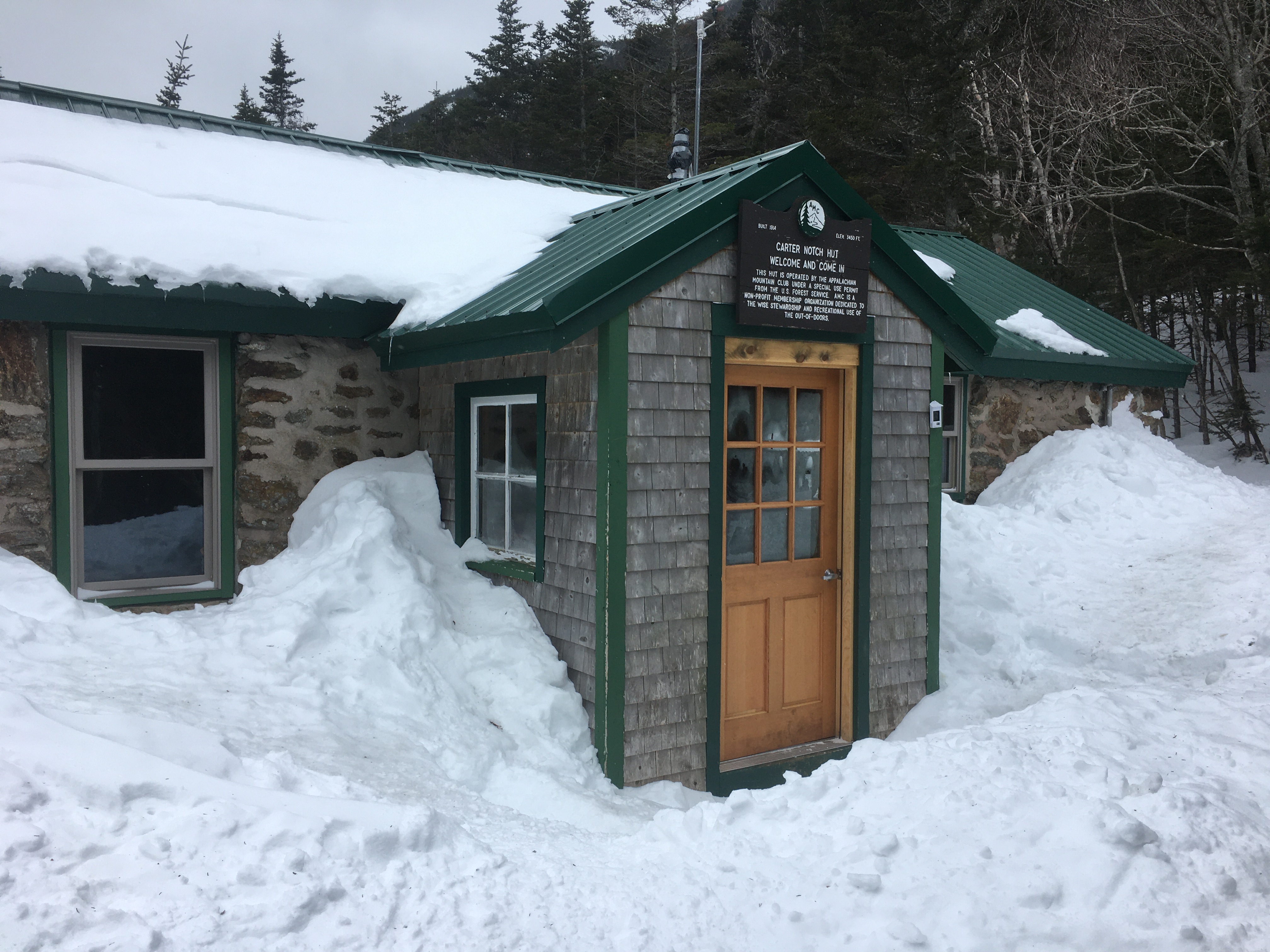
The hut consists of a main building with kitchen and dining room and two separate bunkhouses, each containing four rooms with 4 to 6 bunks per room. On this night, I was the only occupant other than the caretaker and had my pick of the lot. I set up my bunk and headed back to the main hut for dinner. My choice this evening was chili — the last homemade, dehydrated meal left over from my 2018 Appalachian Trail thru-hike. The meals have kept quite well in the freezer of our extra refrigerator.
The Main Building at Carter Notch Hut
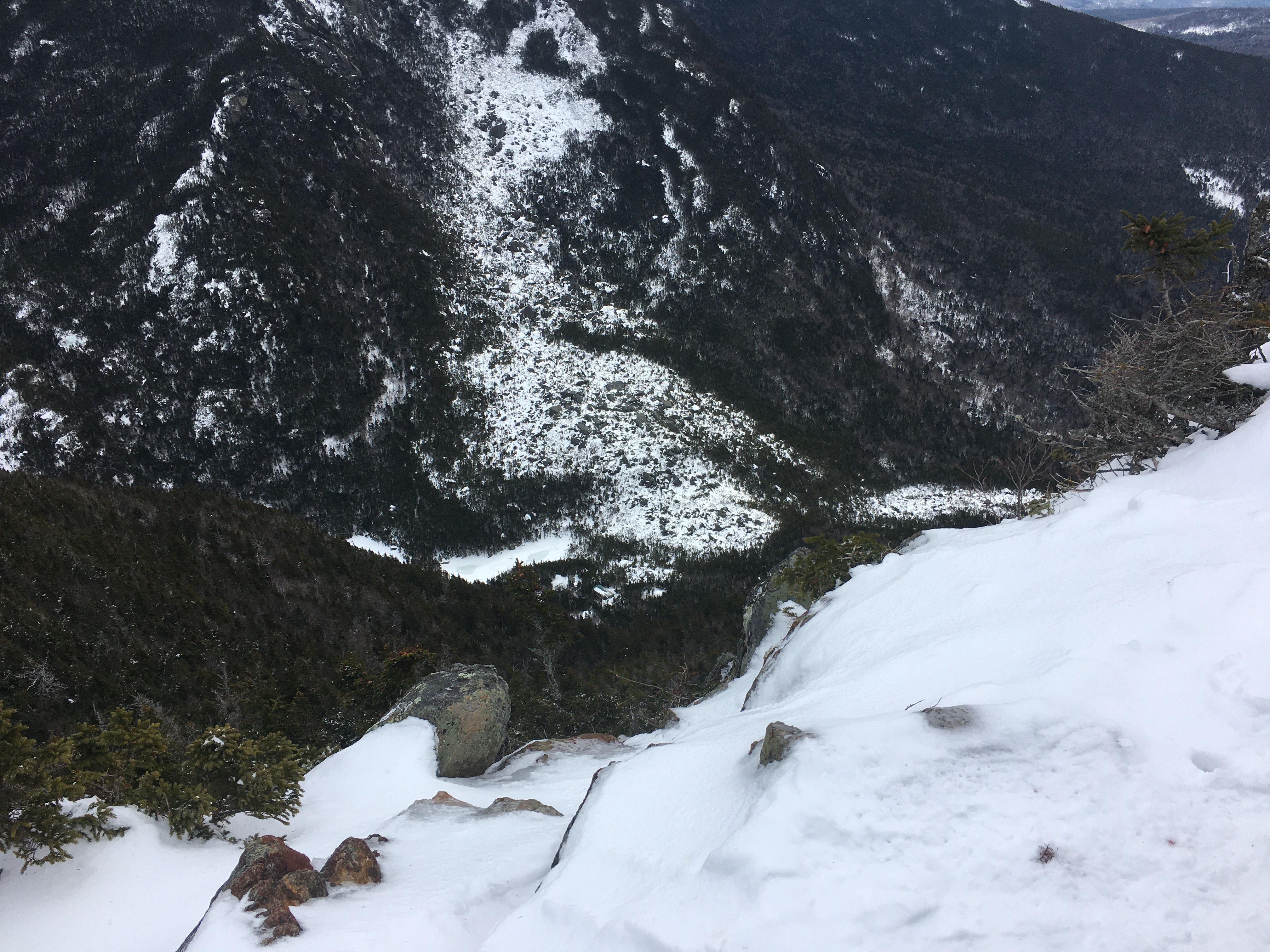
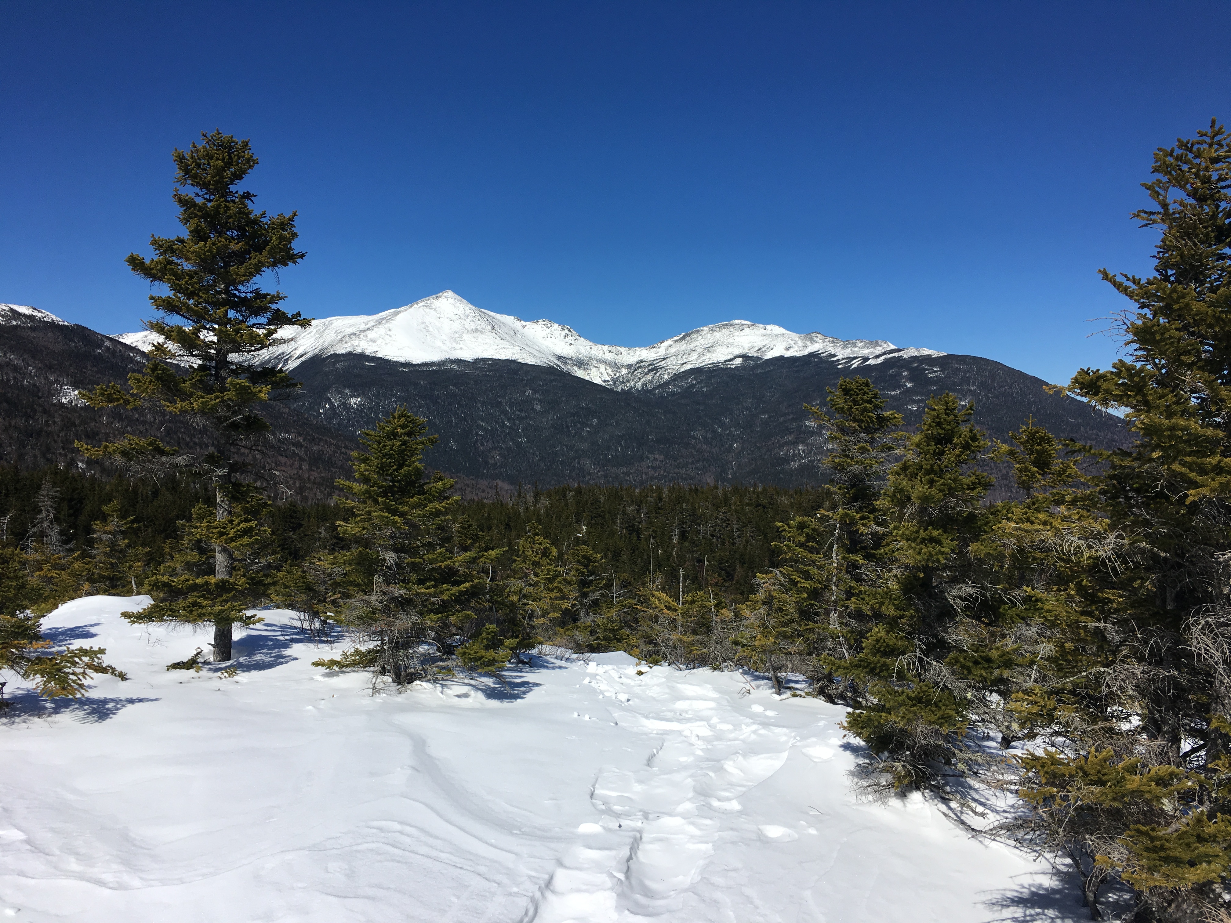
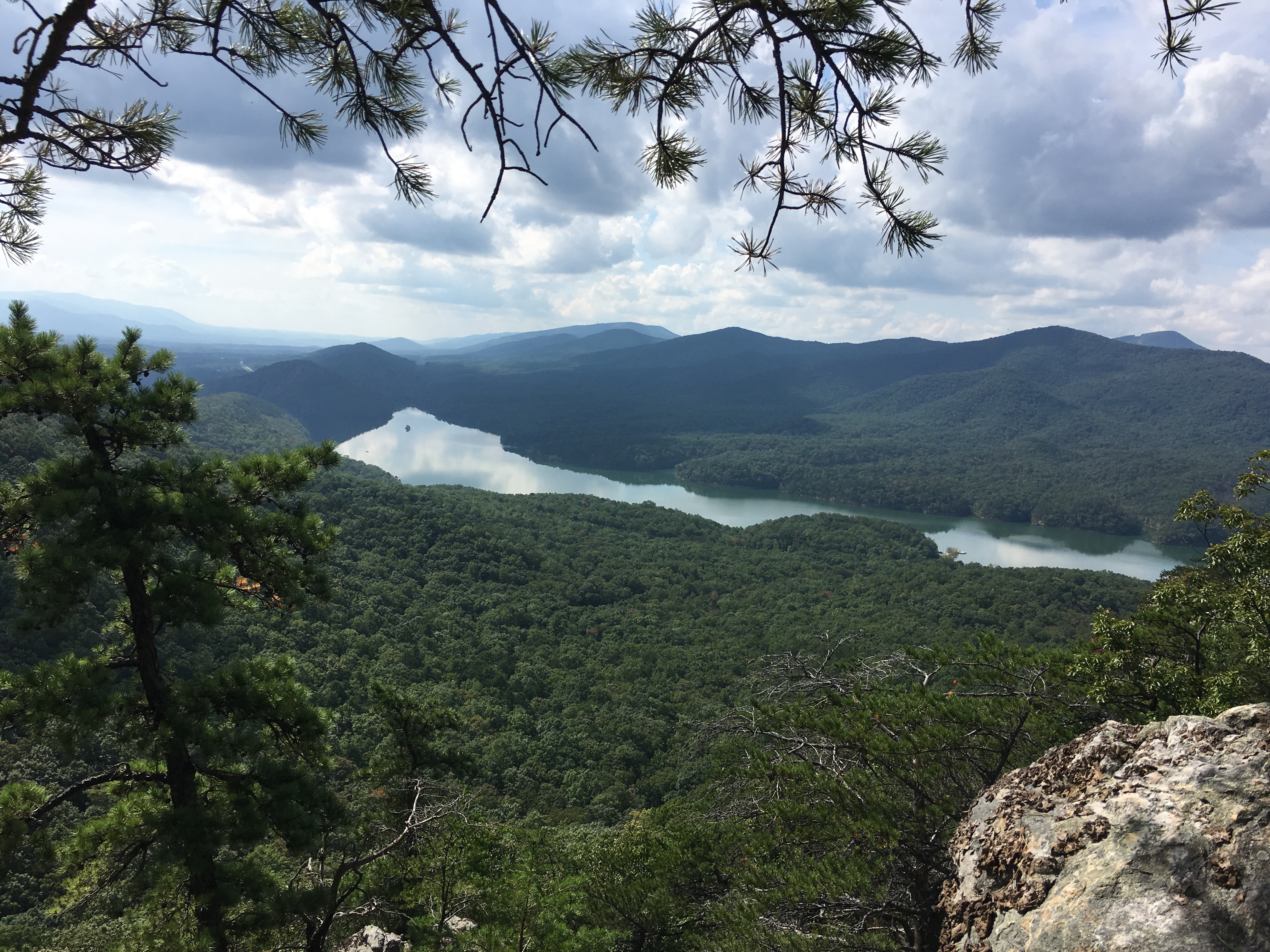
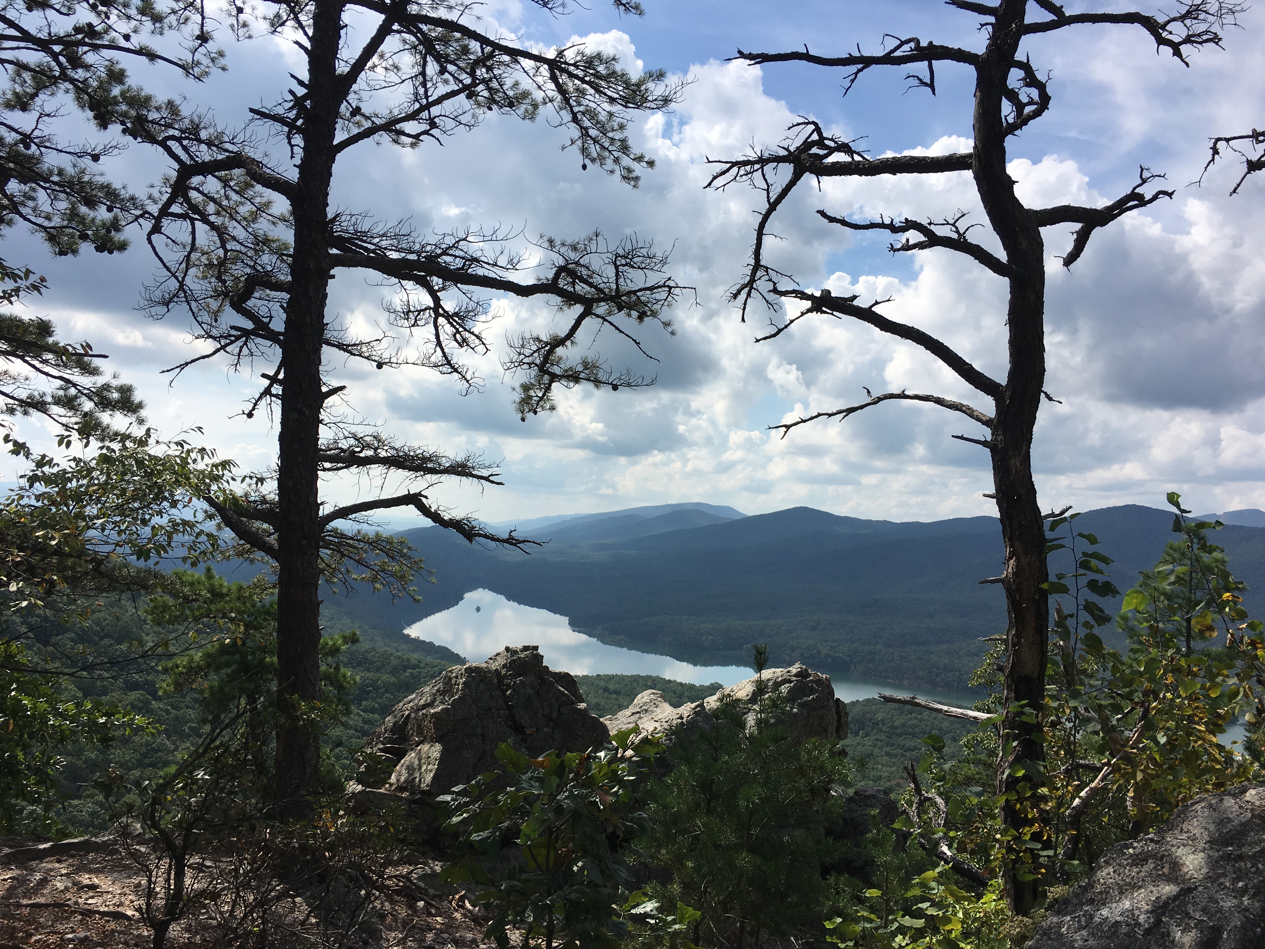
Friday morning I woke early, had a leisurely breakfast, and put on my snowshoes for my planned hike on Wildcat Mountain. I was on the trail at 8:15 and was soon working hard as the Wildcat Ridge Trail rises 1,050′ over 0.7 miles. The trail was in good shape and I was at the summit within an hour. Wildcat Mountain has five distinct peaks, creatively named after the first five letters of the alphabet. The summit of “A” peak is 4,422′ above seal level. Just below the summit is a view point from which I could look across the notch to Carter Dome, and down at the hut about 1,100′ below.
Looking Down at Carter Notch Hut, Nestled between Wildcat Mountain and Carter Dome
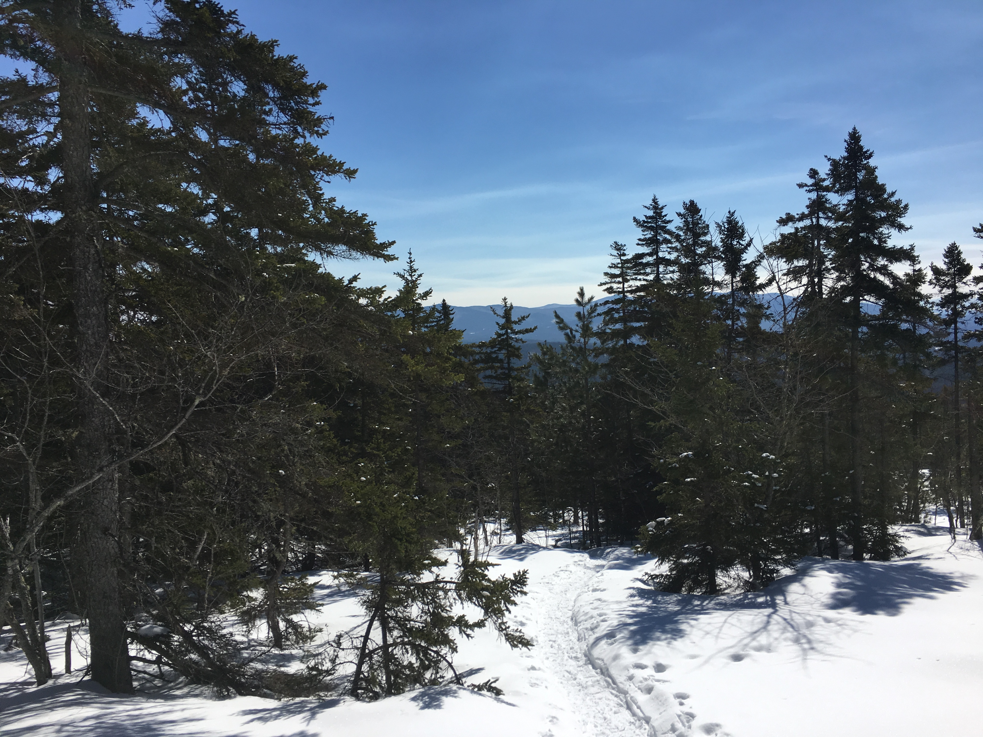
My plan was to hike the ridge over “B” and “C” peaks to “D” peak, a distance of about 2 miles. The AMC includes “A” and “D” peaks on the list of 48 4000′ foot summits in New Hampshire and “D” peak would be my 39th summit during winter. While “B” and “C” peaks are taller than “D” peak, they are not on the list because they do not meet the prominence criterion, which requires that a summit be at least 200′ above the saddle between it and adjacent peaks. Thus, I was mostly descending from “A” peak with brief ascents to “B” and “C” peaks, before reaching Wildcat Col and then ascending 300′ to the summit of “D” peak.
The last time I was on this section of trail was in July of 2018 during my Appalachian Trail thru-hike. The white blazes on the trees blend in a bit more during winter, and are closer to “ground level” as there are a few feet of snow pack on the trail. I enjoyed hiking through the trees on the ridge. The wind on Wednesday and Thursday had died down by the time I started the hike on Thursday and was not forecast to pick up again until Friday night.
The Wildcat Ridge Trail Somewhere Near “B” Peak
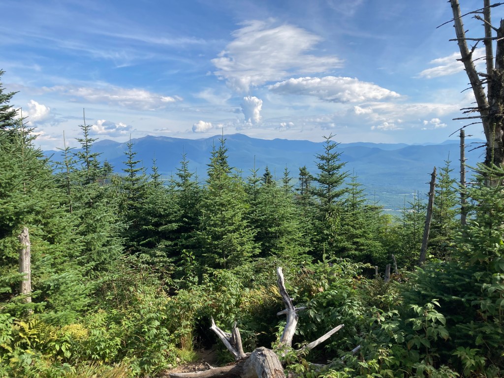
I was at “D” peak by 10:30 and enjoyed the view while snacking on some trail mix and beef jerky. The summit of “D” peak offers excellent views across Pinkham Notch to Mt Washington and the Presidential Range. Intermittent snow was predicted and the summits across the notch were obscured by clouds. The summit of Mt. Madison was barely discernible, placing the clouds near 5,400′.
Mt. Washington in the Clouds
Mt. Adams (center left) and Mt. Madison (center right) from Wildcat “D”
I retraced my steps back across the ridge, with a bit more effort required to get back to the summit of “A” peak. A few snowflakes had started and the view from the summit was not as clear as it had been just a few hours earlier. As I crossed Upper Carter Lake on my way back to the hut, I paused to look back up at the summit.
Wildcat Mountain Summit (“A” Peak) from Upper Carter Lake
I was back at the hut by 12:45 and had some hot soup and a tuna sandwich for lunch, followed by a cup of tea and a granola bar for dessert. I contemplated going back out for a quick hike to the summit of Carter Dome after lunch, but decided I had already enjoyed the best of the weather and this would be a perfect time to enjoy doing absolutely nothing. I hung up my damp undershirt and fleece sweater near the wood stove, put on dry clothes, and headed to the bunkhouse. While a nap was not my primary plan, I knew that lying in my sleeping bag was likely to end that way.
Enjoying a Cup of Tea while Watching Snowflakes out the Window
I woke around 4:15 and headed back to the main hut as the caretaker had started a fire in the stove. A few other hikers had arrived and we chatted by the fire. After dinner I stayed at the main hut until about 8 p.m. and then headed off to bed. The wind picked up overnight and was rather loud at times throughout the night. The temperature was 8 degrees when I woke, but I was quite comfortable as long as I stayed in my sleeping bag. I wanted to get an early start and was up at 6 a.m. and on my way by 6:30. The wind was blowing strong and made for a rather uncomfortable start to the hike, but once I had dropped down about 500′ feet I was protected by the mountains on ether side of the notch and stopped to take off my down jacket. Within 90 minutes I was back at my car and I headed over to Great Glen to get in a bit of cross-country skiing before heading home. I hope to get out at least once more before the end of winter, which is approaching too quickly!
It seems one thing or another kept me from hiking this winter until I finally made it out on March 8.It had been 16 weeks to the day since I finished my AT hike at Springer Mountain.
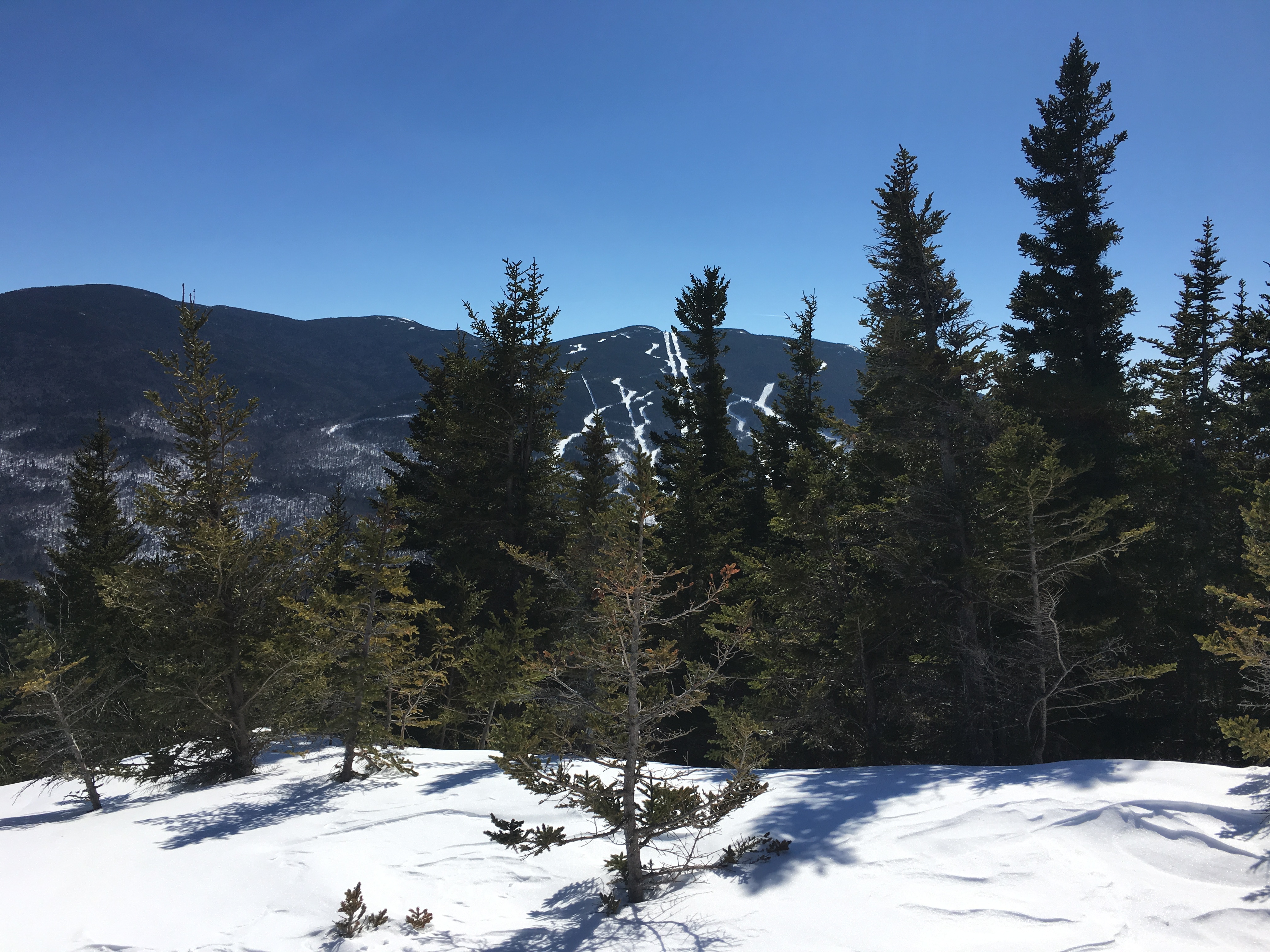
Mt. Whiteface in the White Mountains of New Hampshire seemed like a good place to resume hiking.Roundtrip from the trailhead on Ferncroft Rd to the summit is only 8.4 miles and about 3,000 feet of elevation gain.
Winter is my favorite season for hiking in the White Mountains.The rocky trails are covered with snow, making for a smooth hiking surface; the air quality is better, making for outstanding views; and there are fewer hikers, making for more solitude.My hiking partner for this trip was my son, Brian, with whom I had not hiked since we hiked Mt. Katahdin when I started the AT last June.
From the trailhead, the trailcrosses a stream, enters the Sandwich Range Wilderness Area, and begins the ascent at an easy grade.
Crossing a Small Stream on the Blueberry Ledge Trail
Despite there being fewer hikers in the winter, the trails still get a lot of use.The trail was well-packed.I wore snowshoes anyway, but Brian made it the entire hike in microspikes without “post-holing.”For those not familiar with this term, post-holing is when ones foot breaks through the snow crust and sinks in several feet (sometime up to one’s hip), leaving a hole suitable for installing a fence post.In addition to being exhausting, at least in my opinion, it is bad hiking etiquette, making an unsightly mess and actually making the trail more dangerous for subsequent hikers.
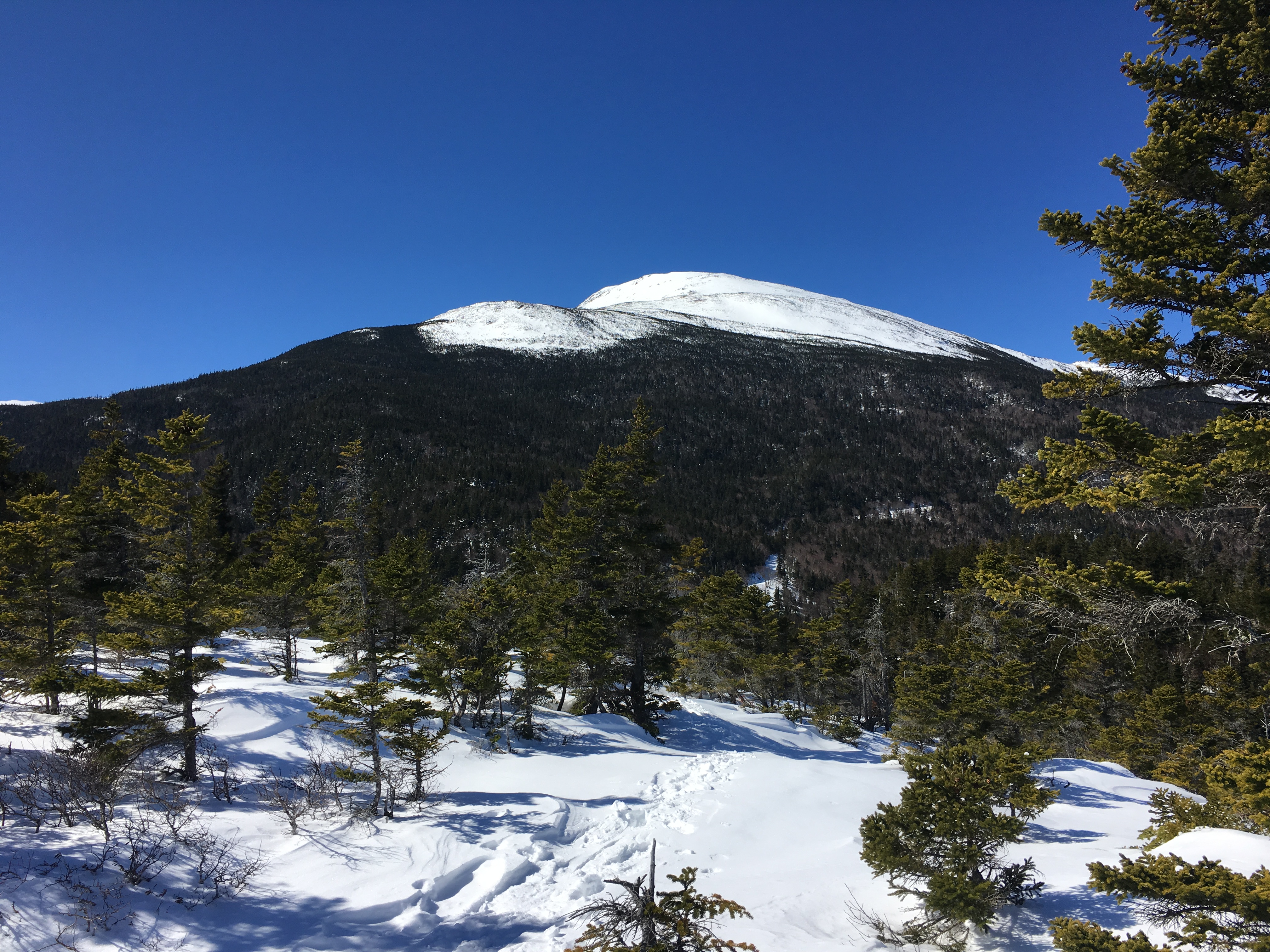
After a couple of miles the grade became steeper and there were a number open areas, not quite open enough for a view.
View Looking Down the Trail with Distant Peaks Visible Just Above the Trees
The View Ahead with Brian in the Lead
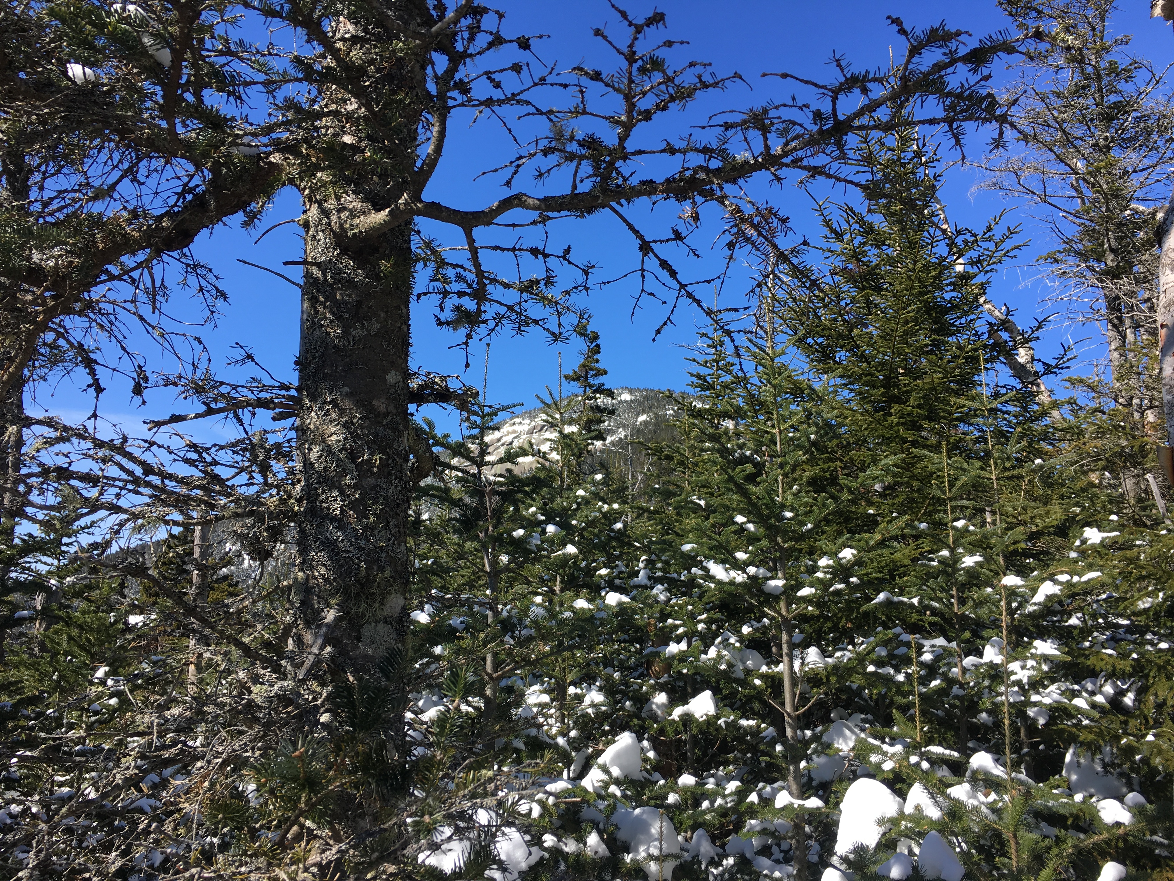
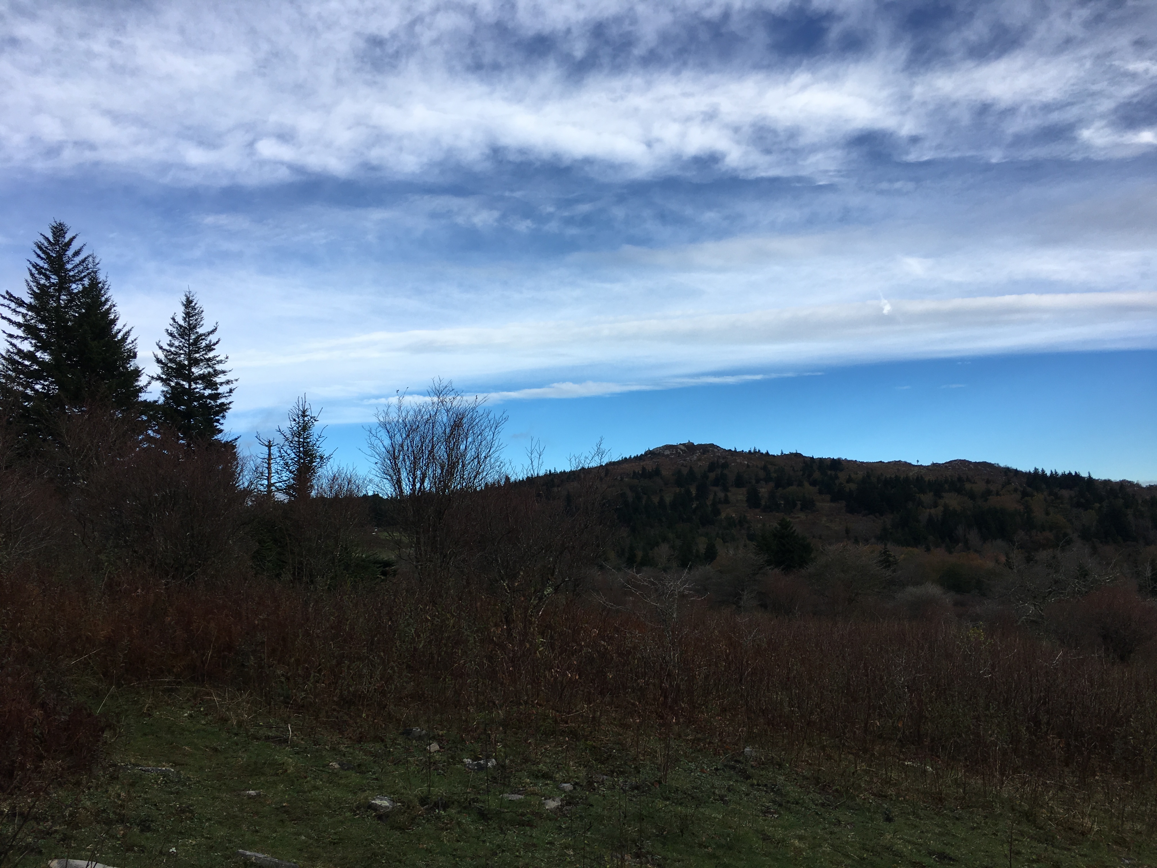
Before too long, we had a glimpse of the summit through the trees.
A Fleeting View of the Mt. Whiteface Summit
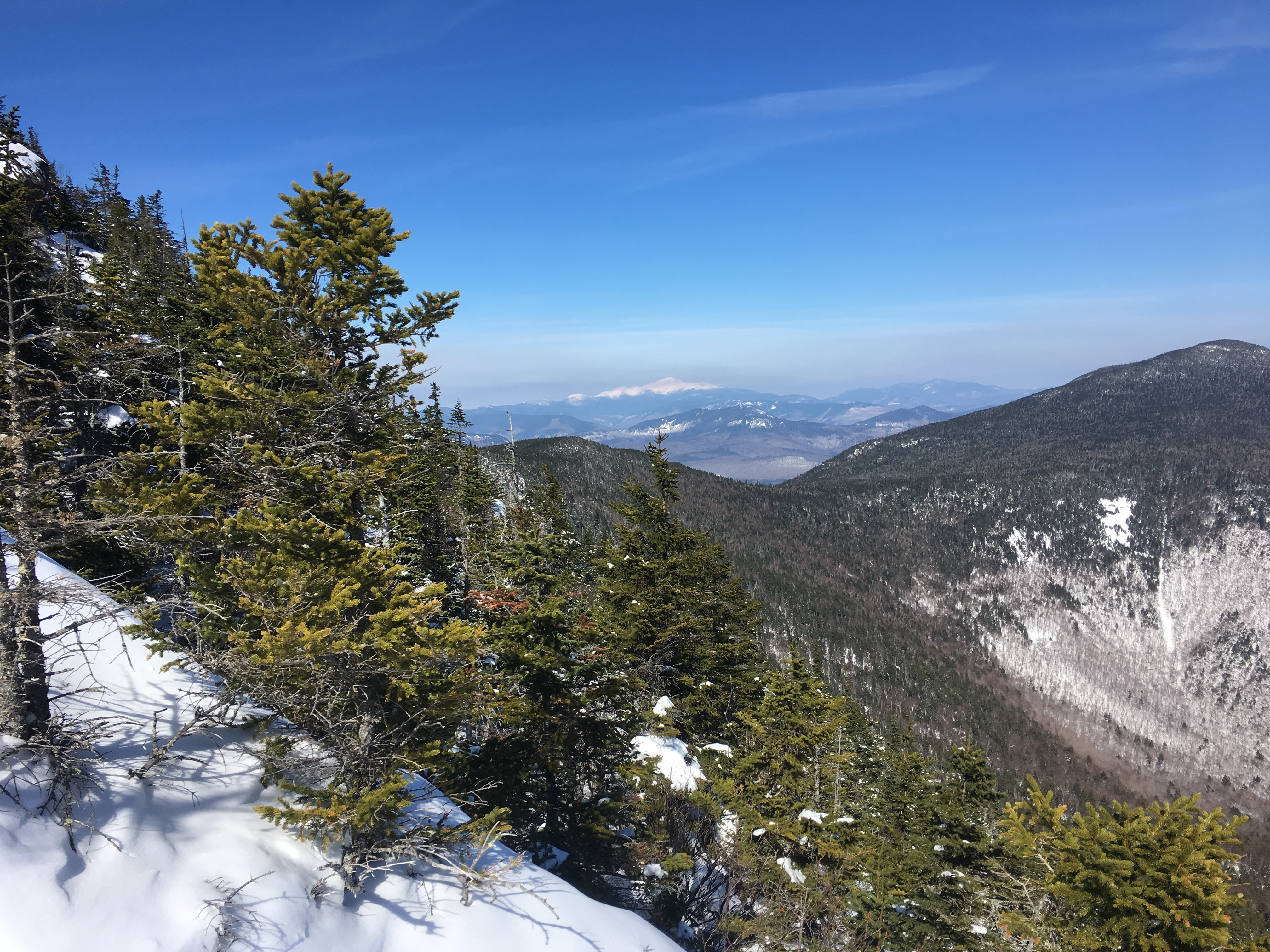
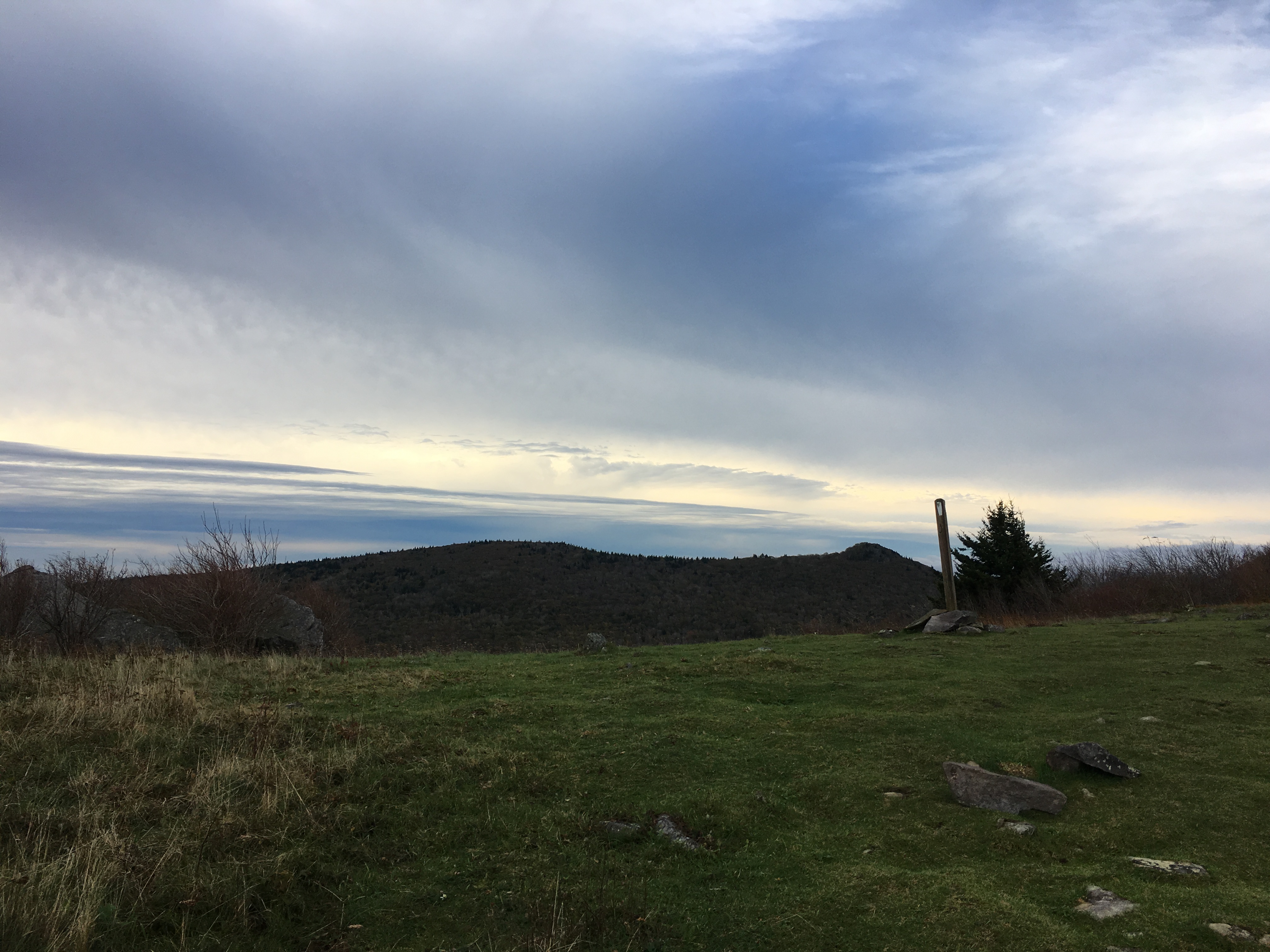
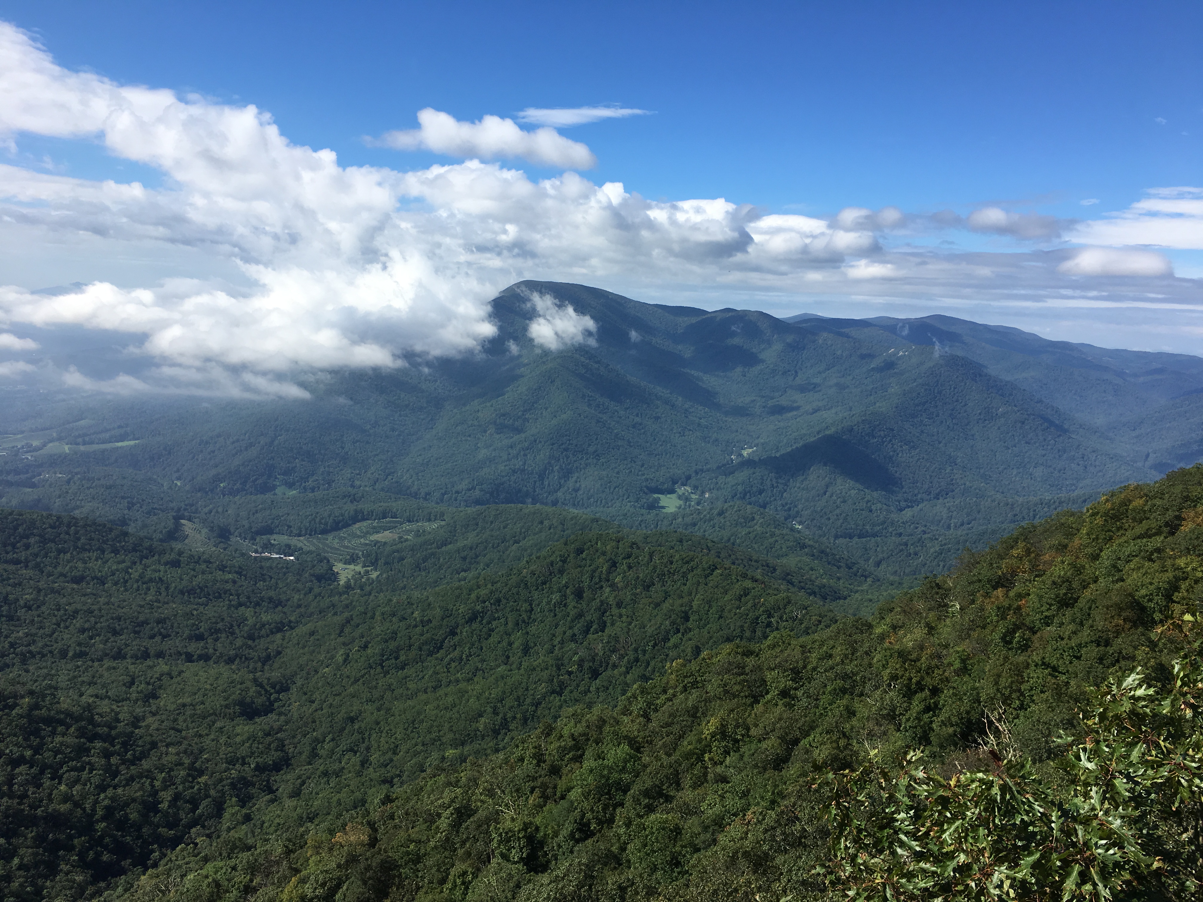
A bit more than a half-mile from the summit, the trail crosses several ledges with excellent views of the Sandwich Range Wilderness.During the summer, the ascent requires grabbing for handholds and scrambling up the ledges.As the Whites have received a lot of snow this year, the ledges were buried in the snow and we had a steep, but relatively easy hike.As the true summit is covered in trees with no views, we stopped at the ledges and enjoyed the views.
View from the South Ledges on Mt. Whiteface
Another View from the South Ledges
Looking Toward Mt. Passaconaway
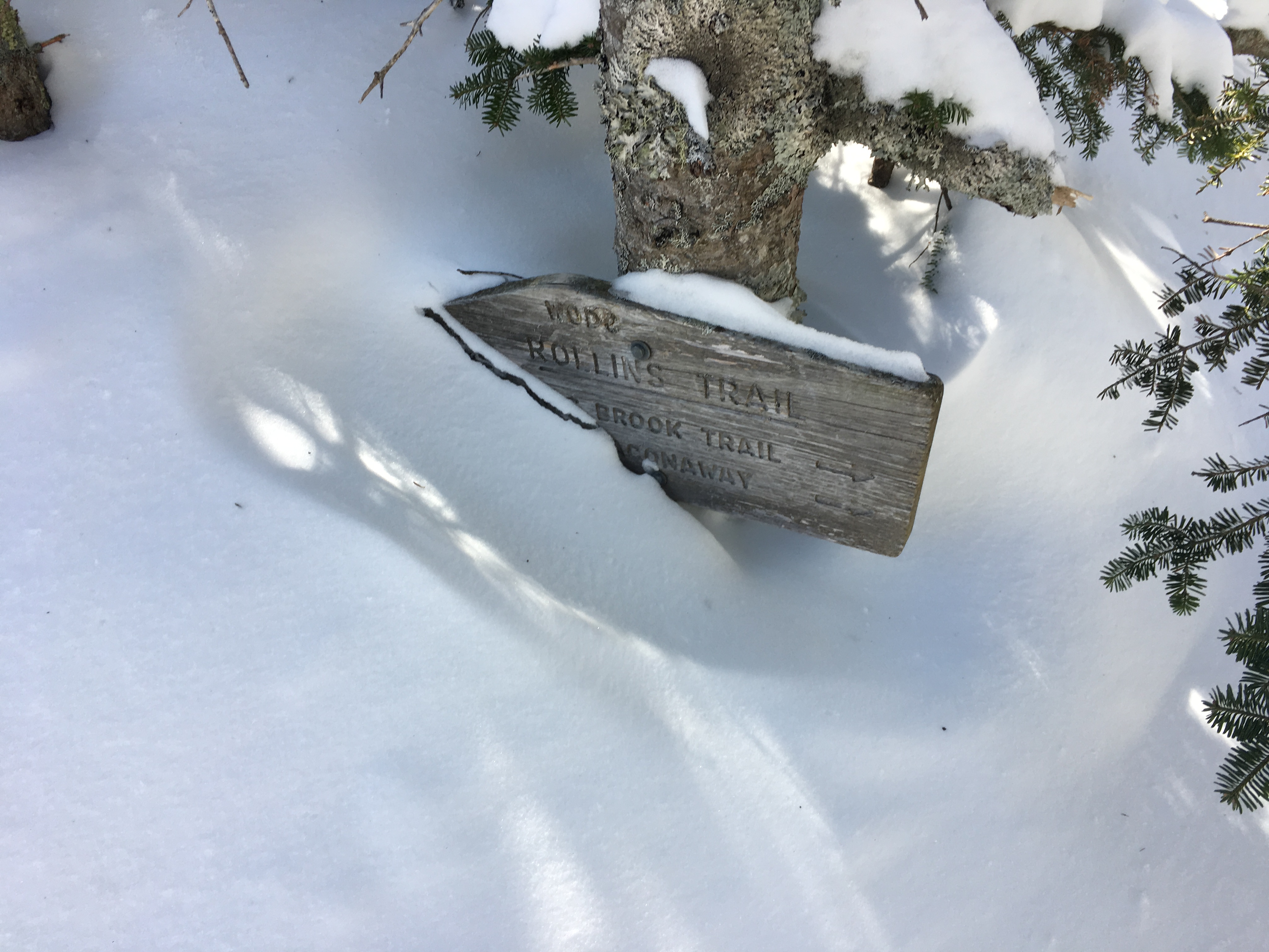
As we continued our way to the summit, we came to junction with the Rollins Trail.The sign at the junction is five or six feet tall, but was buried in snow and barely visible on this day.
The Rollins Trail Sign Buried in the Snow
We hiked 0.3 miles north on the Rollins Trail. Arriving at the summit (4,020’) was anticlimactic, but we knew this going in.Other than taking a quick picture, we did not linger and headed back down.
The Unimpressive, True Summit of Mt. Whiteface
Back at the ledges, we stopped again to enjoy the view and take a few more pictures before descending.
Catching a Few More Views from the South Ledges
One More View
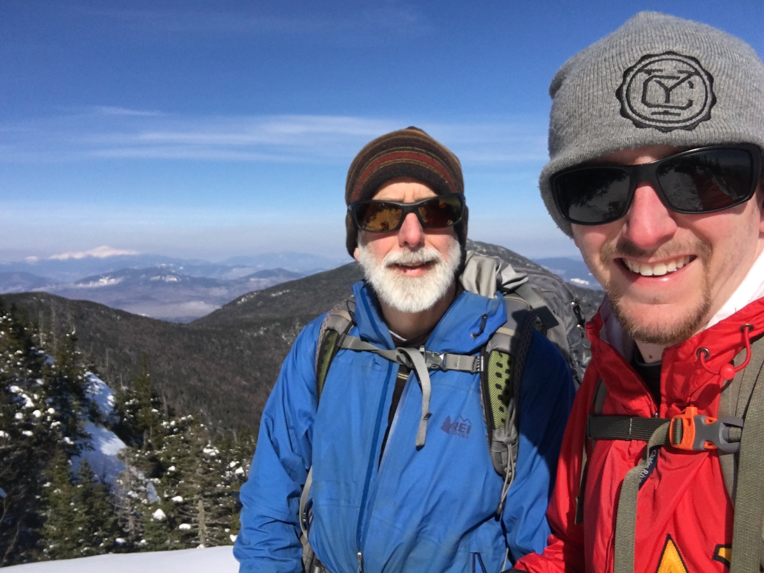
Uncle Malty and Brian at the South Ledges of Mt. Whiteface
We spent the night at the Appalachian Mountain Club (AMC) Joe Dodge Lodge and had dinner at the Red Fox Bar and Grille.
Our plan for Saturday was to hike Mt. Adams, weather permitting.Mt. Adams is a much more formidable hike at 5,774 feet, including nearly a mile above tree line in each direction.The winds were too strong for safe travel, so we opted instead to hike to Lowe’s Bald Spot, an open area just off the road Appalachian Trail with excellent views around Pinkham Notch.
From the lodge, we set out on the Old Jackson Rd trail and entered the Great Gulf Wilderness.Walking on 5 or 6 feet off snow puts a lot branches at chest or face level that are normally overhead, and several sections of trail required care to traverse.
Looking Ahead at Brian through the Branches
We quickly covered the 2.4 miles and arrived at our destination. Upon arrival, I was reminded that this hike is always worthwhile.We had excellent views of the northern Presidentials and across the notch toward Wildcat Mountain.
Mt. Adams and Mt. Madison from Lowe’s Bald Spot
A View of Wildcat Mountain across the Notch
Mt. Washington from Lowe’s Bald Spot
Uncle Malty on Lowe’s Bald Spot
The trail crosses the Mt. Washington Auto Road two tenths of a mile below Lowe’s Bald Spot.The road is closed in the winter, but the owner offers “snowcoach” rides halfway up the road to tree-line, and the workers at the Mt. Washington Observatory are shuttled up to the summit.I expect we would have heard a snowcoach approaching, but we looked both ways before crossing just to be safe.
Looking up the Mt. Washington Auto Road Near Mile Post 2
I hiked again the following weekend and will post pictures from that trip next week.
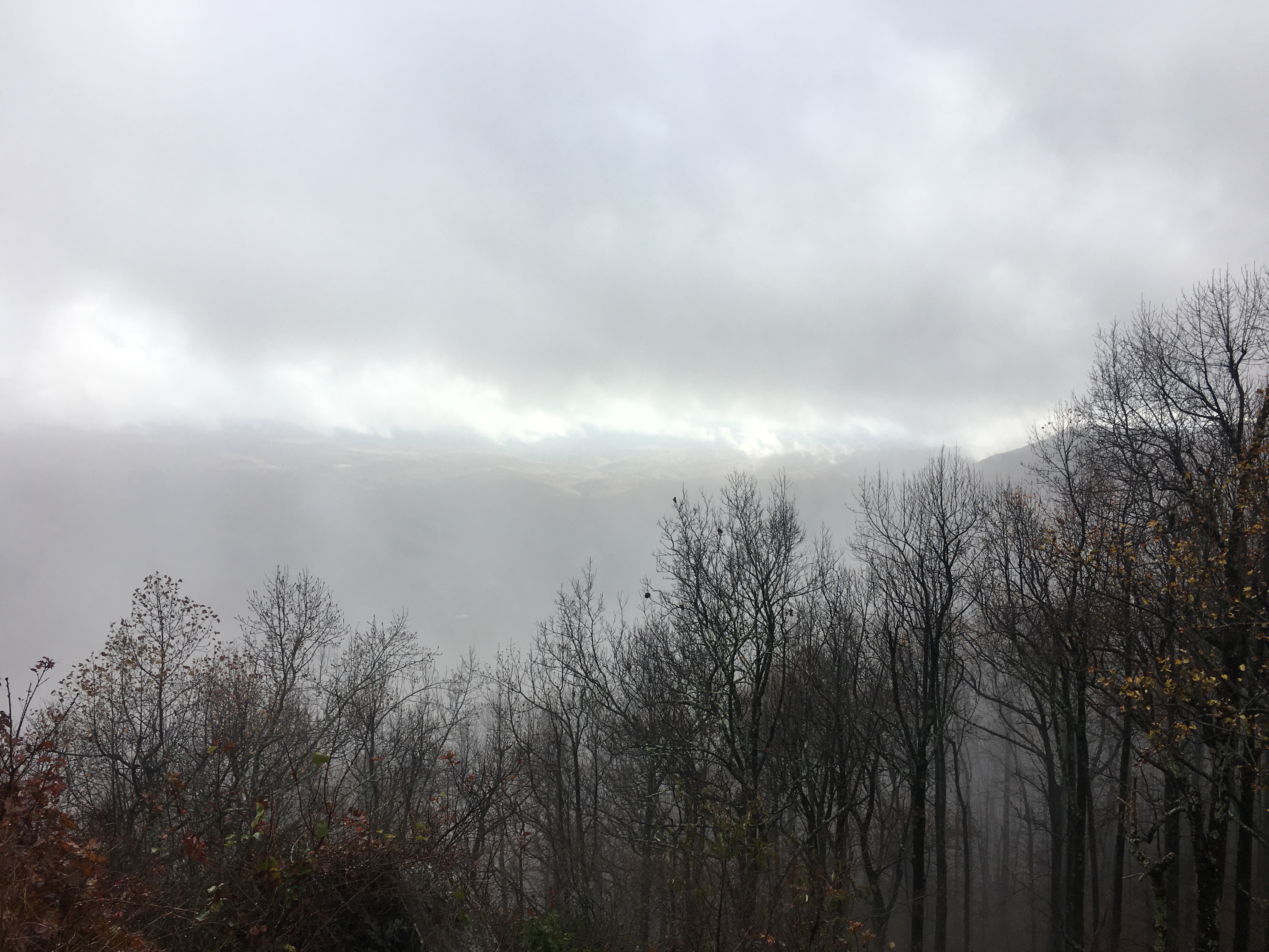
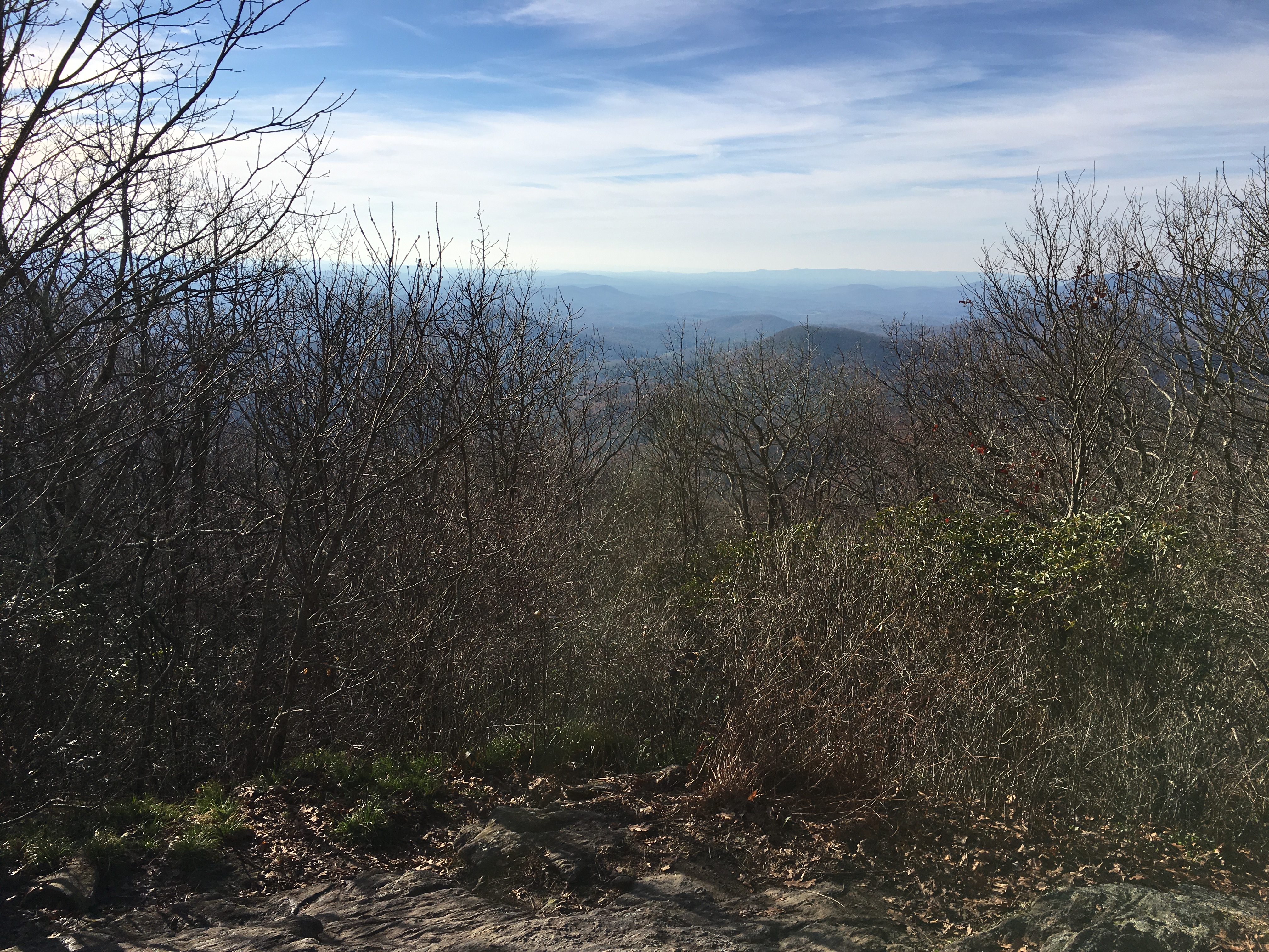
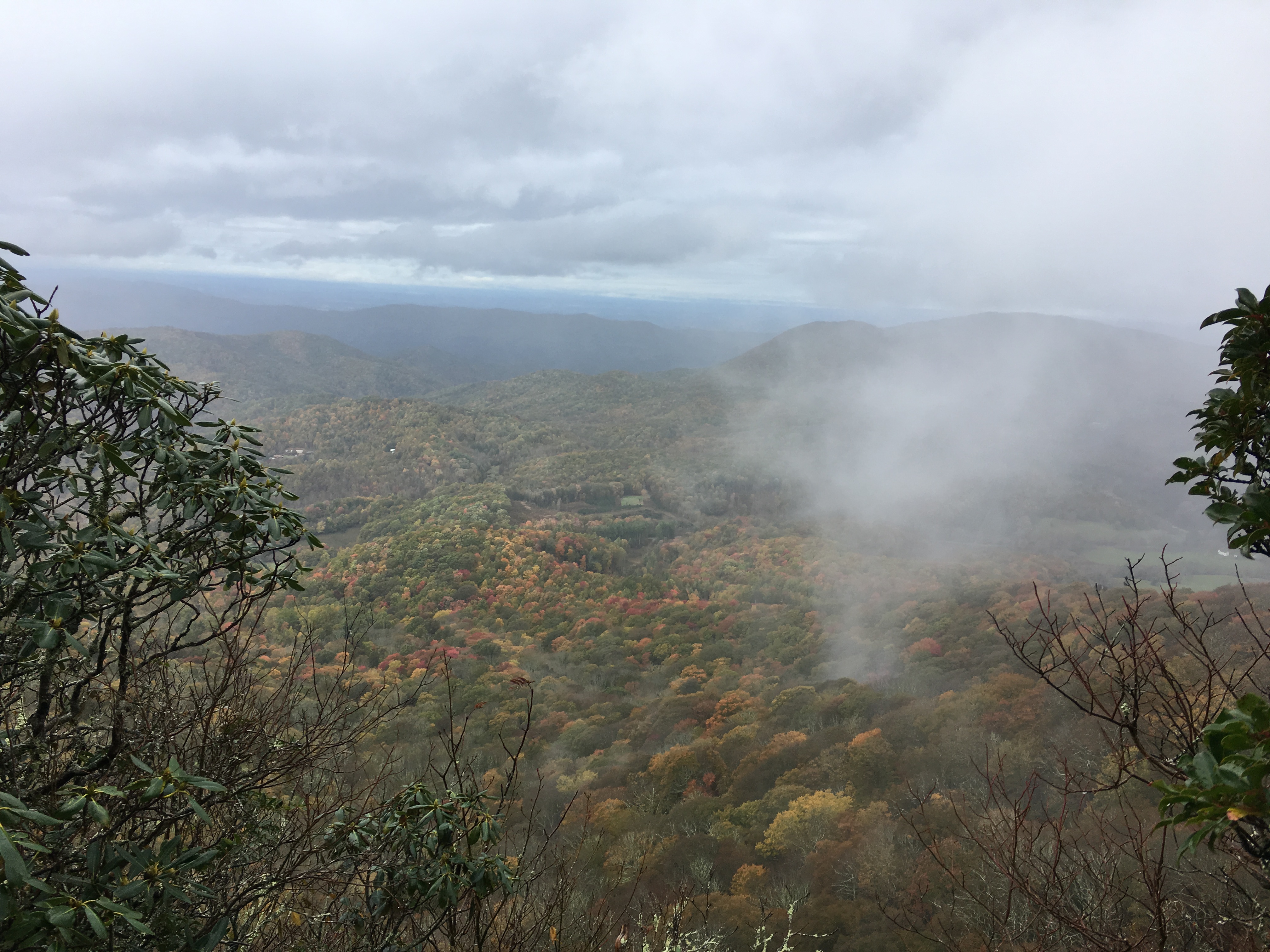
I set out from the Top of Georgia Hiker Center on Tuesday, November 13, with the end of the trip in sight.It was another rainy day, although fortunately, the rain was not as heavy as Monday.The trail undulated up and down across Powell Mountain, Kelly Knob, Tracy Mountain, Rocky Mountain, and Blue Mountain.The grades were easy and the trail surface was smooth until the last section climbing from Unicoi Gap to Blue Mountain.This last section was rocky and it was dark when I arrived at Blue Mountain Shelter, although my eyes had adjusted and I just barely made it before needing my headlamp.The rain had stopped mid-afternoon, but I was still hiking in the clouds except for brief periods when I climbed above them on Rocky Mountain and Blue Mountain.When I put on my headlamp to cook dinner, I could see that not only had I hiked back down into the clouds, but the moisture in the air was so thick it was difficult to see more than a few feet.I put as much gear as possible in my pack for the night in an effort to keep as dry as possible.
I woke Tuesday morning to a heavy dew on everything from my sleeping bag to my camp shoes.I was able to pour water out of my Crocs before I put them on.Tuesday was another 19 mile hike up and down small peaks.The destination for the day was Neels Gap, 31 miles from Springer Mountain.This is the first stop where ill-prepared northbound hikers swap out gear at the outfitter or decide to quit the trail and head back home.The weather was overcast with patches of light rain, but I got an early start and the hike was relatively quick, allowing me to arrive at the outfitter, Mountain Crossings, by 4 pm.I had already planned on spending the night at the hostel before I saw the weather forecast or the “southbound special” consisting of a hot shower, bunk, and a Red Baron pizza for $20.After another cold, wet day, the pizza tasted especially good.
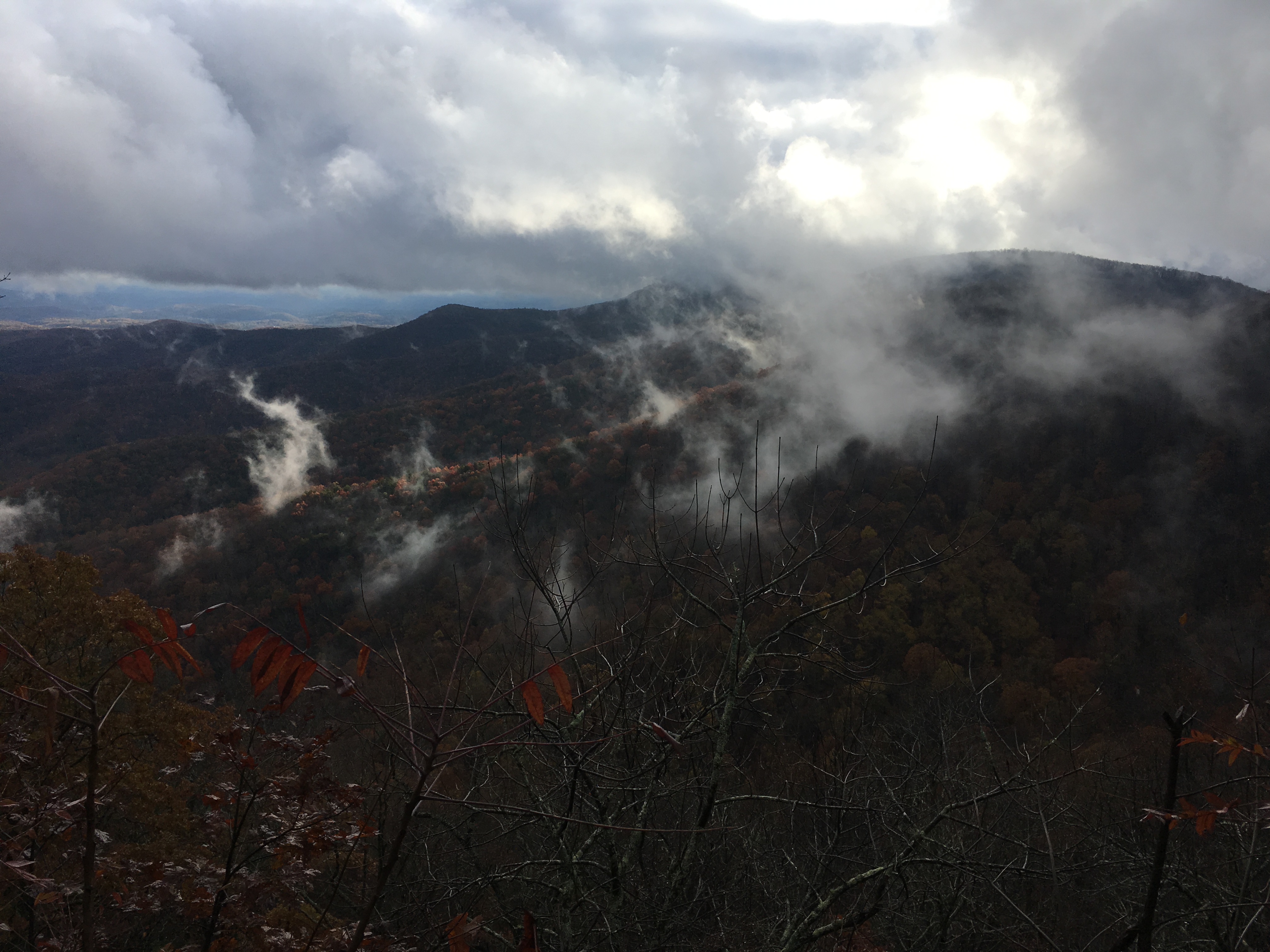
Thursday morning was overcast and rainy, but forecast to clear up by noon.The day started hiking up Blood Mountain, the last significant peak on the trip.The trail was rocky and wet, requiring extra care, but the grade was easy, rising 1,400 feet over 3 miles.The summit was fogged in and I continued on my way.The rain had stopped and I hoped for clear skies.Around noon, the rain started again and continued for a couple more hours.Somewhere along the ridge between Woods Gap and Gooch Gap the rain stopped and the clouds slowly dissipated.
Ramrock Mountain, Shrouded in Clouds
Partial Clearing, Approaching Gooch Gap
Finally, A Late Afternoon View Near Gooch Gap
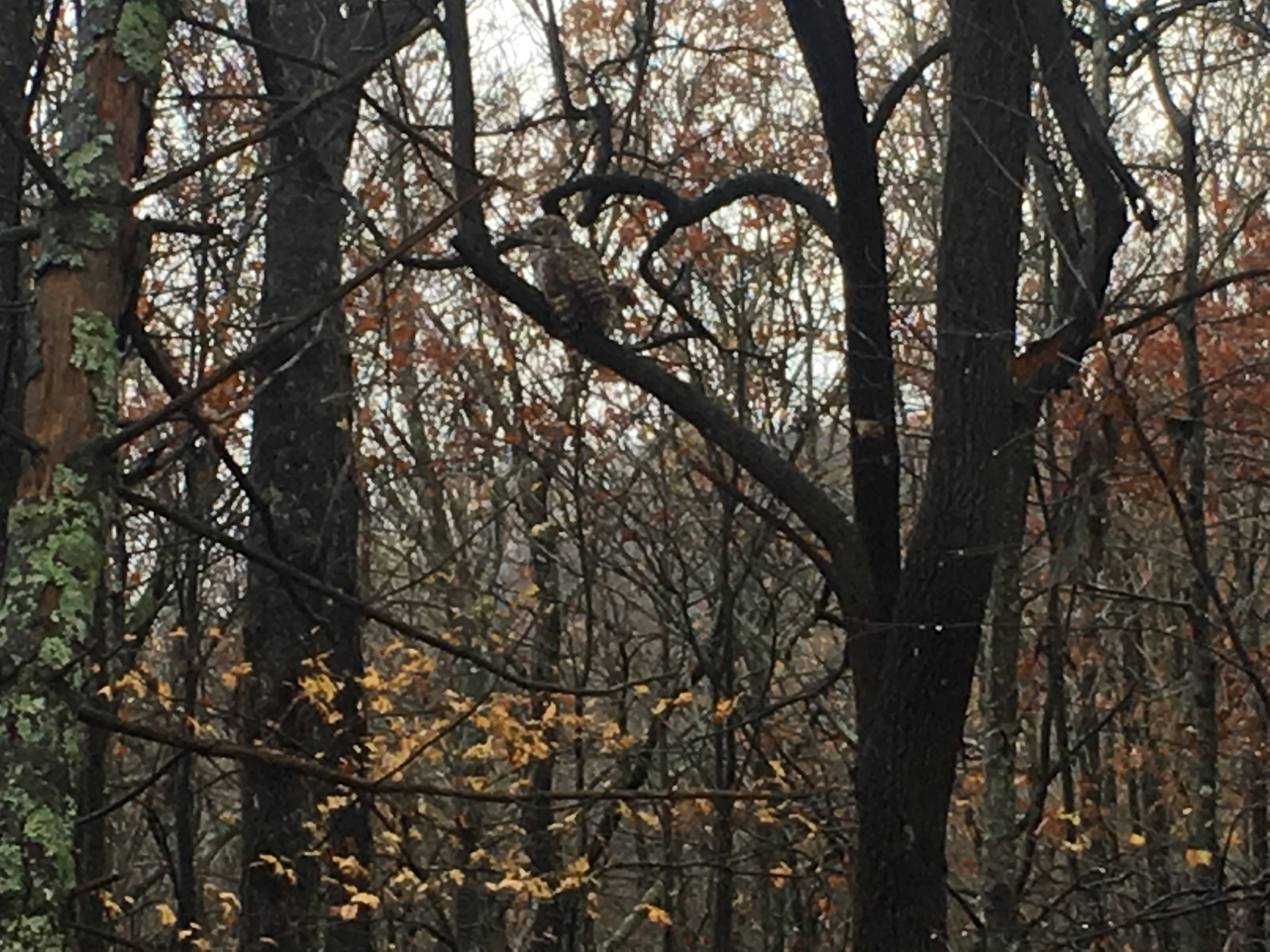
As I approached Gooch Gap and was back in the woods, I saw an owl flying low through the trees.It perched in a tree and I was lucky enough to get a few pictures as I approached.
An Owl Perched in a Tree Near Gooch Gap
The sun never came out, but the skies cleared up overnight.The temperature dropped to 19 degrees making for an uncomfortable night.I had picked up an extra dry bag after my shoes froze in North Carolina, so I was able to put my shoes in the bag and place them in the bottom of my sleeping bag to prevent them from freezing again.
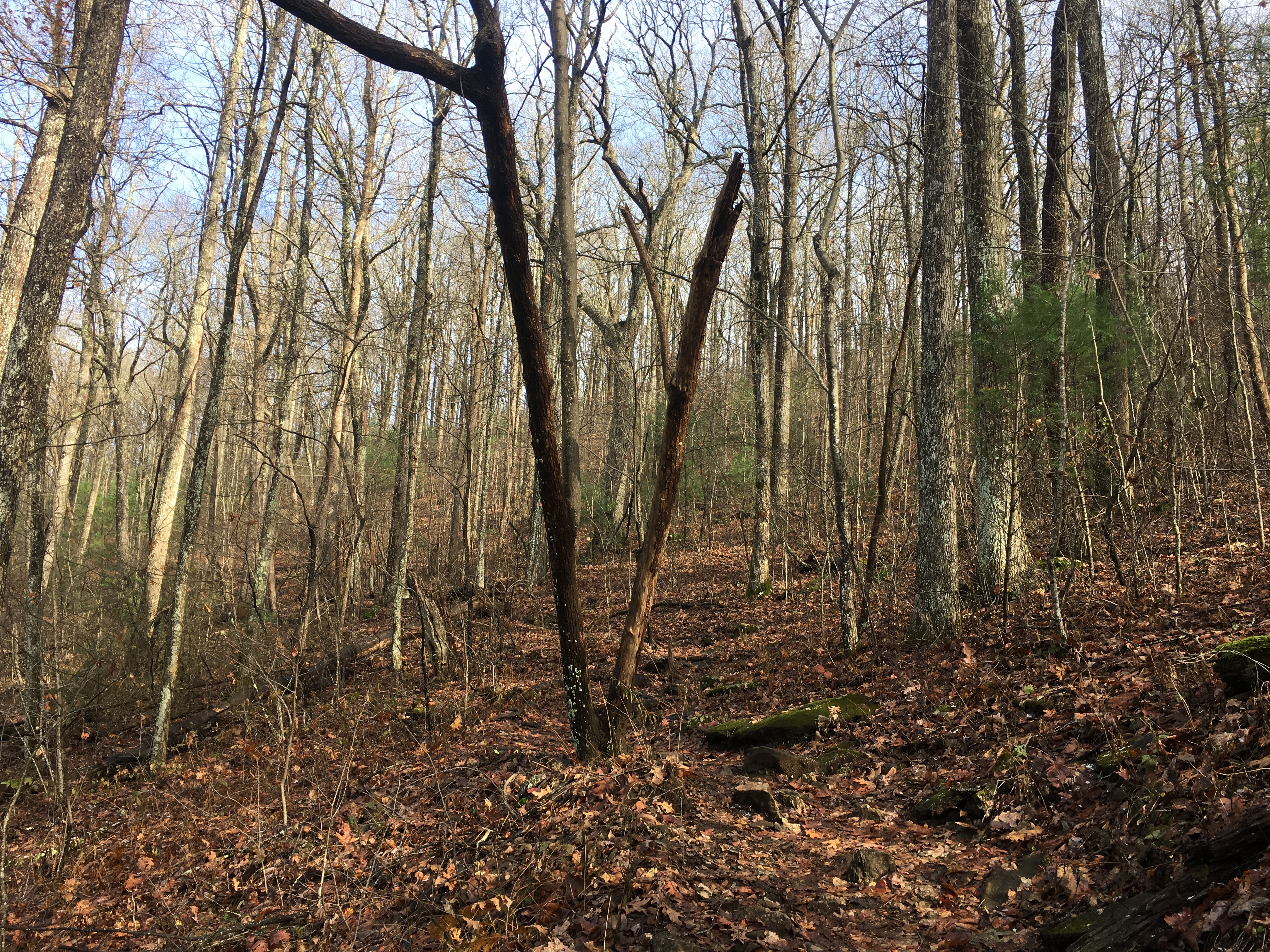
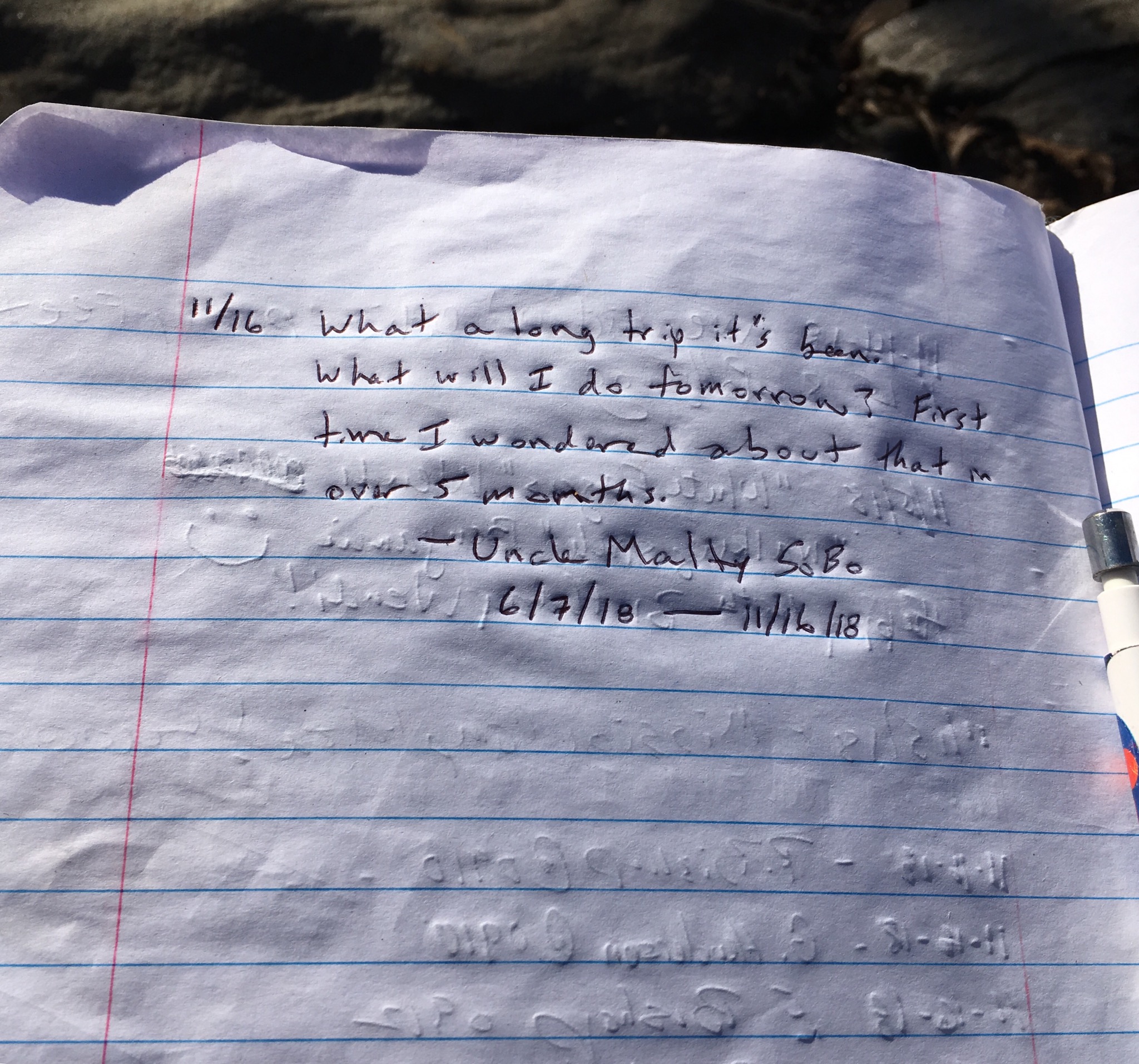
Friday morning was clear, but cold.I ate breakfast and packed quickly, knowing that hiking would warm me up.The hike was a bit surreal — it was hard to believe that I was already at the end of my journey despite this being day 163.I knew in advance that hiking southbound would provide an anticlimactic finish, and the trail was rather unremarkable approaching Springer Mountain.
The Appalachian Trail, Ascending Springer Mountain
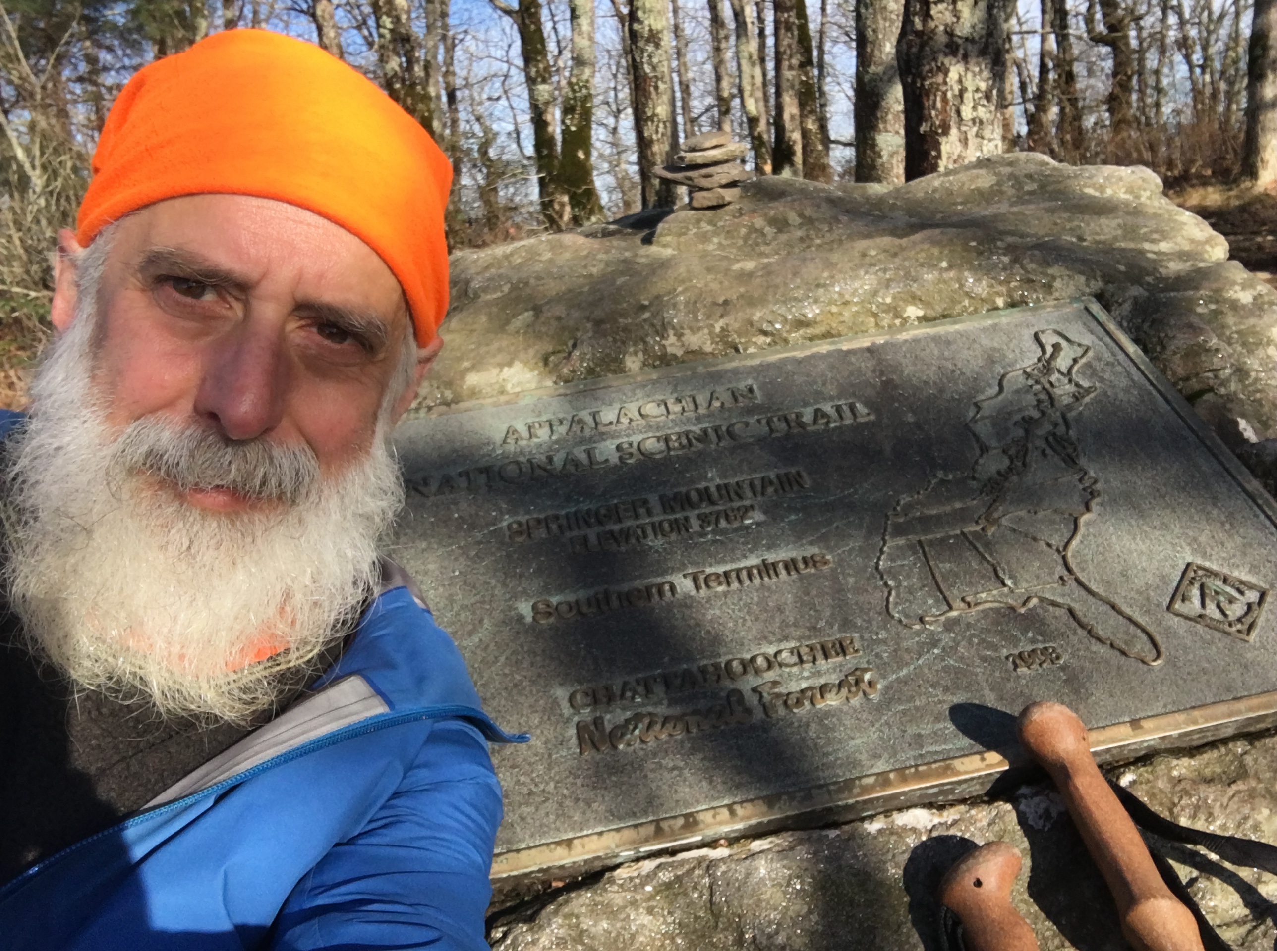
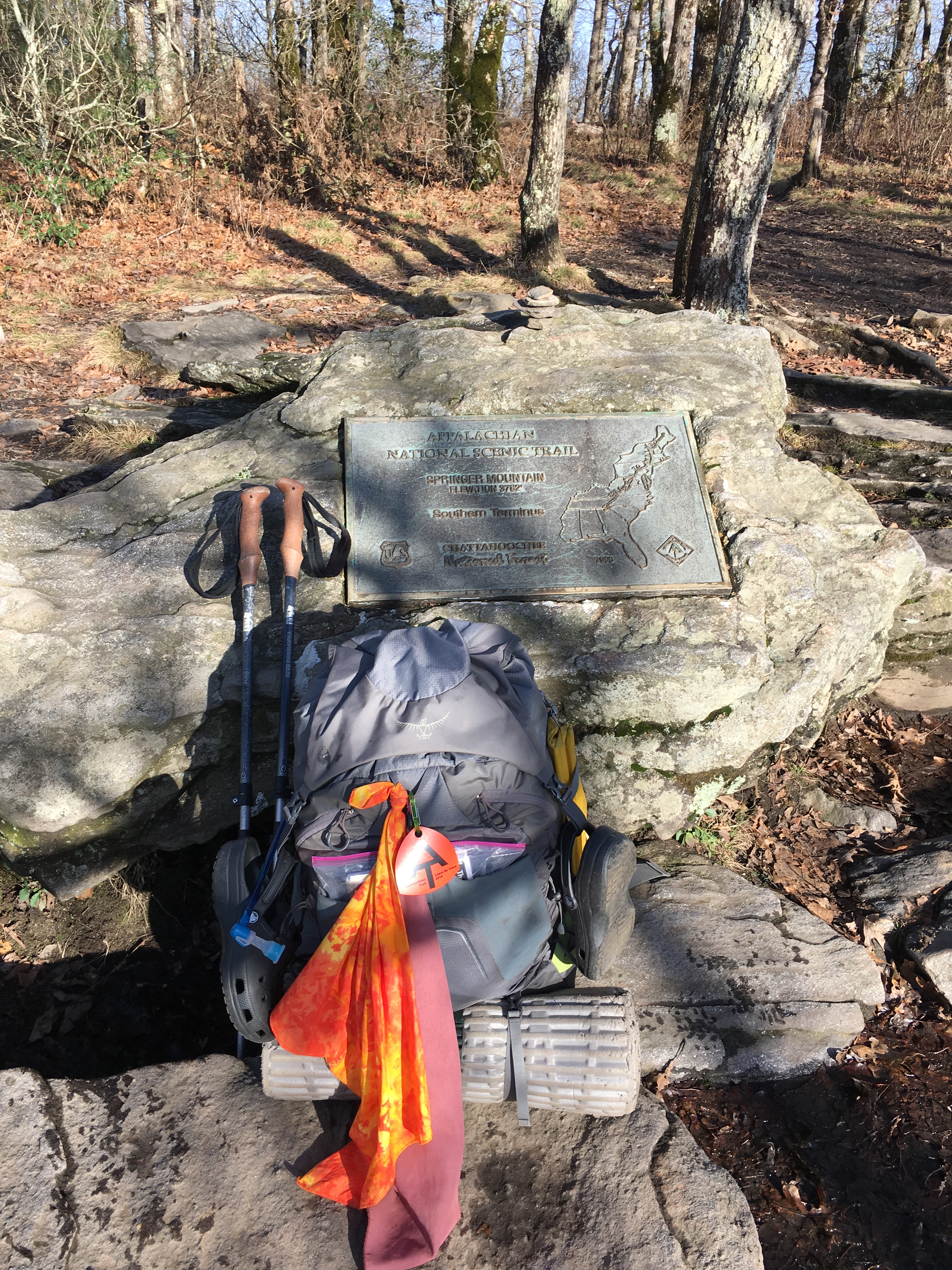
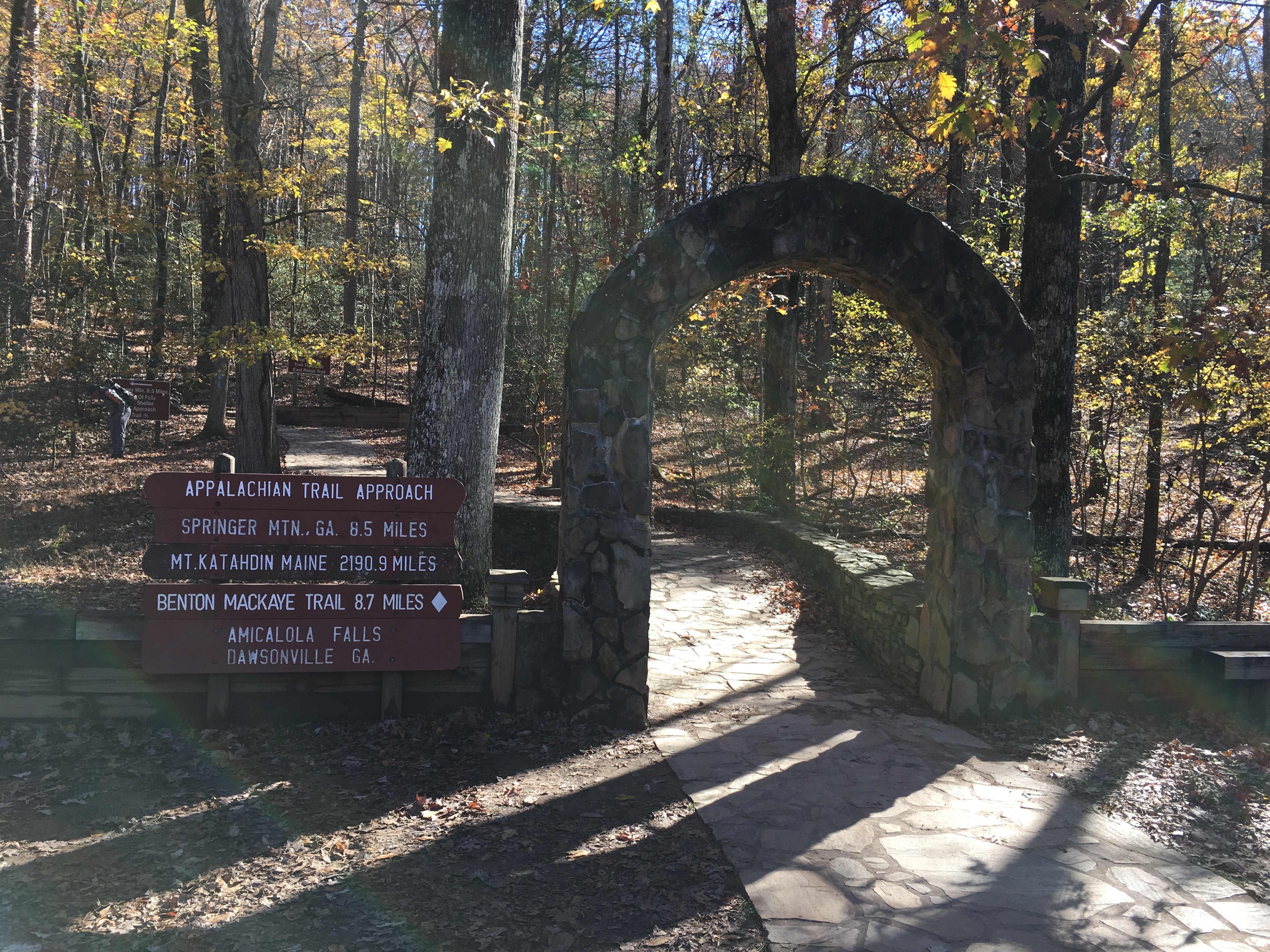
I would likely have walked past the summit had I not seen a sign marking the end of the Approach Trail from Amicalola Falls.As I turned left to get my bearings, I saw the plaque marking the southern terminus of the trail.
I spent the next 45 minutes taking pictures and writing an entry in the trail log.I hoped that a day hiker would come by so I could ask to have my picture taken, but no one came by and I had to settle for a selfie and a picture of my backpack.
Uncle Malty at the Summit of Springer Mountain
Uncle Malty’s Backpack and Trekking Poles Next to the Plaque Marking the Southern Terminus of the Appalachian Trail
The View from Springer Mountain
Uncle Malty’s Entry in the Trail Log at Springer Mountain
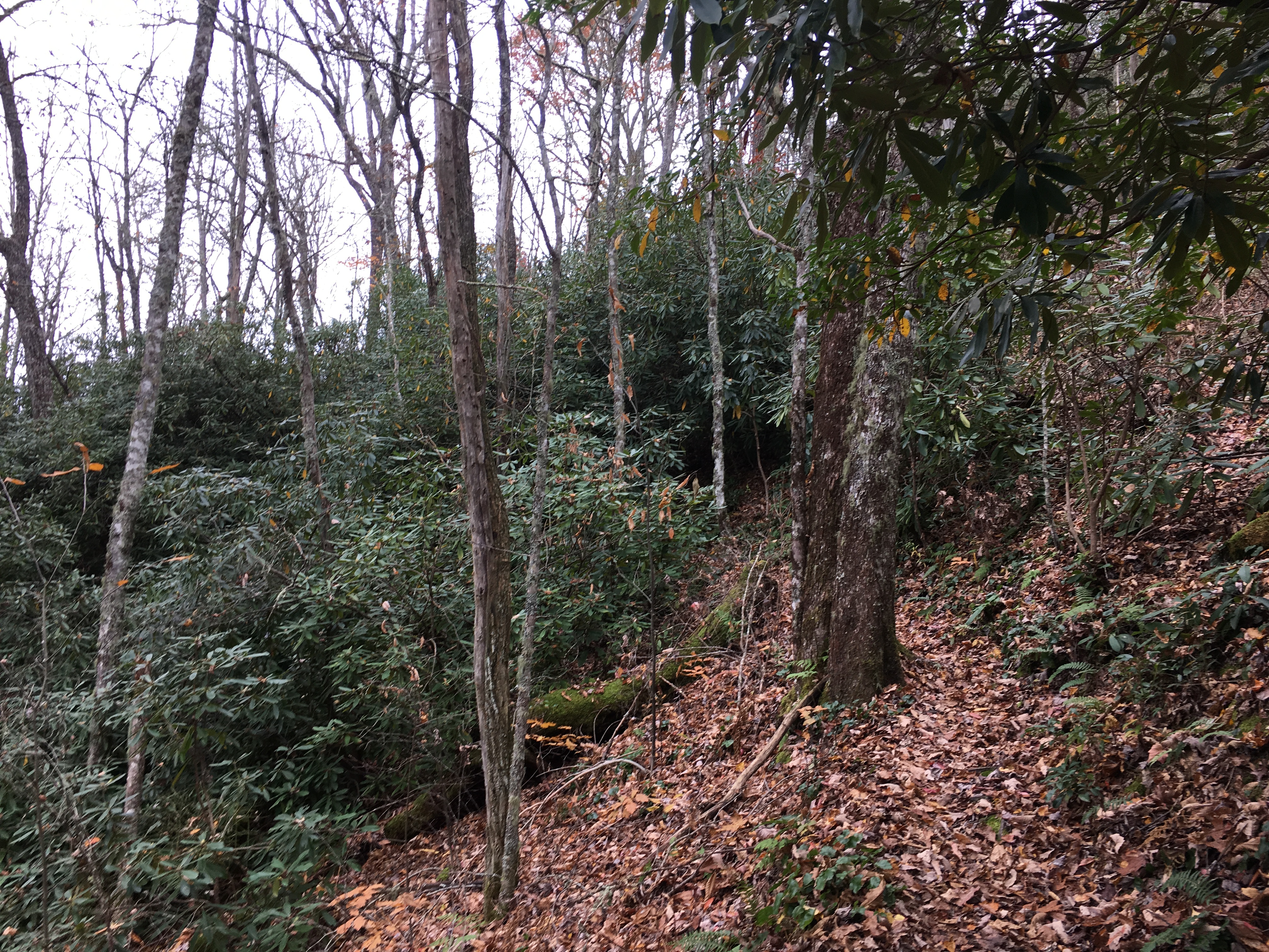
I continued my hike for another mile and a half down the Approach Trail to the Black Gap Shelter.Fortunately, the temperature only dropped into the low 30s this night and I enjoyed my last night of camping.
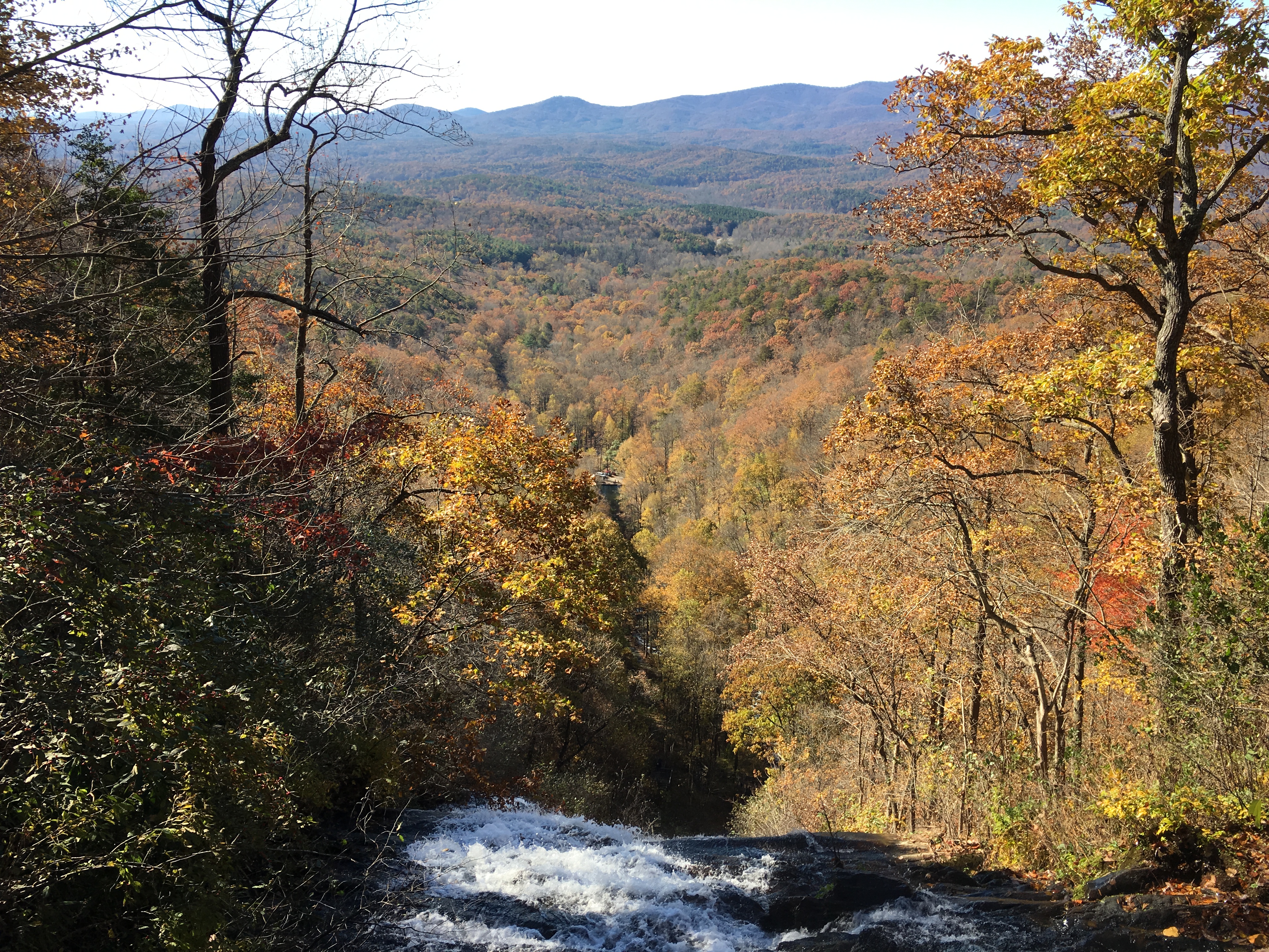
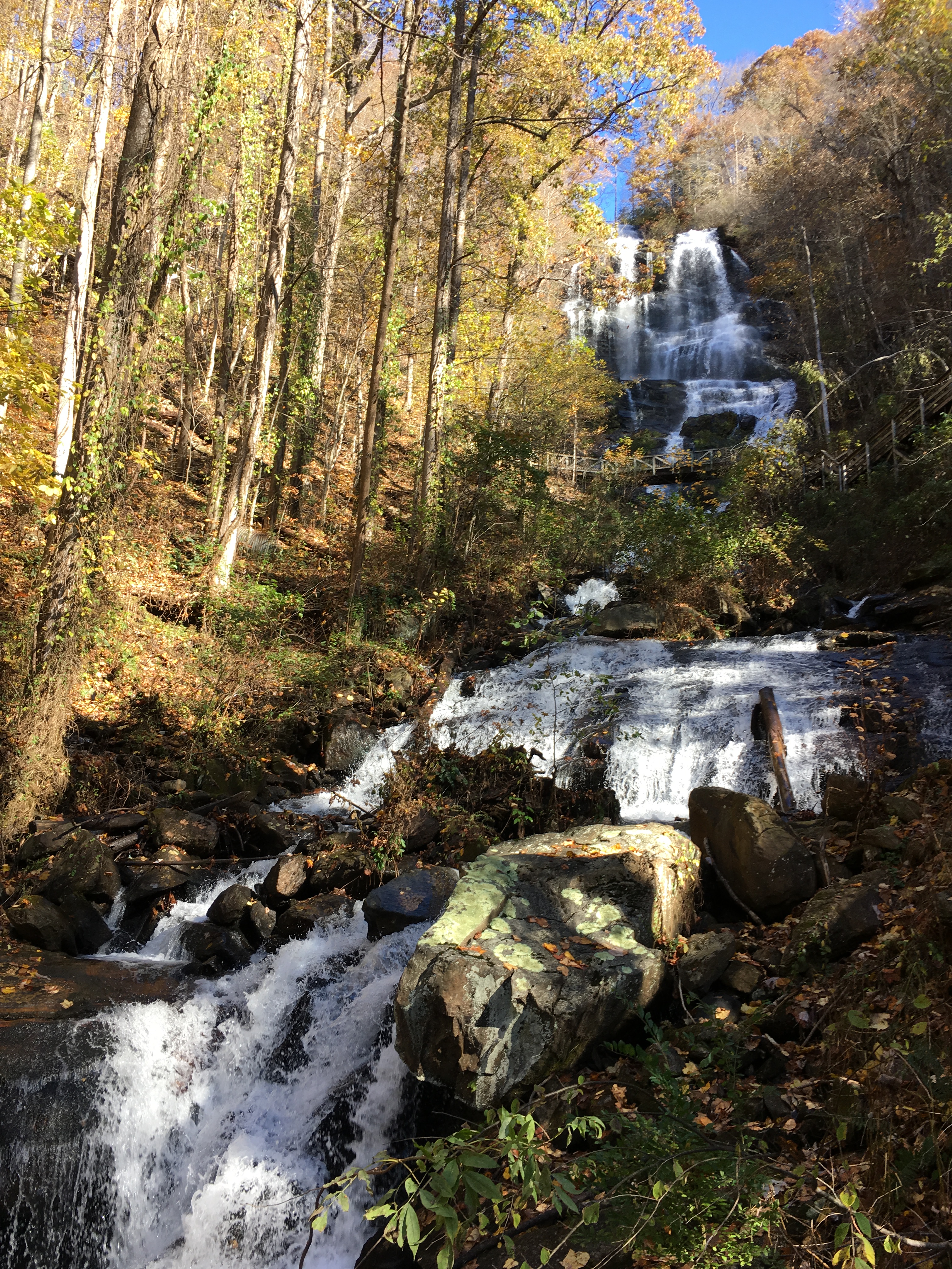
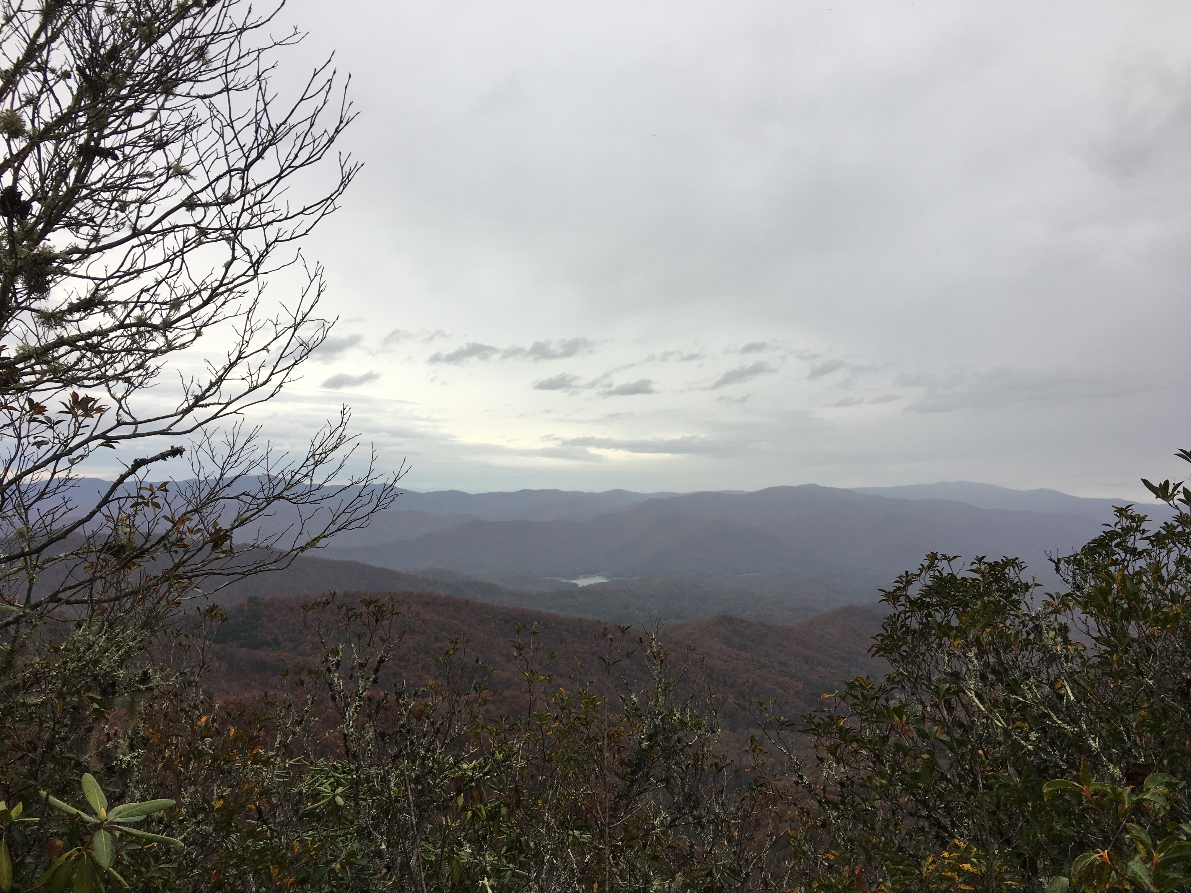
On Saturday morning, I hiked the last 7.5 miles of the Approach Trail to the visitor’s center at Amicalola Falls State Park.The Falls were spectacular and made up for the lackluster view from Springer Mountain.
View from the Top of Amicalola Falls
View from the Base of Amicalola Falls
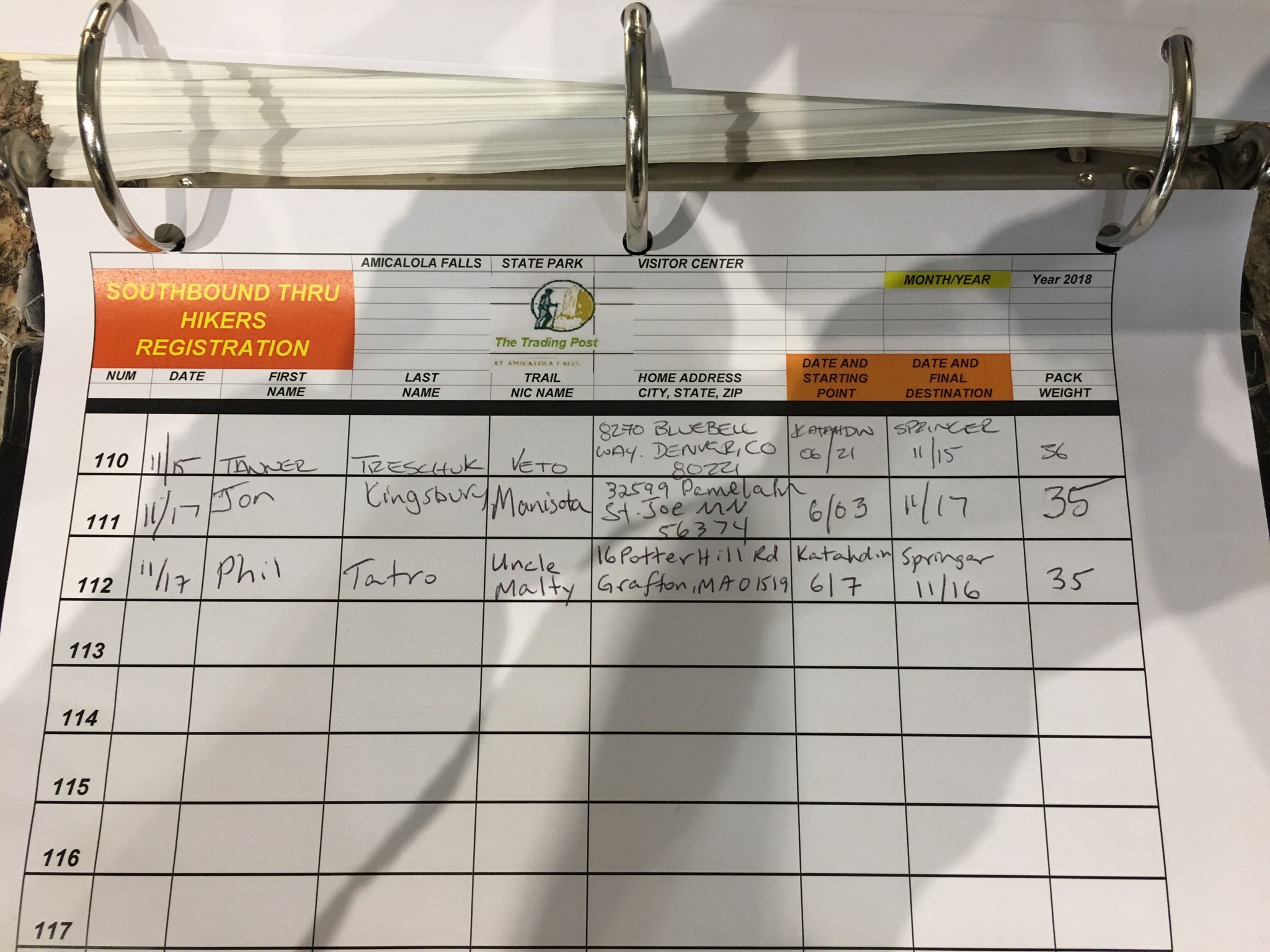
Upon reaching the visitors center, I signed the trail log and waited for a ride I had arranged to take me to the North Springs MARTA train station, from which I would ride into Atlanta and visit friends before flying back home.
The Start of the Approach Trail — The End of This Journey
Register at Amicalola Falls
I hope everyone enjoyed following my journey.Thank you for being part of my trip and for putting up with any typos or errors in my blog, which I wrote and maintained on my iPhone.While I do not have any other major hikes planned, I plan to continue to post pictures and reports from future dayhikes and weekend backpacking trips.I would be happy to have you continue to follow my blog if you are interested.I am looking forward to getting back to the White Mountains in New Hampshire this winter and hope to finally visit Isle Royale National Park in Michigan next summer.
Having crossed between Tennessee and North Carolina for the final time somewhere during my last day in the Smokies, I set out on Wednesday, November 7, with just two states remaining in my trip.
My night at Fontana Village was comfortable enough that I almost wished it was raining so that I could spend another night.Knowing that the sun would be out for most of that day, however, I set out after enjoying the pleasure of a hot breakfast of eggs, toast, home fries, sausage, and pancakes.
The trail climbed steeply and for most of the day I could see Fontana Lake below through the trees.Late in the afternoon, the trail reached on open stretch on the ridge between Hogback Gap and Brown Fork Gap.
Late Afternoon View from the Ridge Approaching Brown Fork Gap
Another View Approaching Brown Fork Gap
The forecast for Thursday was a 40 to 50 percent chance of rain for each hour of the day.Fortunately, I only encountered a few brief periods of light rain.The morning was still only overcast as I reached Stecoah Gap at 3,165 feet, a climb of about 1,500 feet from Fontana Lake.
View at Stecoah Gap
One feature of the trail that I have forgotten to mention previously is the large number of rhododendrons that surround the southern half of the trail.They were most prevalent in Pennsylvania and Virginia, but I still encountered them through Tennessee and North Carolina.In many sections the trail is essentially a tunnel through a rhododendron grove.
Hiking toward another Rhododendron Grove
From Stecoah Gap, the trail climbed over the next five miles to 5,062 feet at the top of Cheoah Bald.The summit was shrouded in mist, an occurrence that had become all to common.
Cheoah Bald, in the Clouds
On Friday morning, the rain had already started before I hit the trail.The rain was light and intermittent for the first few miles and I prayed that it would stop for good.This prayer was not to be answered, however, and soon I was hiking through heavy rain with sleet mixed in.After three hours, I stopped at the Wesser Bald Shelter, changed into dry clothes, and crawled into my sleeping bag to warm up.Eventually the rain stopped and checking my phone, I could see there was two-hour window before it would start again.After I was sufficiently warm, I had a quick lunch, packed up, put my wet clothes back on, and headed out.As much as I did not want to wear my wet clothes, I knew I would need dry clothes at camp and could not risk having all my clothes wet.Light rain had started again by 2 p.m. that continued through the evening.Once moving, I was able to stay warm the rest of the day and I pushed on to complete my planned 16 miles just as it became dark.
This was not my day as I arrived to a shelter full of weekend hikers.They offered the option of sleeping under the overhang in front of the shelter, which sounded tempting, but I could tell they planned on sleeping with their food hanging in the shelter despite the notices I had seen throughout the day warning of bear activity in the area.After dinner, I found a suitable tree to hang my food and went back into the rain and cold to set up my tent.Level ground was nowhere to be found and so I picked the best spot I could find.Once inside, I put on my dry clothes and spent a rather uncomfortable night as the temperature dropped to 20 degrees.
I woke on Saturday morning to a frozen tent zipper, frozen rope on my food bag, and frozen shoes.The first two issues I dealt with easily enough, but by the time I had breakfast and packed up my gear, I was too cold to address the shoe issue.I proceeded to hike with two pair of socks and my Crocs, which I carry to wear in camp.After about an hour of hiking uphill to the top of Wayah Bald, I was warm enough to give the shoes a try.With a bit of patience and improvising, I was able to get the shoes on by using my trowel as a shoehorn.They were still frozen solid, but another half hour of hiking thawed them out and rewarmed my feet.While at the summit of Wayah Bald, I was also able to enjoy some nice views in the morning sunshine.
Early Morning View from Wayah Bald
After descending into Wayah Gap, the trail climbed again to Siler Bald.I hiked the 0.2 mile out-and-back side trail to the top of Siler Bald where I enjoyed the views and my lunch.
Lunchtime View from Siler Bald
Another View from Siler Bald
I cut my hike short by 3.5 miles at Rock Gap so I could head into Franklin, NC to dry out my gear at the Gooder Grove Hostel.The owner, “Zen,” was very helpful and advised me that the next section of trail would be relatively easy, allowing me to make up the miles on Sunday.
Given the forecast for more rain in the upcoming days, I took my time to enjoy the sunshine and wonderful views.As predicted by Zen, I was still able to cover the 20 miles from Rock Gap to Standing Indian Shelter in 8-1/2 hours. The day included hiking over two peaks above 5,000 feet: Albert Mountain at 5,250 feet and Standing Indian Mountain at 5,498 feet.
View from the Fire Tower on Albert Mountain
A Second View from the Fire Tower on Albert Mountain
A Third View from the Fire Tower on Albert Mountain
View at Dusk from Standing Indian Mountain
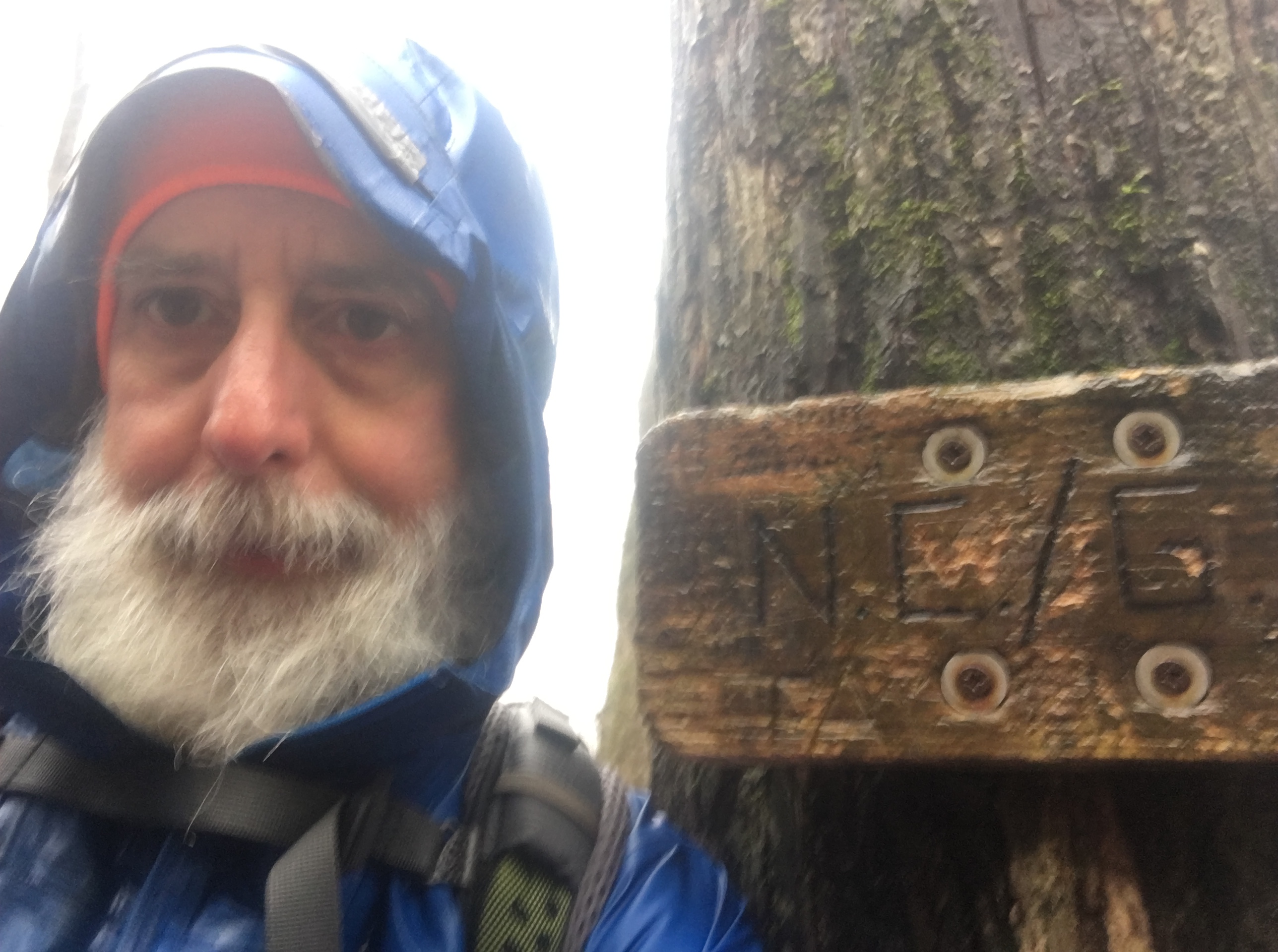
As forecast, I woke to rain on Monday.The rain continued all day, heavy at times, and mixed with sleet at others.I stopped briefly at the North Carolina-Georgia border to take a picture to mark my progress as I entered the last state heading south on the Appalachian Trail.
Uncle Malty at the North Carolina-Georgia Border
The trail continued up and down a series of viewless peaks until I reached Dicks Creek Gap, where I spent the night at the Top of Georgia Hiking Center.After being in the cold rain all day, I felt fine other than having lost dexterity in my fingers.It took me about 20 minutes and a hot cup of tea to complete the registration form, which simply asked for my name, trail name, phone number, and email address.
After a hot shower, I caught the shuttle into Hiawassee, GA.The shuttle driver recommended the local Mexican restaurant, which suited me fine.The Hombre Grande meal hit the spot, consisting of a taco, chalupa, enchilada, burrito, chile relleno, rice, and beans.
The Hombre Grande at Monte Alban Mexican Restaurant
With just four days remaining to Springer Mountain, the forecast called for rain the next three days.Normally this would have depressed me, but I to went to bed looking forward to heading out the next day to finish my journey.
I spent Friday night, November 2, at the Standing Bear Hostel.The caretaker, Jack, was starting a fire in the wood stove in the bunkhouse as I arrived.Having been in the rain all day, I picked a bunk near the stove so I could dry out my clothes and shoes.This was a choice that brought mixed feelings in the long run as everything dried quickly, but it was much too warm for a comfortable night of sleep.
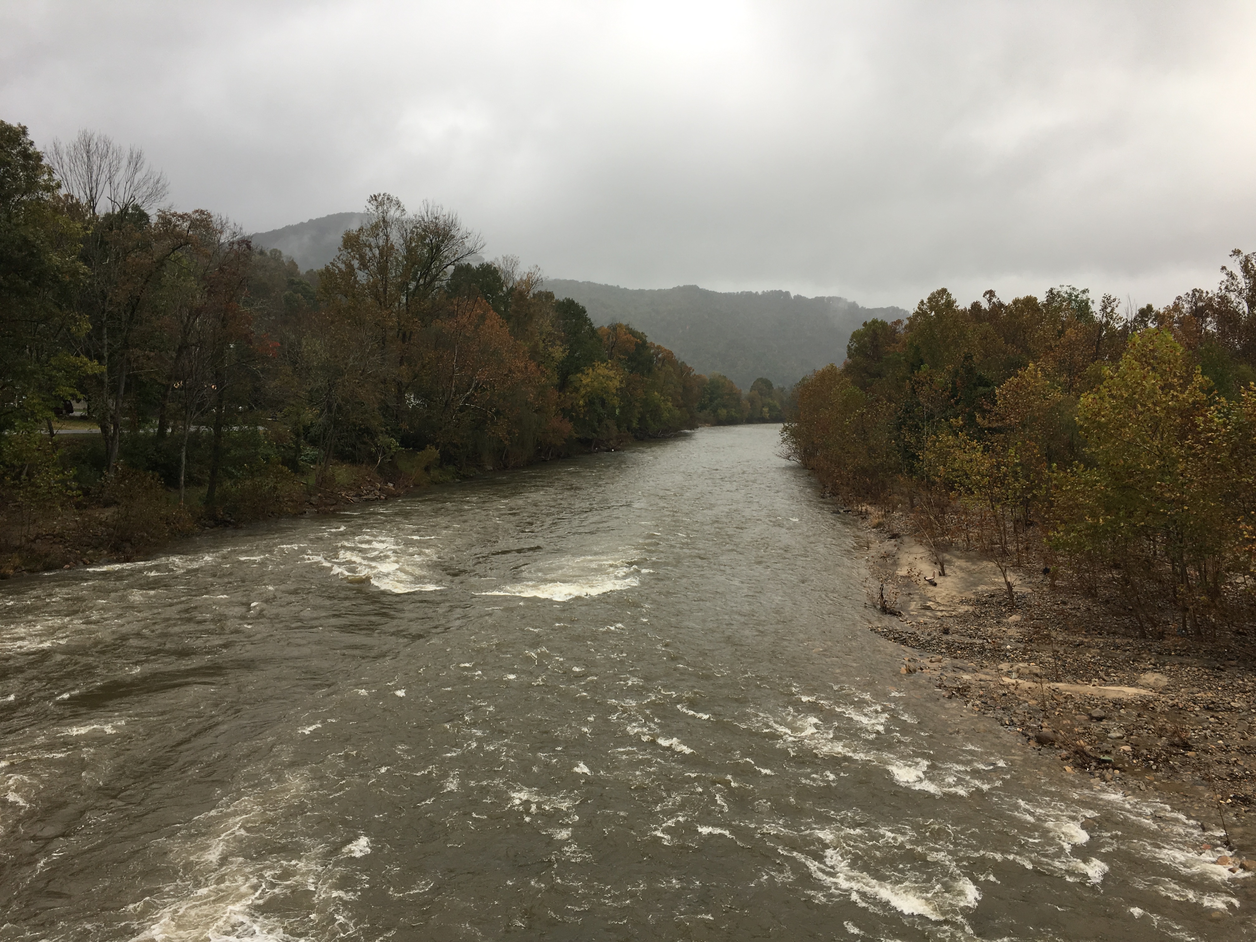
I departed Saturday morning at first light and headed down the trail toward the park, crossing the Pigeon River along the way.
Crossing the Pigeon River
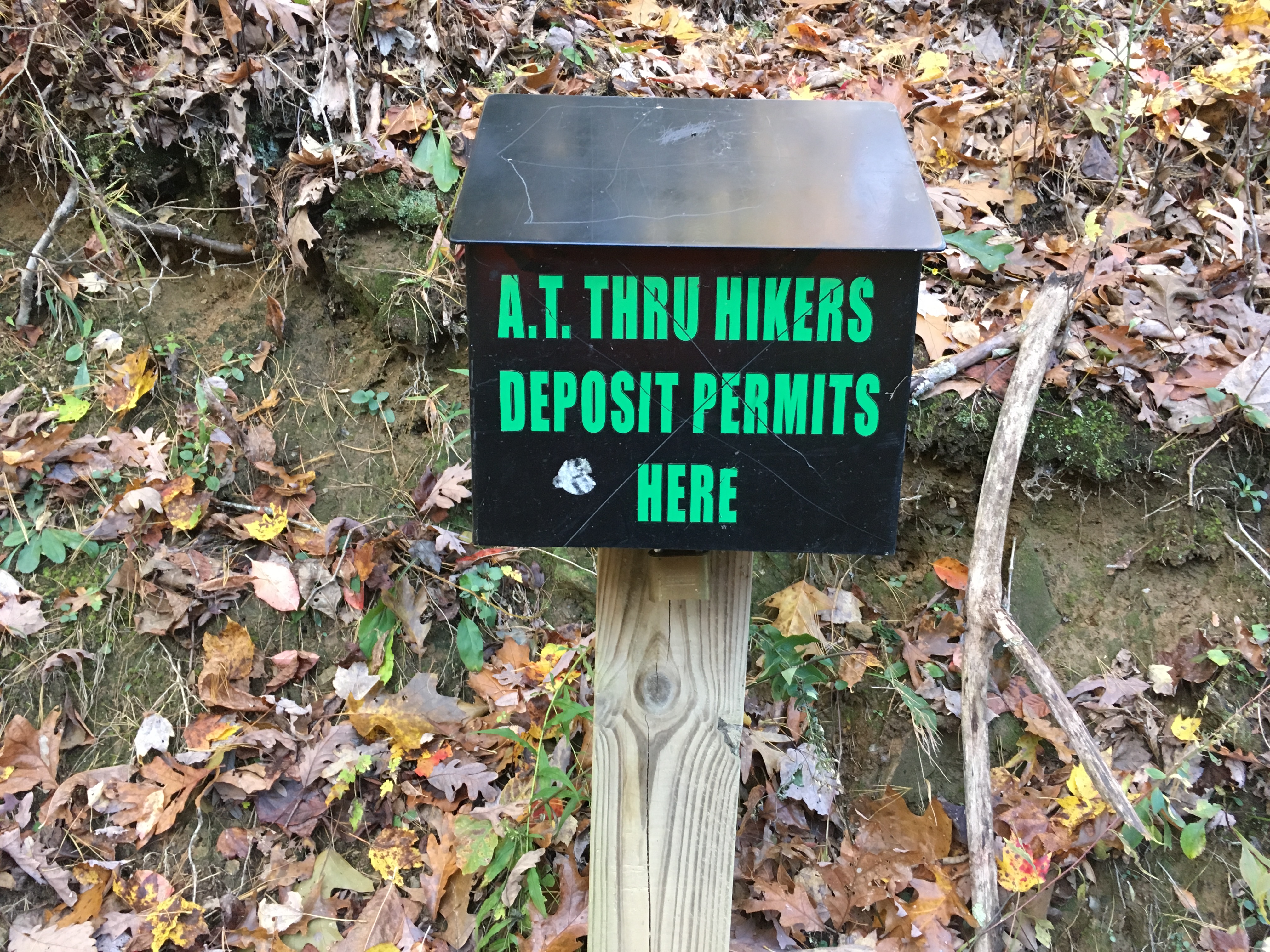
Entry to the park was without fanfare.There was a small sign indicating the park boundary at Davenport Gap and a metal box into which I was required to deposit the lower half of my backpacking permit.
Entering Great Smoky Mountain National Park
The trail immediately started uphill toward Mt. Cammerer.By the time I had ascended to 4,000 feet, it was clear the rain that fell Saturday night at the lower elevations had been snow in the Smokies.I was prepared to put on my micro-spikes over my shoes; however, the snow had melted off the trail and I did not need the extra traction.When I reached the junction with the trail to the Mt. Cammerer summit, I decided to forego the 1.2 mile round trip detour and continue on the Appalachian Trail.
Ascending Toward Mt. Cammerer
View toward Mt. Cammerer from the Appalachian Trail
The views along the trail were partially obscured by trees, but I stopped a few times to observe that last of the fall color below.As I proceeded along the trail, I had some unobscured views near Camel Gap and Deer Creek Gap.
View Near Camel Gap
View Near Deer Ceeek Gap
I climbed higher in elevation, eventually reaching 5,900 feet at the Tri-Corner Knob shelter.The snow cover became a bit thicker, but the trail was still passable without putting on my micro-spikes.For the last two miles, I might as well have been walking in the rain.As the late afternoon sun melted the snow on the tree branches above, the water dropped down on me and the runoff from the “rain” ran down the trail.
Late Afternoon Heading Toward Tri-Corner Knob Shelter
Sunday morning was cold and windy, and the hike continued along a wooded ridge.Views of distant mountains and valleys below were limited by the trees along the ridge.The snow lingered on at the higher elevations.I had one good view from the ridge near a rock formation known as Charlie’s Bunion.
View from the Trail Near Charlie’s Bunion
As Iapproached Newfound Gap, I met quite a few day hikers.U.S. Route 441 is the only road that crosses the Appalachian Trail within the park, and brings tourists from Gatlinburg, TN and other locations.
Monday began overcast and damp.As I climbed to the summit of Clingmans Dome, the highest point on the Appalachian Trail at 6,643 feet, I entered a cloud of light rain.Even though I could tell there was no visibility from the summit, I walked up the ramp to the observation deck anyway just to be sure.
Uncle Malty at the Summit of Clingmans Dome
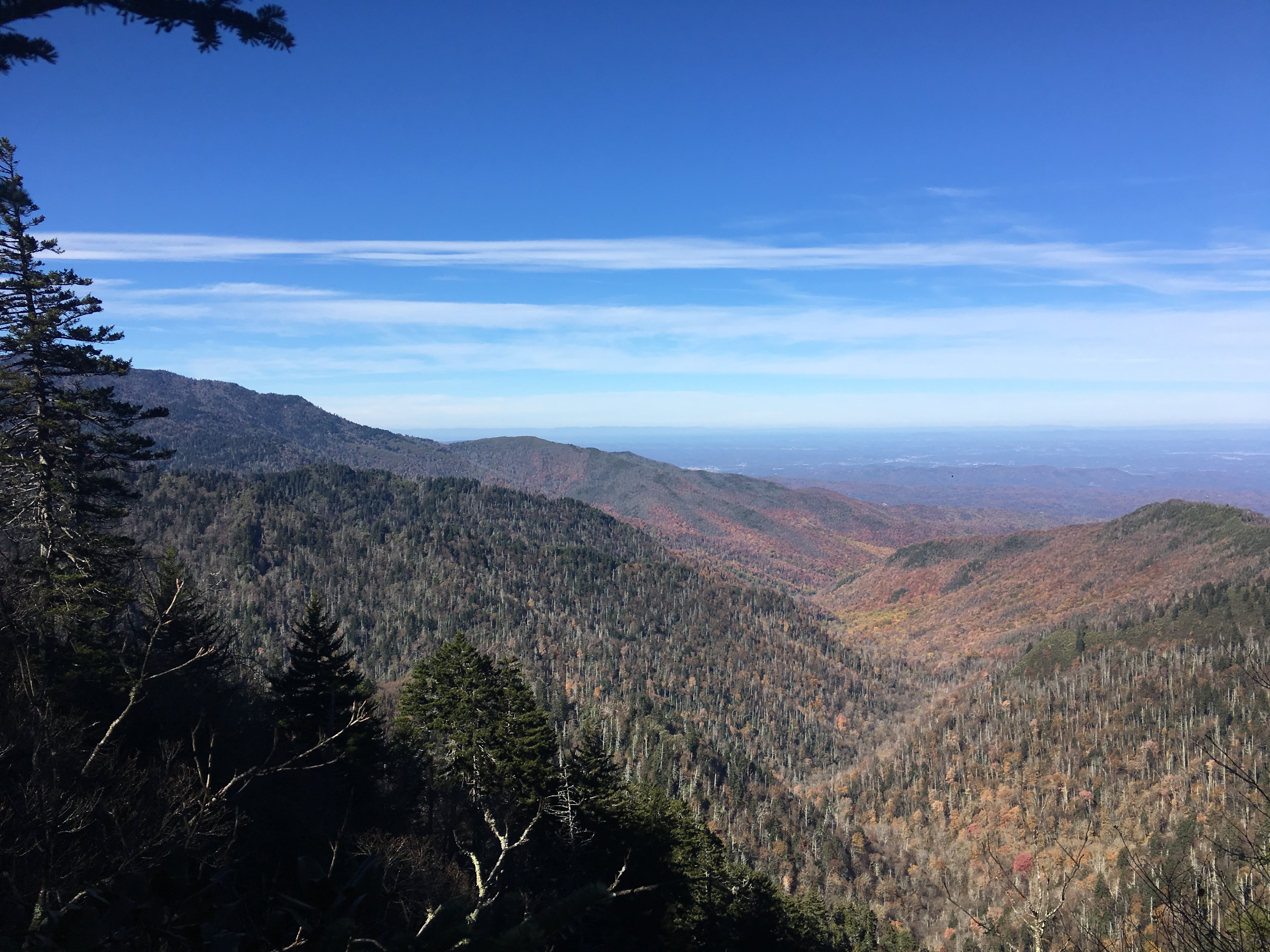
The hike continued up and down over Mt. Buckley and Silers Bald with views obscured by the low clouds.The climbs and descents were a bit steeper than I encountered the previous few months and for the first time on the trip, I found myself running out of daylight as I approached Thunderhead Mountain.
Approaching Thunderhead Mountain, the Final Summit for the Day
After passing the tree-covered summit, I crossed over Rocky Top and finally had some views.The sun had already set, but there was still enough light for some interesting views with clouds moving in for an overnight rain.I finished the last half-hour or so of the hike by headlamp.
Evening View from Rocky Top
Rain Clouds Moving in for the Night
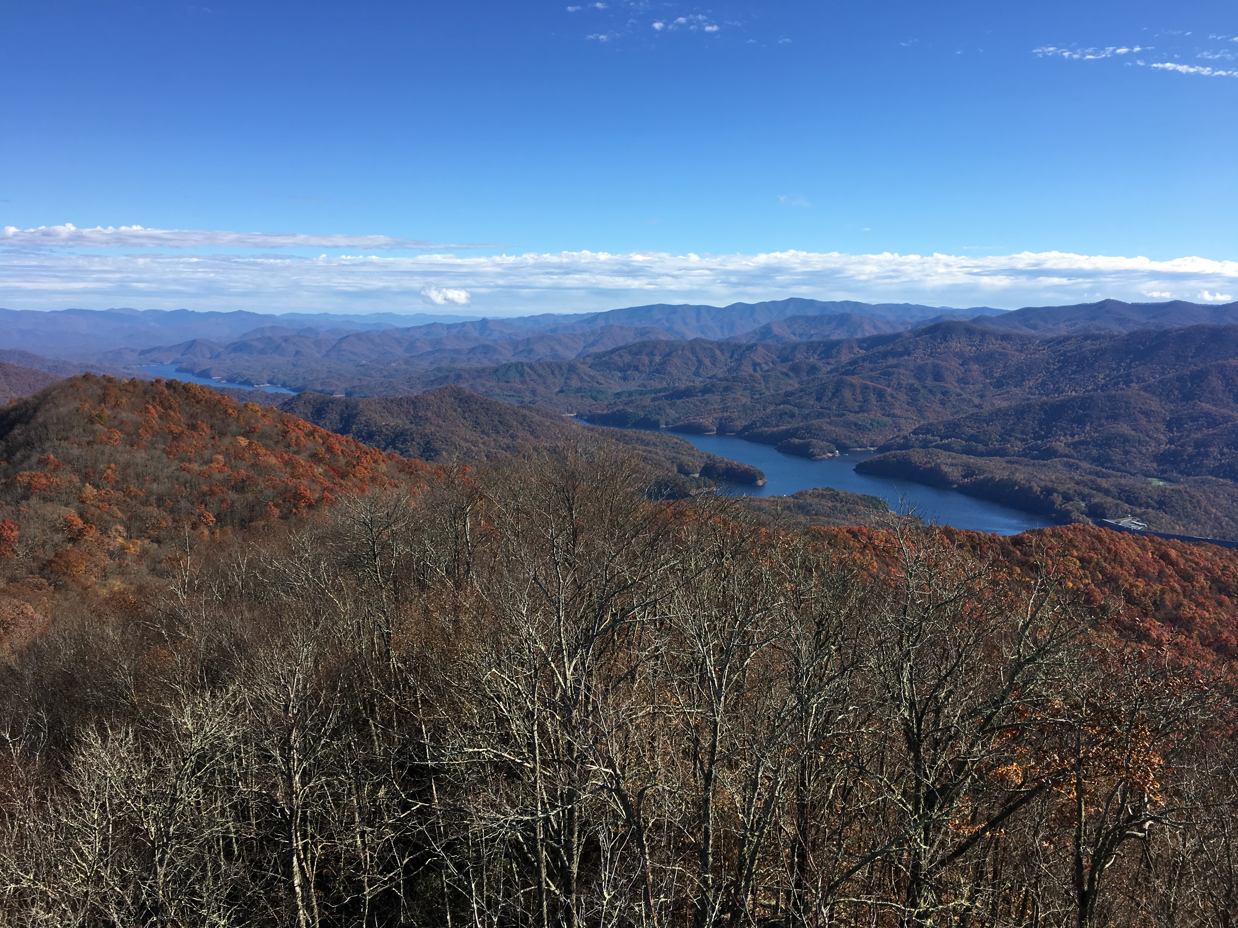
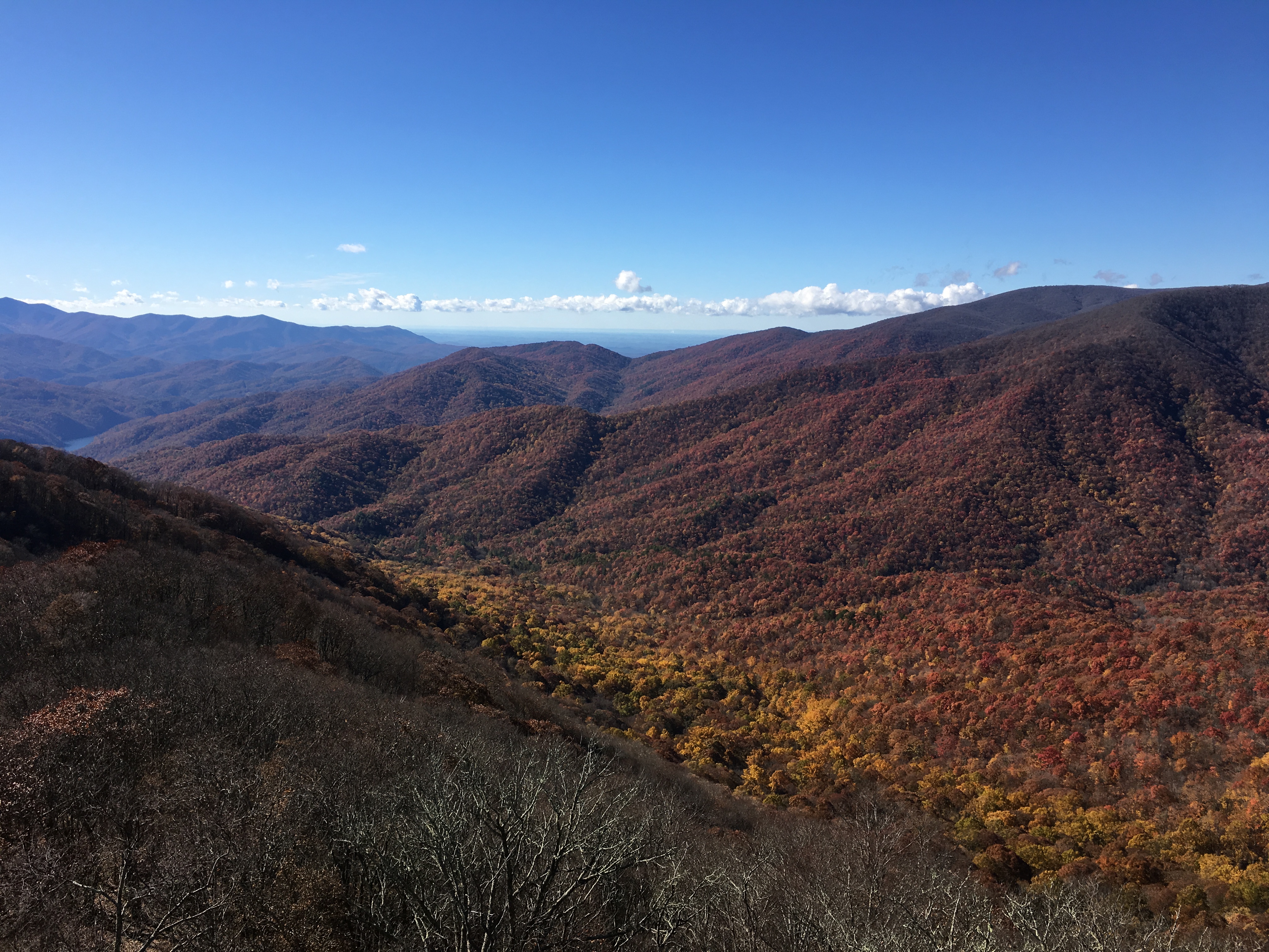
Tuesday started with drizzle as the rain from Monday night tapered off.The sun was out by noon and the hike was mostly downhill.Two short climbs on the way brought me above 4,500 feet at Devil’s Tater Patch and Doe Knob, but the summits were wooded and offered no views.Almost out of the park, I reached the Shuckstack fire tower at 3,800 feet and was finally treated to some beautiful views.
View Toward Fontana Dam from Shuckstack Fire Tower
View from Shuckstack Fire Tower
View from Shuckstack Fire Tower
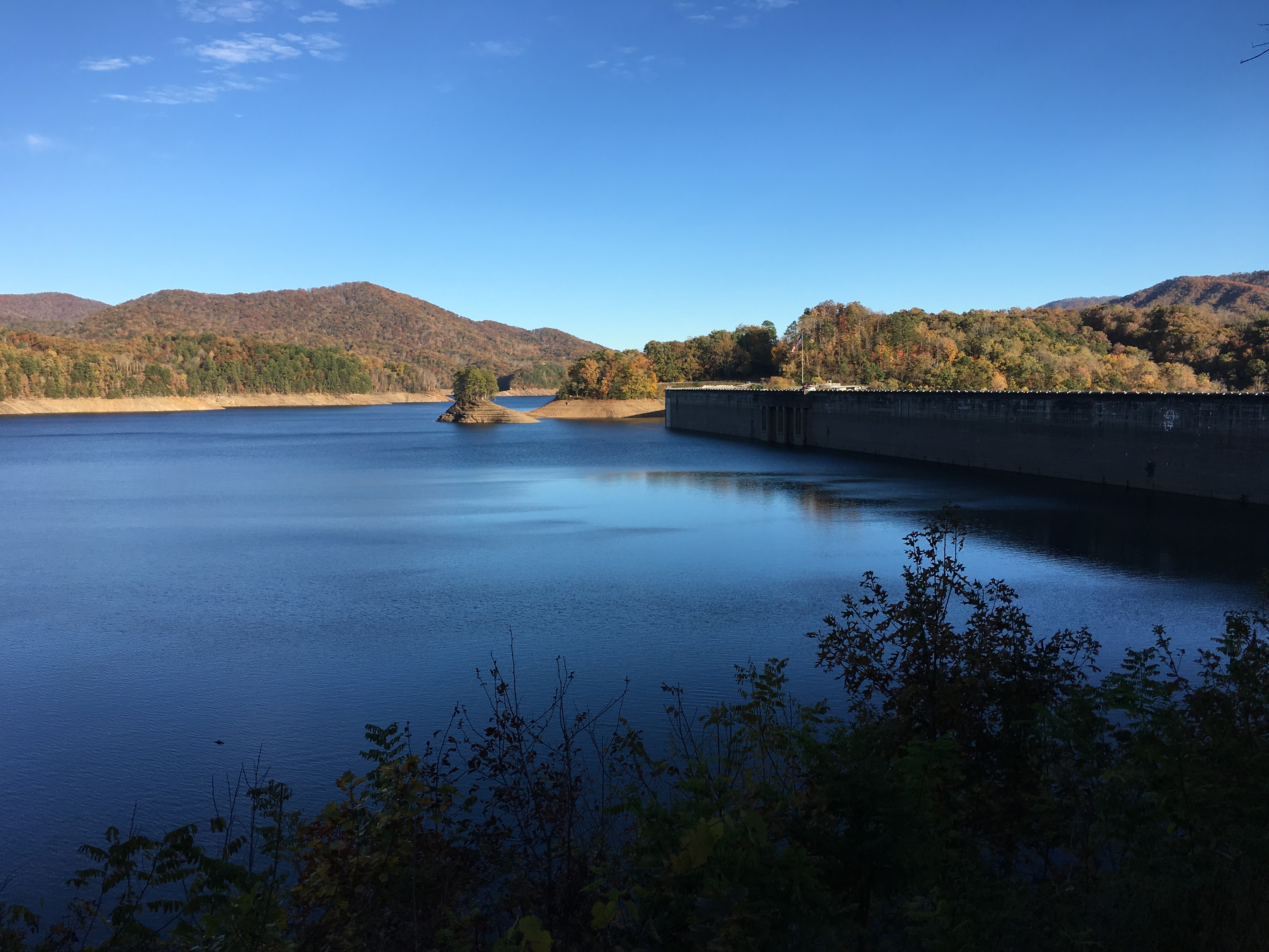
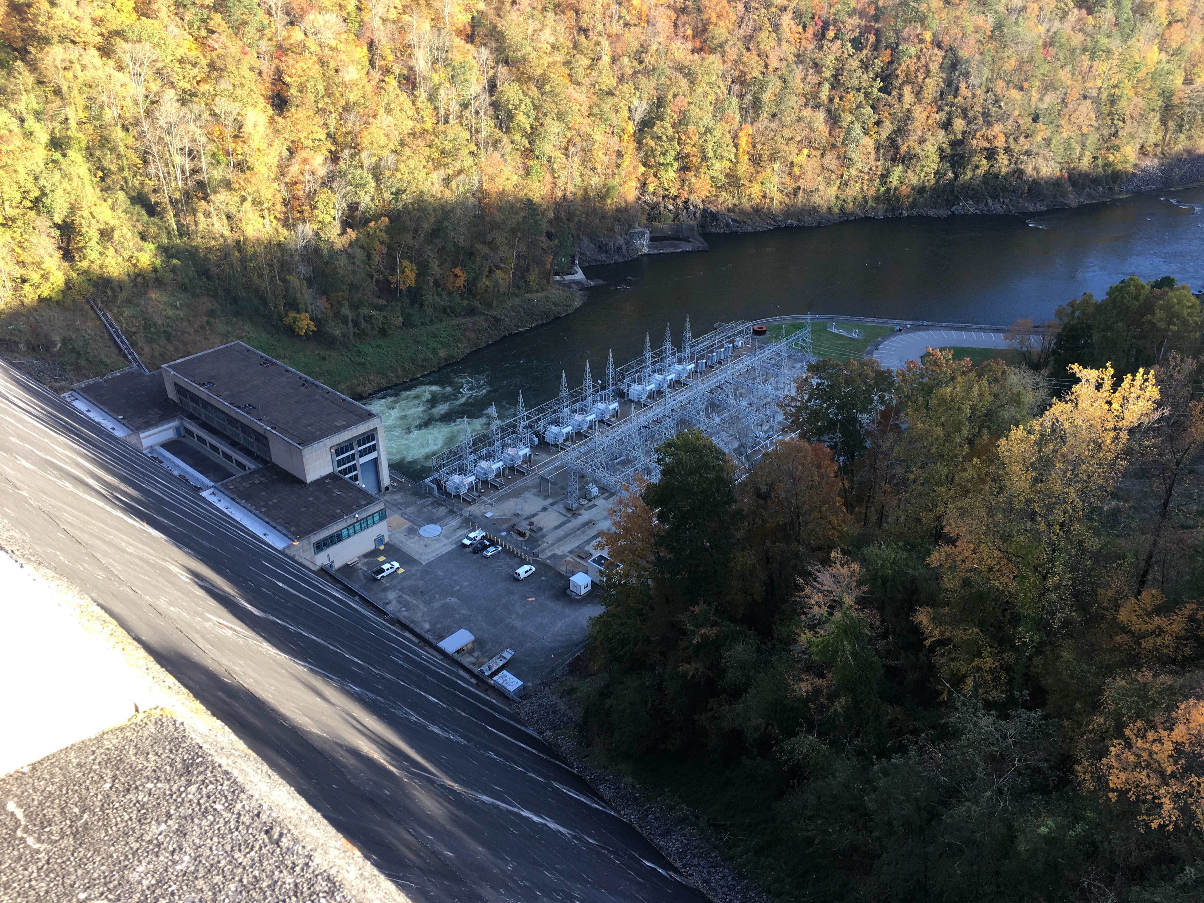
Just beyond the park boundary is Fontana Dam.The dam was built by the Tennessee Valley Authority (TVA) in the early 1940’s to provide electric power to ALCOA to facilitate aluminum production to support the U.S. war effort.The project generates 240 MW of electricity and also provides flood control of the Little Tennessee River.Sadly, the name of the dam is taken from one of four towns that were flooded when the dam’s gates were closed to create the upper reservoir.The water level in the reservoir appeared to be low, despite all the rain this summer!
Fontana Dam and Fontana Lake
View Down-River from Fontana Dam
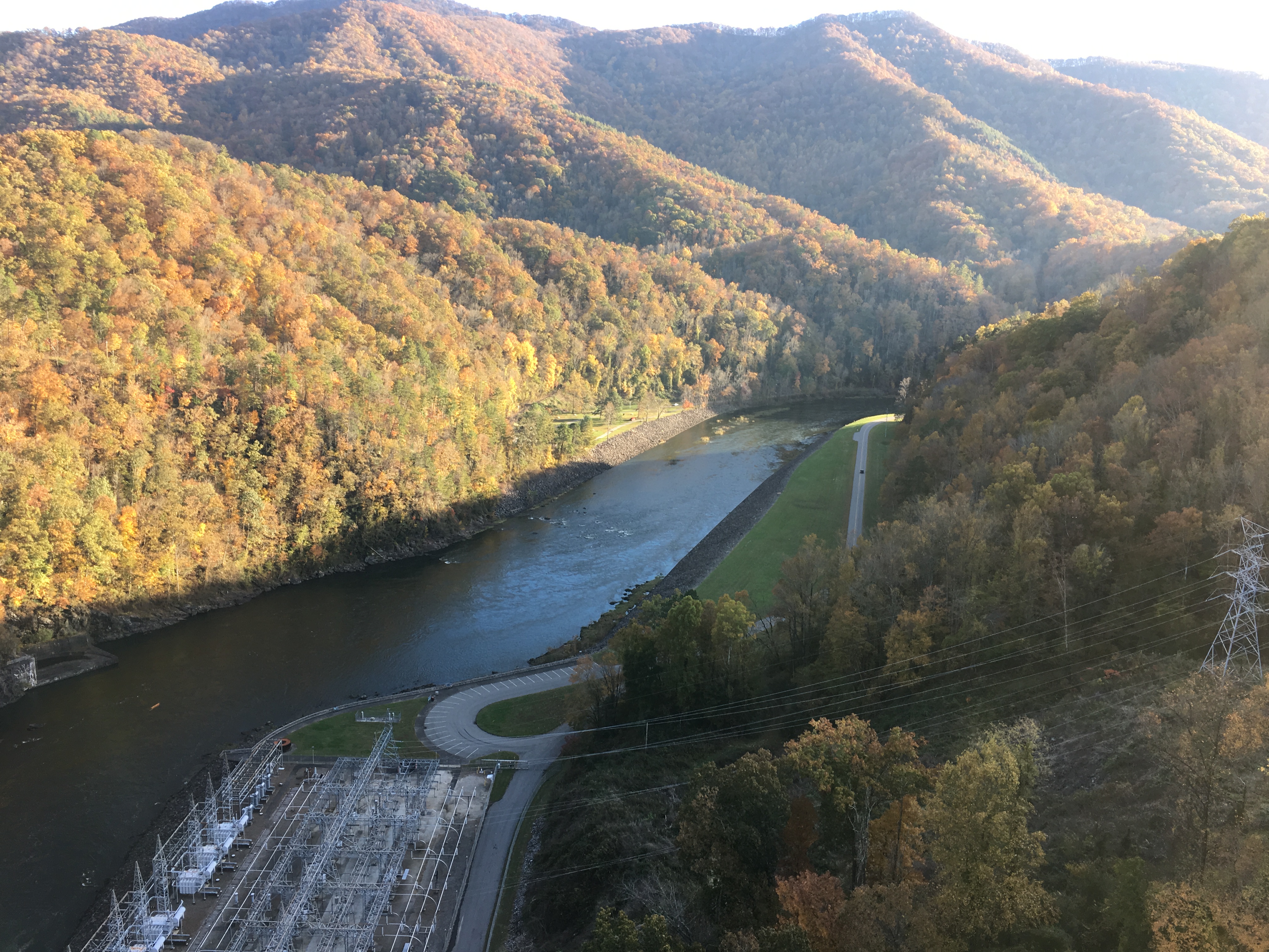
One for the Engineers — the Fontana Dam Generating Station and Switchyard
After hiking across the dam and down to the marina, I was able to call for a ride to the Fontana Lodge. Instead of staying at the Fontana Shelter, I treated myself to a night at the lodge where I enjoyed a hot shower, meal, and sleeping on an actual bed before heading back out the next morning to continue my journey.
“Nothin’ lasts forever, even cold November rain.” — Axl Rose
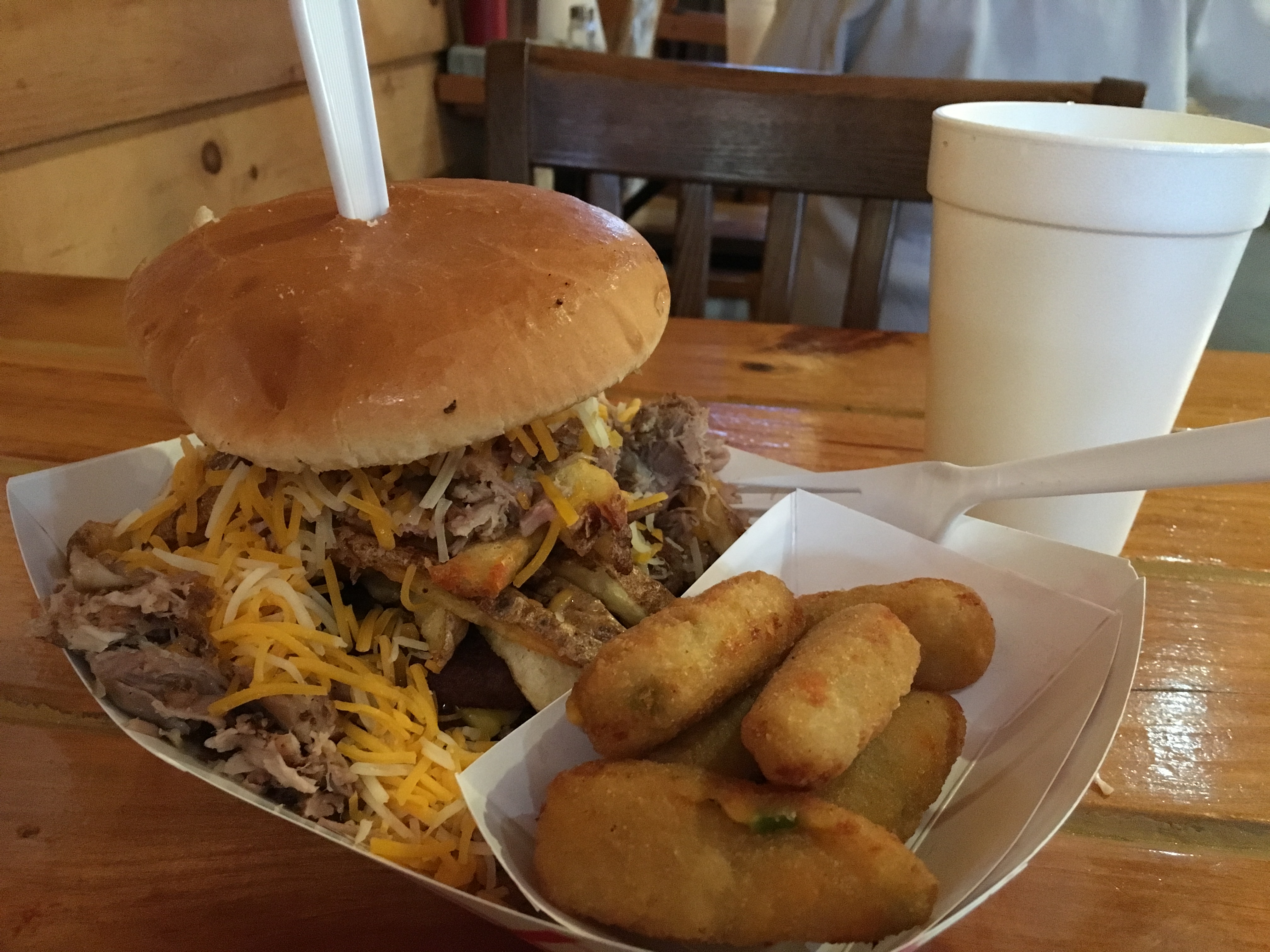
My time off in Roan Mountain, TN passed quickly enough.The highlight was my trip to Highlander BBQ, where I had the AT hiker’s special.It was a double cheeseburger loaded with hand cut fries and barbecued pork, choice of side (I had the jalapeño tater tots), fountain drink, and ice cream.
Dinner at the Highlander BBQ
Properly refueled, I set out Thursday morning (October 25) to ascend 3000’ into the Roan Highlands.About halfway up, I reached an area called Doll Flats where I made the first of many crossings between Tennessee and North Carolina.As I continued to ascend, I observed that some fall color was present at the lower elevations.I soon approached the first summit of the day, 5,559 foot Hump Mountain.
Doll Flats, at the Tennessee-North Carolina Border
Above Tree-Line, Looking Down at the Fall Color Below
View Approaching Hump Mountain
From Hump Mountain, I could see the next major peak of Grassy Ridge.The trail bypassed the summit of Grassy Ridge and proceeded to cross the summits of Jane Bald and Round Bald before descending into Carvers Gap.
View from the Summit of Hump Mountain
View toward Grassy Ridge from Hump Mountain
Lunchtime View between Low Gap and Grassy Ridge
View from Jane Bald toward Round Bald and Roan Mountain
At Carvers Gap, I was once again at the Tennessee-North Carolina border.From there I ascended Roan Mountain, the first mountain above 6,000 feet since New Hampshire.I spent the night at the shelter on Roan High Knob at 6,285 feet, the highest shelter on the Appalachian Trail and just 3 feet lower than the summit of Mt. Washington in New Hampshire.This shelter is one of the few to have four walls and a door, both of which were welcome on a night that was cold, windy, and rainy.
Roan High Knob Shelter
On Friday morning I woke to rain and driving wind.I waited until about 10:30 to see whether the rain would let up.It did not, but I set out anyway to at least get in a few miles.Despite the rain and wind, the temperature warmed a bit as I descended.By 1:00 the rain stopped and the sun occasionally peaked through the clouds, allowing me to complete 17 miles as originally planned.Views were limited, but I did manage to see some fall color through the mist from Little Rock Knob.
View through the Mist at Little Rock Knob
As Friday turned out to be not so bad despite the weather forecast, I departed the shelter on Saturday morning hoping for the same to complete another 17 miles.Unfortunately, the rain continued all day, but I got in my miles anyway.I was warm as long as I kept moving and I stopped only once for lunch.Late afternoon found me crossing the Nolichucky River just before reaching Uncle Johnny’s Nolichucky Hostel, where I was able to warm up with a hot shower and catch a shuttle into town.I had dinner at Los Jalapeños Mexican Restaurant and ordered the house special as it included the most items and I was very hungry after hiking all day in the cold rain.
Crossing the Nolichucky River
Especial de la Casa at Los Jalapeños
As promised in the forecast, the weather was much improved Sunday.I quickly climbed away from the river and onto a ridge.As with many other days, I was walking in the woods all day.The day ended with a windy and muddy approach up Little Bald, which was not even a little bald and offered no views.
Ascending Sunday Morning, Looking Down to the Nolichucky River
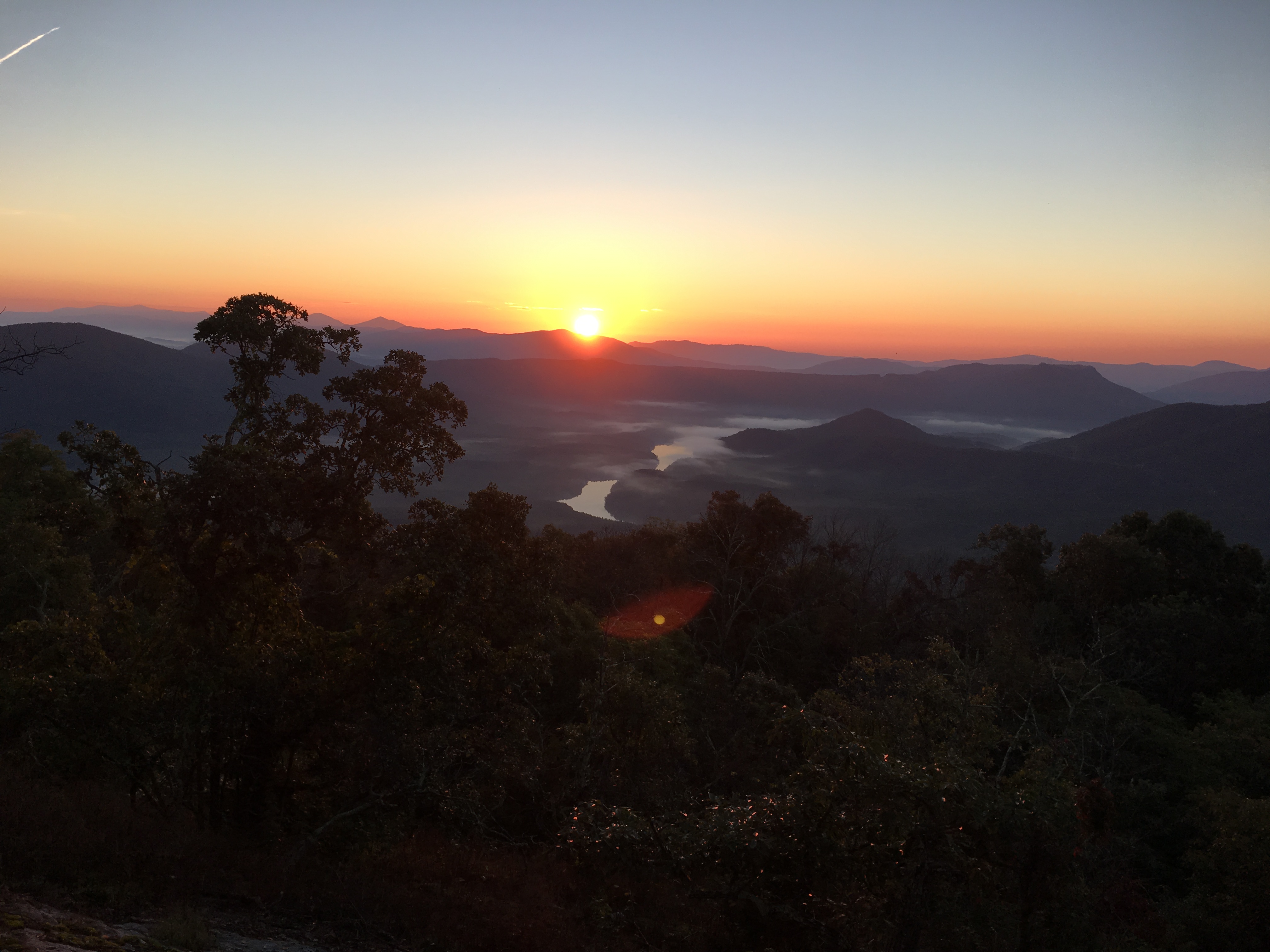
Monday morning I started hiking about a half-hour before daybreak.As I approached Big Bald, four deer ran across the trail about 50 yards ahead of me.The last one stopped briefly twice, but not long enough for me to take its picture.Looking back to the east, I was treated to a magnificent sunrise.Again, the rest of the day was mostly walking through the woods, even across the summit of Frozen Knob, above 4,500 feet.
Early Morning View Approaching the Summit of Big Bald
Sunrise from Big Bald
First Rays of Sun Reaching Beyond Big Bald
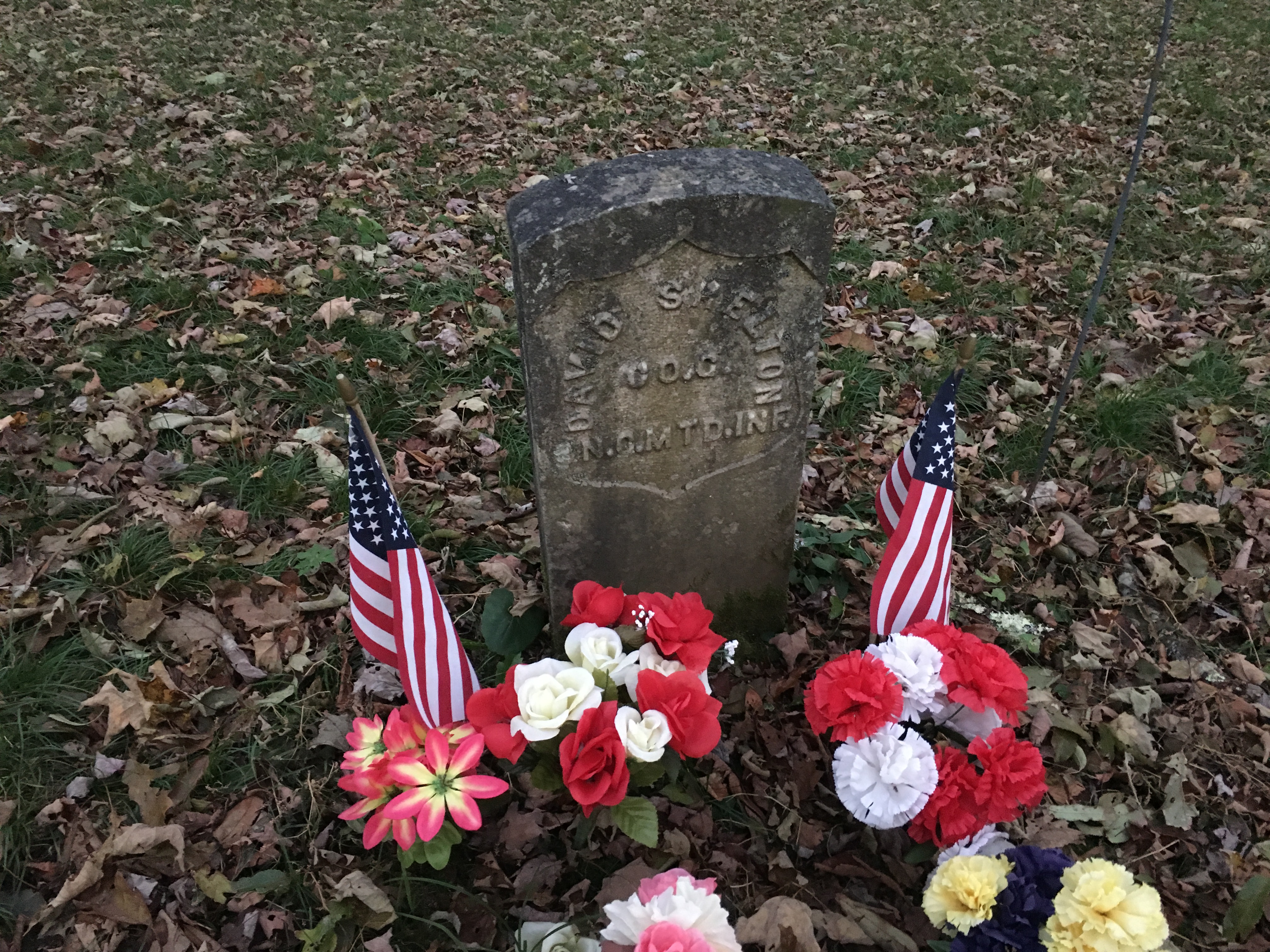
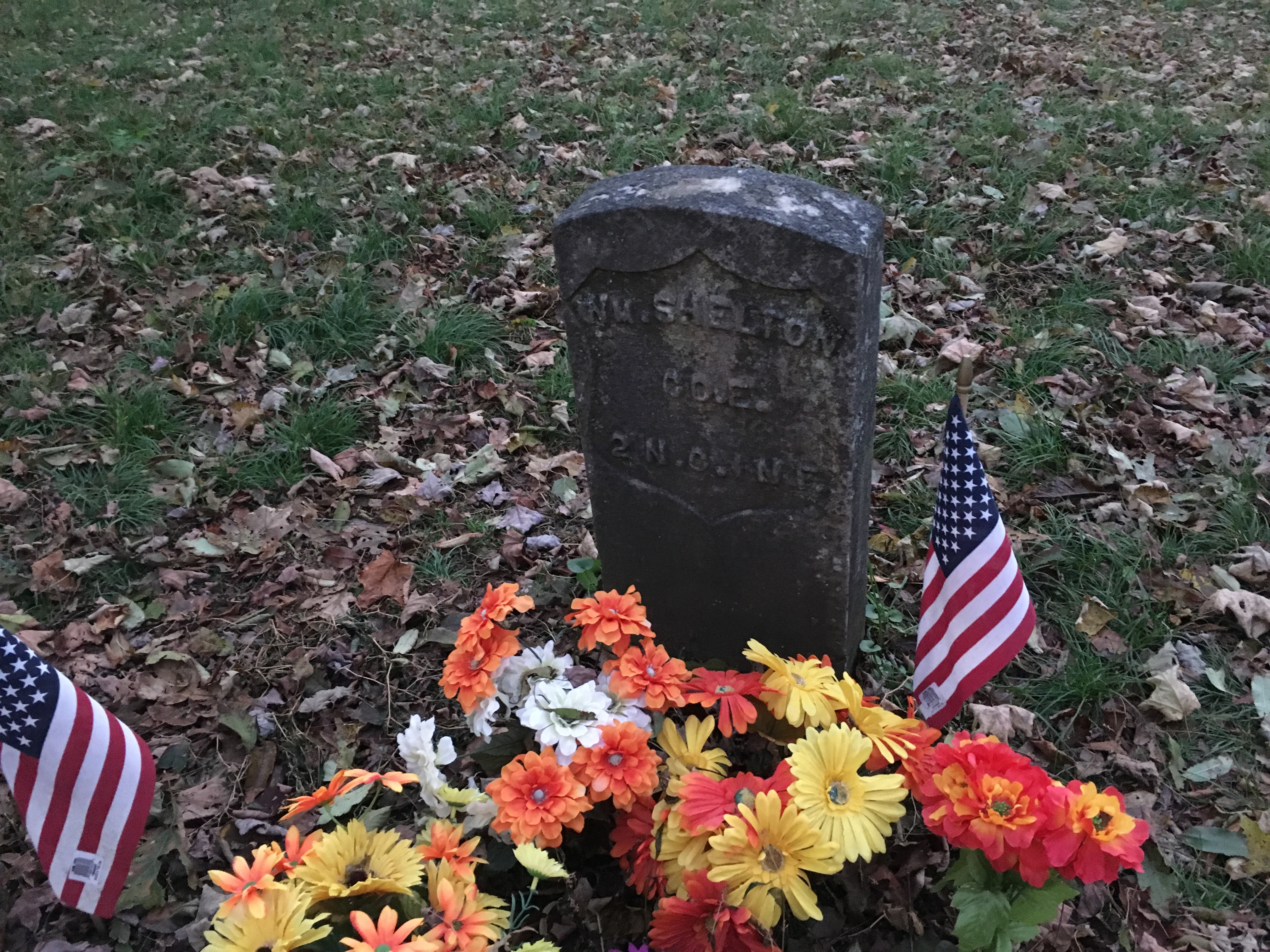
Tuesday was a glorious day in terms of sun, warmth, and scenery.As I had almost 23 miles to hike, I was out again before sunrise.Shortly after daybreak, I reached a side trail to a grave that interested me when reading my guide book.It is a single grave with two head stones for William and David Shelton, an uncle and nephew who lived in North Carolina, but enlisted in the Union Army during the Civil War.Upon returning home for a family gathering, they were ambushed and killed by Confederate troops.
Grave Marker of Union Soldier, David Shelton
Grave Marker of Union Soldier, William Shelton
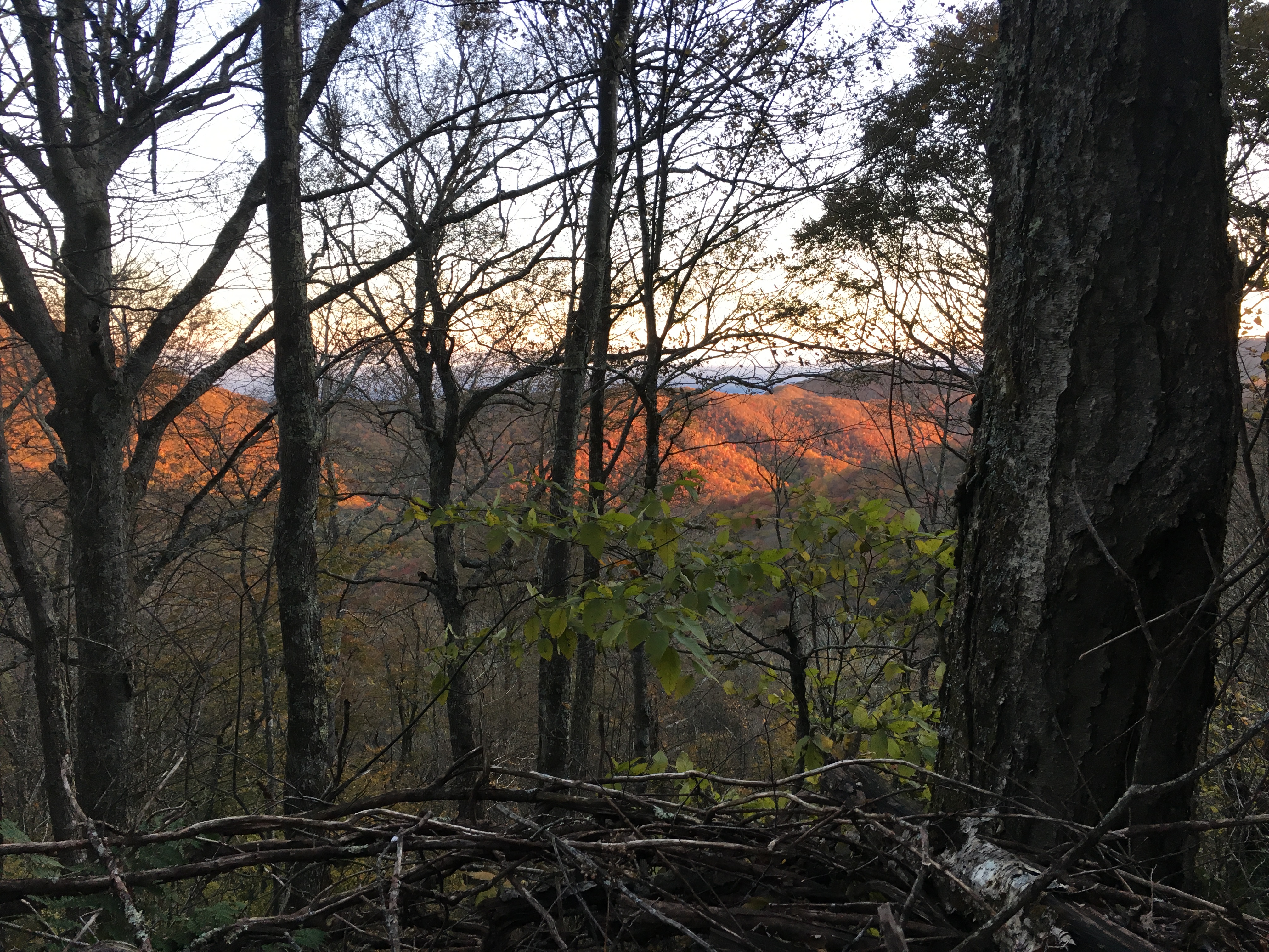
As I ascended Big Butt, I could see the first rays of sunlight reaching the ridge ahead through the trees.
First Sunlight Reaching the Ridge Ahead
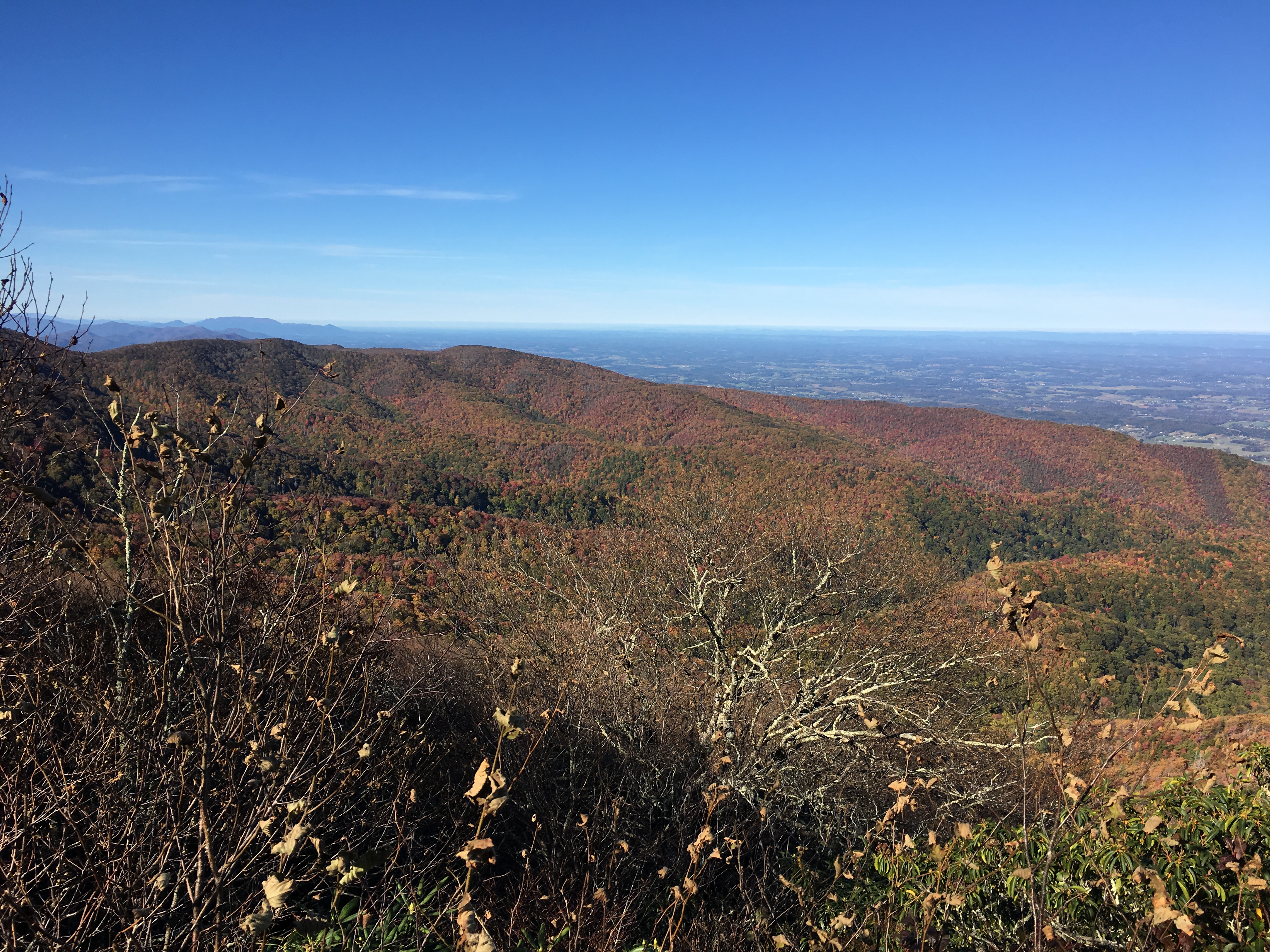
The trail passed just below the summit and so I skipped the scramble up to the rocky peak.While I initially questioned my decision, I was rewarded later in the morning with spectacular views from the rocky ridge along Big Firescald Knob.
View East from Firescald Ridge
View Southwest from Firescald Ridge
View Northwest from Firescald Ridge
I had increased my mileage on Tuesday so that I could have a short 11 mile hike into Hot Springs, NC on Wednesday, allowing me to relax and run errands during the afternoon.I started early nonetheless to maximize my time in town.The hike was relatively uneventful.I had an open view as I crossed Mill Ridge, land that was formerly tobacco fields and now managed by the U.S. Forest Service as habitat for wild turkey and grouse.
View from Mill Ridge
As I neared town I had a birds-eye view of the French Broad River, which I crossed just before entering town.
View Looking Down to the French Broad River about Two Miles from Hot Springs
Rapids on the French Broad River
Crossing the French Broad River Entering Hot Springs
Once in town, I stopped at BluffMountain Outfitters to replace a couple items before reaching the Great Smoky Mountains National Park.I also picked up a few items at Dollar General, stopped at the post office, did laundry, and had a massage.
The first two days of November have been cold and dreary — what I normally associate with the month.On Thursday, I left Hot Springs and crossed over Bluff Mountain at 4,686 feet.Just after passing the summit, rain started, which made the trail a slippery mix of wet rocks, tree roots, and fallen leaves.The rain continued on and off through the night.
An Overcast View from the Summit of Bluff Mountain
The rain continued throughout the day on Friday, despite the forecast, which suggested otherwise.The views from Max Patch and Snowbird Mountain were slim and none, respectively.I made it to the Standing Bear Hostel late in the afternoon and am drying my clothes as I work on updating this blog.
View from Max Patch through the Morning Fog
At this point, I have just 241 miles remaining, which I hope to cover in 14 days of hiking.I will enter the Great Smokey Mountains National Park on Saturday and am looking forward to a few sunny days and good views. At least for the next few days, cold November rain is not in the forecast.
“Tennessee, Tennessee, there ain’t no place I’d rather be.” — Robert Hunter (Grateful Dead lyricist)
After a rest day in Damascus, I was ready to finish off the last 4 miles of Virginia on Saturday, October 20.The day started off with rain that was forecast to end mid-day, so I decided to wait it out and make up a few miles later in the week.I set out around noon with a light rain still falling, which ended within the hour.
Less than two hours in, I reached the Virginia-Tennessee border.Although I had been in Virginia for 5-1/2 weeks, somehow it did not seem that long.I never had the so-called Virginia blues that some hikers report, although I did tire of the rain that included the effects of Hurricanes Florence and Michael.
The Virginia-Tennessee Border, also the Boaundary between the Jefferson and Cherokee National Forests
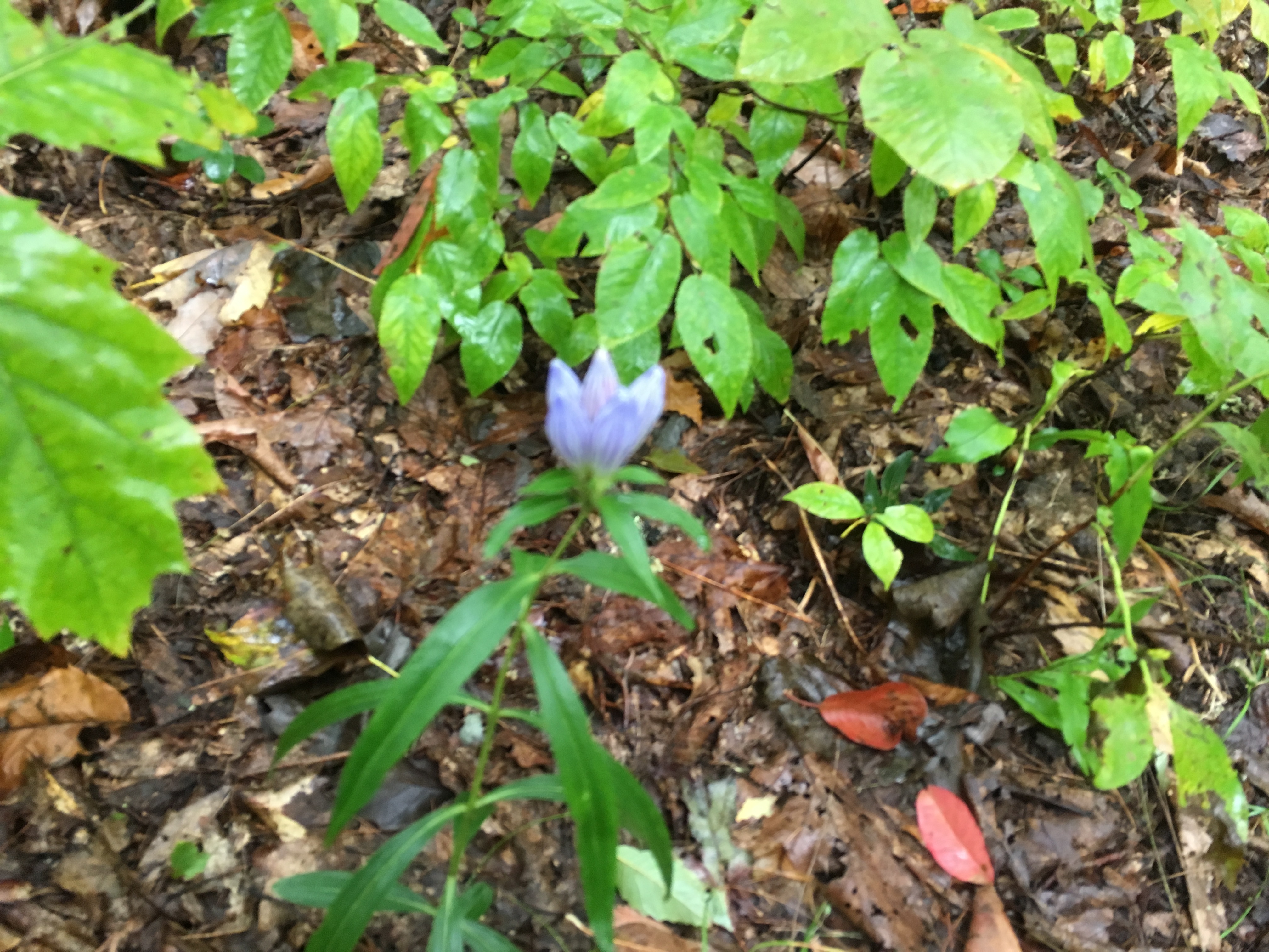
After weeks of seeing purple flowers that seemed more than ready to bloom, I still had not seen one open and decided to take a picture anyway.They remind me of toad lilies that we have at home, which bloom late in the fall and like shade, but I may never know if I do not see one open.
Unknown Flowers, Seemingly Ready to Bloom
Saturday night was rather cold as the temperature dropped below freezing.The next morning was windy and even though the sun came out, the temperature peaked at 43 degrees.As a result, when I arrived at the shelter that night, I still was wearing everything I had worn to bed to keep warm the night before.A few views during the day indicated that, at least in this area, there was still hope of seeing the fall foliage change of color.The day ended at 3,510 feet above sea level, making for another cold night.
View Ascending from Low Gap
View Across a Meadow Approaching Tennessee Route 91
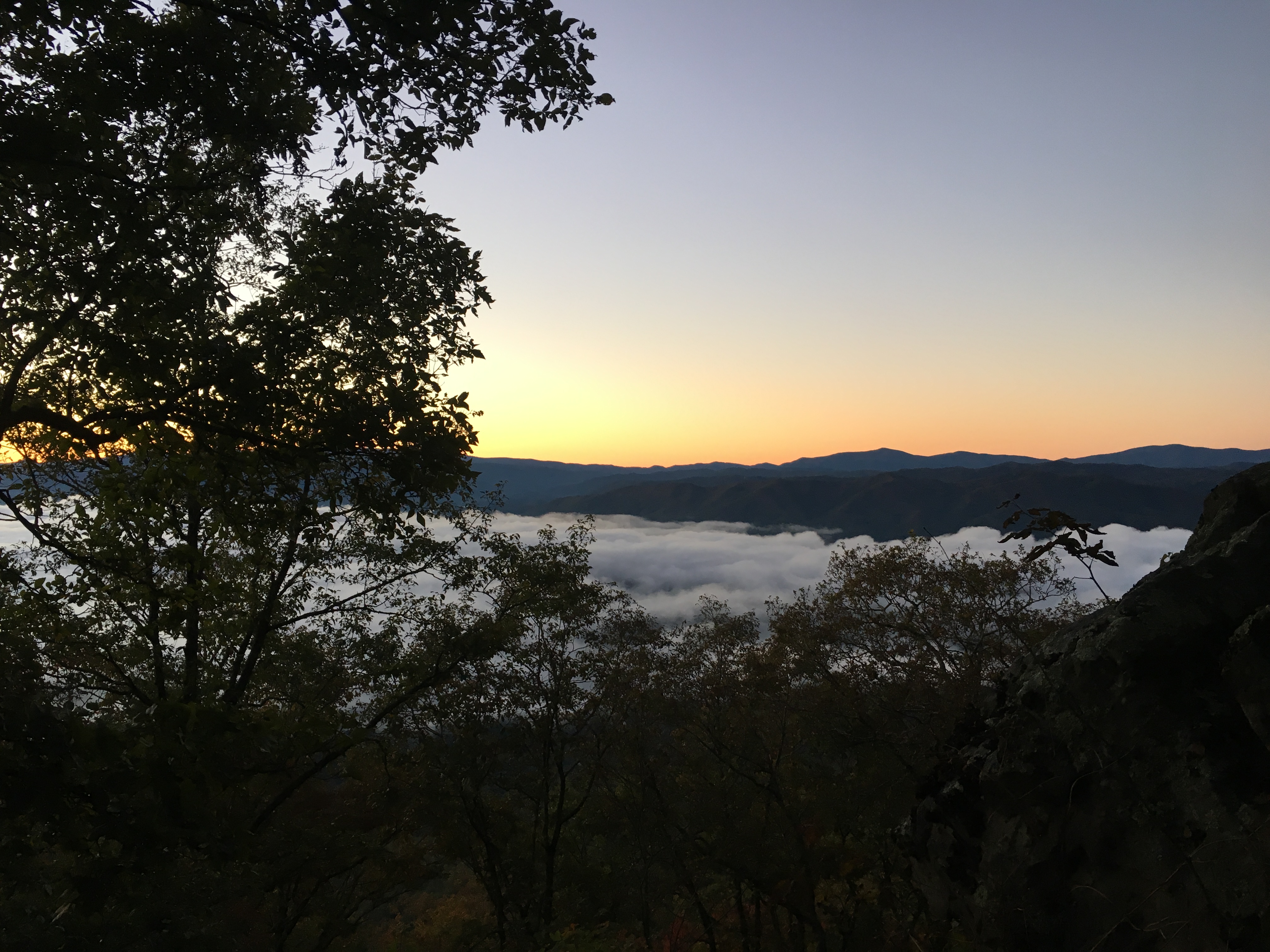
Monday morning was not as bad, despite the cold night.Looking down to Watauga Lake, the lower elevations were shrouded in fog.
First Light Overlooking Watauga Lake
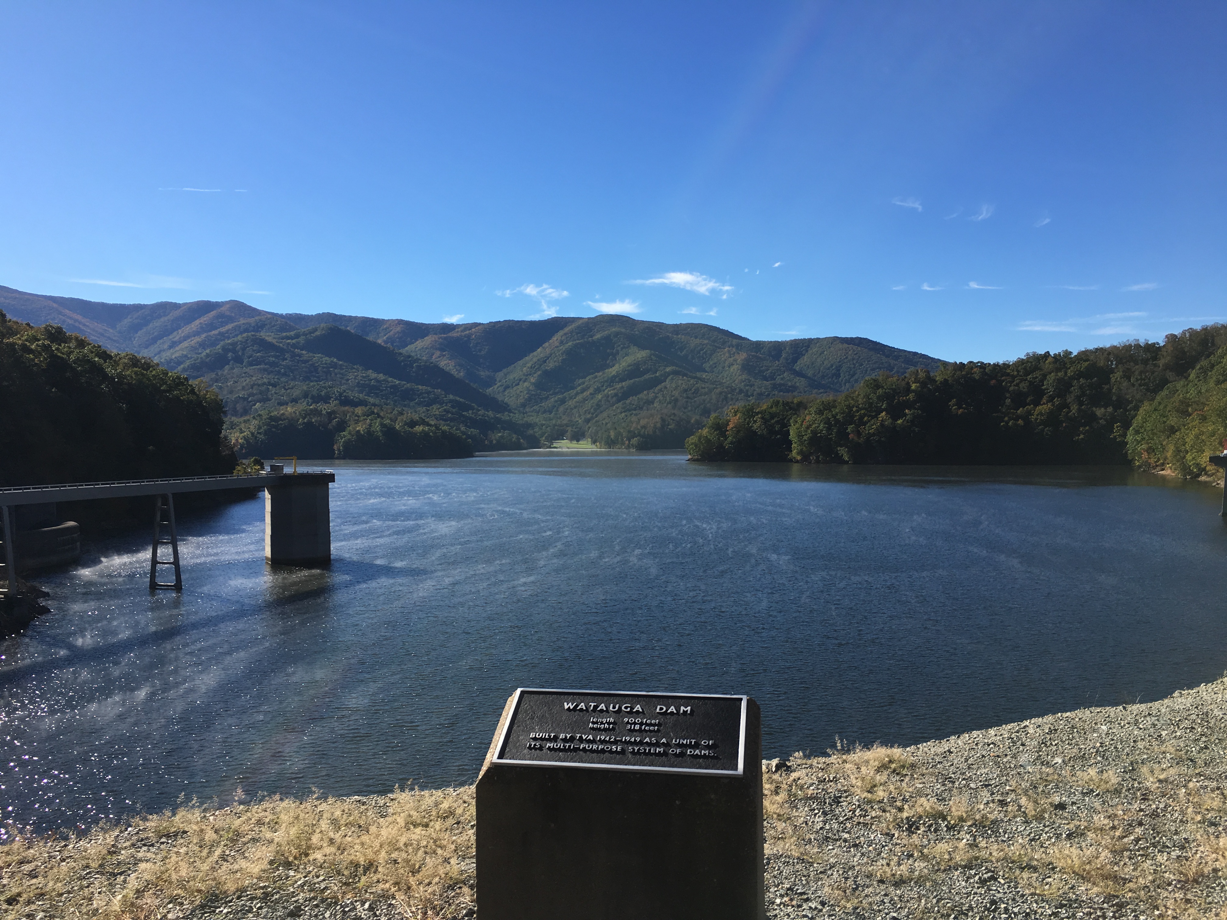
I quickly hiked through the Watauga Lake area, which is closed due to bear activity, but open to hiking along the four miles of the Appalachian Trail with instruction not to stop.Being alone, I sang songs through the area so the bears would know I was there.In addition to letting them know I was there, I assumed my a cappella renditions of various Grateful Dead songs would send the bears running for cover.For the record, I did not see any bears on this day, although I will never know for sure the reason why.I did keep my phone handy and snapped a few pictures of the dam and reservoir as I walked.Watauga Lake is a reservoir behind a Tennessee Valley Authority (TVA) dam.In the reservoir are two inlet towers that drain water into penstocks to run two hydroelectric generators.
Watauga Lake from the Dam, with one of the Two Hydroelectric Inlet Towers
View Downstream of the Dam
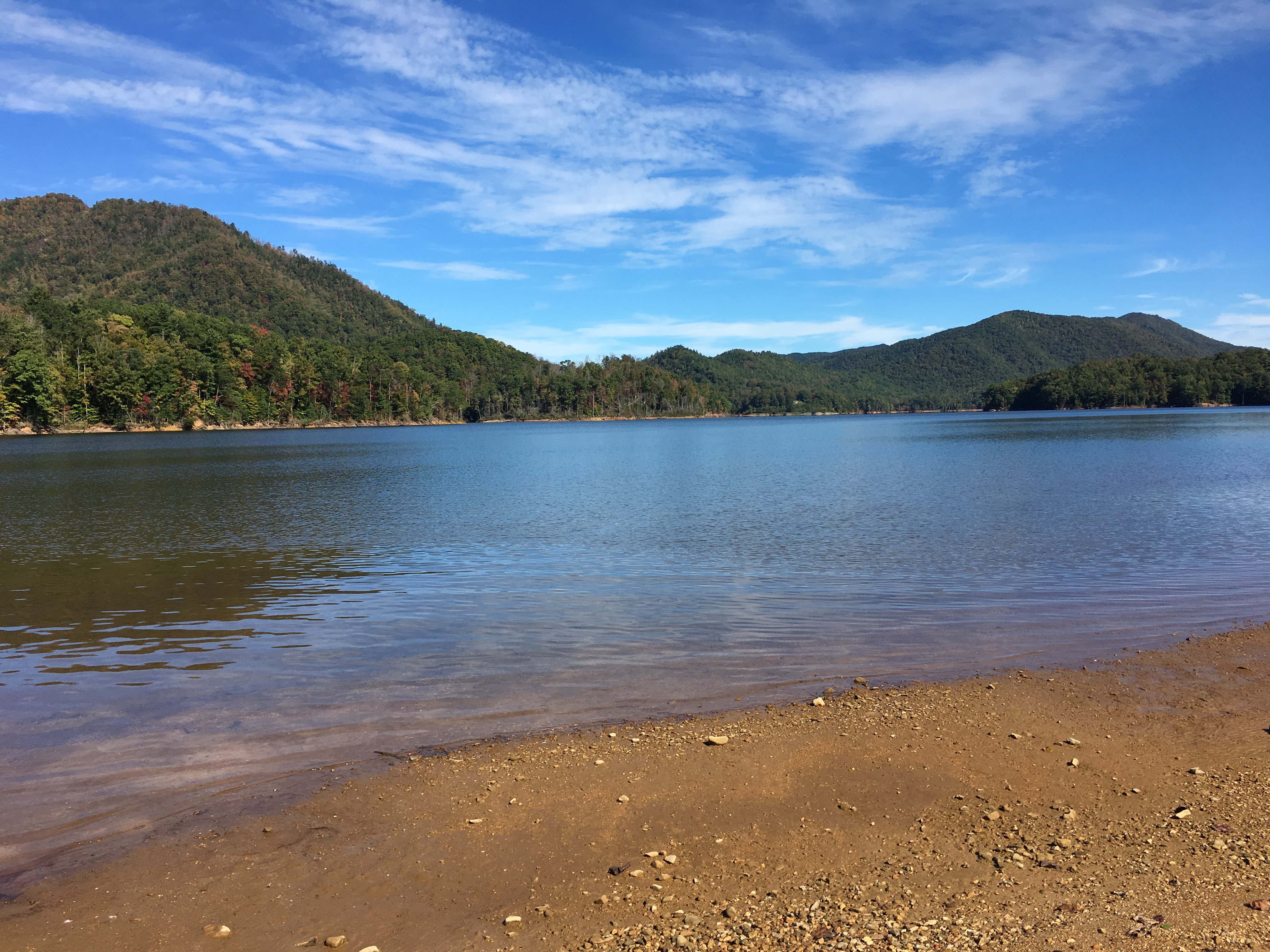
View of Watauga Lake from the Public Access Beach Near U.S. Route 321
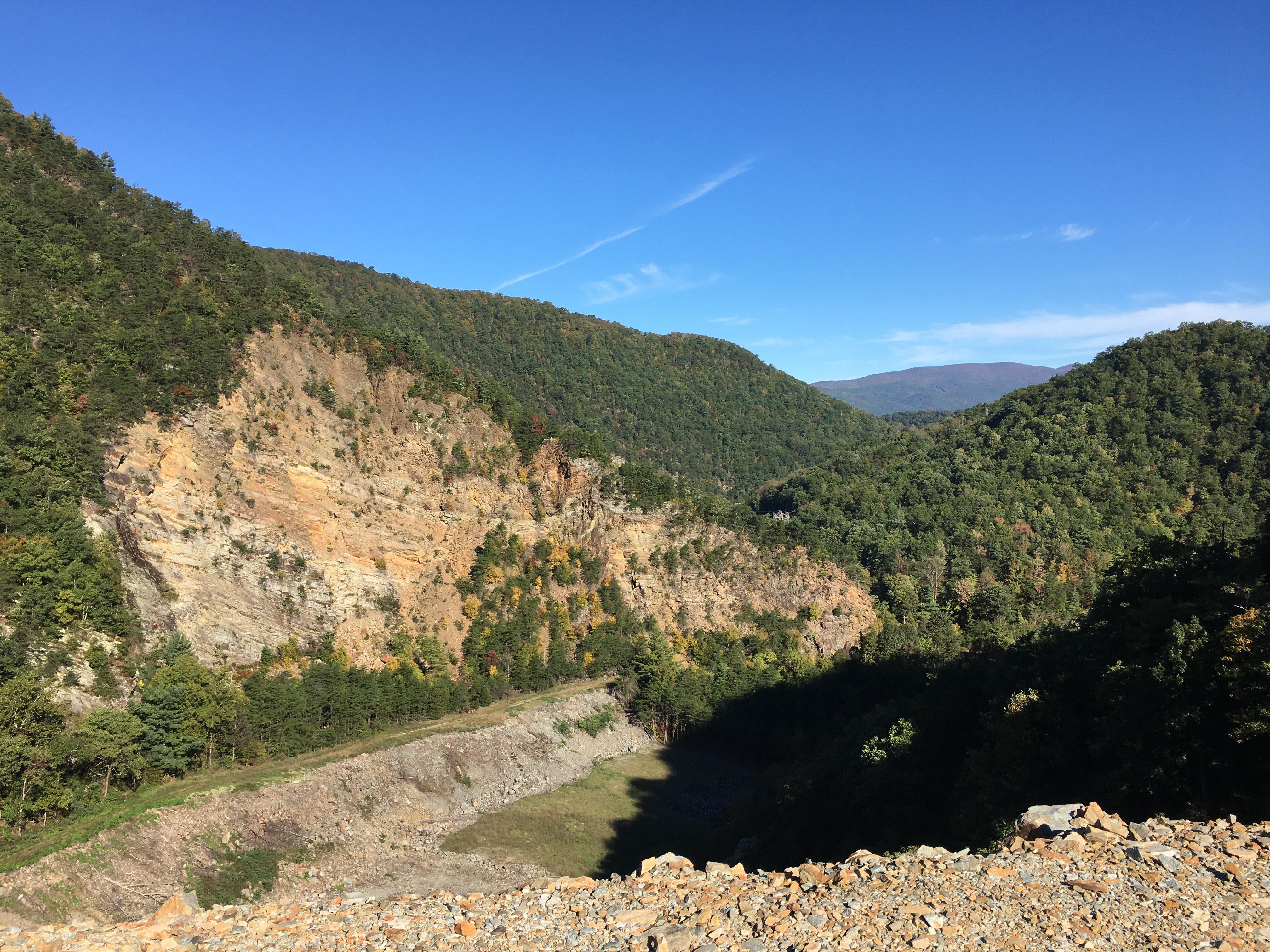
After circling the western end of the lake and crossing Pond Mountain, the day ended with passing the Laurel Fork Falls and hiking through the Laurel Fork Gorge.
Laurel Fork Falls
I woke early on Tuesday and was hiking by headlamp by 5:30.While I had not planned any more 25 mile days, I heard the trail was smooth in this section with easy grades.This was one trail report that proved to be valid and I was able to cover the distance in 12 hours.
Along the way I had some nice views.The first was at a bench in a nice sunny spot, which I arrived at approximately 5 minutes after I had stopped for a lunch break.
Trailside Viewpoint
The trail ran alongside the Elk River for a while, providing a nice backdrop in Sugar Hollow.
Elk river Passing Through Sugar Hollow
The best scenery of the day was off the trail at Jones Falls.I was hesitant to add mileage to the day and was going to proceed past the trail junction, but someone had added a note on the sign post that the view was worth the trip.After confirming it was only one-tenth of a mile, I decided to make the excursion. As the note promised, I was not disappointed.
Jones Falls
The day ended with a walk through a pine grove carpeted with needles, and a walk across an open meadow with views of peaks that I expect to reach shortly.
Passing Through a Pine Grove
View Across Meadow Approaching Tennessee Route 19E
View Toward the Roan Highlands
As luck would have it, in my hurry to arrive at my destination, I out-hiked the UPS delivery truck and I am now taking an unplanned day off waiting for my next resupply.I would forego the food and purchase what I need in town, but the box includes a new pair of shoes.I am overdue for a new pair as my present pair now has almost 600 miles on them.
I have reached the portion of the trail that straddles the Tennessee-North Carolina border and will cross into North Carolina tomorrow.The trail will cross back and forth for the next week as I work my way toward the Great Smoky Mountain National Park.I plan to post again next week when I reach Hot Springs, NC.
After completing 136 miles the previous week, the most in one week on this trip, I decided to take Monday off and stay a second night at the Angels Rest Hikers Haven.Good fortune was with me on this day as my inquiry to Pearis Mountain Massage resulted in an appointment despite the short notice.I don’t know where most of the time went on this day, but I enjoyed the day off the trail as my body recovered.
Tuesday morning (October 9) I was back on the trail.As I ascended from the trailhead, I quickly found myself in a dense fog.Although it was not raining, I decided it would be best to put the rain cover on my backpack as the wind was blowing down condensation from the trees above at a rate that was both impressive and discouraging.By lunchtime, I had hiked out of the cloud.However, by this time the hike was primarily in the forest with no views.Late in the day, I reached a viewpoint on Sugar Run Mountain and decided to stop for an afternoon snack.
Afternoon View from Sugar Run Mountain
Rain started on Wednesday morning by 8:30 and continued all day and into Thursday.I had about 4 miles hiked before the rain started and hiked another 10.5 miles in the rain.By 1:00 the rain had become rather heavy and I decided to stop for the day and spend the afternoon at the Jenny Knob shelter.I believe this rain and subsequent wind were components of Hurricane Michael.I later heard we received about 3 inches of rain each day.By Thursday evening the rain had stopped and high winds moved in.I decided to take advantage of the wind and after hanging my food, I used the excess rope as a clothesline.To prevent my clothes from blowing away overnight, I threaded the rope through my clothes before tying it to the tree.I was glad to be in the shelter that night as the strong wind blew down a lot of dead wood.Three branches hit the shelter and the trail was littered with branches on Friday.
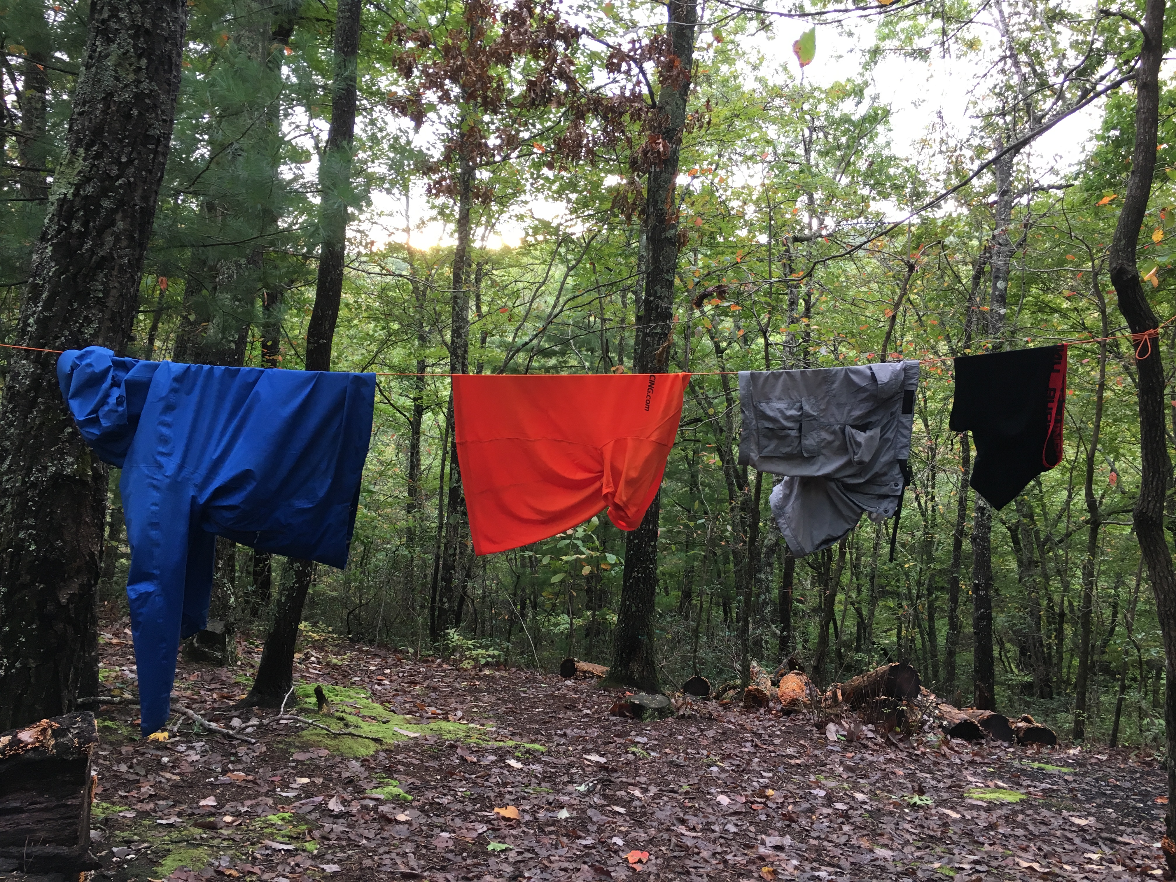
Drying Clothes before Heading Back Out after Hurricane Michael
The hike on Friday covered 24 miles — a bit more than I would have liked, but the miles went quickly and I was able to stop for lunch at the Brushy Mountain Outpost after crossing U.S. Route 52.I had the daily special of a cheeseburger and fries.While I was eating my lunch, I received some anonymous trail magic as the owner told me that earlier in the day someone had paid for the next thruhiker to stop in for lunch.
Saturday started with drizzle and fog, and with cold winds once I got up to the mountain ridge.After battling through a miserable morning, the sun came out and I was finally warm.I had some nice views from Chestnut Knob, the high point for the day at 4,409 feet.On the way down I met a couple of beagles who apparently were out on a training excursion.Their collars included a radio that appeared to be both a receiver and transmitter.I hadn’t realized the world of high-tech now included remotely tracking and sending commands to the hunting dogs.I am not certain how far the dogs were supposed to go, but they turned around and followed me back down the mountain and it was nice to have their company for a couple of miles.
View from the Top of Chestnut Knob
View Descending from Chestnut Knob
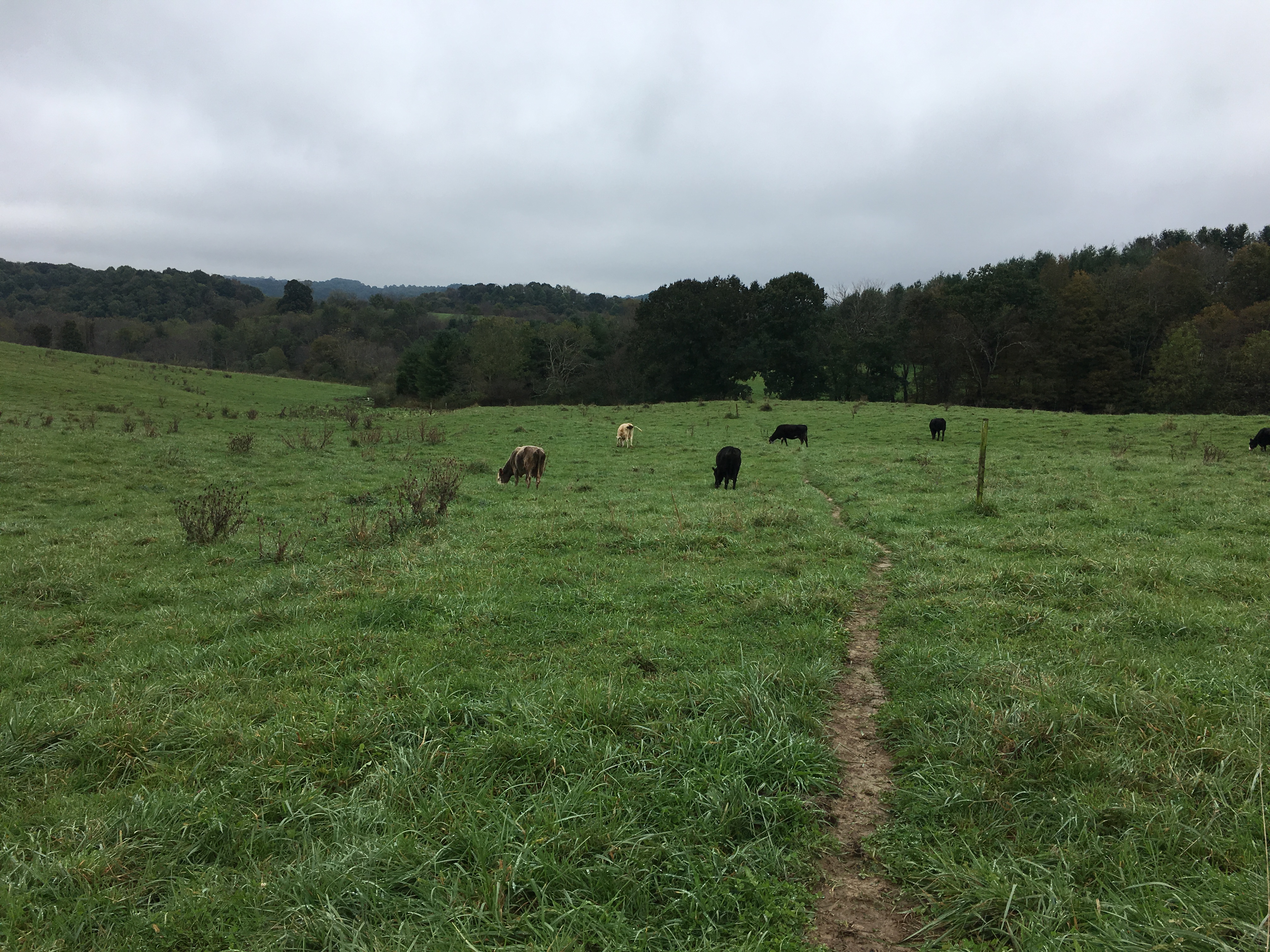
Sunday also started with drizzle and fog and brought me across several pastures.The last one in the afternoon was the first where the cows were right along the trail.Unlike previous hikes, these cows did pick up their heads and looked me over as I hiked.This was unfortunate as it compelled me to keep my eyes on the cows when I would rather have been watching where I was stepping.Fortunately, I was able to avoid any mishaps that would have required cleaning my shoes.
Hiking Among the Cows in Davis Valley
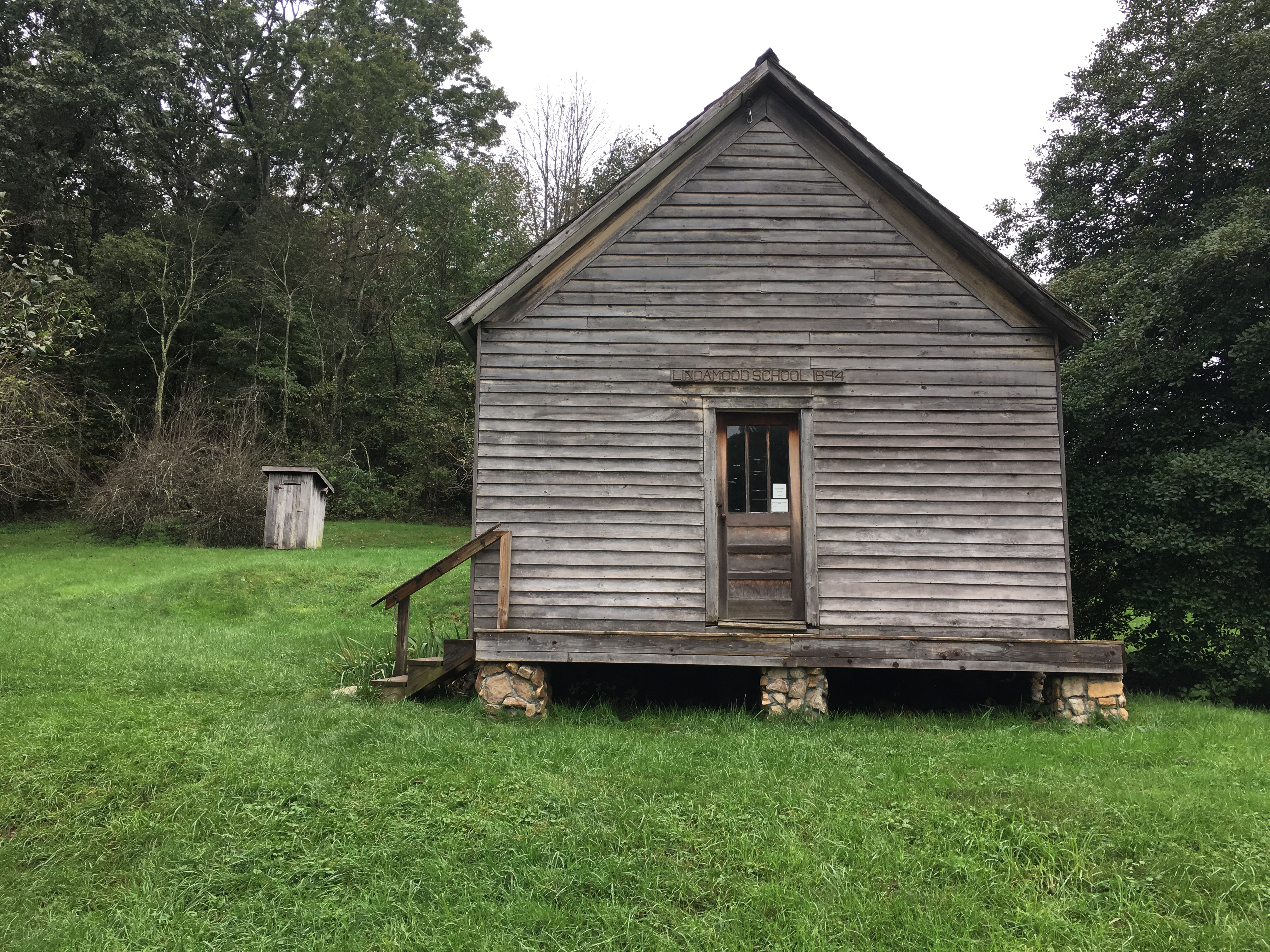
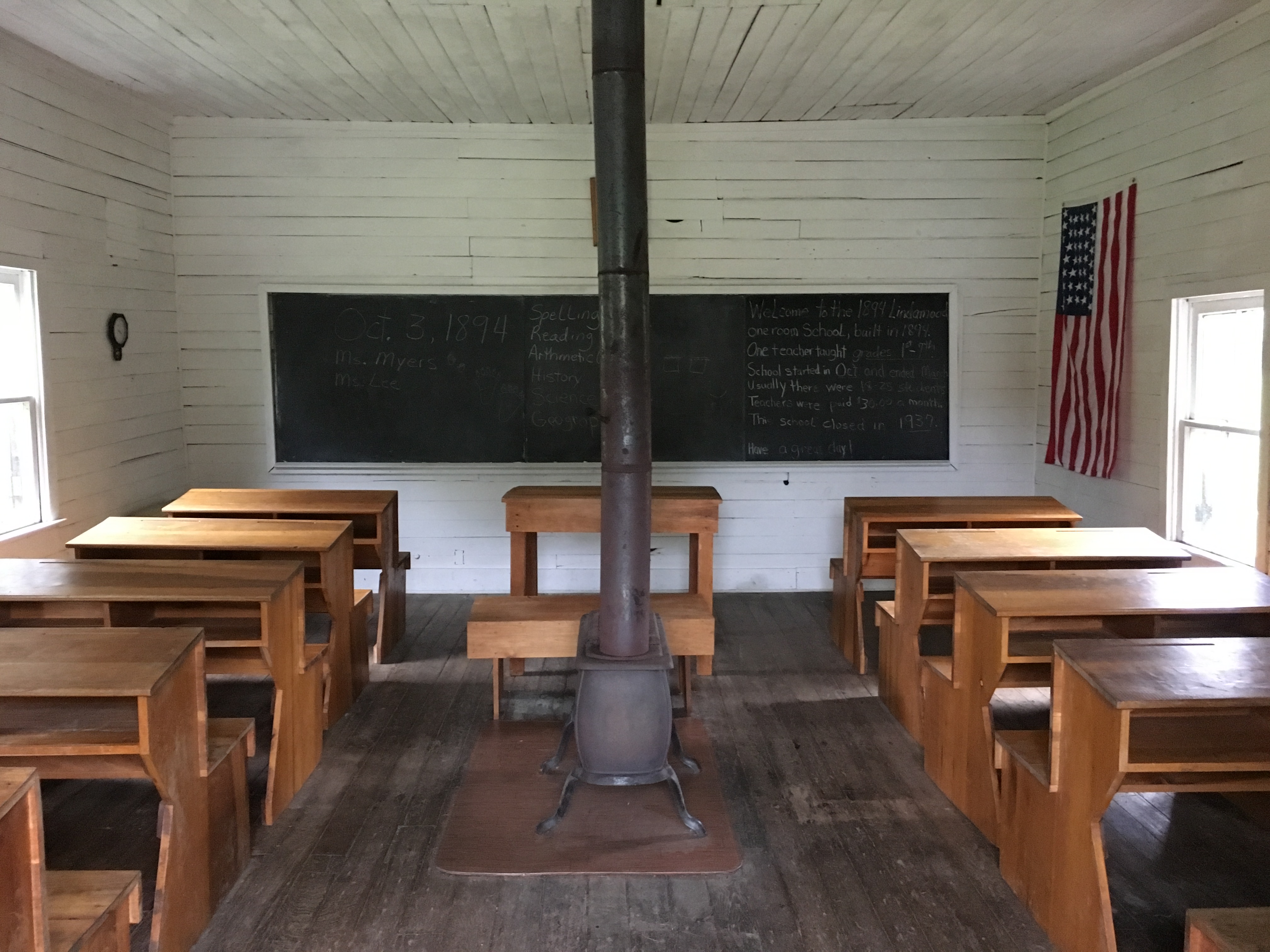
Later in the day I passed the Settlers Museum, which included an 1894 schoolhouse.The visitors center included exhibits on life at the time the valley was settled as well as interesting background on the locations in Europe from which the immigrants came.
The 1894 Lindamood Schoolhouse
Interior of the Schoolhouse
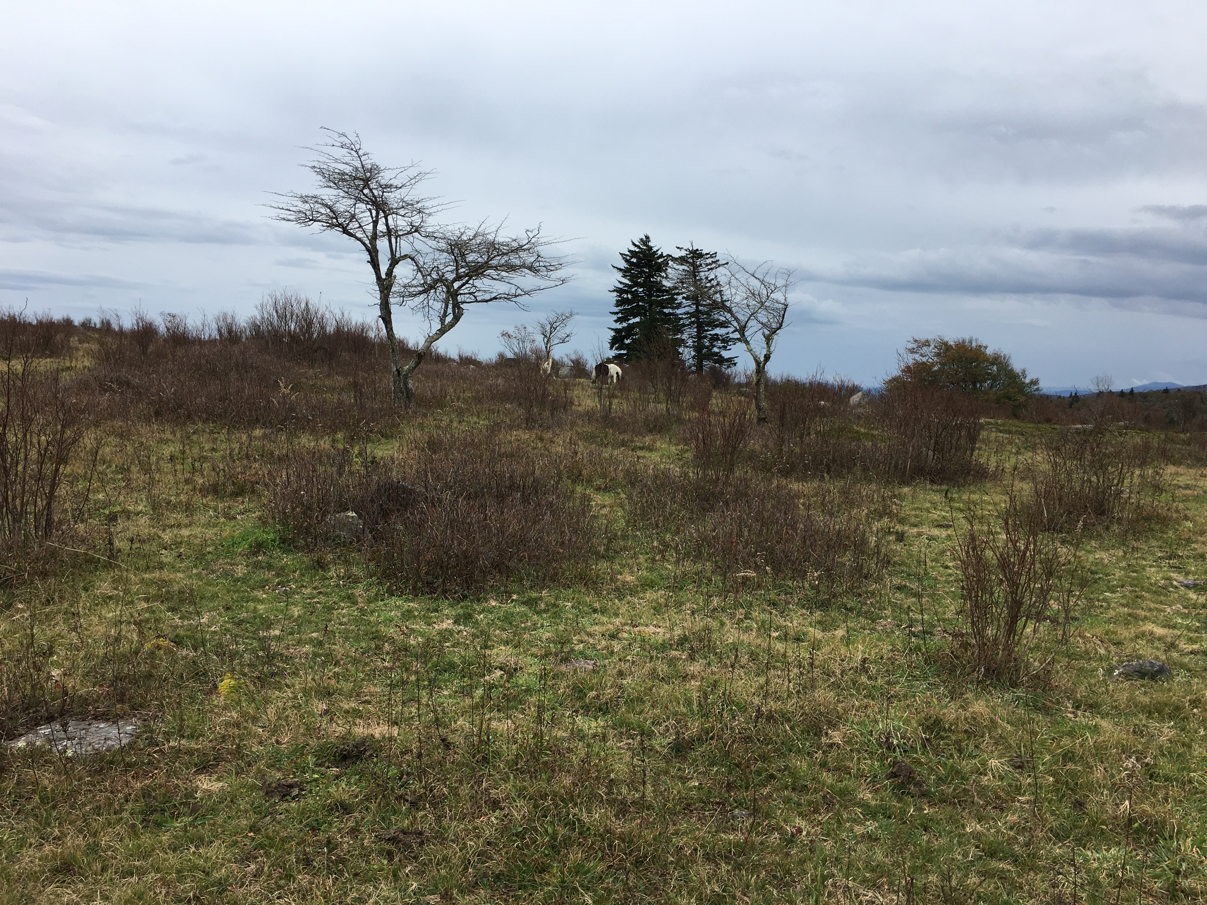
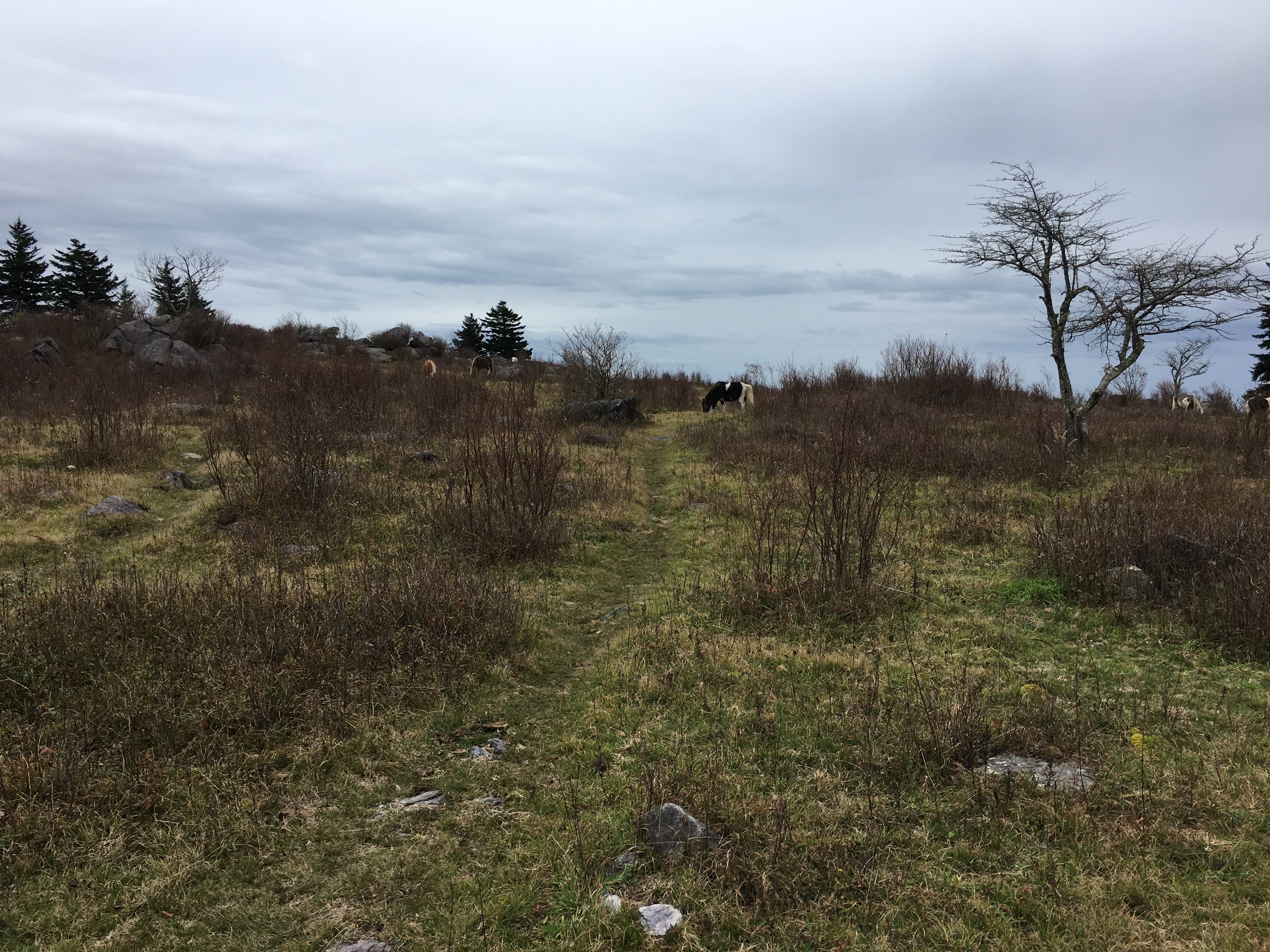
Monday and most of Tuesday were spent hiking through the woods without any appreciable views.Tuesday afternoon, I began the ascent of Pine Mountain and reached the area known as the Grayson Highlands.This area includes Mt. Rogers and Whitetop Mountain, the two highest peaks in Virginia.In addition to these mountains, the area includes large open tracts of land that are home to feral ponies.The ponies were brought to the area sometime in the first half of the 20th century to maintain the open vistas and control the risk of forest fires through their grazing on the brush and other undergrowth.The ponies now roam wild with some assistance from the Wilburn Ridge Pony Association.
Feral Ponies Grazing in the Grayson Highlands
Another Grazing Pony
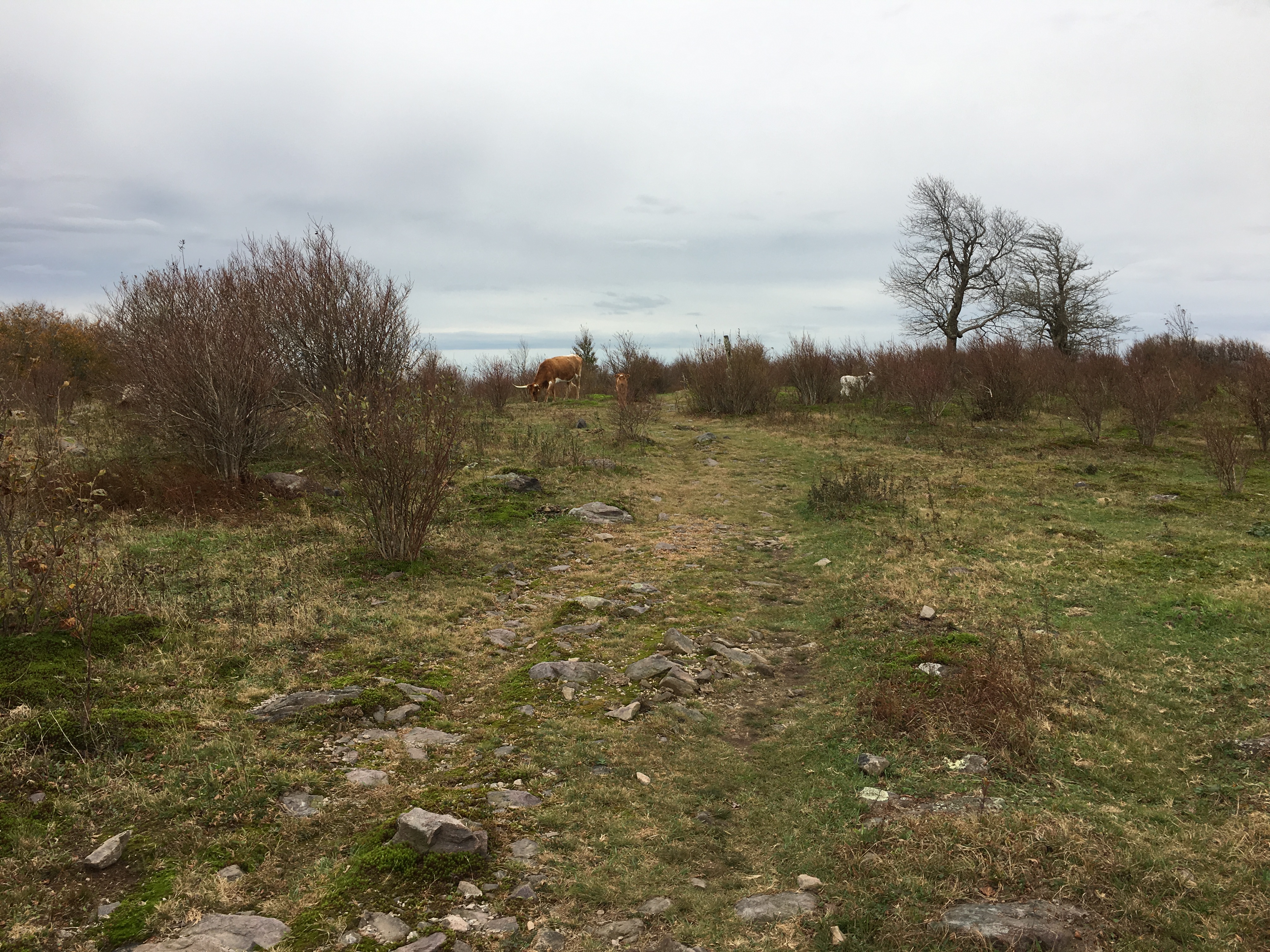
I encountered several of the ponies as soon as I reached the highlands.Unfortunately, they appear rather small in my pictures as I did not want to approach too closely.In addition, I encountered some cattle that also roam freely across certain areas of the highlands.The elevation in the highlands is above 5,000 feet above sea level and it was easy to see that fall had progressed much further in this area than at lower elevations, as most of the leaves were already on the ground.Nonetheless, the late fall colors provided beautiful scenery, particularly with the overcast skies.
Cattle in the Grayson Highlands
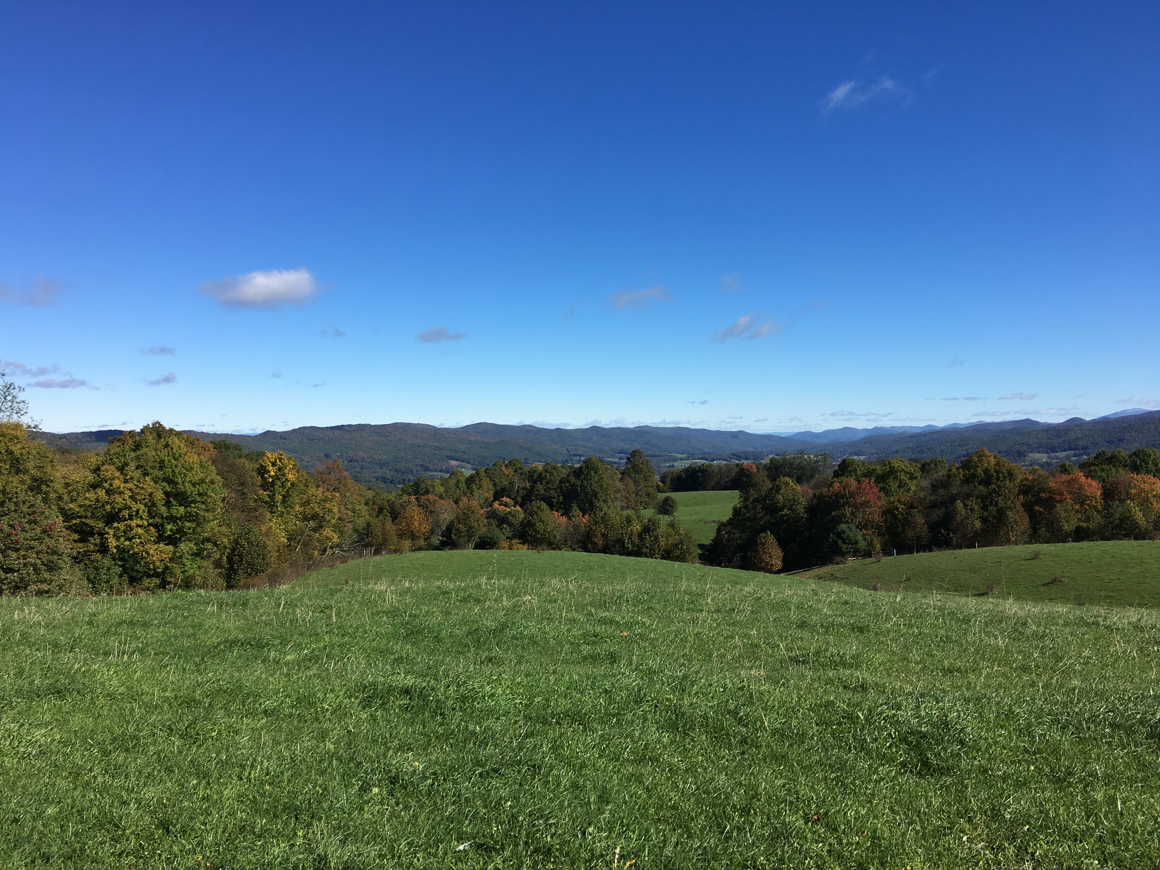
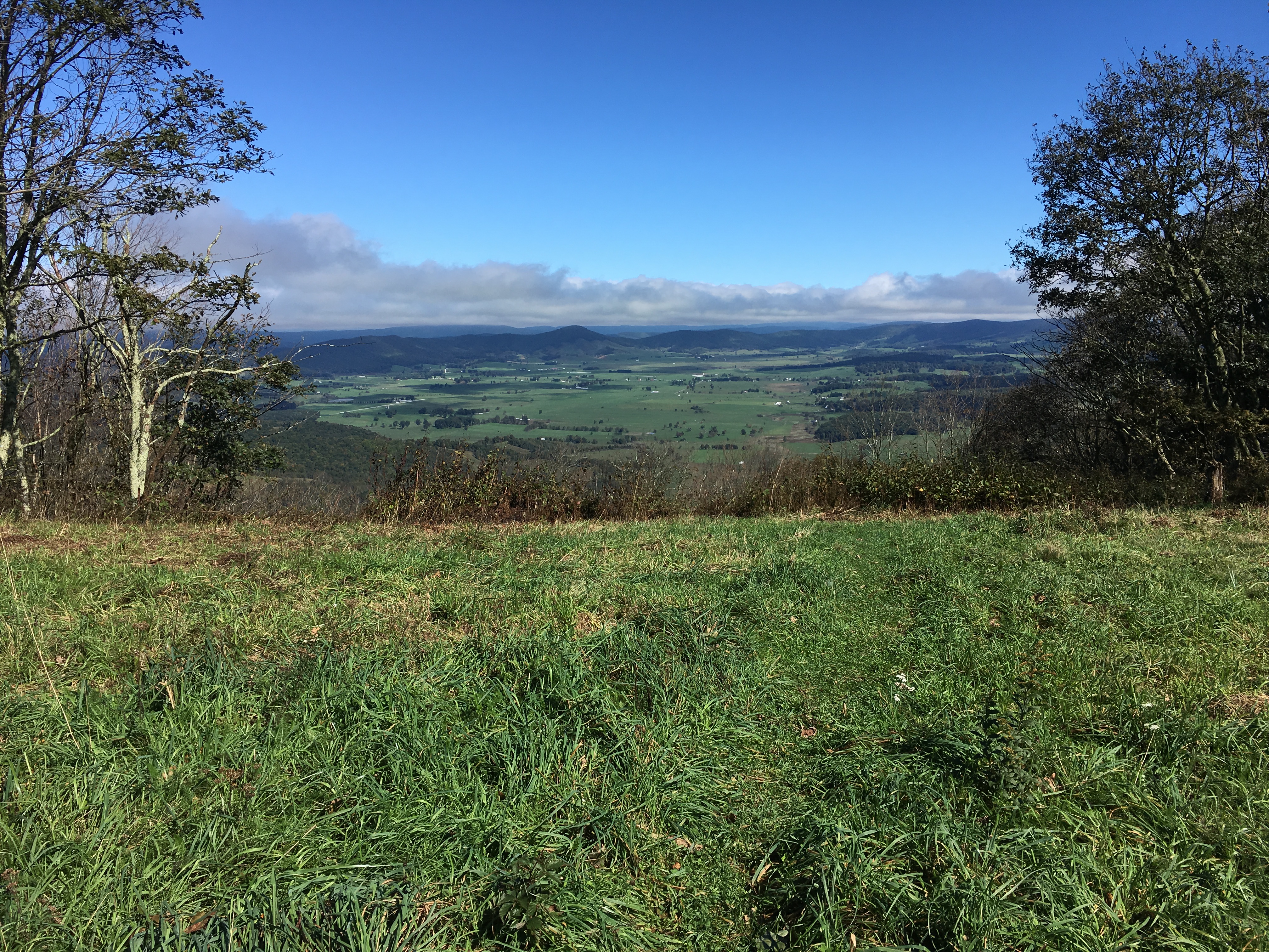
View Across the Grayson Highlands
View Toward Distant Mountains Across the Highlands
After another rainy night, I woke to low temperatures, high winds, and cloudy skies on Wednesday.I had hoped to see more ponies and perhaps get better pictures, but apparently they had more sense than I and stayed wherever it is they stay to keep out of the weather.The overcast skies did at least provide some interesting views.
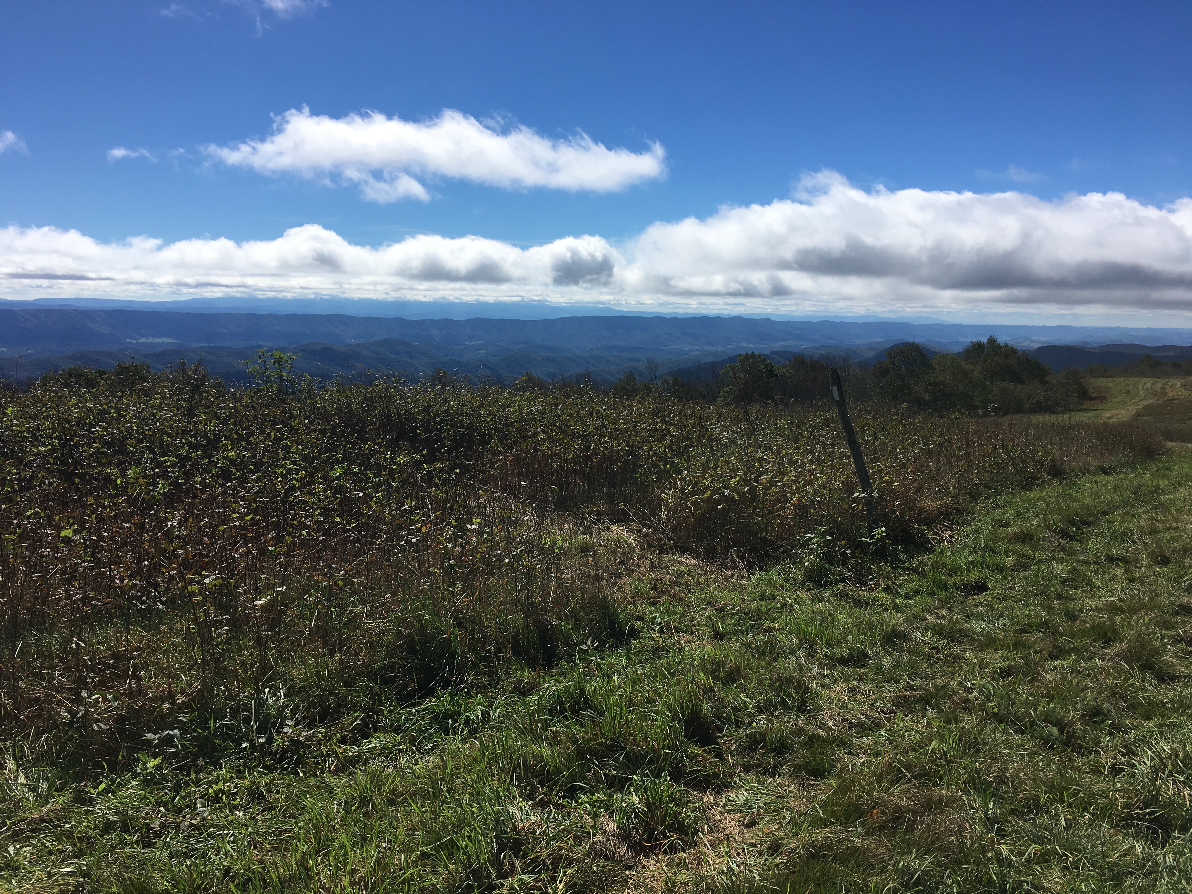
Morning View Across the Wilburn Ridge in the Grayson Highlands
Blue Sky Following the Rain on a Cold Morning
Another Morning View Across the Grayson Highlands
The Wilburn Ridge was rockier than most of the recent hiking and included a short section known as the “Fatman Squeeze.”Apparently, no one has come forward with a request for a more “correct” name.Although it looks narrow, I did not have any trouble fitting through without taking off my backpack.Many of the livestock gates have been much more difficult to pass through.
Narrow Passage between a Rock Cliff and a Large Boulder
View from Whitetop Mountain
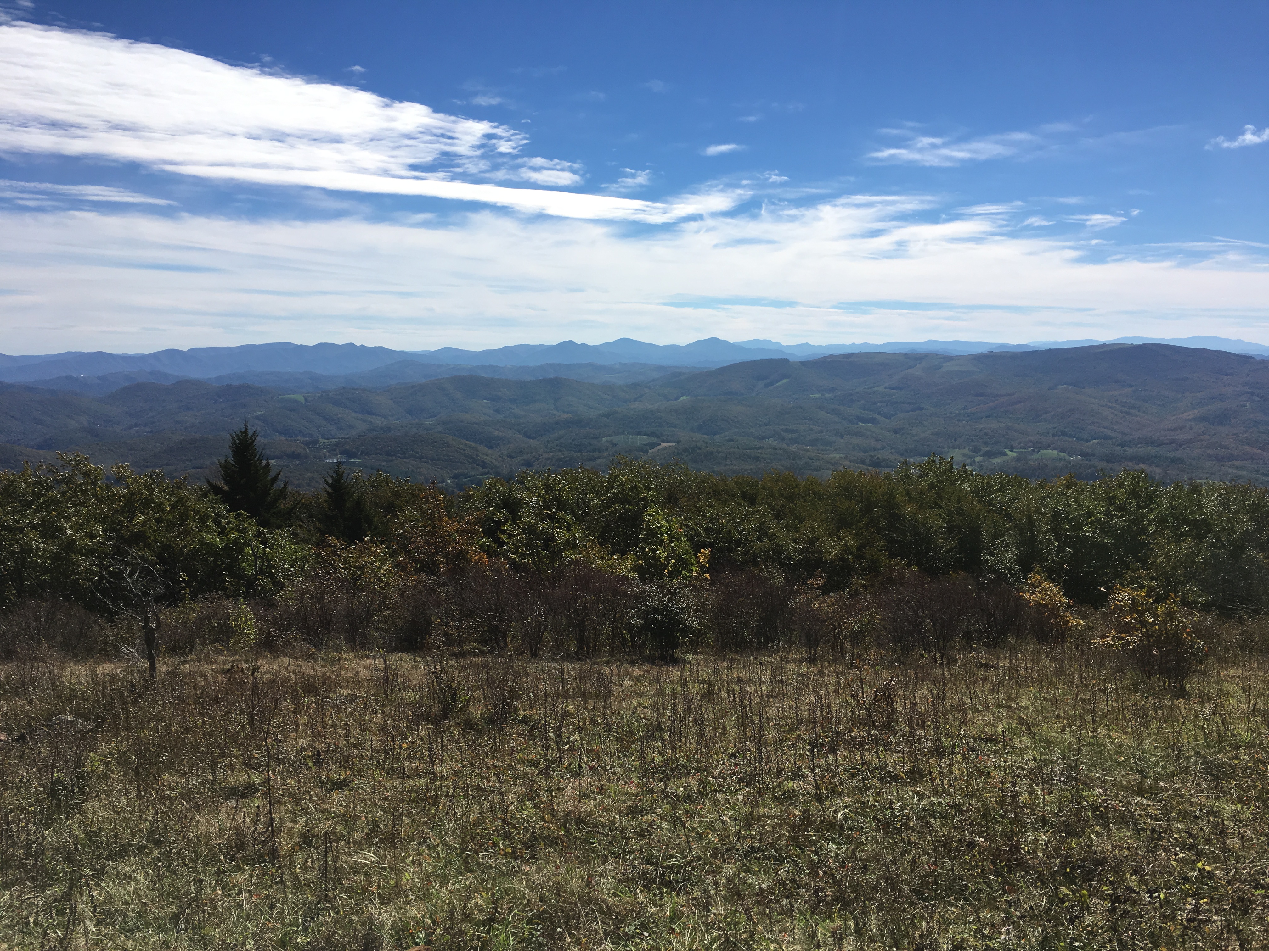
Thursday brought me to Damascus, just 3.7 miles from the Tennessee-Virginia border.The weather cleared up and air quality seemed the best I had seen in quite a while, providing sharper views of the distant mountains.
View from Cuckoo Knob While Descending to Damascus
As luck would have it, we had beautiful weather on my day off yesterday and it is now raining again as I prepare to leave.As several cold, but clear days await, I plan to wait until noon to leave after the rain has hopefully stopped.I now have just 469 miles remaining and three more states, and I am becoming optimistic that I can still make it home for Thanksgiving.If the next week goes well, I may commit all-in and purchase my plane ticket back to Boston.
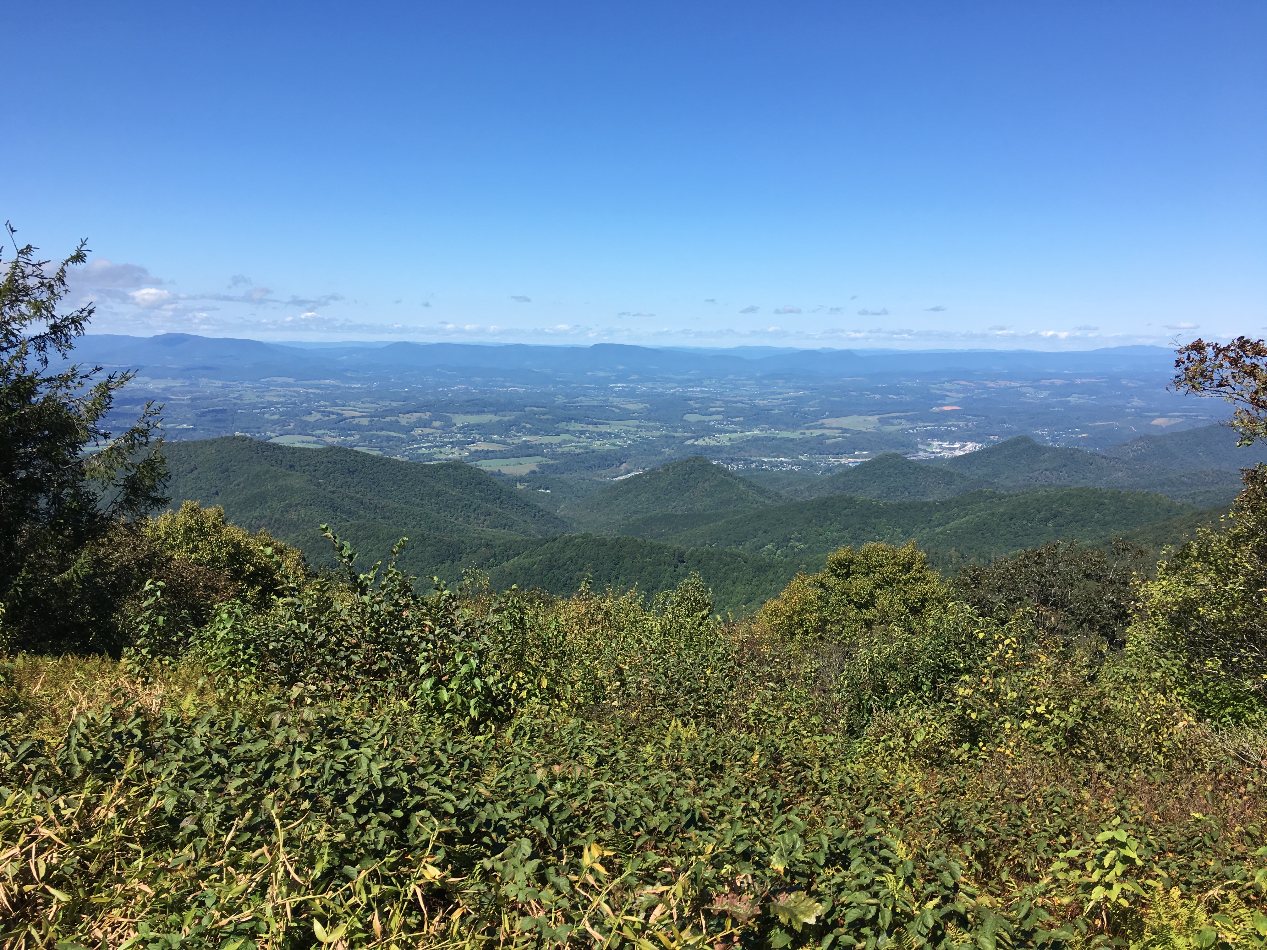
I have covered a lot of ground in the past two weeks — approximately 230 miles. After leaving Shenandoah National Park, the trail paralleled the Blue Ridge Parkway for about 100 miles.More recently, I have been following mountain ridges past some of the iconic sites in the area.I am now working my way southwest toward the Virginia/Tennessee border and hope to be there in another 10 days.
After taking a day off in Waynesboro, I headed back out on Tuesday, September 25.As usual, or so it seems, it was raining.By early afternoon the rain stopped and I had my first views in a week at Cedar Cliffs.I was hiking with a southbound hiker that I met recently named“Jester,” as we both had a common goal for the day to hike 20 miles to Reids Gap at VA Route 664 and spend the evening camping at the Devils Backbone brewery.The brewery offers shuttle service to and from the trail.Although we had just been in town, we consumed large quantities of food and drink, including ice cream sundaes for dessert.
View to the Northwest from Cedar Cliffs
View to the Southwest from Cedar Cliffs
Jester and Uncle Malty Finishing Dessert at the Devils Backbone Brewery
Good weather continued through most of Wednesday.I had some nice views in the morning from Three Ridges Mountain.After descending and crossing the Tye River on a suspension bridge, I ascended The Priest.At 4,063 feet, The Priest is the first 4,000 foot peak on the trail south of Killington in Vermont.The grade was easy with plenty of switchbacks, ascending 3,000 feet in four miles.However, about two-thirds of the way up it was necessary to descend off the trail and take cover from a passing thunderstorm.
View Toward The Priest from Three Ridges Mountain
Suspension Bridge Over the Tye River
Post-Thunderstorm View from The Priest
I woke Thursday to steady rain and quickly decided that the planned 22-mile hike was not going to happen.Rather than sit all day in a three-sided shelter, I decided to see if I could make 16 miles.The hike started off well enough, but the temperature was in the 50s and as the wind picked up, I quickly became chilled.Fortunately, my plan included an early escape option at 6.6 miles.Upon reaching the Seeley Woodworth Shelter shortly before noon, I quickly changed clothes, made tea, and got into my sleeping bag, which is where I spent the rest of the day.
The rain continued through the night, but the skies cleared just before sunrise.The hike on Friday followed a ridge, ascending and descending several peaks, including the northernmost grassy balds on the trail, Tar Jacket Ridge and Cole Mountain.The last peak of the day was the wooded, 4,059-foot summit of Bald Knob, which ironically is not a bald.
View From Tar Jacket Ridge
The Ascent up to Cole Mountain
Cole Mountain Summit
Saturday morning began hiking around the Lynchburg Reservoir, with the trail providing partial views through the trees to the water below.At the south end of the reservoir, I crossed the Pedlar River and began the ascents of Rice, Punchbowl, and Bluff Mountains, before descending to Big Rocky Row and then to the Johns Hollow Shelter.Along the trail and at the summit of Bluff Mountain, I met some of the scouts and leaders from Boy Scout Troop 1028 in Charlottesville, VA.Between the older scouts who hiked over Bluff Mountain and the younger scouts who hiked up from the James River, I would say there were 20 scouts camping behind the shelter.Before I departed Sunday morning, I made a point of letting the Scoutmaster know that I appreciated how well-organized and respectful the scouts were.
The Pedlar River Bridge
View from Bluff Mountain
The James River from the Ledges below Big Rocky Row
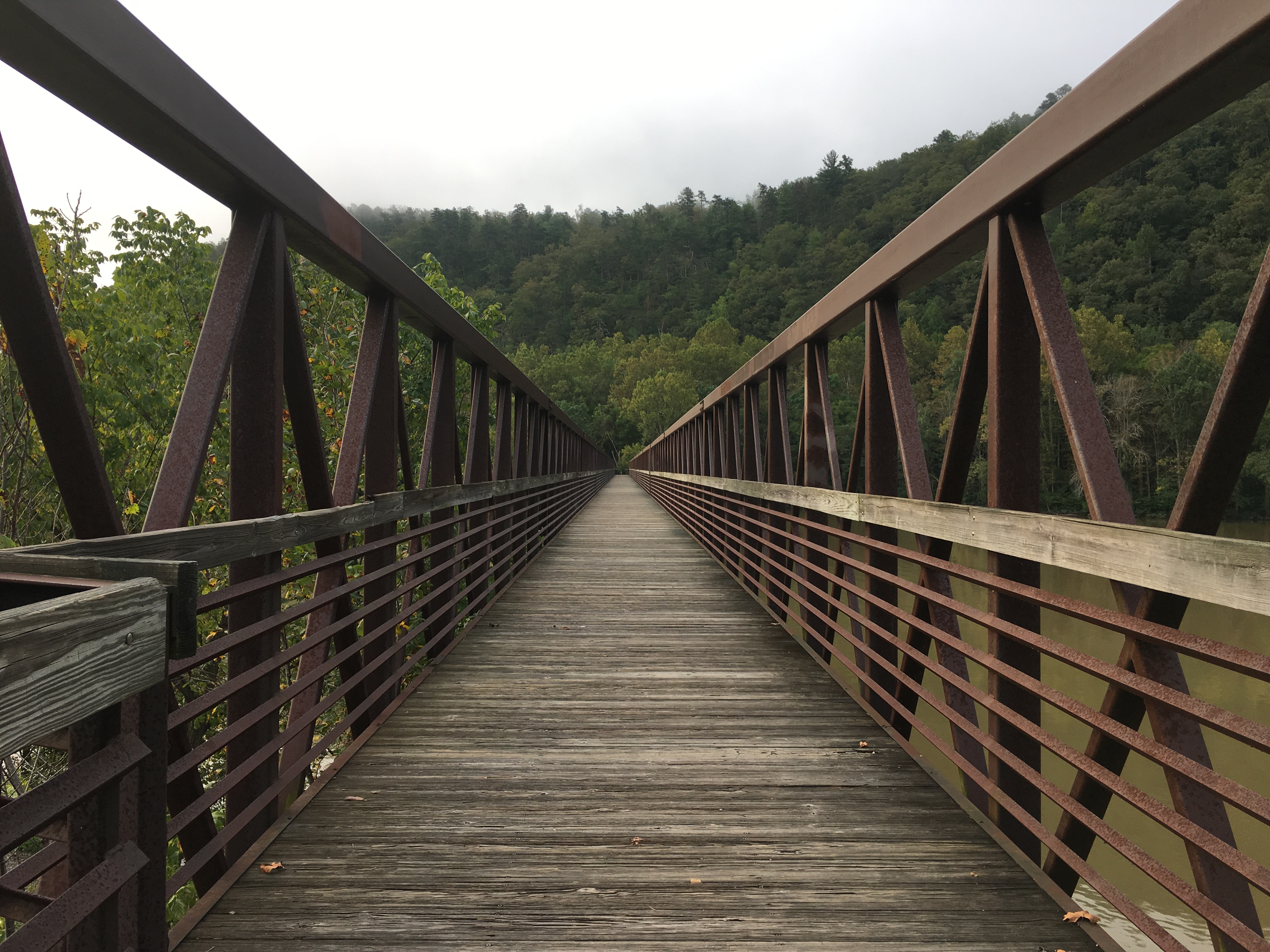
Sunday began crossing the James River on the longest footbridge on the trail.The day was overcast to begin, and I ascended into a cloud of mist as I headed up to Highcock Knob and Thunder Ridge.The flat rocks at the respective viewpoints made nice places for lunch and an afternoon snack, but no views were seen on this day.
The James River Footbridge
As the daylight becomes shorter each day, it has become more difficult to hike as far in a day as earlier in the trip.As I headed into October, I decided that while night hiking by headlamp is not for me, hiking for an hour in the morning by headlamp would be an acceptable solution.If something was to happen in the morning, such as temporarily losing the trail, it would only be an hour until daylight.Also, evening chores such as hanging the bear rope and fetching water are much more easily done during daylight hours.I left camp on Monday at 6:00 and crossed the summit of Apple Orchard Mountain.Just before sunrise, as I descended, I heard quite a racket from a large group of hound dogs below.I was concerned whether I was descending directly toward them, especially after sun up when I could sense they were moving and I heard the whoopin’ and hollerin’ of their owners.It turns out October 1 was the first day of a special three-day bear hunting season.Fortunately, when I came to a trail junction, I could tell we were not headed toward each other.The rest of the day was viewless and uneventful, until I was caught in an afternoon rainstorm.Fortunately, I was less than 10 minutes from the next shelter and I stayed relatively dry.
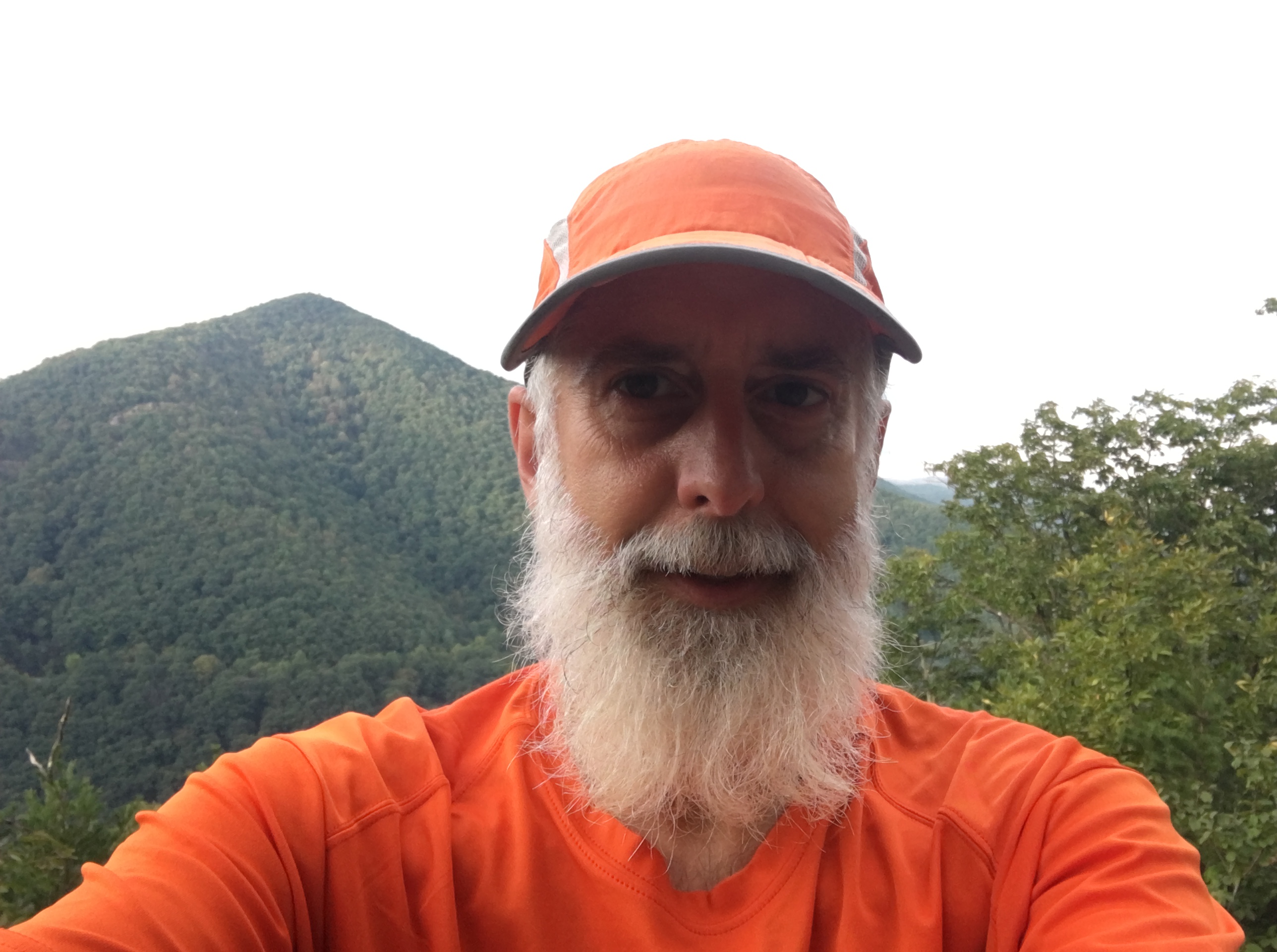
Uncle Malty Modeling New Attire for the New Season
Tuesday brought several viewpoints and several crossings of the Blue Ridge Parkway.Unlike Shenandoah, where the trail is never far from Skyline Drive, the trail crosses the Blue Ridge Parkway less frequently.I surmise the ridge at this point was more narrow, resulting in the road crossings.Most of the views were similar and the best seemed to be of Sharp Top Mountain and Flat Top Mountain from the Peaks of Otter Overlook.
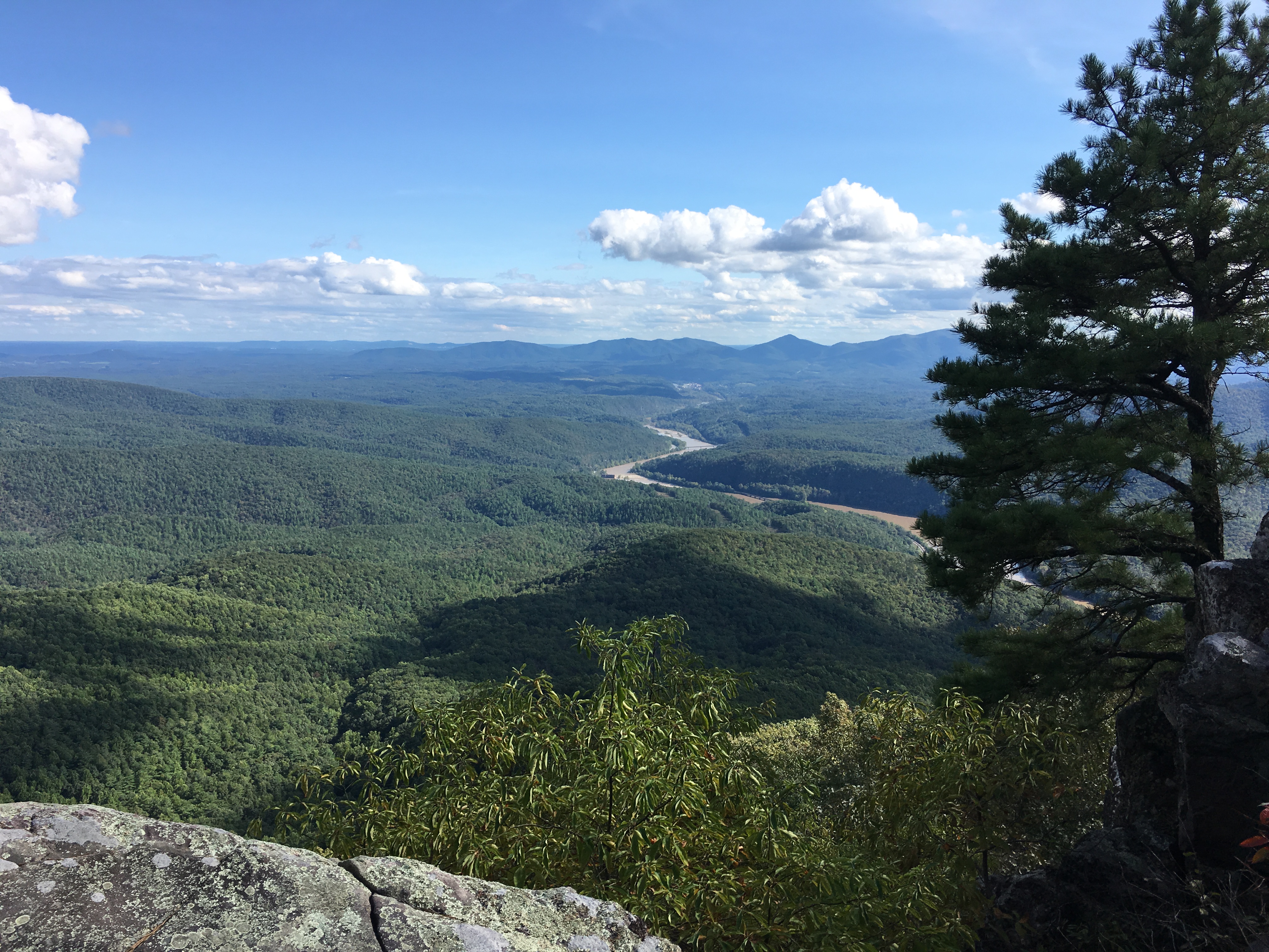
View from the Peaks of Otter Overlook
Wednesday morning was just awalk through the woods, but that afternoon, after crossing U.S. Route 220, I entered the most popular hiking area along the Appalachian Trail in Central Virginia.The trail ascended to a ridge that surrounds the Carvins Cove Natural Reserve and Reservoir, providing views from many different angles.
The Carvins Cove Reservoir
Another View of the Carvins Cove Reservoir
Thursday morning was a long day, covering 23 miles and the “triple crown” of the local area.I planned to be up at 5:00, but I woke early and decided to get an extra early start, leaving camp at 5:00.The first attraction was the cliffs on Tinker Mountain.The name reportedly is derived from a group of Revolutionary War deserters who hid on the mountain and earned a meager living repairing pots and pans.It was still dark, but the lights from the town below made a nice view, as did occasionally turning off my headlamp and checking out the stars above.I had the good fortune to reach some open ledges just before daybreak that provided another view of the reservoir, and I enjoyed a spectacular sunrise while eating my first snack of the morning.
First Light Viewed from Tinker Mountain
Sunrise Over the Carvins Cove Reservoir
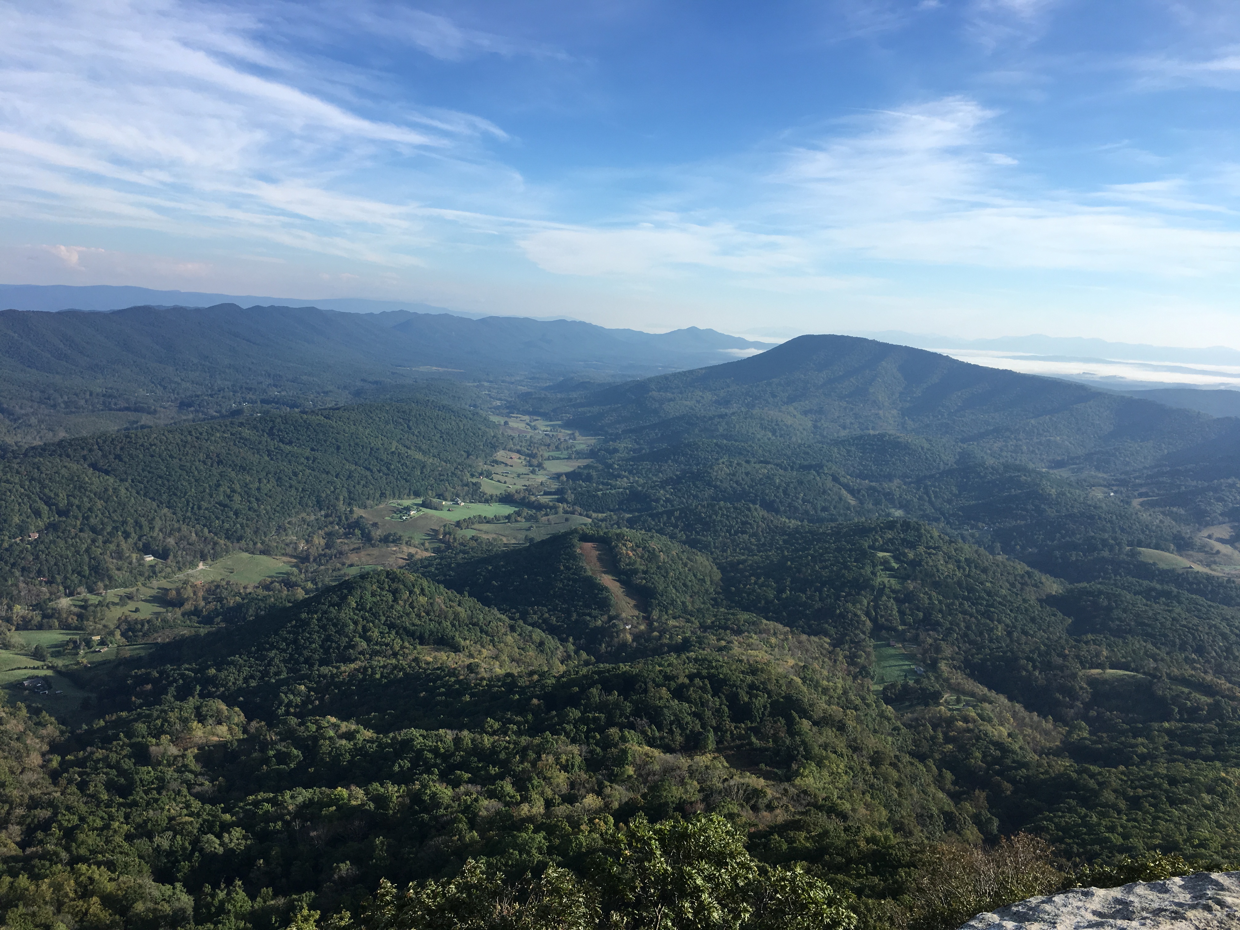
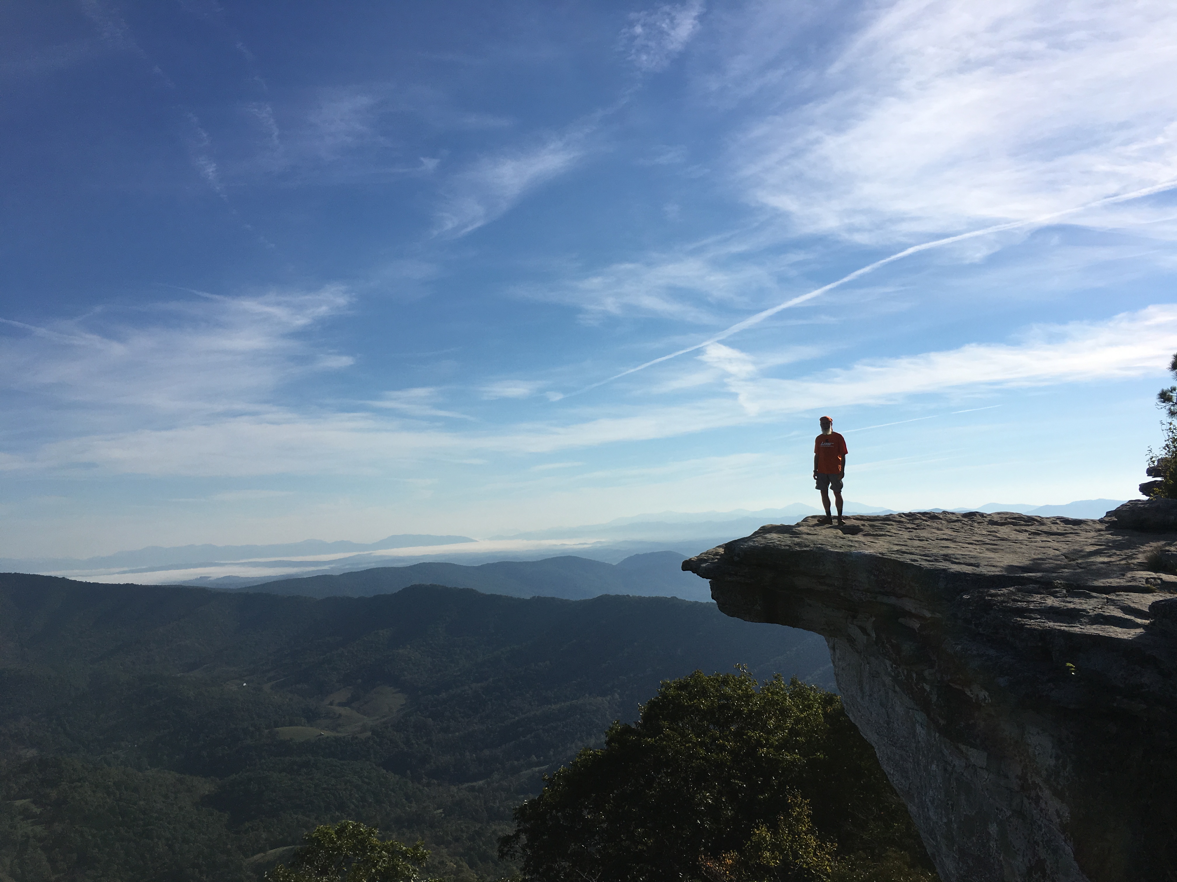
The next stop was McAfee Knob,which I suspect is the most well-known attraction in the area, if not on the entire trail.When I first arrived, it seemed smaller than I anticipated; however, after seeing myself standing on it in a picture taken by “Lars,” one of the other southbound hikers I recently met, I have a different perspective.
View from McAfee Knob
Uncle Malty on McAfee Knob
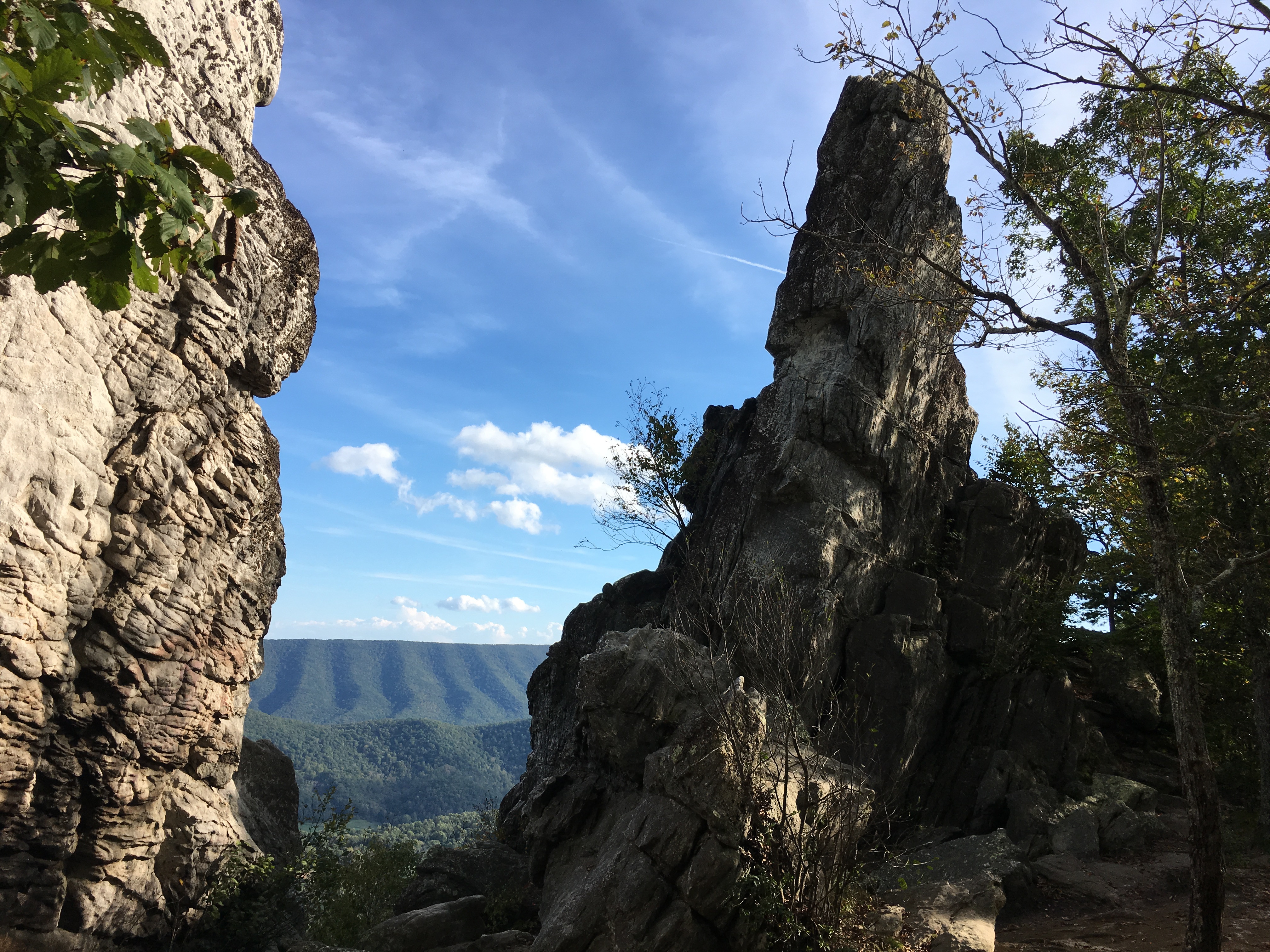
The last attraction was a rock formation named Dragon’s Tooth.Reaching the ledge was a strenuous hike with a bit ofscrambling at the end.Once there, I was content to view Dragon’s Tooth from below.
Dragon’s Tooth
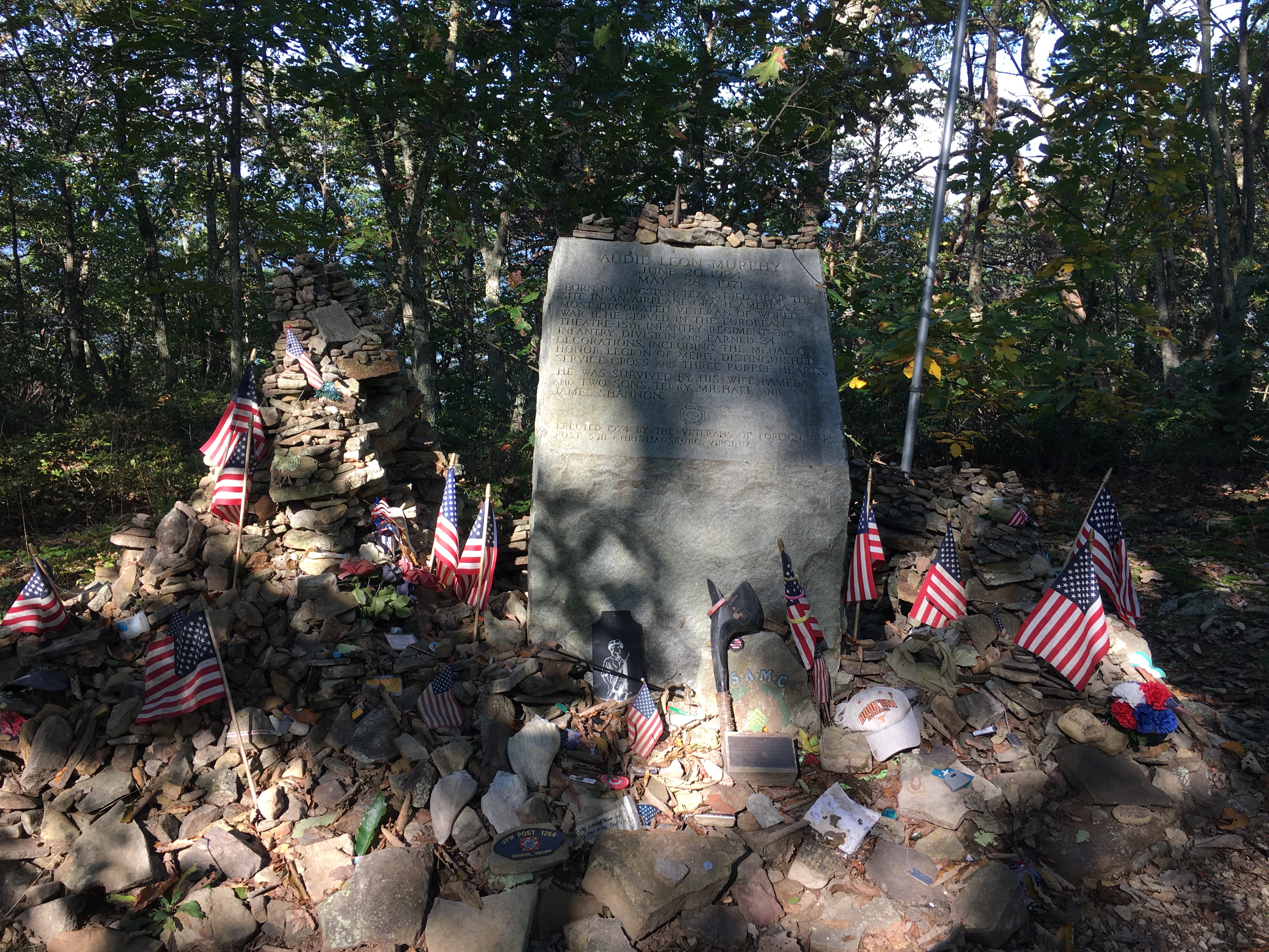
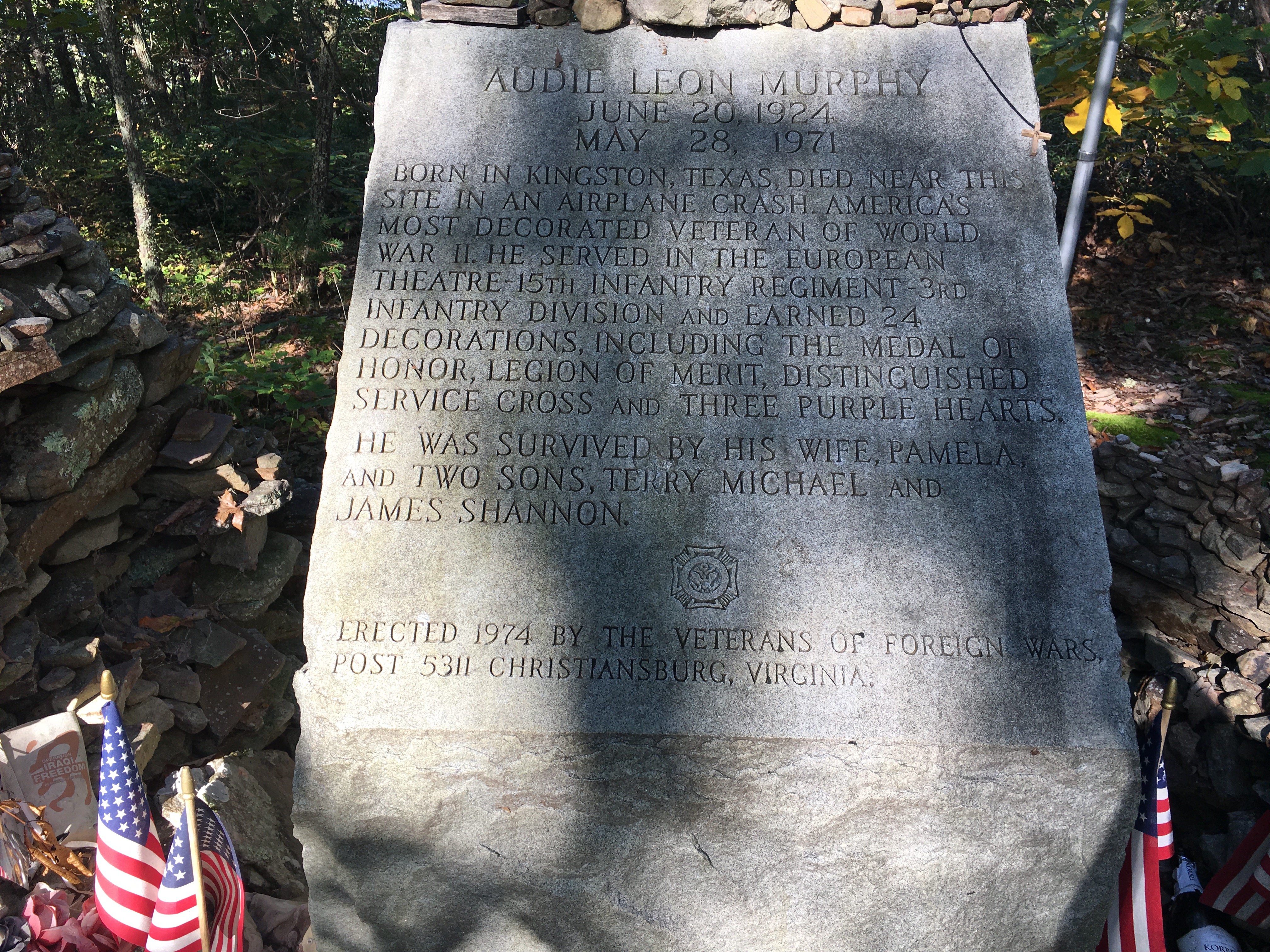
The rest of the week was less scenic as I was back primarily back to walking through the woods and across viewless ridges. Friday brought me to a memorial to Audie Murphy, the most decorated U.S. soldier in World War II.The location of the memorial is about 50 yards from the trail near the site where he died in a plane crash in 1971.The local VFW post does a very nice job maintaining the memorial.
Audie Murphy Memorial
Closer View of the Text on the Memorial
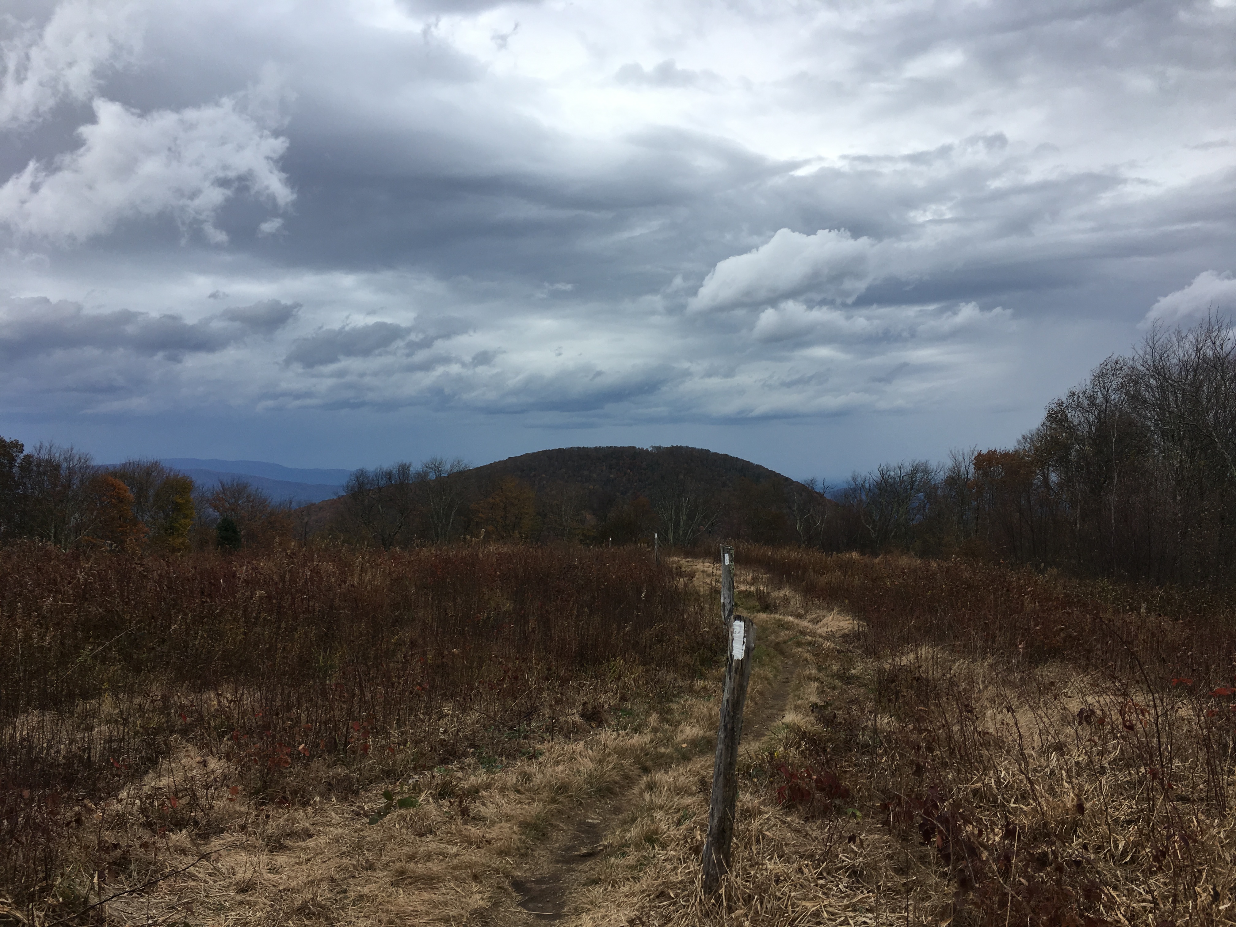
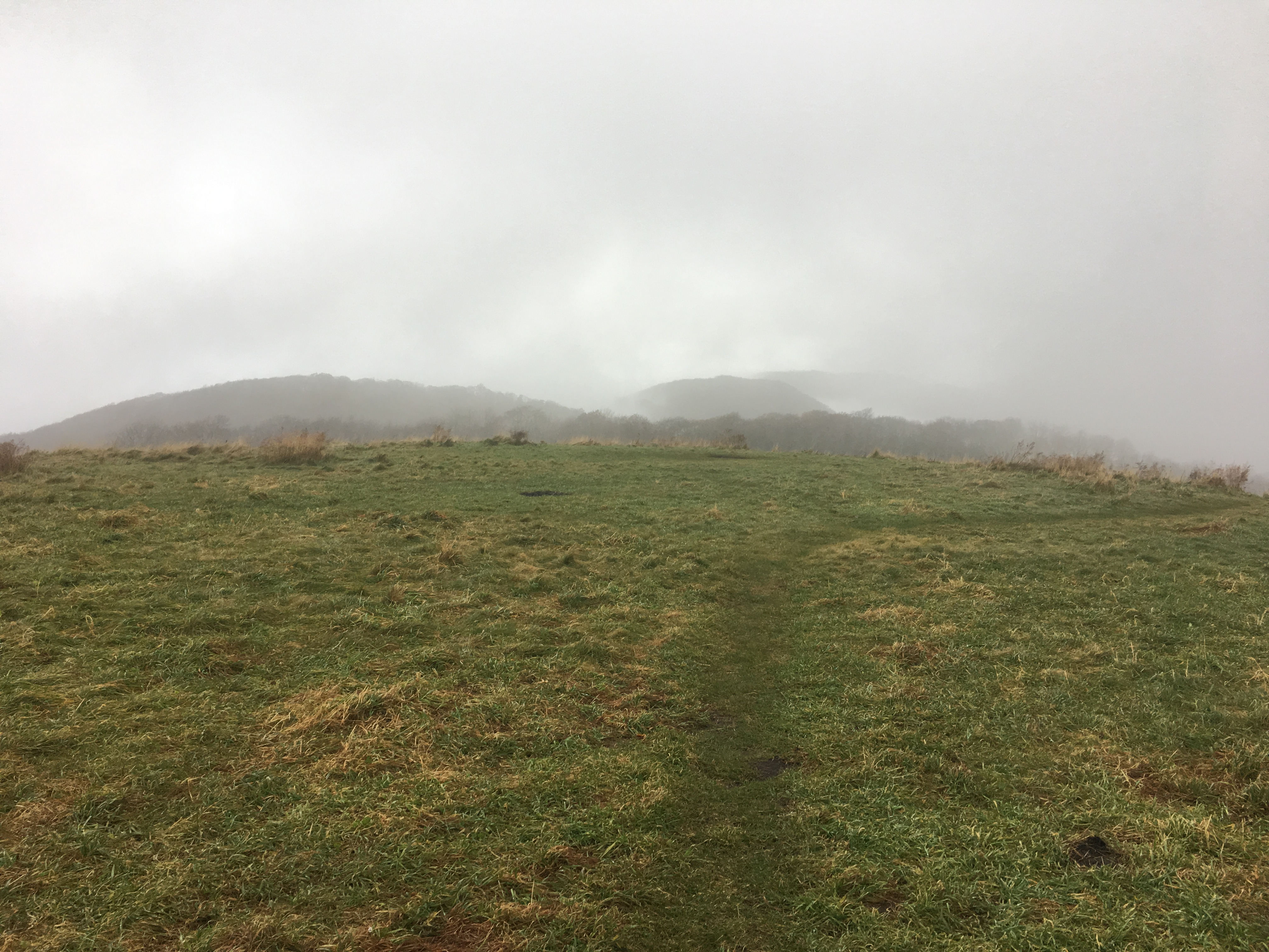
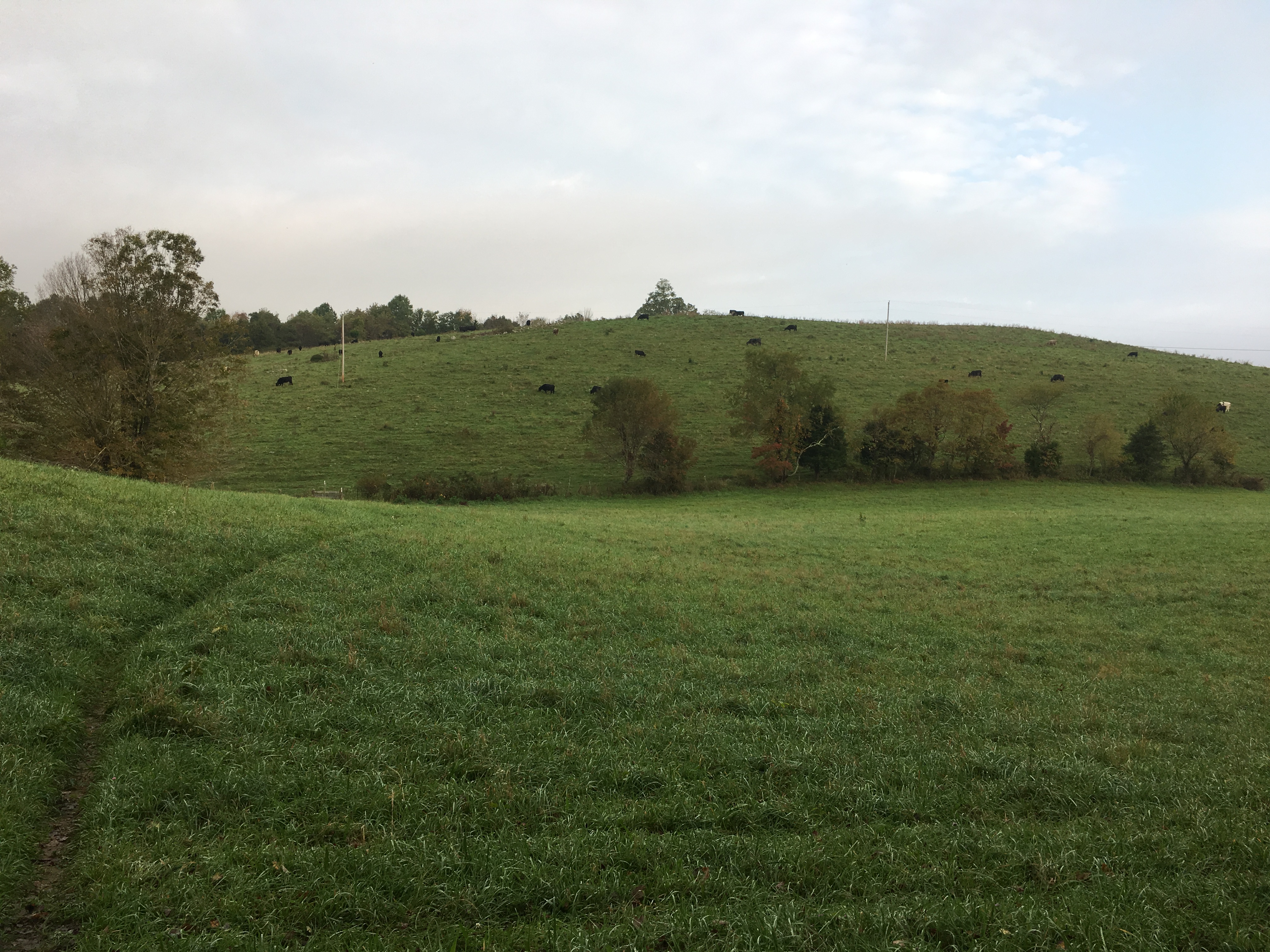
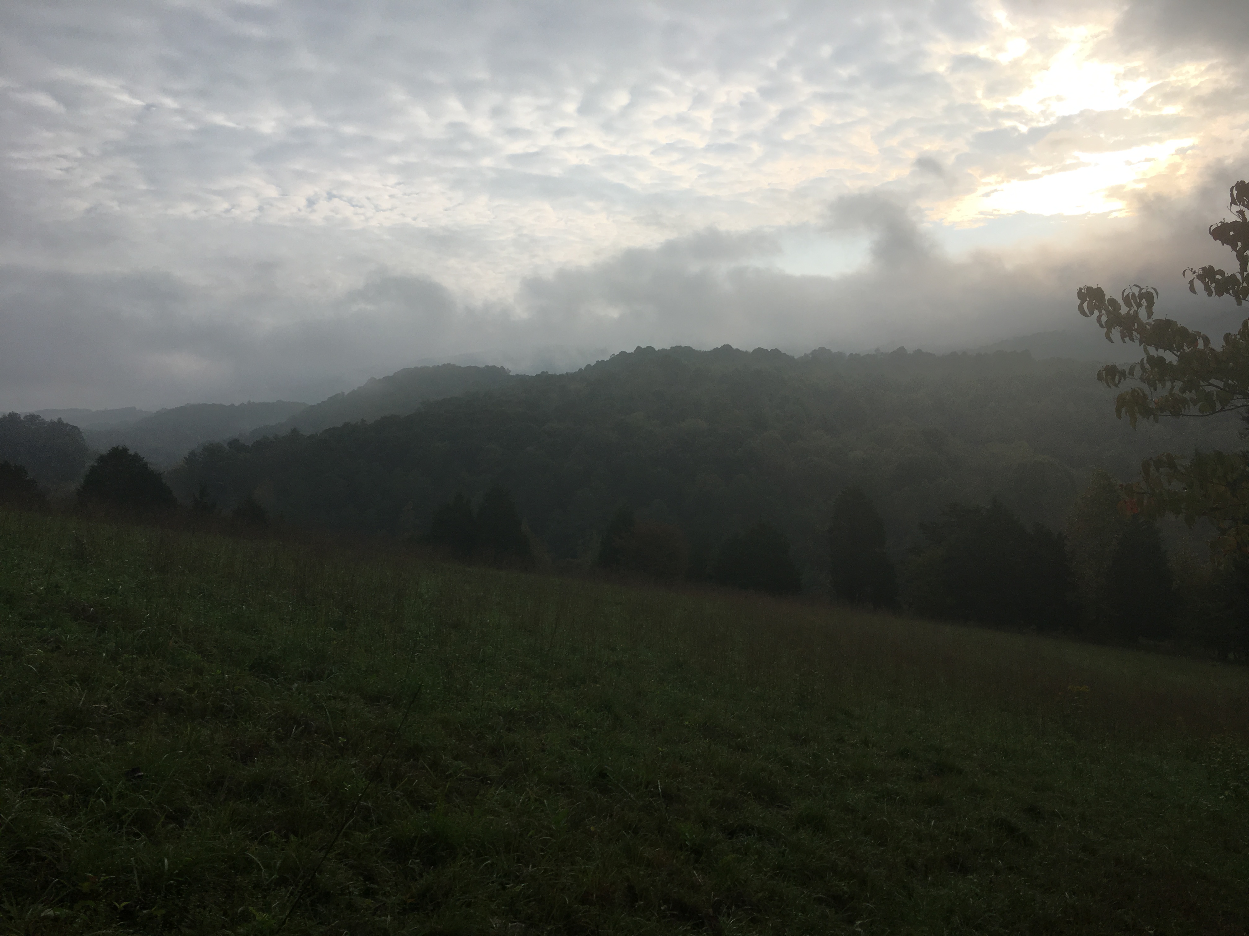
Saturday morning was another foggy day.Crossing two meadows provided different scenery from the mountaintop views earlier in the week.
Meadow of Grazing Cows – Not One Picked Up Its Head As I Passed By
Misty Morning View Across an Open Meadow
Sunday was just a long, viewless 23-mile hike into Pearisburg.Normally, I might have stopped sooner, but I wanted to make it into town to treat myself to a hot shower, clean clothes, and dinner for my birthday.As it turned out, I only had to treat myself to the first two.I went to dinner at a Mexican restaurant with two other hikers, a southbound hiker named “Hansel” and a section hiker named Paul, who insisted on paying for my dinner and margaritas.
I am back on the trail, dealing with more rain and waiting for some cold nights to take care of the mosquitoes that seem to have recently come back to life.Perhaps some cold nights will also cause the remaining leaves to finally turn color.Several people in the area have told me the temperatures in the 80s last week were unusual for this time of year.They also are concerned that between the leaves taken down by Florence and the warm weather, the fall colors will be unspectacular this year.With more rain from hurricane Michael approaching, we will just have to wait to see what happens.