Shenandoah

“I didn’t come this far to only come this far.” — Tom Brady

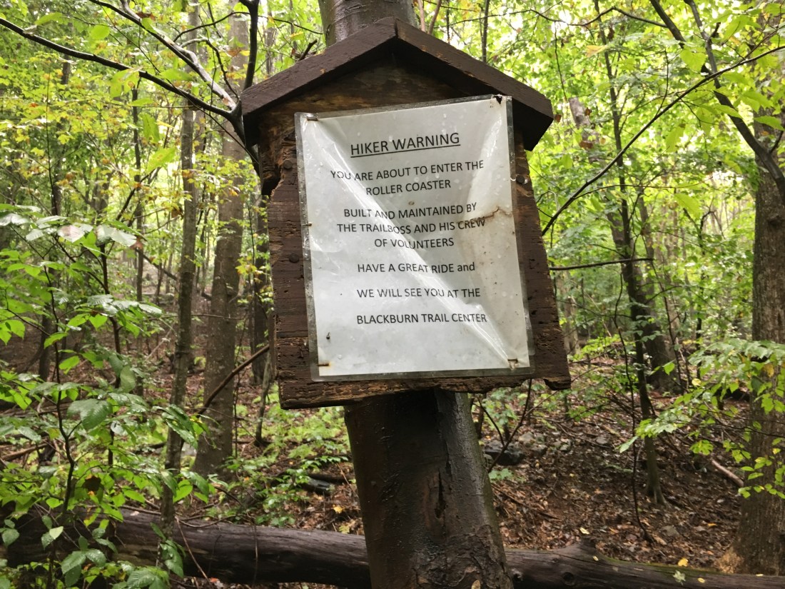
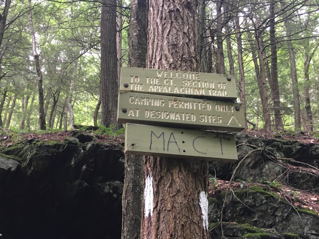
It seems like it has rained for the entire last week; however, looking back at the pictures I took, we did have some sunshine after all.  The forecast continues to include a chance of rain every day, and the humidity keeps my clothes from drying even when rain does not fall.  With 1,328 miles completed since summiting Mt. Katahdin, I was reminded of the quote above that Tom Brady used during the New England Patriots playoff run in 2016.  I hiked this far, not to complete a 1,328 mile trip, but as part of my journey to Springer Mountain.  I still have some more work to do on the remaining 863 miles.

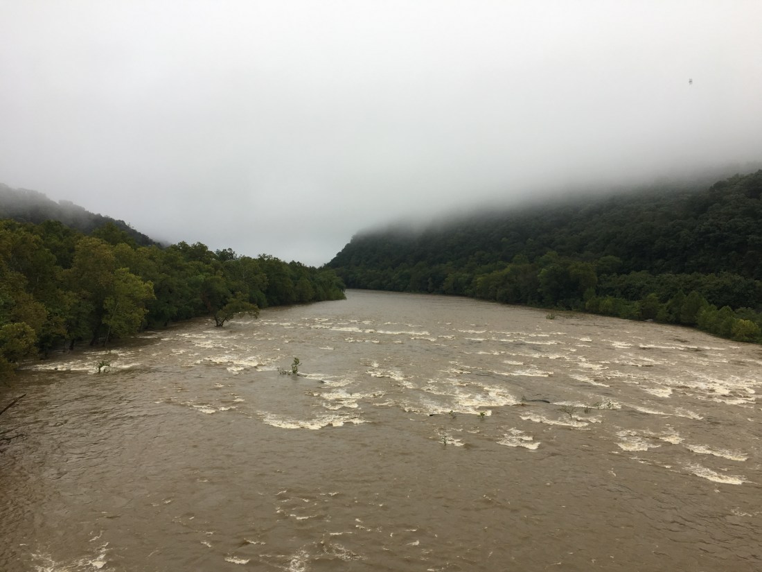
The worst of the rain from Hurricane Florence hit Shenandoah National Park last Monday, so I decided it would be best to sit out one more day after Katie flew back to Massachusetts.  I spent one more day at the Mountain Home B&B and then headed into the rain on Tuesday morning.

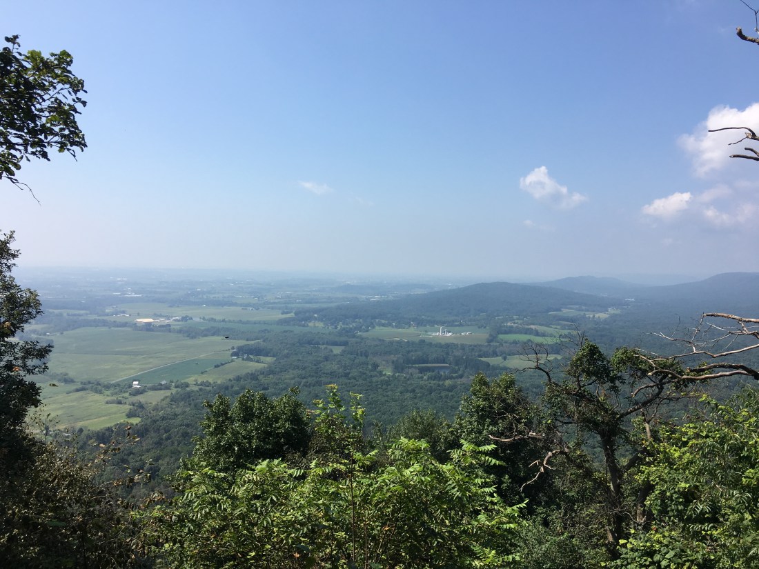
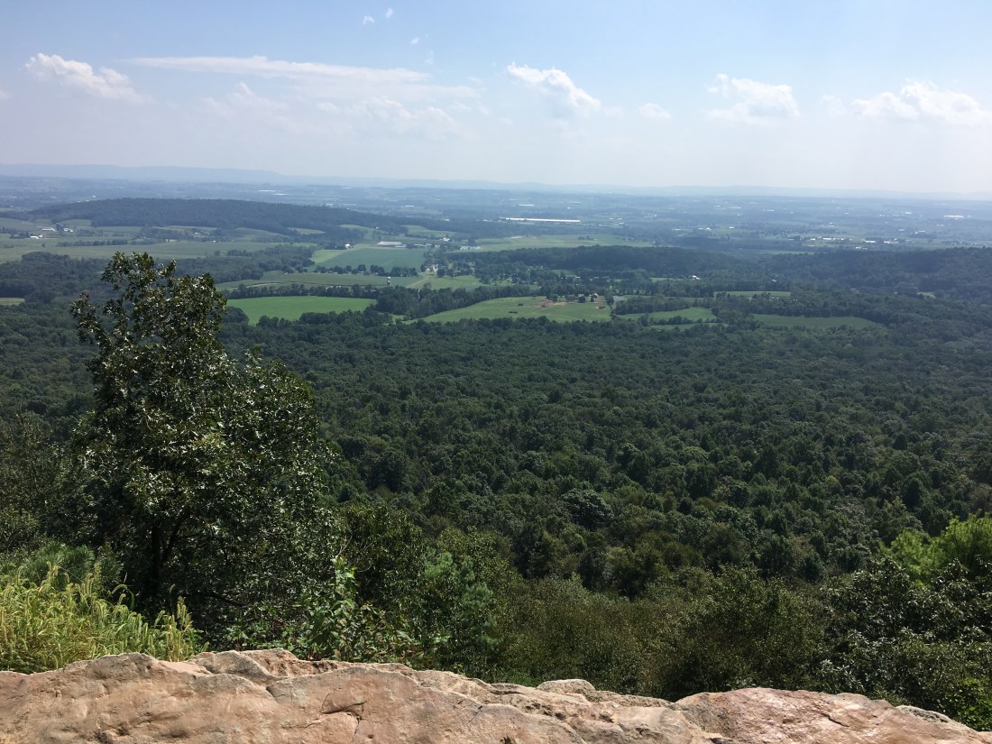
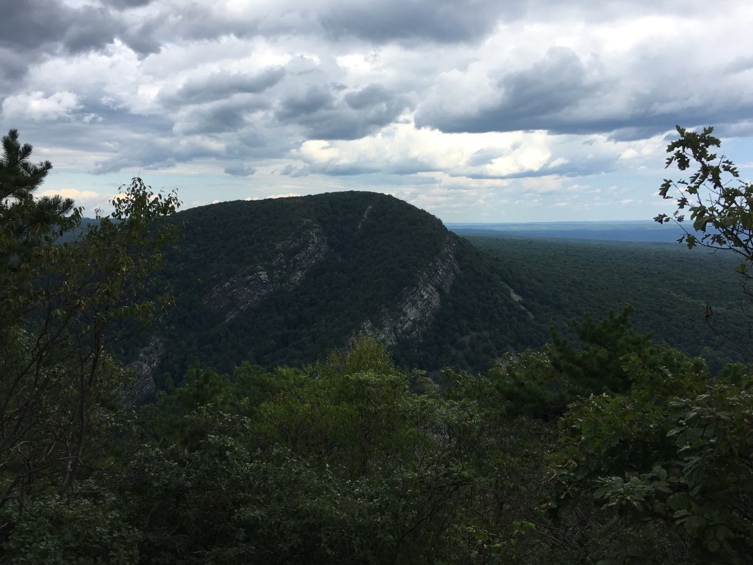
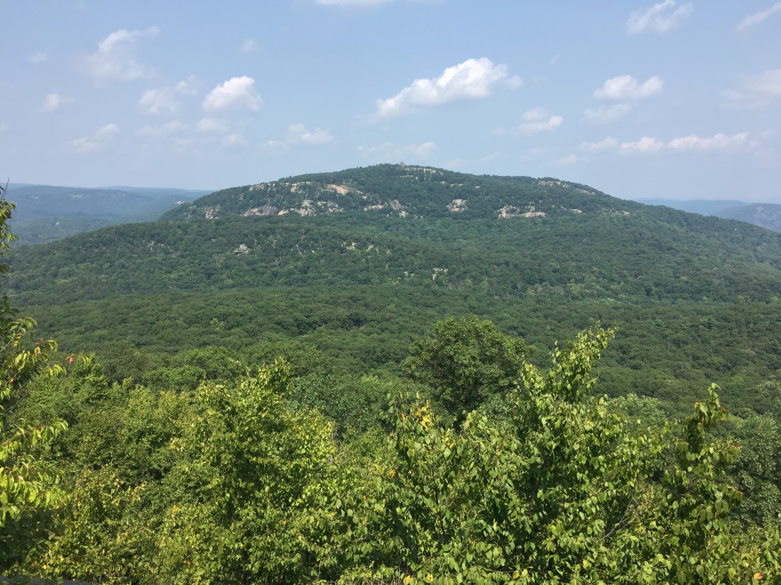
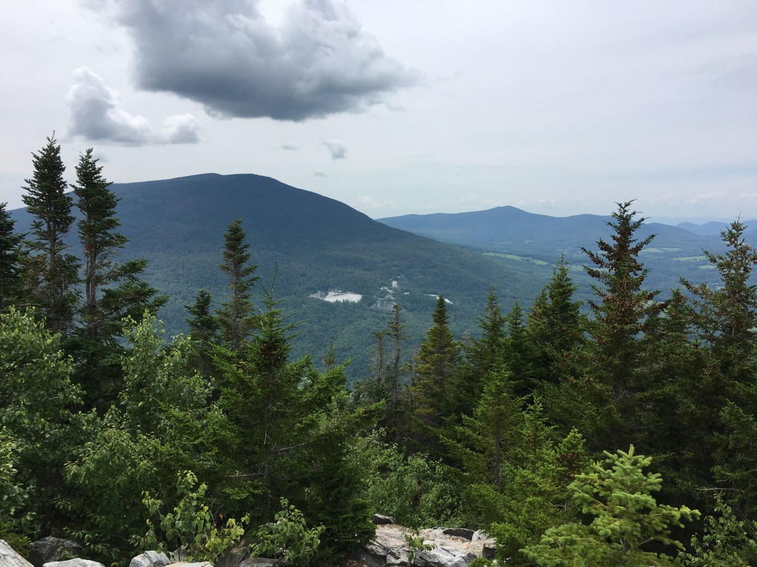
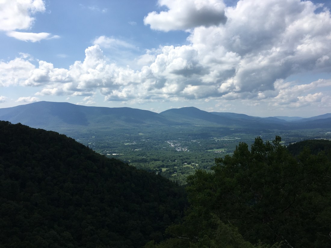
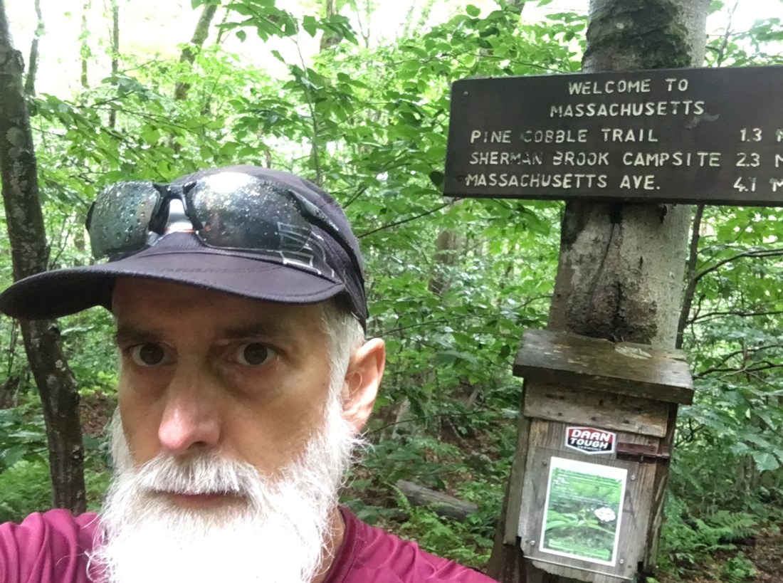
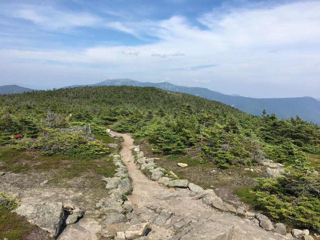
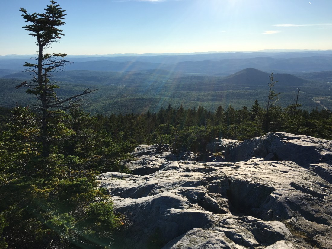
It was still raining mid-morning when I reached the northern park boundary at Possums Rest Overlook.  The rain continued most of the day, but the sun started to break through later in the afternoon as I approached Marshall Mountain.  The elevation at North Marshall Mountain was 3,368 feet above sea level — the first time the trail climbed above 3,000 feet since Mt. Greylock in Massachusetts.

F0369221-CB57-4F18-B184-7CB627A5A887
Afternoon View to the Northeast from Marshall Mountain
B047C03E-6D9B-4047-B6BD-1FEF0F3BD481
Afternoon View to the Southeast from Marshall Mountain

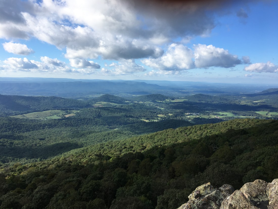
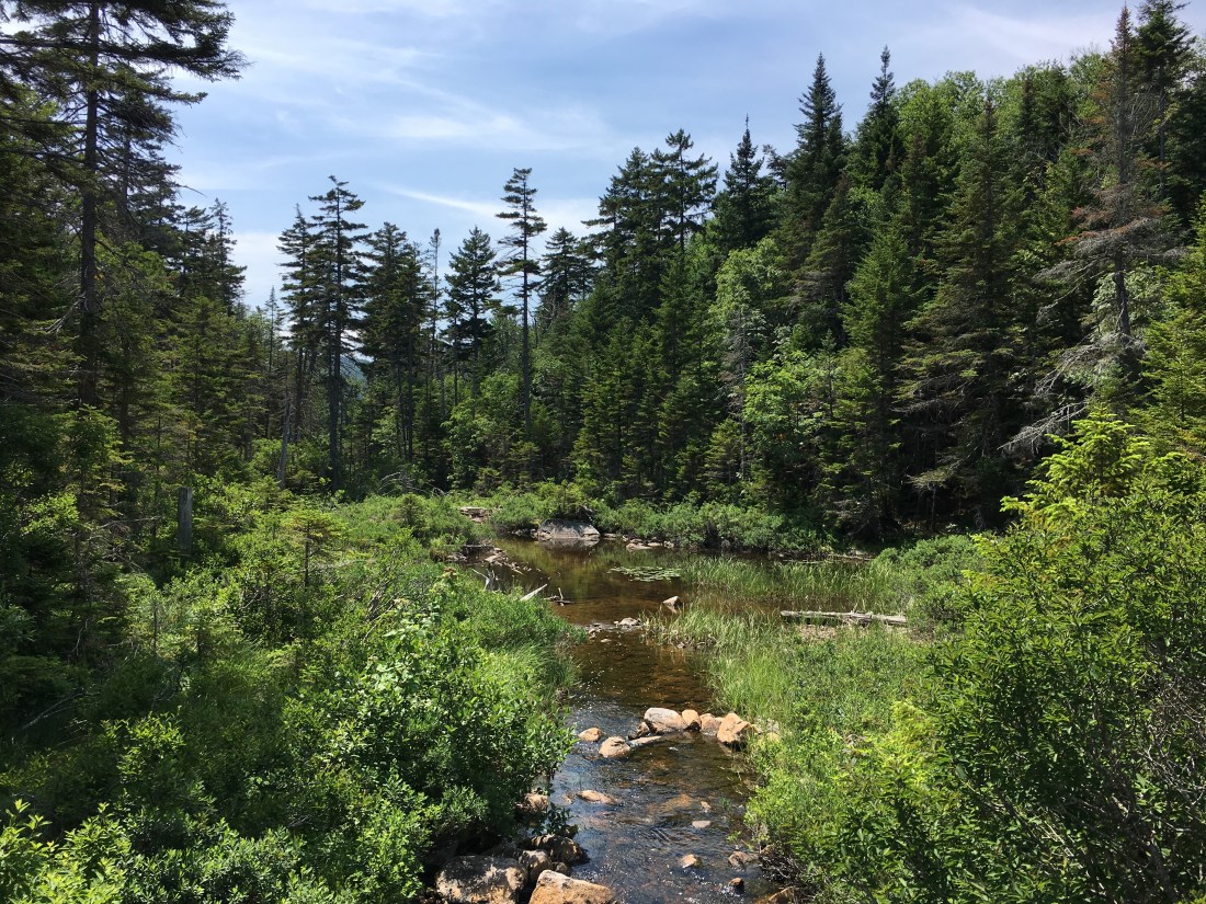
Clear skies prevailed into Wednesday morning as I worked my way across the three peaks of Hogback Mountain.  Just about the time I felt my shoes were finally dry that afternoon, the skies began to rumble.  While  I was spared a thunderstorm, a steady rain did fall long enough to get my shoes wet again.  As my clothes rarely dry due to the humidity, and my pack cover kept my gear dry, my shoes were the only casualty from this rain.

7B37F20F-30DE-429B-A37E-D8B373679063
View from Hogback Mountain

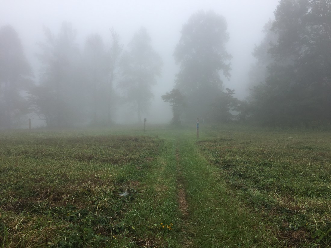
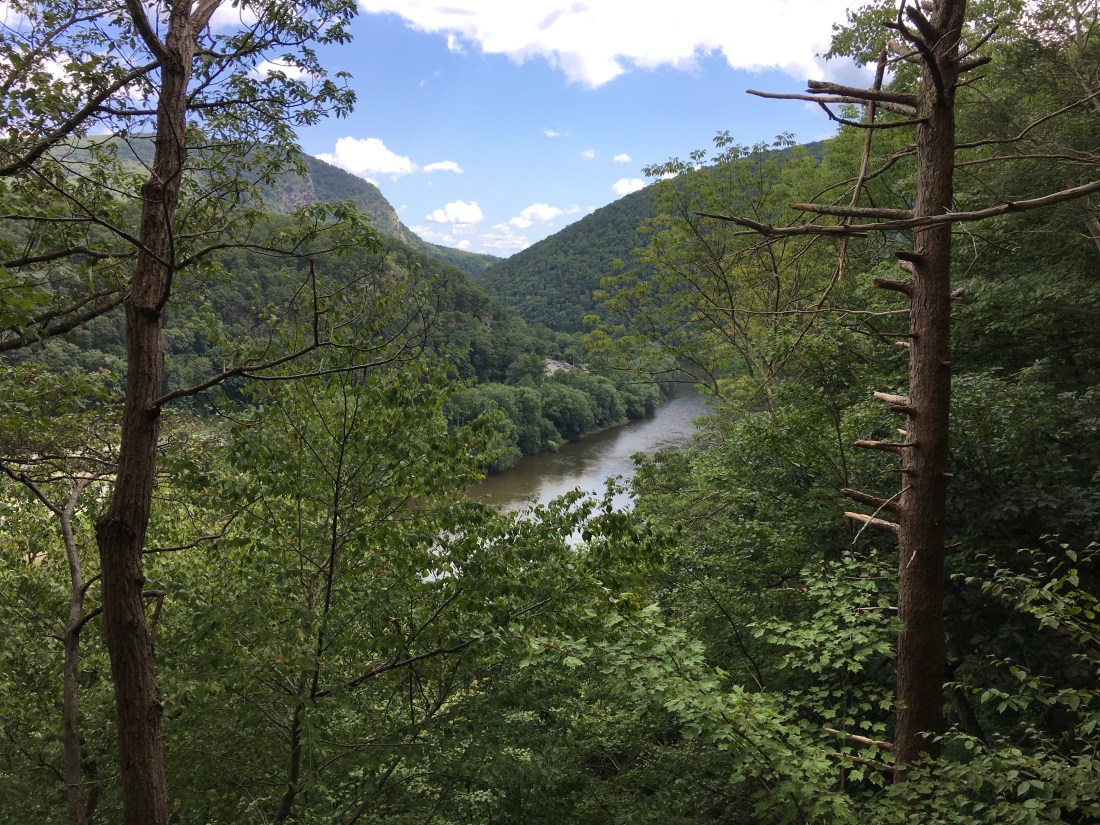
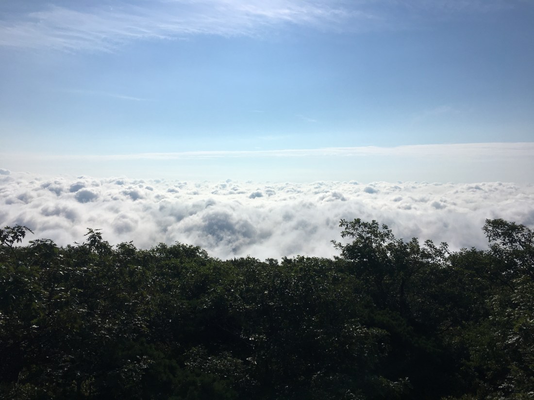
Thursday morning brought a dense fog from low-lying clouds; however, I quickly climbed above the clouds and was greeted by sunshine on my way up to Mary’s Rock.  While looking for the origin of the name, I found that Skyline Drive passes through a 610 foot long tunnel through the mountain.  I also found at least five possible origins of the name, mostly pertaining to the wife or daughter of Francis Thornton, who owned most of the land in area in the early 1700s.

935F1FA4-EE53-4343-A6E1-55B16F686312
View of Thornton Gap from the Trail Ascending Maey’s Rock
79607307-809A-471C-B80E-87DAA376E13C
Low-Lying Clouds over the Town of Luray from Mary’s Rock
BD573600-9DBB-44D0-BE5E-31EC490504F9
The Summit of Mary’s Rock

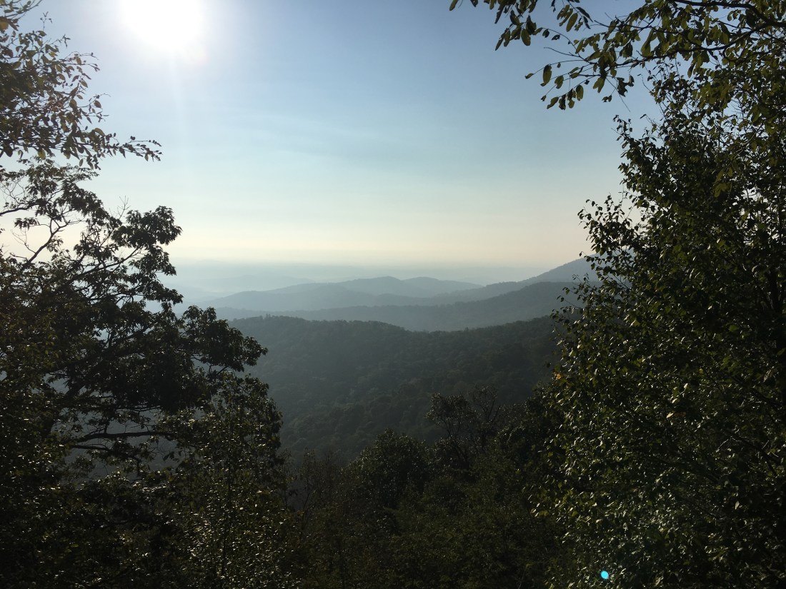
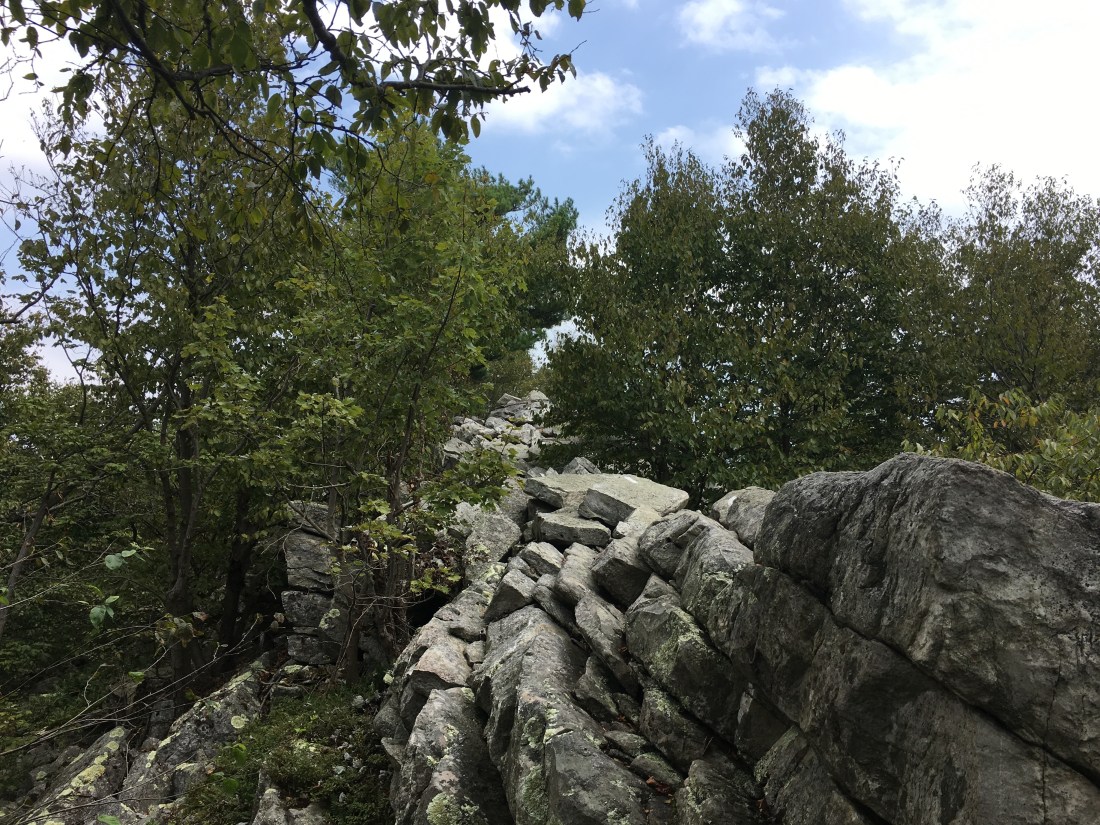
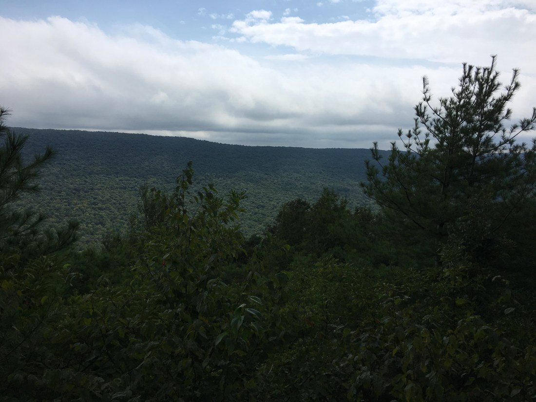
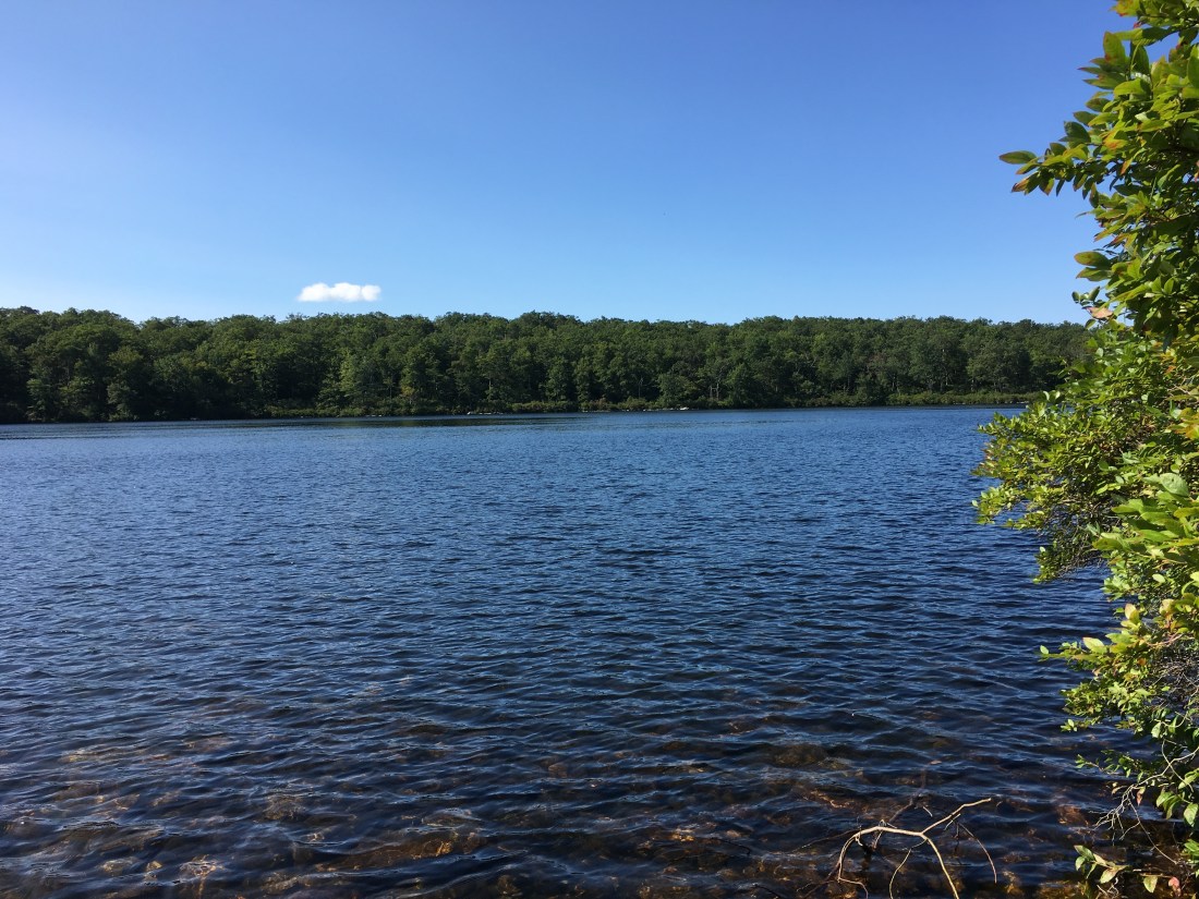
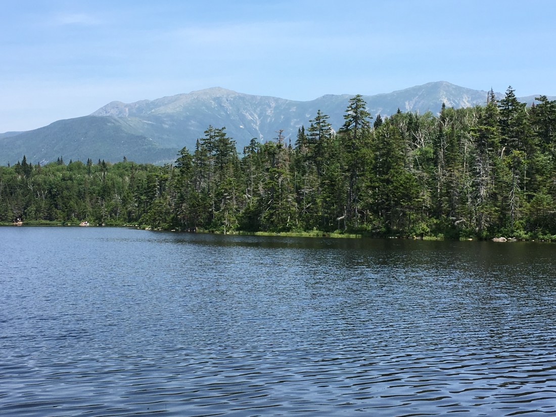
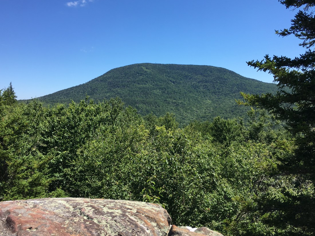
Eventually, the fog came in to the higher elevations and I was in and out of the clouds as I crossed Little Stony Man and Stony Man Mountain.  Stony Man required hiking a side trail off the Appalachian Trail, which I decided was worth the effort to see the view.

3617EF85-9EE1-42E3-9BEF-E3F8B75FF7AB
The Ledges of Little Stony Man
878CD673-5421-4F81-AE9E-076EA0CD7396
Stony Man Mountain Viewed from Little Stony Man
A8BFBD97-496E-40B4-8250-05DE92CCD299
View from the Summit of Stony Man Mountain
772EF1A8-BA83-44D2-8030-6EFF5FD3FD30
Uncle Malty on the Summit of Stony Man Mountain

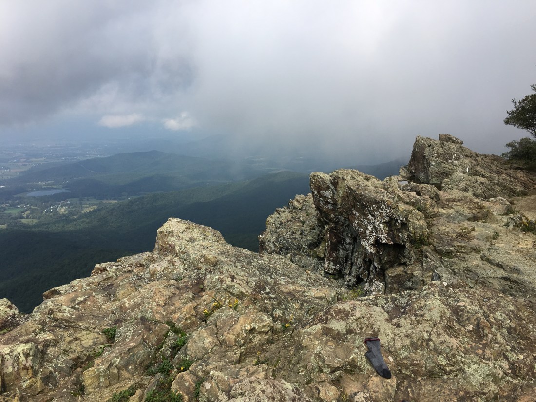
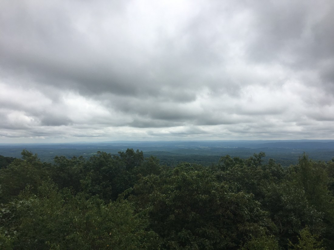
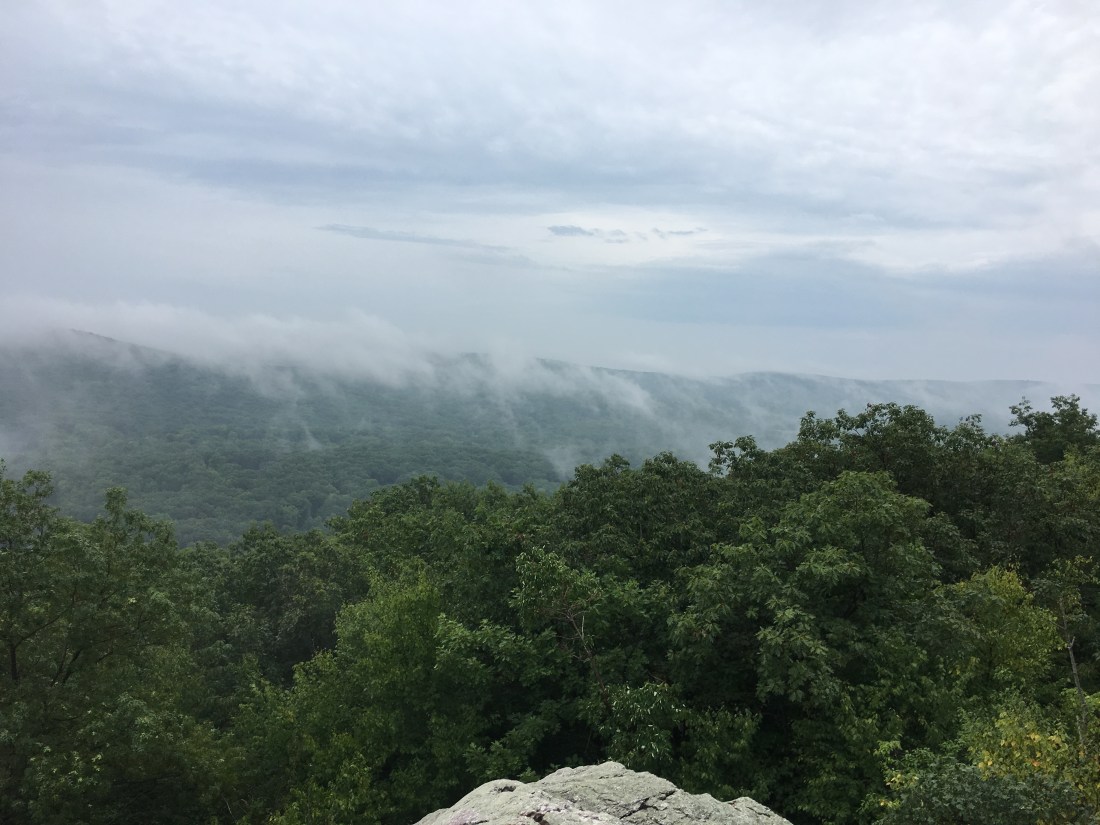
The rain came in again Thursday night and I woke to another foggy morning.  A few breaks in the clouds allowed limited views at Fishers Gap.  The rest of the day was foggy with intermittent drizzle.  The day ended ascending into a cloud of mist covering Hightop Mountain, where I camped at a shelter after descending partway down the south side to an elevation of 3,175 feet.

61D67D49-ADF1-4198-AA1B-06087A5CAA08
View at Fishers Gap

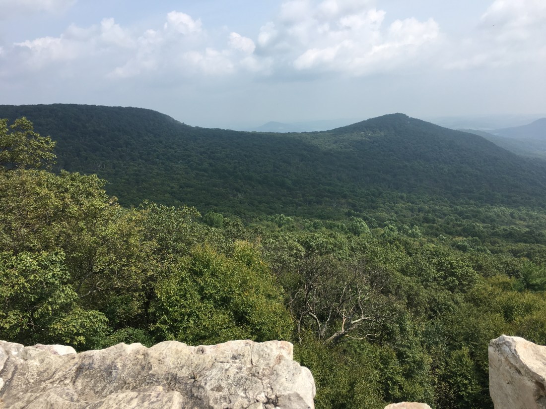
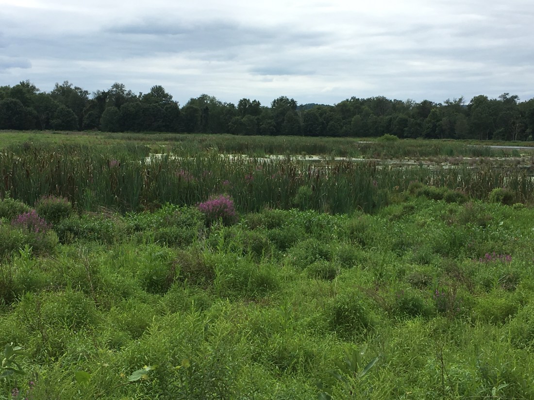
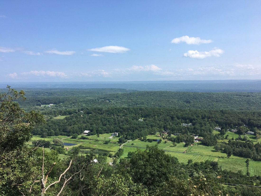
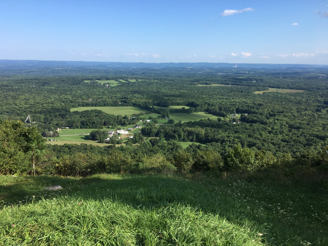
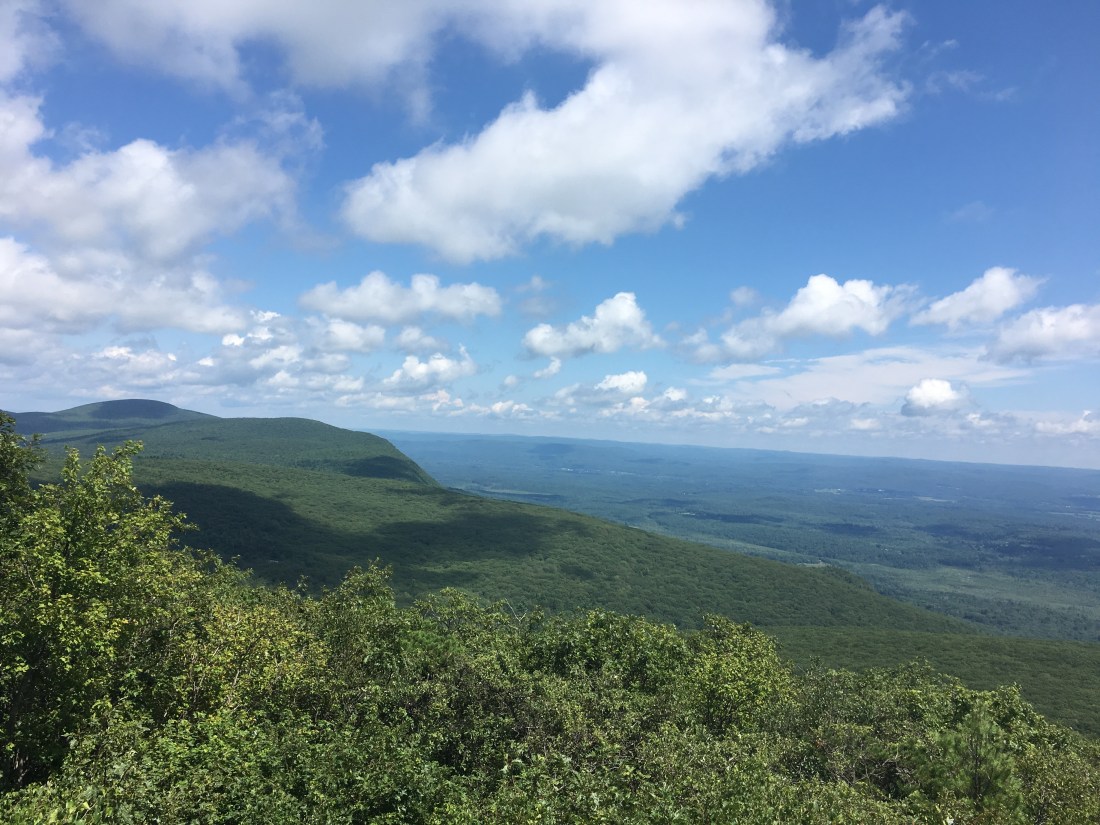
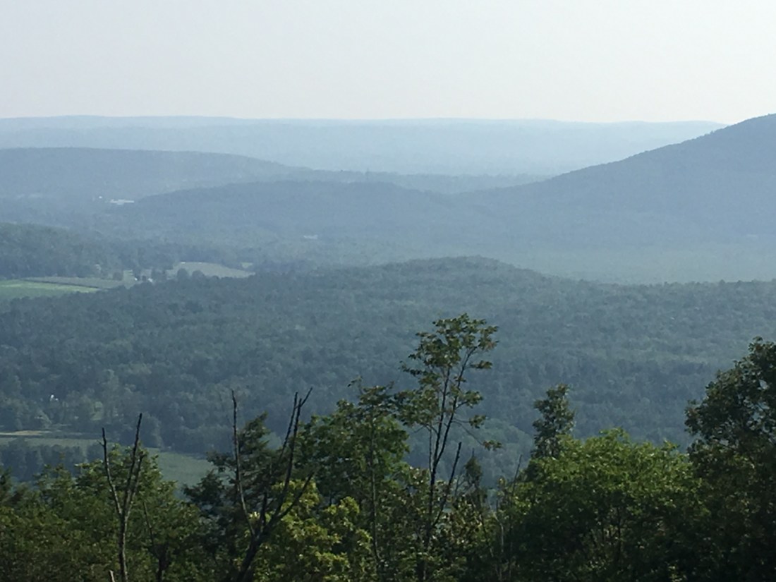
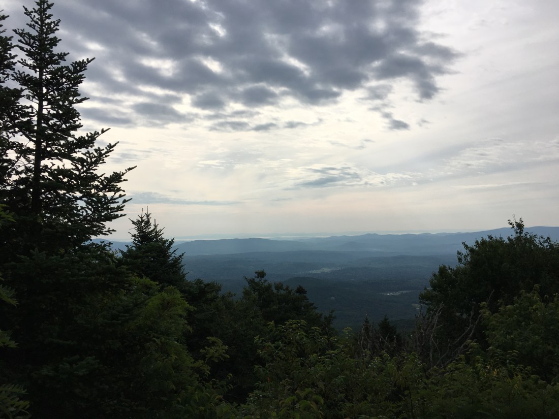
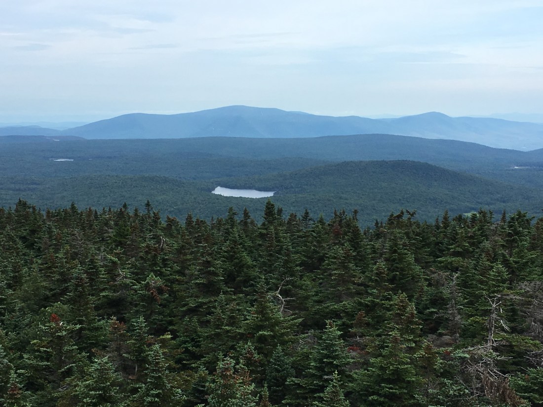
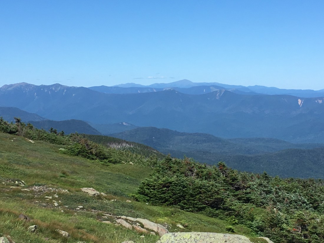
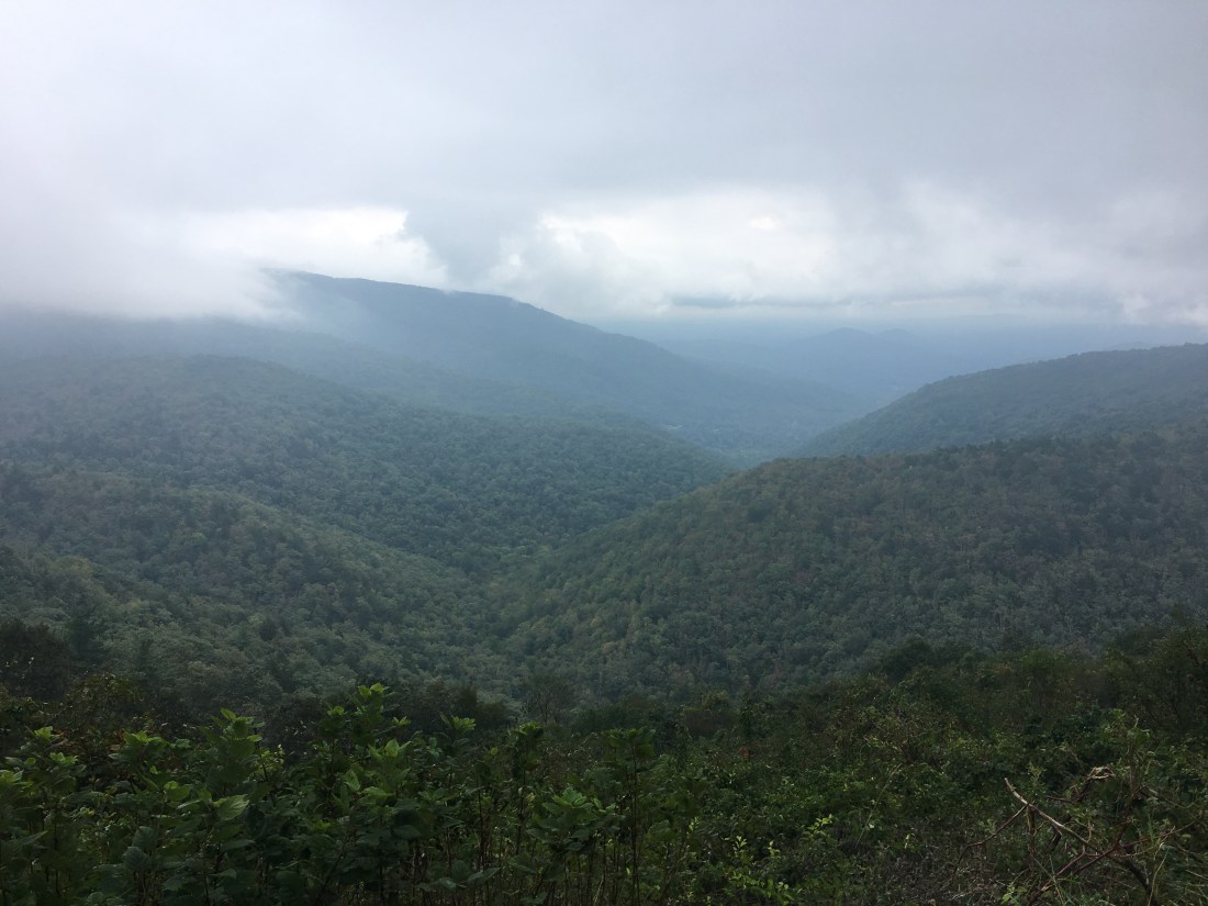
I was momentarily encouraged Saturday morning when I woke at 5:30 and could see a star-filled sky.  Much to my dismay, the fog rolled back in shortly thereafter.  I had a foggy view at the Ivy Creek Overlook.  It was a pleasant view despite the fog, and it certainly would be a beautiful view on a clear day as the leaves begin to change color.

2CE384C1-5781-4690-8855-F71649BF4CD2
View at the Ivy Creek Overlook

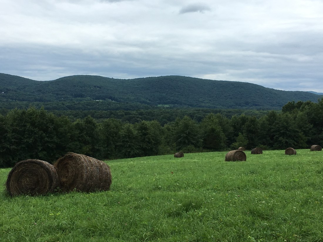
One of the advantages of hiking in a National Park is having places to supplement my usual diet.  I was slowing down by mid-afternoon and still had 7.5 miles to complete, so I stopped at the Loft Mountain Campground Store on Saturday afternoon for an ice cream sandwich and bottle of Coca Cola to supplement my lunch.  Recharged with sugar and caffeine, I quickly reached the Blackrock Hut, my home for the evening.

Sunday was my last day in Shenandoah, and the rain kept my camera in my pack the entire day.  The reports I heard indicate that Florence has looped back around and a stationary low pressure front will keep rain in the area for several more days.  The day dragged on, but eventually I reached the southern boundary of the park at Rockfish Gap.

I am spending today at Stanimals 328 Hostel in Waynesboro, Virginia.  I won’t be able to wait out the storm and will be back on the trail again tomorrow.  The 10-day forecast does not include sun, but I remain optimistic that the sun will shine again before I reach Springer Mountain.  Regardless, I do still have some work to do.

Maryland, West Virginia, and Northern Virginia

The past week has been a mixture of clouds, fog, and rain, and progress has been slowed due to scheduled and unscheduled breaks.  However, the sun should return soon and I look forward to entering Shenandoah National Park when I resume my hike tomorrow.

I crossed the Mason-Dixon Line into Maryland over a week ago on Thursday, September 6, just before lunchtime.  Shortly after, I reached Pen Mar County Park and enjoyed a view of Pennsylvania as I ate my lunch.  The afternoon was a mixture of hiking over rocky ledges, through forests, and across open fields.

4C4DD6F2-351B-4470-94C8-E9AFD5FECB78
Crossing the Mason-Dixon Line
D18E6361-3572-4E8A-A96D-789B1B8D1F8F
View Across the Maryland-Pennsylvania Border from Pen Mar Park

Friday brought more of the same, but also brought me to Washington Monument State Park.  The park is the site of a monument constructed in honor of George Washington in 1827.  The monument is much smaller than the one on the mall in Washington, DC; however, it was nonetheless impressive.  The tower offered nice views of the surrounding countryside from its observation deck, including several Civil War sites such as Antietam.

B054791D-C34A-47D3-A993-7E9A8ABA3639
The “Other” Washington Monument
D639324F-EBC5-45BE-9184-04959142B7B2
History of the Washington Monument
4347F656-7F1F-45AE-90F1-57B8C6273EBF
View from the Observation Deck of the Washington Monument.

Although we had threats of thunderstorms most of the preceding hot and humid week, the rain finally started to fall Friday evening.  I was camped on a tent pad at the Dahlgren Campground and the rain came down fast and hard enough that at one point I could feel a half-inch of water accumulated below the tent floor.  Fortunately, the tent remained watertight and the water subsided before morning as the rain gradually let up.

Saturday morning dawned with foggy overcast skies and the threat of more rain.  I started the morning passing through a Civil War site in Fox Gap.  A monument marked the location where Confederate Brigadier General Samuel Garland, Jr. was mortally wounded in the Battle of South Mountain, just prior to the Battle of Antietam.  I missed a second monument in the area where Union Major General Jesse Lee Reno was also mortally wounded  in the battle.

1C9FA550-F581-43C0-940F-E7137842C7A5
Monument to Confederate Brigadier General Samuel Garland, Jr.

Later that morning I passed through Gathland State Park, which contains the estate of Civil War correspondent George Alfred Townsend.  I passed the ruins of one building that was particularly interesting, but did not find any specific information on the origin of the structure.

18C93147-09CB-4988-82C9-EFF5A9886889
Ruins of a 19th Century Building In Gathland State Park

As I approached the Potomac River, the rain began to fall and continued for the next few days.  The last 2.7 miles of the trail in Maryland is on the old Chesapeake & Ohio canal towpath, between the Potomac River and the remains of the canal.  I crossed a bridge over the river and into West Virginia, noting that the water level was already high.  The next day the bridge and towpath were closed due to concerns with flooding with more rain on the way.

8F03F534-7860-44B7-882B-25C8FFED8ADE
Train/Footbridge Across the Potomac River

I spent the next two days at the Teahorse Hostel in Harpers Ferry.  The first day planned, and the second day unplanned.  Finding the hostel was a minor challenge as I had planned to use the Appalachian Trail map application on my phone, but was unable to “open” my phone due to the rain.  After stopping at the Appalachian Trail Conservancy office for directions, I was back on my way to the hostel.  I cooled off quickly while not hiking and was happy to reach the hostel and have a hot shower.  I spent the evening having dinner with two friends from Maryland, Bill Edwards and Neil Burbure, who drove into town to meet me.  Both are colleagues from my former job at the North American Electric Reliability Corporation (NERC), and Neil is also a current colleague at EN Engineering, having joined me at Energy Initiatives Group shortly after I left NERC.  Our hostel host, Ben, ran a very organized and comfortable establishment and kept us well fed with a breakfast of all you can eat waffles each morning.

Monday was still drizzly and so I decided to stay another day and explore the historic Lower Town.  I saw the U.S. armory fire house used as a stronghold by abolitionist, John Brown, when he and his men raided the armory in an attempt to arm and liberate local slaves in 1859.  The raid was ended in 36 hours by local farmers, militiamen, and U.S. Marines led by Robert E. Lee.  The history-rich area has inspired me to learn more about the Civil War and return to the area someday to investigate further.

6771E5FA-2A0B-4894-B5B2-058004331184
U.S. Armory Fire Engine House Used as Stronghold by John Brown
EE985363-49E0-4A11-A616-8709C900A4E4
High Street in Harpers Ferry Lower Town
621FBF02-733F-4C32-9583-998BA36E4BEE
The Town’s Inn in the Historic Lower Town District

A dense fog still covered the area the next morning as I departed Harpers Ferry, but at least the rain had stopped.  As West Virginia has the fewest Appalachian Trail miles of any state on my trip, I soon found myself crossing the border into Virginia.  The trail followed the border for much of the next two days and I crossed back into West Virginia briefly at least once.  By nightfall I received news that Shenandoah National Park would be closed until further notice beginning on Thursday in preparation for Hurricane Florence.  With only 33 miles remaining before reaching the park, I shortened my mileage for the next two days.  Fortunately, my wife Katie would be joining me on Friday for a planned weekend off the trail.

E634E55F-22C1-4451-98A3-523006F6C3BA
Crossing the Shenandoah River Leaving Harpers Ferry
968A2E1D-A107-4A0B-AAEA-1F4271AF550C
The First of Several Crossings Between West Virginia and Virginia

Tuesday afternoon and Wednesday morning took me across a section of trail known as the roller coaster.  Over 13.5 miles, the trail traverses up and down across 10 ascents and descents of 300 to 500 vertical feet.  The hills are generally rocky and none of the ledges provide views, even in clear whether.  The guidebook indicates the trail crews had no choice due to the narrow corridor allocated to the trail in this area; however, it seems the trail generally traverses every hill over its entire length.

FC670F49-8283-4C40-8166-E03D61C27BCE
Sign at the North End of the Rollercoaster

The fog persisted, no matter the terrain.  Even the open fields in Sky Meadows State Park offered limited visibility.

F04EEDB4-2393-4709-BF82-C83895E0DB3F
Crossing Sky Meadows on a Foggy Afternoon

I arrived at the Mountain Home B&B on Thursday afternoon and waited for Katie to arrive.  Our host, Scott, provided transportation into town and I enjoyed a bison burger, Vienna lager, and a dunkelweizen (a dark German-style wheat beer) at the Front Royal Brewing Company.

On Friday, Katie and I toured the Copper Fox distillery.  They are hiring and I was tempted to change careers after my hike, but decided the commute from Massachusetts would be a bit too long.  On Saturday, Katie and I decided to give Skyline Drive a try, but concluded on our way to Thornton Gap that it was not only too foggy to enjoy any views, it probably was also too dangerous to drive the winding road.  Instead we opted for Plan B and toured the Luray Caverns.

2B1CFCD0-4412-4CE5-BBC5-7602F56116A9
Inside Luray Caverns

The weekend was too short.  Katie is now back home and I am back at the Mountain House B&B.  The park is open, but the remnants of Florence are passing over the area today.  Given the heavy rain and wind, I decided to stay dry one more day before entering Shenandoah and working through the final 970 miles of trail.

Pennsylvania

I completed my trek across Pennsylvania on Thursday, two weeks and 229 miles after entering at the Delaware Water Gap.  It is not the most scenic state on the trail; however, the trail and facilities are well-maintained and despite the rocks, I maintained a pace better than two miles per hour.  The trail was predominantly a series of ridge walks around 1500 feet above sea level and about 1000 feet above the valleys below.  Most of the time was spent in forests, with an occasional scramble across a rock formation and sometimes breaking out of the trees to gain a view.  The southernmost part of the state also included some walking through or around fields of corn and soybeans.

My first full day in Pennsylvania was Friday, August 24.  Views that day must have been nonexistent or unremarkable, as I have no pictures on my phone.  The highlight of the day was lunch at the Cafe on Broadway in Wind Gap, where I enjoyed a cheeseburger and a thick, strawberry milkshake.  Normally, I would not have walked into town for lunch, but after three weeks in wet shoes I needed to visit the CVS pharmacy to take care of my feet.

Saturday brought me to a unique location on Blue Mountain overlooking the town of Palmerton, which was the site of a zinc smelting factory for most of the twentieth century.  The smelting process released heavy metals into the water and air, and the air emissions drifted toward Blue Mountain, killing the vegetation and wildlife on over 2,000 acres.  Reforestation of Blue Mountain is finally taking hold after being on the EPA Superfund list for years, although I observed that some barren areas still remain.  The Appalachian Trail has been rerouted several times in this area.

41FE39BE-7D3F-45A3-AF98-428D8D8BB904
The Appalachian Trail Crossing a Revegetation Area on Blue Mountain
55801489-E671-4D60-A8F1-847B90486F81
Palmerton, PA Viewed from Blue Mountain
773F7815-89C8-4AFA-88D0-BBA6AE870670
Notice of Rerouting Associated with Restoration of Blue Mountain
664DAE39-83B1-4A0E-8E8E-4E576E2C807A
View Across Lehigh Gap from a Barren Slope on Blue Mountain

The trail, on Sunday, took me past several rocky sections including Bake Oven Knob and the Knife Edge.  Bake Oven Knob provided a nice view, although the area suffers from significant graffiti.  Signs warn that possession of spray paint cans is illegal, but do not seem to be much of a deterrent.  The Knife Edge was simply a tedious scramble across a ridge of large boulders.  Unlike the knife edge on Mt. Katahdin in Maine (which fortunately, from my perspective, is not part of the Appalachian Trail), this knife edge did not drop precipitously.

F563374F-8F1F-4506-8AE5-9D54FF25BCC7
A Rock “Decorated by Local Artists” at Bake Oven Knob
690ABD25-4AE7-4DF8-B00D-407E179041FB
View From Bake Oven Knob
56AD1049-BB9B-44AC-91A1-6968E746C145
The Knife Edge

Monday brought me to the Windsor Furnace area and a nice lunch spot at Pulpit Rock.

BF974D4F-B503-47AE-B755-2CC564970A85
Lunchtime View from Pulpit

Scenery the rest of the week was limited as I was mostly walking through forests and the few overlooks were mostly overgrown.  I did have nice views on Wednesday from the Shikellamy Overlook and Kimmel Lookout.

BF00B25E-2700-4590-AB73-5737D6A7B910
View from Shikellamy Overlook


43C9E320-F4A2-4243-8D12-5326839D2899
View from Kimmel Lookout

Thursday, I passed under interstate highway I-81 and over Swatara Creek.  Just before reaching my destination at Rausch Gap, I came to an area flooded by beaver activity.  While the area I had to cross was outside the beaver pond, it appeared that water from the pond was breaching the top of a berm and flooding the surrounding area.  After surveying the situation and finding no expedient way around, I changed from my hiking shoes to my Crocs, which I wear as camp shoes in the evening, and reluctantly waded across.

FEAFDAD4-23FE-4F00-B103-CCBC4563F568
Bridge Across Swatara Creek
F92D67F9-402A-4FDD-9F24-C45C17AA6741
Trail Flooded by Beaver Activity Near Rausch Gap

On Friday, I was in the forest virtually all day.  I did pass one viewpoint at Shikellamy Rock.  While it was overgrown and did not offer much of a view, it did offer some relief from the “green tunnel” in which I had been traveling.

B2A71E52-A206-4886-93B9-1C6FBE4F0D33
Overgrown Viewpoint at Shikellamy Rock

Friday night brought rain and relief from the heat, but not from the humidity.  Saturday morning started foggy and the day was overcast, at best.  At one interesting point, the trail passed directly under a steel lattice tower of an electric power transmission line.  While I had crossed many rights-of-way, this was the first to pass directly  under a transmission tower.  The day ended crossing the Schuylkill River into the town of Duncannon.  I took relief from my travels at the Doyle Hotel.  The building was constructed over 100 years ago and has seen better days, but $25 for a room with a shared bath down the hall was worth a try.  As it turned out, I was satisfied that I received my money’s worth.  The owners were very friendly and I enjoyed Buffalo-style chicken wings and a cheeseburger at the bar downstairs before heading out for what turned out to be the largest mint chocolate chip ice cream cone I can imagine — three scoops the size of baseballs made me glad that I ordered the small size!

57B2AA69-D116-42B6-856D-8FD545E88408
Looking Straight-up Under a 230 kV Transmission Line Tower
BE4B0527-4470-4CEE-BC6E-22E4EF94028C
Crossing the Schuylkill River Entering Duncannon

Sunday brought me to some flatter ground after I descended from Cove Mountain.  The trail in this area crosses land purchased by the Appalachian Trail Conservancy to preserve space for the trail.  The land is either leased to farmers, or sold with a permanent easement for the trail.  I am not certain which; it may vary among the various parcels

83205AA9-1A88-4B15-B80C-BFBE0947590E
Appalachian Trail Farmland 

Sunday evening was a special treat as I was the guest of my Delta Phi fraternity brother, John Caddell, and his family.  Departing on Monday, well-fed and with clean clothes, John hiked with me for the first two miles or so.  The heat and humidity returned for the week and I was able to stop for a cold drink in Boiling Springs between crossing more farmland and ascending up to Center Point Knob.

4279EBC7-10A5-42B3-A5F9-A1A43456C16D
Monument at Center Point Knob

The official midpoint of the trail varies from year to year as various sections of the trail are rerouted.  On Tuesday afternoon, I reached the official 2018 midpoint — 1095.5 miles down and 1095.5 miles to go.

DAA56851-3DDE-4B05-94B7-1848285D39B3
Uncle Malty at the Appalachian Trail Midpoint

The rest of the week was under tree cover.  I felt fortunate to have the shade given the temperature was in the low 90s all week.  On Thursday I reached the Mason-Dixon Line and crossed into Maryland.

New Jersey and the Delaware Water Gap

I crossed into New Jersey last Saturday, August 18, near a place called Prospect Rock.  The rocks had dried out by this point in the afternoon and my outlook began to improve as I made my way to camp for the night.

9A5329DD-E9AB-4EAD-B567-EC99DCA217E4
The New York-New Jersey Border on the Appalachian Trail

The trail in New Jersey follows the New York-New Jersey border, often less than a tenth of a mile from New York.  Sunday morning included a mile-long boardwalk across a large bog, although being in New Jersey, I prejudicially kept thinking of the word swamp (I blame Bruce Springsteen for this — “somewhere in the swamps of Jersey”).

96B2CB15-D642-4DF9-93C7-668ACDA3B460
A Mile-Long Boardwalk Across the Pochuck Creek Wetlands

Late morning brought me to a road crossing with a choice between a hot dog vendor and a farm stand with a deli and ice cream.  I opted for two hot dogs with sauerkraut, a bag of chips, and a can of ginger ale.  In addition to feeling like having a hot dog, the hot dog stand had a Grateful Dead “Steal Your Face” sign on the side, which may have been the deciding factor.  While there was nothing stopping me from crossing the street for ice cream as well, I decided not to be a glutton and headed back to the trail.

After my early lunch I crossed over Pochuck Mountain and through a conservation area that included a large marsh that appeared to attract a large number of birds.  I passed several bird-watching couples with binoculars.

B488E587-4C7C-4AA8-87F5-20483D861380
View from Pochuck Mountain


40A521CA-75BF-49FB-91CE-532D939C2A66
The Wallkill River Marsh

As I neared the end of the day, I had another change in scenery as I crossed a field of hay bales.  My destination was Lott Road, which would take me over the state line into New York where I was able to camp behind the Town Hall.  My real agenda, by no means hidden, was to dine on Buffalo-style chicken wings and a cheeseburger, washed down with a cold a beer, at the Wit’s End Tavern.  This also gave me a chance to become better acquainted with Spork, Happy, and Kayak — fellow south-bounders that I occasionally meet on the trail.

AD02CBB8-F212-43B2-9482-9ADDE1332D3D
Hay Bales in Rural, Northern New Jersey

Monday brought me to High Point State Park in New Jersey and a new geological phenomenon, known to thruhikers as the “Pennsylvania rocks.”  I had first heard of them reading Bill Bryson’s book, A Walk In The Woods.  The worst are jagged rocks, with their pointy corners or edges sticking up out of the ground.  So far, the rocks are not as bad as they are hyped up to be.  I have hit plenty of rocky sections in the past week, some with the dreaded pointy rocks, others with loose “scree” rocks, some covered with medium size rocks, and others that look like an avalanche of large boulders.  All have been separated by sections of easy trail.  I have been told I am through the worst of them.  Regardless, as I am now approaching Duncannon, PA, where I have been told the rocks will end, I am finding them quite tolerable compared with the mud in Vermont.

5D452ED8-BEAC-41DA-90FB-DE8A855AD7C9
The High Point Monument, Marking the Highest Elevation in New Jersey
37710404-DE56-412C-B251-7D3EF00E8977
View from the Observation Platform in High Point State Park

As I proceeded through the week, I found the trails in New Jersey to be agreeable to my feet and continued to make good progress toward Springer Mountain in Georgia.  Lunch on Tuesday included some nice views from a pavilion on Sunrise Mountain.

A4EE0C08-BF2F-405A-8CF6-43EA5A445D1E
Lunchtime Scenery from Sunrise Mountain

Wednesday brought me to the edge of the Delaware Water Gap National Recreation Area, although views this day were still dominated by rural landscapes, whenever the trail ascended out of the woods.

7FCD92BA-3DA5-4DBD-8B6C-DFEFE62243E3
More of Rural New Jersey from Kittatinny Ridge

Thursday brought me to the Delaware River.  I had a nice overlook from Raccoon Ridge on Kittatinny Mountain, before descending to Sunfish Pond, the southernmost glacial tarn along the Appalachian Trail.

A1C9997C-42A4-4AB5-8173-73F2C2D9CC0D
Delaware River and Water Gap from Raccoon Ridge
E936D2B6-8E22-4475-B002-F2CDF6228672
View from the Shore of Sunfish Pond

After descending alongside Dunnfield Creek, it was time to cross the Delaware Water Gap.  The footpath is a pedestrian lane on the Interstate I-80 bridge.  While I am sure it is nearly perfectly safe, it was a bit intimidating walking alongside large trucks, separated by a waist-high, 10” thick concrete divider.  I put my hat in my pocket to avoid having it blown into the river below by the breeze from a passing truck, and stopped just once, to take a picture at the state border as I passed into Pennsylvania.

1683D1A5-31D0-4D66-A89A-44B09941A319
Cascading Water in Dunnfield Creek, Headed to the Delaware River
50626AC3-B0D7-4D26-9F9C-60E241FF81D0
Uncle Malty’s Trekking Poles and Shadow Straddling the New Jersey-Pennsylvania State Line

The trail into Pennsylvania quickly ascended 1000 feet above the river, providing views into the water gap, as well across the water gap from Mt. Minsi in Pennsylvania to Mt. Tammany in New Jersey.

BD9DB220-34A4-46CC-9787-2F8286527D4B
The Delaware Water Gap from Mt. Minsi
471CABCE-7AF5-40F6-A249-42052CBC8256
View of Mt. Tammany from Mt. Minsi

As the afternoon proceeded, I hiked along a ridge on Kittatinny Mountain in Pennsylvania, with occasional views into the valley below.

4417528D-96A3-4F33-9137-89D74D34E6A8
Rural Pennsylvania from Kittatinny Mountain

The hike has now proceeded halfway across Pennsylvania, which I will describe in my next post.

New York

Entry into New York last Monday, August 13, was uneventful, without even a sign to mark the occasion.  Most of the day was the proverbial, walk in the woods, with no views.  Rain started about lunchtime and lasted the rest of the day.

Tuesday morning brought me past Nuclear Lake, the site of a nuclear fuels-processing research facility until 1972.  The site has been tested and apparently has been given a clean bill of health after the facility was decommissioned.  The afternoon provided a nice view from Hosner Mountain. 

A6C13FD6-14CC-4ED7-96AC-2EB751D9EC71
An Overcast Morning Passing by Nuclear Lake
075258DC-440B-42E5-BC0B-1BAE131B39BA
Afternoon View from Hosner Mountain

I spent Tuesday night at the Ralph’s Peak Hiker Cabin, a shelter that is located on a residential, but fairly rural street not far from the Taconic Parkway in Hopewell Junction, New York.  This allowed me to take a break from my usual routine and order Chinese food.  I was hungry enough that meeting the $15 minimum order for delivery was not a problem.

Wednesday brought me to a 32-mile stretch of trail with no official shelters.  I have been told the shelters in this section were razed to prevent issues with homeless people from New York City.  The trail passed Canopus Lake.  Given the heat and humidity during the week, I would have liked to stop at the beach for a swim.  However, as it was 9:30 in the morning, I decided I would rather put in as many miles as possible before the day heated up too much.

0323F639-FAF6-423E-9D61-E676B954DDD4
Canopus Lake

I spent Wednesday night camped on the ball field at the Graymoor Franciscan monastery.  The monks have welcomed hikers since 1972, and the site is quite popular.

Thursday brought me the closest to New York City.  I crossed another suspension bridge.  This one, the Bear Mountain Bridge, was large enough that I did not notice any movement as I walked across.  The trail passed through a small zoo after crossing the bridge, giving me my first view of a bear on the trip.

4C8F76C4-AAFB-4579-BBAA-BED6B587DA31
Entering Westchester County
704C0EFC-6791-410C-9736-5B39664980F2
The Bear Mountain Bridge

The afternoon included views from the summits of Bear Mountain and West Mountain.  I had some unexpected excitement later in the day when I found out the trail requires crossing the Palisades Interstate Parkway.  Fortunately, traffic was light; the crossing provided a good line of sight; and there is a wide median, so I only needed to cross two lanes at a time.  However, this seems like a crossing that definitely requires a footbridge or underpass.  Ironically, after seeing the first bear of the trip in the zoo that morning, a mother and two cubs were spotted near the campsite that evening.  Fortunately, no issues occurred other than some weekend campers had their food taken during the night.

9D48D8ED-BC34-42C3-871B-275E135F768D
View from Bear Mountain
5A231E62-8D05-48EF-8CBB-F369AEE45970
View of Bear Mountain from Black Mountain

By Friday the heat, humidity, and bugs were getting to me.  The trail provided no unique views on this day.  The highlight was when my son, Brian, met me with a resupply of food during the afternoon.  We took the opportunity to drive into Monroe, New York and had lunch at a pizza restaurant.

A heavy rain on Friday night did nothing to improve the heat, humidity, or bug situation, and resulted in wet, slippery rocks on the first day in a while that involved a lot of scrambling on open ledges.  Views were muted by early morning cloud cover, which seemed to exacerbate the humidity.

5B9FB3B7-A895-4A9A-A614-2700364B0A40
Overcast Morning View from the Cat Rocks near the New York-New Jersey Border

The open ledges provided some relief from the bugs, until the trail ducked back down into the woods.  I was at a low point mentally on this day, as there seemed to be no end in sight to the hot, humid, and rainy weather.  Fortunately, a phone call home to Katie provided needed emotional support and the weather is now improving as I work my way across New Jersey.

Connecticut

I entered Connecticut last Thursday, August 9, at Sages Ravine.  The stream at the bottom of the ravine has several cascades, but I never seem to be able to capture them adequately with my camera (and so I did not try).  The ascent from the ravine headed straight up to the summit of Bear Mountain.  There was plenty of scrambling up the rocky slope and I was glad I did not have to descend by this route.  From the summit, I was able to look back to Mt. Everett and Mt. Race in Massachusetts, as well as look forward to the upcoming trail in Connecticut.

A10EC562-7183-45AB-A8EE-0F388DF60BE3
View from Bear Mountain Looking Back to Mt. Everett and Mt. Race
C6C60138-CC44-4EF2-A39D-656F7F613766
View South into Connecticut from Bear Mountain

I had planned to spend the night in Salisbury and was glad to find good trail conditions from Bear Mountain into town.  Even though I was meeting my son, Brian, in two more days, it was time to dry out and do laundry after the rain in Massachusetts.  Being in town provides other amenities I miss, so after a shower I headed over to the White Hart Inn for a burger and a cold beer.  The Sea Hag IPA (India Pale Ale) was a delicious local selection.  After dinner, I went to the local market to supplement my food supply, and I also picked up a pint of Ben & Jerry’s Cherry Garcia ice cream, which I ate in one sitting for dessert.

Apparently, my dinner and dessert selections provided a good base of fuel for my hike on Friday, as I was able to cover 24.8 miles.  This is the most miles I have hiked  in one day so far, and a feat I may not repeat.  I also was inspired by the weather forecast, as I knew it would be raining on Saturday and so I decided to “make hay while the sun was shining.”  The day started with an ascent of Prospect Mountain and proceeded on to Falls Village.  The Housatonic River drops 60 feet at Great Falls, providing a spectacular, thundering  water fall.

2BAF0ED6-CA5B-411F-8C25-1EF36EF7B5EA
Early Morning View from Prospect Mountain
934CE7D9-CE63-4860-869C-330EF66195CD
Waterfall on the Housatonic River in Falls Village

The afternoon found me listening to the drone of engines from the Lime Rock Speedway.  It seemed that no matter what direction the trail turned, the noise continued for well over an hour.

I was concerned as evening approached whether I would have the energy to finish the last 3.7 miles to the shelter, when I came to a road crossing and scored some trail magic.  A man named Paul was there with ice-cold Coke, bananas, and moon pies — the latter being alternating layers of cake and marshmallow, covered in chocolate, reported as containing 300 calories.  After a Coke, banana, and moon pie, and some discussion about Paul’s upcoming hiking trip to New Hampshire with his son, I was adequately fueled and ready to go.  I completed the hike as the sun set, made a sandwich for dinner, and headed to bed.

The next morning, I had 7 miles remaining to arrive in Kent, CT to meet Brian.  The morning started with a steep ascent up to St. John’s Ledges and Caleb’s Peak.  I finished the rocky part of the day just before the rain started and safely descended to Kent.

C85BBDB9-3104-4DFE-B9D5-CBE624A18CA6
View Toward the Housatonic River from St. Johns Ledges
F29667C0-9AA8-4CA0-A33F-39A9847A65AD
View from Caleb’s Peak

Brian graciously chauffeured me on errands and I replaced my trekking poles at REI.  The pair I had for the last 15 years or so had finally given out on the trip.  After lunch on Sunday, Brian drove me back to Kent and, after waiting for the  rain to stop, I was back on the trail.  The trail detoured into New York over Schaghticoke Mountain, before crossing back into Connecticut.

0B7114A8-A5DA-4CA5-8F11-B50F06AA6EED
View from Schaghticoke Mountain

Monday morning I crossed back into New York, this time for good, after hiking the last three miles to the border.

Massachusetts

After drying out in Williamstown last Friday night, I patiently waited for the rain to stop on Saturday so that I would not immediately be wet again upon my departure.   After being dropped of at the trail, I quickly backtracked a few hundred feet to take a picture of the Housatonic River that I had missed on Friday because my phone battery was low.

EA80AF42-BA11-489F-BD6F-42F58FF3C4EB
Housatonic River, North of MA Route 2 in North Adams, MA

From there, I started south again and soon began the ascent of Mt. Greylock, the highest peak in Massachusetts, at 3,489 feet above sea level. I stopped on the way up and enjoyed the iconic, postcard view of the valley below.

E62BB294-C2BE-4778-A13B-BC455D95AD3B

At the summit is a memorial to  Massachusetts war veterans.  I would haves liked to gone inside and climbed the stairs to the observation deck, but decided that given my late start, I had better keep hiking.

F280134F-7917-4799-8D9D-DFB32FFAF6B9
The Massachusetts Veterans War Memorial on Mt, Greylock
225FE807-1E45-43B5-BDFD-24B289CF22F4
Plaque Describing the History of the War Memorial

On Sunday, I woke to sunshine and headed out on the trail toward Cheshire, MA.  The hike included walking through a few meadows and a corn field on my toward town.  The trail passes through town and I arrived in time to attend Mass.  I also was able to see the cheese monument in the center of town, which honors Reverend John Leland and the 1,235 pound “Big Cheshire Cheese” that he presented to President Thomas Jefferson.

17494026-3BE6-4A5A-8052-454B7E21F7AE
Passing Through a Corn Field, Approaching Cheshire, MA
6A08B9B2-FA29-4CAF-A80A-7EB8A6CA9F43
The Cheshire Cheese Monument

Later in the day, the trail also passed through Dalton, MA, where I was able to escape the afternoon sun and enjoy a cheese steak sandwich and a cold ginger ale, before continuing my journey.

Monday brought a variety of terrain, including a limited view from Warner Hill, passing by a marsh, and crossing over the Massachusetts Turnpike.  While I had driven under the footbridge many times before while traveling between Massachusetts and New York, this provided a different perspective of the road.

E201B262-1121-4302-8DCA-08C65B13FDE7
Early Morning View From Warner Hill
E9680EF5-486D-4689-BA24-3170C1DB624A
A Marsh in Western Massachusetts
5533855E-68BE-42BD-8CE1-59D9A6EBBD43
Footbridge Over the Massachusetts Turnpike (I-90)

Tuesday brought the return of thunderstorms.  I started early, both to beat the afternoon heat and the rain, and completed my 16-mile hike before the afternoon thunderstorm.  Along the way, I had some limited views from Cobble Hill.

32A23E70-565B-4C58-A9EA-4A4D11EE335D
View From Cobble Hill

Wednesday was another hot day and I was caught in a late afternoon rain.  Fortunately, my pack cover kept my gear dry and my clothes, other than my boots and socks, dried quickly to the usual “dampness” to which I have become accustomed during the humid days of July and August.  The trail passed several fields and a monument to the last battle of Shays’ Rebellion.  The rebellion was fought in western Massachusetts to protest economic and civil rights injustices under the Articles of Confederation.  While the rebellion was defeated by the Massachusetts militia, it was one of the factors leading to the Constitutional Convention.

A437A7DF-CC58-454E-A4EB-39C465669D08
Monument in Sheffield, MA Commemorating the Last Battle of Shays’ Rebellion in 1787

Thursday brought me to Mt. Everett, the second highest point on the trail in Massachusetts.  The summit was above the morning clouds as the sun worked on burning off the moisture from the previous night’s rain. By the time I reached the ledges on Race Mountain, the clouds had cleared and I had views back to Mt. Everett and ahead to Connecticut.

726748C8-1089-4CF4-9F07-D59948D41C9E
Morning Clouds Below the Summit of Mt. Everett
B0A1D225-90B0-435F-930B-E10B0059C093
View South toward Connecticut from Race Mountain

I soon descended into Sages Ravine and crossed into Connecticut.  it felt good to have another state complete.

5E0CA937-11F1-43EC-A4A5-57CE0964725A
Sign in Sages Ravine Welcoming Hikers to Connecticut

I am enjoying a Saturday afternoon and Sunday morning with my son, Brian, before returning to the trail in Kent, CT.  I will post pictures of Connecticut the next time I am connected to the internet.

Vermont — Part 2

Had I known what was coming, I would have titled my last post, “Beautuful Vermont” and titled this one, “Vermont Mud!”  I always hear about mud season in Vermont, from the time the snow melts in the spring until about Memorial Day when the ground dries out.  I haven’t experienced it first-hand, but can only imagine as the rain this week has turned the trail into a mess.  I encountered several sections that were 2-3 miles of almost constant mud, several inches deep, as wide as the trail, interspersed with sections of standing water (underneath which, was, of course, more mud).  When I checked into the hiker-friendly, Williamstown Motel, I felt guilty giving them my laundry until I washed my socks out in the shower.  After wringing them out a dozen times, they were still far dirtier than after a day gardening at home.  Now that I have clean, dry clothes, I am ready to go out and get wet again!

The week started well.  Katie dropped me off Sunday evening in Wallingford after a restful and very enjoyable weekend and I hiked 1.5 miles in to reach the first lean-to.  Another night setting up my tent as a I arrived late and saw at least one hike had food hanging in the lean-to.

Monday was a beautiful day.  I made good time and enjoyed several nice views along the way, including Little Rock Pond, the Big Branch wilderness area, Baker Peak, and Griffith Lake.  The trails were still not dried out from the rain the previous week, but were generally in good condition.

75B0A4F0-112F-4855-B3FB-CE5D0B6D7516
Little Rock Pond
90309423-E864-4935-B907-84C31EEFCD98
View from Baker Peak  

I got an early start and crossed Peru Peak and Styles Peak under overcast skies on Tuesday morning, and headed up Bromley Mountain, one of the alpine skiing mountains in southern Vermont.  Although rain was forecast, it held off for the entire day and the sun eventually came out, brightening everyone’s outlook in spite of the forecast of rain for the rest of the week.  While I heard some complaints about mud, the trails were in good shape at this point, in my opinion.

B3470531-0844-428C-B836-03B20F7EB372
Overcast Morning Skies Over Peru Peak
87863ACB-E348-4066-A318-4898F63BB5D5
The View from Bromley Mountain, Where the AT Descends South Down One of the Ski Trails Before Re-entering the Woods

As I approached Manchester, VT, I reached Prospect Rock and had a wonderful view of the town.  This location was a special moment on my trip, as this was the destination of my first hike with Casey and Brian, about 20 years ago.  We still laugh about the uneaten half of a tuna sandwich that we found in my backpack on our next camping trip, about one month after the hike.  Fortunately  it was well-sealed in a plastic bag!

2C58D9A1-CCF2-456D-8C79-10A6069972CF
View of Manchester, VT from Prospect Rock

As I approached my destination of Stratton Pond, the trails become muddy, but still nothing like I was about to encounter the next few days.

C2BA216A-D733-4BE2-9430-818F3E691A85
Sunset Reflection on Stratton Pond

Wednesday morning was overcast again, but the rain graciously held off until noon. I summited Stratton Mountain and enjoyed the view from halfway up the fire tower steps.  That was plenty high enough for me given my respect for (a.k.a. fear of) high places.

95761C71-C2CA-4C93-86B8-E3303D5F7B3A
Early Morning View from Stratton Mountain
C08A841E-0632-4AA9-A7A2-D6DB7921D1F9
View Back to Stratton Pond from Stratton Mountain

Hiking for the next three days quickly deteriorated after descending Stratton Mountain, as I entered one of the muddiest sections of trail I had ever encountered up to that point. Then the rain started and I realized I hadn’t seen anything yet! It was a good day to be a beaver and I contemplated their role as I passed by a pond.  Recalling a nature show from many years ago that referred to them as nature’s engineers, I couldn’t help but think this must be true, as I observed they must have spent all their time at work building a wonderful dam while their home looked like it could use some work.

0289776F-B831-4E94-A7DA-65963BCB7C2F
Beaver Lodge and Pond somewhere South of Stratton Mountain

After several hours of rain, I stopped at the Kid Gore lean-to for lunch and conversation with a couple of north-bounders.  I then headed back into the rain, to ascend Glastenbury Mountain and reach my destination at Goddard lean-to.  Looking at the bright side, there was no lightning during the day.  I awoke to a heavy thunderstorm and lightning that night and was thankful.

Thankful for the lightning occurring at night, but not for the rain.  The Wednesday night downpour made for a miserable day hiking on Thursday.  After several miles of muddy trails, I reached a raging stream, appropriately named given the circumstances, Hell Hollow Brook.  As my shoes were already soaked and covered with mud, it was an easy decision to ford the stream without changing to my crocks, which I wore while wading across some of the rivers in Maine.  After finding a safe place to cross, I resumed my hike and received a brief reprieve from the mud with a couple of miles of relatively dry trail.  I crossed City Stream along VT Route 9 and stopped for lunch.

D69ADF17-9D84-404A-9551-AE9FF451C708
City Stream Along Route 9 Near Bennington, VT

After checking the forecast and seeing the rain would hold off u til 9 pm, I decided to bypass the Compton lean-to and continue another seven miles to the Seth Warner lean-to per my original plan.  About 20 minutes later the rain started again.  During a lighter period of rain, I passed another beaver pond and saw my first wildlife of the trip other than snakes, toads, and frogs as I watched one of the beavers swimming back and forth across the pond.  As I turned to walk away, I heard the loud smack of its tail on the water and I looked back to see it had submerged.

B7F1056A-8209-4E34-B8A2-59C25C23CAF0
Beaver Pond and Bog on the Way to Seth’warner Lean-to

Friday brought more rain.  The trails improved as I exited Vermont, vowing never to hike that section of trail again.  I am sure as I time passes and my memories fade, I may be back, but hopefully during a drought.  I crossed into Massachusetts with 593 miles complete.

25DA8DFC-E2F3-41D6-8C02-693FF3944A58
Uncle Malty at the VT-MA Border

Given an impending afternoon thunderstorm, I booked the last room at the Williamstown Motel and prepared for the next section of trail.  The weather caused Brian and I to postpone our weekend of hiking, but he was still good enough to drive up and bring me a resupply of food and we enjoyed a wonderful afternoon together staying dry.

Vermont — Part 1

Since my last day hiking in New Hampshire and entering Vermont last Saturday, the hiking has been easier and the scenery a bit different.  The trails have fewer rocks to negotiate and rather than heading straight up, the trails follow long switchbacks that zigzag up the mountains at easier grades.  I have been able to cover 16 to 21 miles each day for the last week, which will be necessary to continue to reach Georgia before the end of November.

The views are different, with the trail alternating between hiking through forests and crossing meadows.  The trees are different also, as I have passed many maple trees in addition to the birch and pine I have encountered for the past seven weeks.  In several locations I observed the tubing in place for the annual collection of sap for maple syrup.

484C4A09-55D2-44AC-8D42-B71320FC6453
Crossing a Meadow in Vermont between Rain Showers
32086E84-32B9-46D7-8C78-FA934835165D
Crossing a Field of Cattails on a Bog Bridge in New Hampshire, Just Before Reaching Hanover and Crossing into Vermont

I also have experienced a lot of rain this week.  Sunday cleared up in the afternoon, but Monday the rain fell from shortly after I started hiking before 7 a.m. until mid-afternoon, and started again after an hour or so of sunshine.

Tuesday was drier as I reached the junction of the Appalachian Trail and Long Trail.  The Long Trail runs 273 miles from the Vermont-Massachusetts border to the Vermont-Quebec border, is the first long-distance hiking trail in the United States, and is the model on which Benton MacKaye conceived the idea of the Appalachian Trail.  The two trails share 106 miles in common from the Vermont-Massachusetts border to “Maine Junction.”

E9C206CA-262B-4FBB-BC25-3BCA90479745
Maine Junction, Where the Long Trail and Appalachian Trail Converge for Southbound Hikers

The rain held off for the afternoon which allowed me to take a steep, 0.2 mile side trip to the summit of Killington Mountain.  After eating lunch and enjoying the views from the summit, I realized the ski gondola was operating and so I headed over to the ski area restaurant and refueled with a can of ginger ale and a dark chocolate- sea salt chocolate bar.

Wednesday was a day to which I had been looking forward for the entire trip, as my wife Katie would be meeting me for a weekend off the trail.  I broke camp by 6:30 to quickly complete my 13.2 mile hike to Vermont Route 140.  On the way, I passed though Clarendon Gorge, crossing the gorge on another suspension bridge.  Unlike the bridge over the Peabody River in New Hampshire, I had company on this bridge.  As I stopped to take a picture of the gorge, the bridge suddenly started moving as another hiker crossed heading northbound.  Once I settled down and the other hiker crossed, I took my picture and headed back to firm ground.

4B30F8E2-1268-4506-B41B-98045B1AC9C4
View of Clarendon Gorge from the Suspension Bridge Over the Gorge


0ED0CF52-A90B-4E39-93CA-7A3630C938C2
The Suspension Bridge Over Clarendon Gorge

After crossing the gorge and surviving one more downpour as I crossed over Bear Mountain, I reached Vermont Route 140.  My curiosity as to why I did not hear car traffic as I approached was answered when I found the road closed for construction work.  Fortunately, the detour did not delay Katie for too long.  After a day running errands at home and a day at Craigville Beach on Cape Cod, it is almost time to head back to Vermont.  While I am excited to have completed 513 miles, I still have 1676 miles left to hike.

Farewell, New Hampshire

I am already well into Vermont, but have not had a chance to post anything for a while as I have not been into town other than passing though Hanover, NH and Norwich, VT last Saturday.

I started last week with a road walk from Lincoln, NH back to the AT.  The walk went quickly — the worst part was seeing people swimming and lounging at pools at the hotels along Route 3, and wondering why I wanted to hike in the hot sun.  Once I was back on the trail, all was well.  I reached Lonesome Lake by early afternoon and ate my lunch at the hut.  The view across the lake provided a nice view of the Franconia Ridge, which I had hiked the day before with. Casey.  Looking in the other direction also provided a nice view of the outlet from the lake.

1DF56EF2-24C5-4AD6-BADB-569BC1D1FFC4
Looking Across Lonesome Lake at Mt. Lafayette and Mt. Lincoln
226C8459-A2AD-4CE0-B23A-1C87826652F7
The Outlet from Lonesome Lake

The hike up to North Kinsman Mountain went quickly as did the trip across the col to South Kinsman.  I had read previously that the descent from South Kinsman would be steep, and it lived up to the trail description and then some!  After a slow, tedious descent, I reached my destination at the Eliza Brook shelter.

D0E19217-8A2E-4354-809F-FADB28C95D78
View from South Kinsman Looking Back to North Kinsman

Eliza Brook ended up being my home for two nights, as thunderstorms were predicted for the Tuesday and I did not want to be caught above tree line on Mt. Moosilauke.  Wednesday morning started slowly, taking care to avoid a slip on the wet rocks and tree roots that dominate the trails in New Hampshire.  I crossed Mt. Wolf and was treated to one more view back toward the Franconia Ridge.

B47D3142-540F-4EC8-9921-9AA69E889DA9
Franconia Ridge from the Summit of Mt. Wolf

After descending to Kinsman Notch, I began the ascent up Mt. Moosilauke.  The first section of trail was steep, but had wooden blocks attached to the granite slabs to make the ascent easier.   It also followed the path of a stream that cascaded down the mountain.  I took a picture as I started, but it turned out the views were better further up the trail.  Once at the summit, Mt. Moosilauke provided a panoramic view of the past week of hiking.

7C5FCAB7-2AF6-4254-981B-EBD09FB30BFF
Water Cascading Down from Mt. Moosilauke
447CD4E4-8E0A-4AAA-A76F-15EBCFAE6ABE
View from the Summit of Mt. Moosilauke

The hike down to Jeffers Brook went quickly.  Shortly after arriving at the shelter, a man and his daughter, who hiked the AT in 2015, arrived with homemade doughnuts and Long Trail ale.  The doughnuts were fried and cream filled, and reported to be 700 calories each.  After some good conversation, I set up my tent and hung my food bag.  I have been mostly sleeping in the lean-tos; however, when I saw others had hung their food in the lean-to, I decided I would rather not sleep there in case a hungry bear visited during the night.  I fail to understand people who assume that because they “have not had a problem so far,” they do not have to worry about bears.  In this particular case, an 8-1/2 x 11 sign was posted in the lean-to warning about bear activity in the area.

Thursday was mostly hiking through the woods.  At one road crossing I passed under some power lines that are part of my past.  The line in the center of the right-of-way is the high-voltage direct current transmission line that brings up to 2,000 MW of power to New England from hydroelectric generators at James Bay in Quebec — a project I worked on in the early 1990’s.

6F4DEAC3-11A8-4B34-99DE-C9CDAFFC2240
Transmission Right-of-Way with the +/-450 kV HVDC Line from Quebec

At a subsequent road crossing, I learned that Carl, the omelet guy, was back in business and I enjoyed a plate full of scrambled eggs, ham, cheese, green peppers, and onions.  Carl is a retired  construction worker who for several years now spends his days from June through September cooking free meals for passing thru-hikers.  Carl was “evicted” from his usual location by the U.S. Forest Service the previous week and word spread quickly along the trail.  However, Carl’s resilience is as large as his generosity, and after a few days off he had found a new location.  After lounging for a while to digest my meal, I was back on the trail with several miles left to hike over Mt. Cube before sunset.  After ascending the mountain, I snapped a few quick pictures and sent a text message home before descending to the Hexa-Cuba lean-to.  I arrived at dusk, but still full from my late-afternoon omelet I decided I could skip cooking dinner this evening.

54623B37-37ED-40D5-B68B-BF52DAC53C49
Rays of the Late Afternoon Sun on Mt. Cube

Friday began with an ascent of Smarts Mountain, which provided views from the summit fire tower as well as from the open ledges while descending the mountain.  By Friday, I was paying the price for the great weather the past few weeks as many of the streams were dry and finding water became more difficult.  Information was frequently passed back and forth between the north-bounders and south-bounders regarding which lean-tos had dry water sources and where the next water source could be found.

40578BA2-C2FF-4CF9-8375-C437180868B6
View from the Fire Tower on Smarts Mountain
55A6F485-5F89-45A8-9602-76B94A05B164
View of Smarts Mountain from the Ledges Below, with the Fire Tower Barely Visible Just to the Left-of-Center on the Summit

After descending from Smarts Mountain, I came to a sign that reminded me of home.  While feeling a bit homesick, I knew the road I crossed would only take me to Grafton, NH rather than home to Grafton, MA.  Fortunately, I knew I would be home for a long weekend in six more days.

7E802A8B-1663-4442-B819-76ADF6C61E4E
Road Sign on Lyme-Dorchester Road Before the Trail Re-entered the Woods

I spent Friday evening at the lean-to on Moose Mountain between the North and South peaks.  I had the lean-to to myself as the only other hikers had set up their tents for the evening.

Saturday morning brought me down to Hanover, NH, where I was able to shop for groceries to refill my food bag.  I also stopped at Ramunto’s Brick and Brew for a lunch and to recharge my phone.  The first slice of pizza was on-the-house for thru-hikers, and enticed me to purchase a second slice and a Caesar’s salad, washed down with a Bell’s Two-Hearted Ale — a double IPA from Kalamazoo, MI.  As much as I would have liked a second beer, I resisted the urge knowing I had almost seven miles more to get to camp for the night.  I descended down to the Connecticut River and crossed the border into Vermont.  Fours days later I have reached Wallingford, VT, and I will cover these four days in my next post.

B41C049A-7061-4138-9770-DD6A72694503
The NH-VT Border, Looking North
1DA49C3D-9354-4926-A477-B75B440E5328
Looking South Down the Connecticut River — Hanover, NH to the left and Norwich, VT to the Right